How Your Visit to Sierra de la Macarena in Colombia Helps for its Conservation?

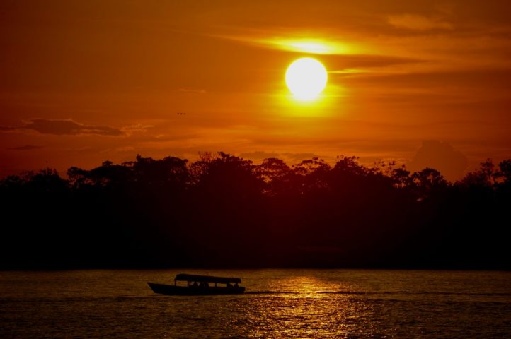
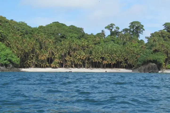
La Macarena is a municipality located in the department of Meta, Colombia, with natural reserves such as the Sierra de la Macarena Natural National Park which has become internationally known for the seven colors river, Caño Cristales.

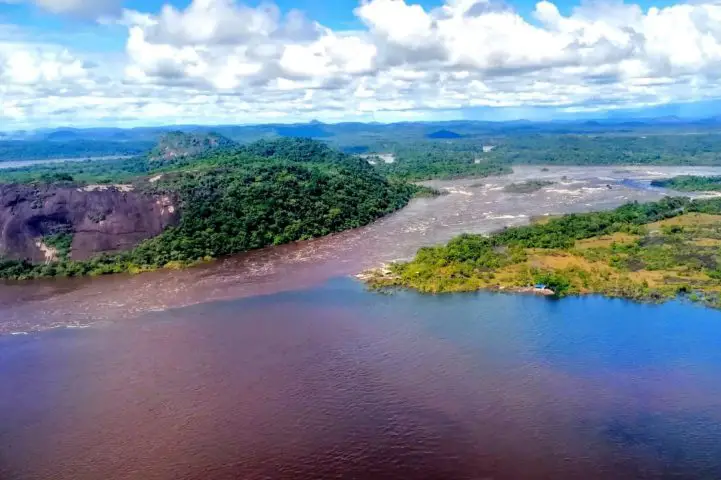
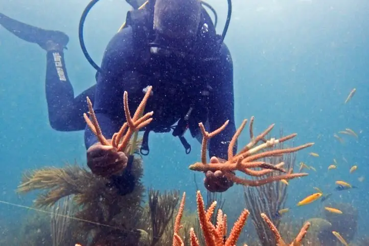
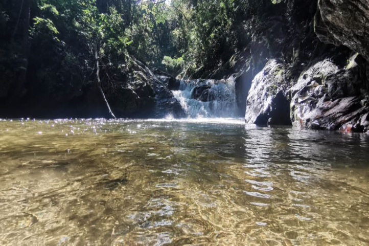
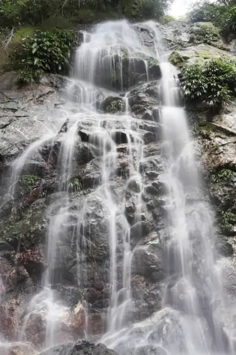
The sierra also has petroglyphs of ancient cultures in the Angosturas I and II sectors, in the Guayabero River. There are also enormous waterfalls, such as the Caño Canoas Waterfall, the Yarumales Waterfall, the Mico Waterfall, Soplaculos among others, which are difficult to reach due to the steep terrain.

This region of Colombia has been hard hit by the armed conflict, the planting of illicit crops, extensive cattle ranching and large-scale deforestation. Even after the signing of the peace agreement, it is a territory that continues to undergo a slow process of re-organization of the territory and the role of the people who inhabit it.

Ecotourism and community-based tourism is one of the lines that the local community is developing, taking advantage of the impressive natural wealth of the territory. Plans include the creation of ecological trails where visitors can also participate in the restoration process by planting a tree.

They also want to promote other destinations that activate tourist visits at times other than Caño Cristales, and thus have an income derived from tourism activity throughout the year.

Sierra de la Macarena is a Territory of Great Value for Humanity

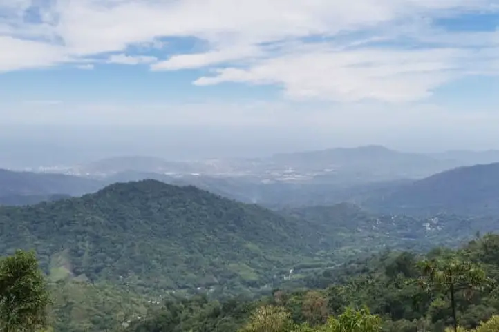
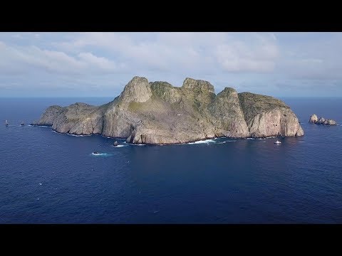
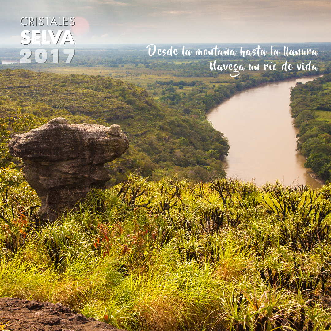
The Sierra de La Macarena National Natural Park is located in the department of Meta, in a strategic location where the Andes, the Orinoco Savannah, the Guyanese Shield and the Amazonian plain converge, giving it a hyper mega biodiversity character, a true biological heritage for humanity.

The protected area also connects with the Tinigua and Picachos National Parks.

Sierra de la Macarena

The Sierra de la Macarena is an isolated mountain range that due to its nature, location and type of soil is home to endemic species of flora and fauna, that is to say that only exist in that place. An example of these is the aquatic plant Macarenia clavijera, which gives the reddish, pink and greenish colors to Caño Cristales, the region’s tourist destination par excellence.

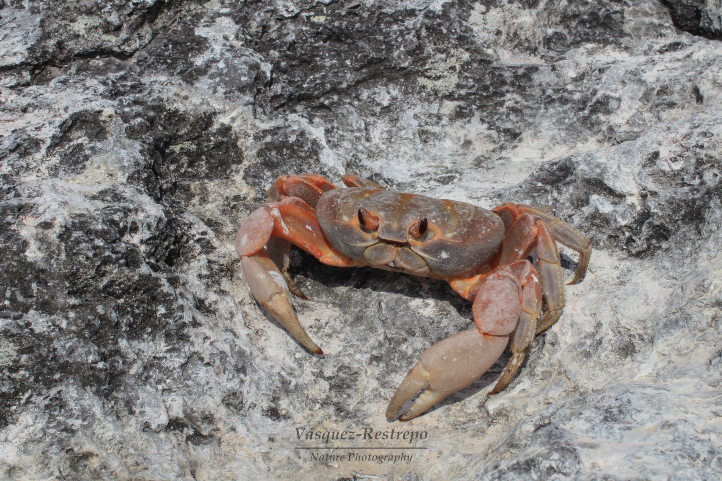
Eighty-three percent of the Macarena mountain range is made up of humid forest (tropical humid zone) with an area of 5030 km², in addition to the herbaceous vegetation of the Amazon plain. La Macarena is considered worldwide as one of the most important wildlife refuges on the planet.

Thus, this natural treasure has extraordinary landscapes that are world icons such as the above mentioned Caño Cristales, as well as unique species such as the cumin tree (Aniba perutilis), the jaguar (Panthera onca) and the tapir (Tapirus bairdii).

Sierra de la Macarena National Park, Colombia Picture by Parque Nacionales

Effects of the Armed Conflict and the Peace Process in La Macarena

During the 1970s, the Macarena sector experienced an increase in population due to the fur trade and foreign tourism, but unfortunately, in the 1980s, the logging boom began. Besides that, for more than 40 years La Macarena and surrounding municipalities were occupied by blocks of the former FARC-EP guerrilla and other armed groups in constant conflict.

Guerrilla occupation generated many displacements and a difficult task for the conservation processes of the National Park System and non-profit organizations such as WWF. In fact, no inhabitant could move freely without a mobility permit issued by the FARC.

At the same time, this territory has been the scene of territorial and socio-environmental conflicts related to land ownership, extensive cattle ranching, deforestation, illicit crops, and the presence of armed actors. Despite the efforts and hope brought about by the Peace Agreement, disputes and conflicts in this region were reconfigured and exacerbated after its signing in 2016, increasing the challenges for the conservation of these strategic ecosystems and for peace building in the communities.

Community Actions for Conservation

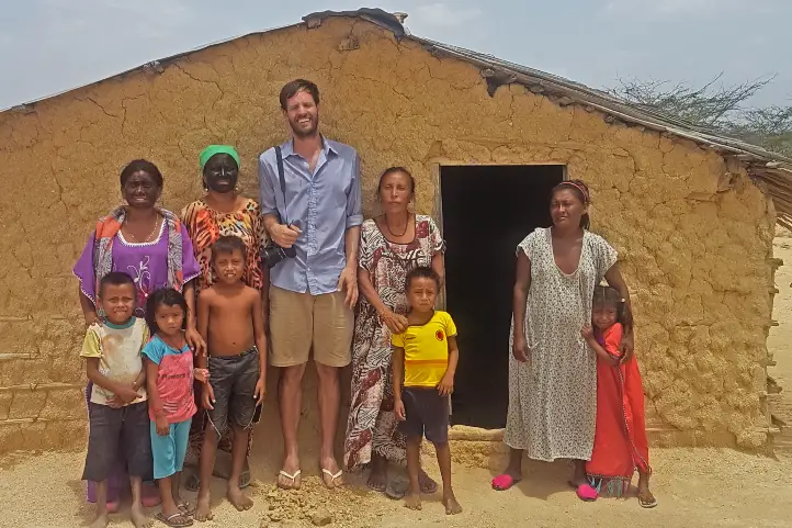
In the midst of this complex context, some small farmer families living in the Sierra de La Macarena have decided to make a commitment to conservation and are now participating in ecological restoration processes with the production and planting of native tree species, and with ecotourism entrepreneurship.

Tourism appeared as a saving option. Today, in fact, it is for 350 families who live directly from the income generated by this activity. People who work in simple but clean hotels, cooking for tourists, as guides, canoeists, and drivers. Even translators, although so far they only have three who speak English.

Thus, the Ministry of Commerce, Industry and Tourism (MinCit) o Colombia has generated strategies to promote sustainable tourism and support the communities of La Macarena.

Sierra de la Macarena National Natural park

Sierra de la Macarena NNP is in the department of Meta, in the Andean foothills of the Amazon rainforest. In this part of the country, the Andean, Amazonian and Orinoco ecosystems converge, and it has a territorial extension of 10,000 km².

This protected area was created by Decree 1989 of September 1, 1989 and covers an area of 605,793 hectares distributed in 5 municipalities in the southern part of the department of Meta.

The park’s Environmental Management Plan incorporates an ecotourism management plan, which indicates the possible scenarios for this activity. Currently, there are only two characterized scenarios with defined carrying capacity and regulations: Caño Cristales and Raudal Angosturas 1.

Other scenarios have been identified but are not yet regulated for visits, including the La Paz Ecological Trail, the Santo Domingo and Cafetales waterfalls in Mesetas and San Juan de Arama, as well as Raudal II near Puerto Concordia. Thus, these areas cannot be visited because they are still in the process of being organized.

Tourist attractions of Sierra de la Macarena National Natural Park

Today it is possible to visit Caño Cristales with its new trails and the Raudal Angosturas I, thanks to the articulated work that has been carried out since 2014 with the creation of the Mesa Ruta Sierra de la Macarena and the need to expand the supply of ecotourism trails in the Caño Cristales sector, as well as to carry out sufficient technical procedures to implement new ecotourism scenarios that will involve a larger population in the community benefits of tourism in the municipality of La Macarena.

Caño Cristales, the Rainbow River

Cano Cristales, La Macarena, Meta, Colombia.

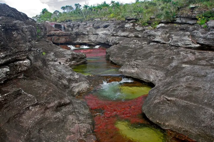
The Macarena’s most recognized attraction in the area is Caño Cristales, better known as “the river of the five colors”, “the most beautiful river in the world” or “the river that escaped from paradise”; one poet even called it “the rainbow that melted”.

Macarenia clavigera, an aquatic plant endemic to the Macarena, is what allows the river’s crystalline and shallow waters to offer a variety of colors that visitors can appreciate. The extension of the river does not exceed 100 kilometers and has a width of no more than 20 meters, which flows into the Guayabero River. The trails established to learn more about this beautiful place are five circuits of stone and plants, ranging from 3 to 15 kilometers in length.

For more information about Cano Cristales visit our entry Travel Guide to the Rainbow River – Caño Cristales – in Colombia.

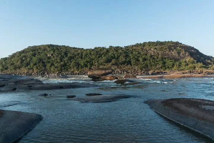
Raudal de Angostura I and Ciudad de Piedra

Raudal de Angosturas, La Macarena, Meta, Colombia.

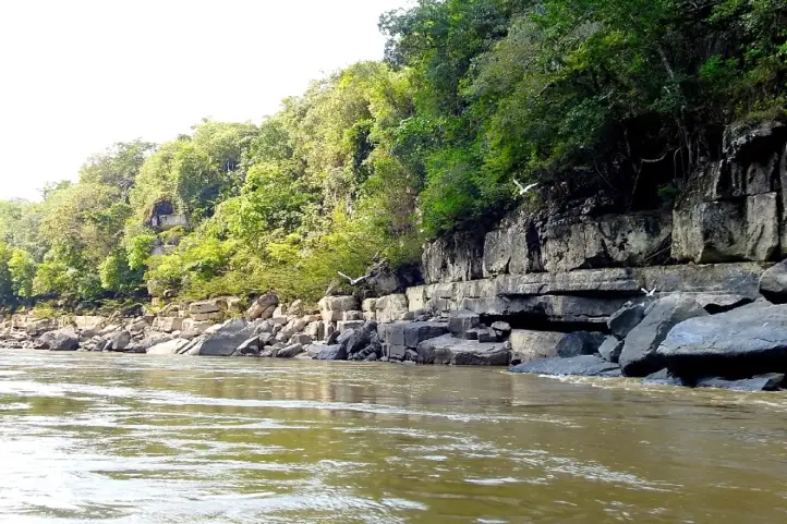
The Raudal Angosturas I destination opened in 2017, as a new ecotourism scenario for the enjoyment of tourists from Colombia and the world. It is a project where you can appreciate the pre-Columbian petroglyphs carved in rocks in low relief that tell the story of the ancestors of the Tinigua tribe when they lived in this area. In turn, Ciudad de Piedra is a trail composed of huge gray rock formations carved over centuries by the force of water.

Many local and national organizations worked together to create this tourist destination, among them, National Natural Parks of Colombia, Cormacarena, the Governor’s Office of Meta, the Mayor’s Office of La Macarena and other members that are part of the Technical Tourism Board: Sierra de la Macarena Route.

Raudal Angosturas I is located between the border of the Sierra de la Macarena and Tinigua National Parks and in the Recovery Zone for Southern Preservation in the municipality of La Macarena, Meta.

This natural wonder contains engraved in its petroglyphs the history of the Tinigua Indians and also the footprint of the armed conflict in Colombia.

The Military Forces of the region support this process of ecotourism management, since it will ensure the safety of those who will enjoy nature tourism in the Macarena Special Management Area.

If you wish to visit the other tourist attractions, you must have a guide specialized in the area, but you must inform the park facilities in the municipality of Granada, Meta.

How to get to Sierra de la Macarena National Natural Park

The following alternatives are the most time efficient, as it is possible to arrive by land but the time will be longer, and probably not safe.

Via Bogotá – La Macarena

Take a 1-hour flight from El Dorado International Airport (BOG) Bogotá to La Macarena Airport (LMC) at La Macarena city with Satena airline. There are also private charter flights that take you there.

Via Cali – Villavicencio – La Macarena

Take a 1-hour flight from Alfonso Bonilla Aragón International Airport in Palmira to Vanguardia Airport (VVC) at La Villavicencio city. Once at the airport, take an approximately 1- hour ride to La Macarena.

What to do in Sierra de la Macarena National Natural Park

Hiking in La Macarena

There are 6 ecotourism trails allowed, which can be done walking or with the help of a horse, and are distributed as follows:

Caño Cristales Ecotourism Scenario, Colors subarea:

  • Salto del Aguila: the number of people allowed daily is 75.
  • Los Pianos: the number of people allowed per day is 62.
  • Caño Escondido: the number of people allowed per day is 37.
  • Intermedio: the number of people allowed per day is 42.

In this scenario you can appreciate the landscape, characteristic vegetation, geological formation, waterfalls, natural pools, aquatic plants (Macarenia clavijera) red, fuchsia and pink; in addition to bird watching.

Scenario Raudal de Angosturas I

  • Ciudad de Piedra: the number of people allowed daily is 37.

In this trail you can do bird watching tour geological formation and rocky outcrop, in addition to the Caño with red plants.

Scenario Mirador Cristalitos

  • Mirador-cristalitos: the number of people allowed daily is 87.

This trail has pictograms, a panoramic view of the convergence of the three ecosystems along its route.

Bear in mind that the trails mentioned above are only authorized by the environmental authorities o the park and may have variations in the routes, which visitors will be informed of when registering. You cannot choose the trail to visit, it is assigned by the authorities and given in order of registration.

Birdwatching at Sierra de la Macarena

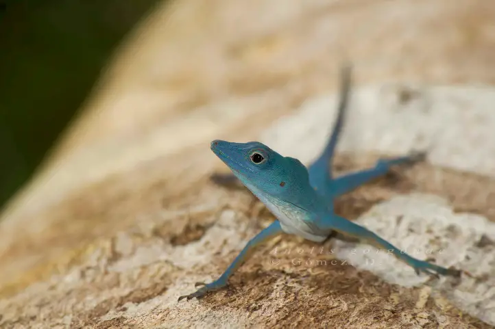
There are more than 450 bird species registered in the la Macarena, represented in 65 families, which means that 27% of the Colombian avifauna is present in the park. Dominant bird species are from the Guianas, Amazon and, to a lesser extent, the Andean region.

The following bird species have been recorded from the Amazon: Paroaria gularis gularis, Piaya melanogaster, Electron platyrhynchum pyrrholaemum; from the Andes: Asio flammeus, Trogon personatus personatus, Campephilus pollens, Cistothorus platensis tamae; migratory birds from North America: Anas discors, Pandion haliaetus carolinensis, Actitis macularia, and Coccyzus americanus americanus.

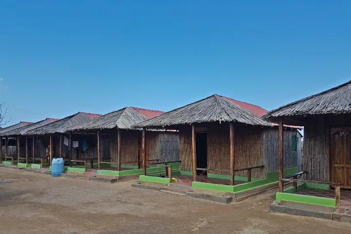
Where to stay in Sierra de la Macarena National Natural Park

Sierra de la Macarena Natural National Park does not currently offer accommodation for travelers, it is possible to stay in La Macarena. Our recommendation of hotels are is La Manigua Lodge, a beautiful ecolodge recently installed in the area. Know more about ecolodges in Colombia in our entry Complete Guide to the Best Eco lodges in Colombia.

Best time to visit Sierra de la Macarena National Natural Park

The main attraction of La Macarena, Caño Cristales, only receives visitors during the winter season, that is, between June and December; for the summer season the community allows the aquatic plants to recover. However, Raudal de Angosturas I is open all year round.

Dry season on the eastern side of La Macarena starts at the beginning of December until late of February at a temperature of 24º C (75 ºF). On the western side the rainfall regime is bimodal, it also has 2 dry periods separated by rainy seasons.

Sierra de la Macarena National Natural Park Entrance fees

The entrance fee varies depending on the nationality and age of the visitors. These are the entrance fees for 2021:

  • Colombians, resident foreigners and tourists from Bolivia, Ecuador and Peru (ages 5 to 25): COP 19,500
  • Colombians, resident foreigners and tourists from Bolivia, Ecuador and Peru (over 25 years old): COP 35,500
  • Non-resident foreigners (over 5 years old): COP 53,500
  • Children under 5 years old and Colombians over 65 years old have free entrance presenting their IDs.

What to consider before visiting Sierra de la Macarena National Natural Park

  • To take any of the tours inside the park you must hire an authorized and certified guide.
  • Consider wearing personal protective items (sunscreen, sunglasses, insect repellent, and hat).
  • The use of flash when taking photographs is prohibited.
  • Use of binoculars to watch animals’ behavior is recommended.
  • Bring along valid identification documents and health insurance.
  • It is recommended to be vaccinated against yellow fever and tetanus.
  • If you take specific medications, take them with you a personal first aid kit.

Some prohibitions

Feeding, bothering or hunting animals, alcoholic drinks and drugs, throwing cigarette butts, burning garbage, felling, and capturing wildlife.

References
About the authors

Sara Colmenares

The current director of Sula. Doctor in Biological Sciences. Her main interests are to explore and understand the organism-environment interactions, taking advantage of emerging knowledge for the management and conservation of species and ecosystem services. She is currently working as a consultant in functional ecology, ecosystem services, and conservation projects in Colombia related to ecotourism and birdwatching.

Luisa Martin

Engineer, world traveler, amateur photographer, traveling blogger, and foody.

The Eight Wonder of the World at El Tuparro National Natural Park

A vast green savannah, large rivers, golden beaches, gallery forests and crystal clear waters is what you will find in the Tuparro National Natural Park, a jewel in the heart of the Orinoquia. In this publication you will find important information for your visit to Tuparro National Natural Park in Colombia.

Discovering Tuparro National Natural Park

El Tuparro National Natural Park is located in the Orinoco region of Colombia, and it is part of the department of Vichada. The Tuparro park is bathed by the Tomo River to the north, and the Tuparro, Tuparrito and Caño Maipurés rivers to the south.

Its landscapes expresses in its forms a typical image of the so-called Guiana Shield, one of the oldest geological formations of our planet shared by Brazil, Colombia, Venezuela and, of course, the Guianas.

Tuparro Biosphere Reserve of the World

The park was created in 1970 to advance scientific studies and conserve the region’s biodiversity. This led to its declaration as El Tuparro National Natural Park in 1980 with 548,000 ha. The cultural and biological richness of this region made it worth to be declared a national monument, and core area of a Biosphere Reserve. Know more about biosphere reserves of Colombia in our entry Next Travel Ideas? Visit the Biosphere Reserves of Colombia.

It is also considered an Important Bird Area (IBA) site because it is estimated that there are more than 320 species of birds, many of them associated with the water bodies.

A Sanctuary for All

The park is a sanctuary for birds, orchids, monkeys, snakes and toninas (pink freshwater dolphins). There is also an ancient cemetery that belonged to the Maipur indigenous nation, which is now extinct.

Besides, there are indigenous communities surrounding the protected area: Piaroa, Curripaco, Cuiba, Puinave and Guahibo, who preserve and maintain their traditions amidst the park’s tourism.

What does it mean Tuparro?

This park owes its name to the Tuparro River. Tuparro is the name given to the small hills, rocky outcrops, of less than 900 m. high, which are remains of the ancient Guyanese shield, composed of quartz and currently considered one of the oldest mountains on the continent.

The Raudales de Maipures on the Orinoco River and at the mouth of the Tuparro River, is one of its main attractions. The Orinoco river narrows in this area and its current flows thunderously between giant rocks that extend up to 5 km.

How to Get to Tuparro National Natural Park

Via Bogotá-Puerto Carreño

Take a 1-hour flight from El Dorado International Airport (BOG) Bogotá to German Olano (PCR) at Puerto Carreño city with Colombia´s state own airline: Satena.

Once at the airport, take an approximately 45- minutes ride to Casuarito Port. Once at the Port you should take an extra 10-minutes boat ride to Puerto Ayacucho (Venezuela). Finally in Puerto Ayacucho you should take an extra 15-minutes boat ride to Tuparro.

Via Bogotá- Villavicencio

Take a 1,2-hours flight from El Dorado International Airport (BOG) in Bogotá to Vanguadía Airport (VVC) at Villavicencio city with Satena Airline. In the airport take an approximately 1h1min flight to to German Olano (PCR) at Puerto Carreño city with Satena Airline.

Once at the airport, take an approximately 45- minutes ride to Casuarito Port. Once at the Port you should take an extra 10-minutes boat ride to Puerto Ayacucho (Venezuela). Finally in Puerto Ayacucho you should take an extra 15-minutes boat ride to Tuparro.

What to do in Tuparro National Natural Park

During the induction talk, visitors are informed about the activities carried out in El Tuparro National Natural Park, the conservation objectives, the services offered, and the ecotourism activities that can be carried out.

Hiking and Trekking

Hiking is the most exciting activity in Tuparro National Natural Park. The Attalea (Maipures) trail has a length of 3 km uphill through a palm forest and rocky outcrop. Moderate intesity. When you reach the highest point you can have the view of the Raudal Maipures. This trail is currently being managed by local indigenous communities.

The Eighth Wonder of the World Tuparro Natural Park

The Raudal de Maipures and the Balancín

Formerly called Quituna by the indigenous people of the region, the waters of the Maipures raudal belong to the great Orinoco River. There, this riverbed marks part of the extensive border limits that separate Colombia and Venezuela.

Maipures is one of the most impressive attractions that El Tuparro National Natural Park offers to its visitors. In the 19th century, specifically in 1800, the famous German naturalist Alexander von Humboldt passed through the Maipures stream. He called this place “the eighth wonder of the world”. Among its main attractions, undoubtedly, is the “Balancín”, in the sector of the Atarrayadero, a rock that remains suspended over another, despite the strong currents with which the great Orinoco lambastes there.

The best time to enjoy all the splendor that Maipures offers is during the summer months (low water season due to the few rains that fall in this region), that is, between the months of December and March.

Birdwatching and Wildlife Tours

El Tuparro National Natural Park is a perfect place for those interested in fauna and flora. However, it is not easy to spot wildlife because most of them have crepuscular habits (dawn and dusk) and are elusive.

Birdwatchers will be able to enjoy some of the species since there are records of more than 300 species of birds. Research and monitoring have found 74 species of mammals, 17 species of reptiles, 229 species of fish, and up to 828 species of plants in the protected area. Insects have not yet been surveyed, so all the data that you document during your visit (citizen science) will be of help to continue to nourish the park’s lists.

The main ecosystems present in the park are typical of the Orinoco, including dry and flooded savannah, gallery forests, riparian forests, and rocky outcrops.

Aquatic Tourism

Finishing the hiking activity through the Anaconda trail, you can go through a path in the savannah where meters ahead the visitor will find the attractive blue well, ideal for a refreshing swim. The bathing activity can also be developed in the attractions of Bocas del Tomo, Raudal del Tuparro and caño Peinillas. Kayak can also be practiced in the Raudal del Tuparro.

El Tuparro

Research and Environmental Education

The protected area’s exuberant biodiversity and its conservation status make it a suitable place for scientific research. In addition, activities related to the Environmental Communication and Education Plan are carried out in coordination with educational institutions and in the development of the lines prioritized for the fulfillment of the institutional mission.

Where to stay in Tuparro National Natural Park

Tuparro Natural National Park does not currently offer accommodation for travelers, but it is possible to stay in Puerto Carreño. Therefore we recommend the following hotels:

  • El Lago
  • Cacique Samanare
  • Voragine

Best Time to Visit Tuparro National Natural Park

The best time to visit El Tuparro is the dry season which starts at the beginning of June until late of September and from the beginning of April until late of November, with temperatures around 25º C (77 ºF).

Tuparro National Natural Park Entrance fees

The entrance fee varies depending on the nationality and age of the visitors. These are the entrance fees for 2021:

  • Colombians, resident foreigners and tourists from Bolivia, Ecuador and Peru (ages 5 to 25): COP 10,000
  • Colombians, resident foreigners and tourists from Bolivia, Ecuador and Peru (over 25 years old): COP 16,000
  • Non-resident foreigners (over 5 years old): COP 46,500
  • Children under 5 years old and Colombians over 65 years old have free entrance presenting their IDs.

Before Visiting Tuparro National Natural Park Consider:

  • The entrance of Visitors only will be allowed if it is accompanied by an authorized touristic operator that meets the law requirements, the visitor who enters the park without a touristic operator will be returned by the Staff of the protected area.
  • Due to the security of the visitors and uncomfortable situations that have been presenting with our neighboring country, national parks authorities recommend not traveling to Venezuela.
  • You should avoid taking harmful elements that go against biodiversity, such as aerosols, guns, alcoholic beverages and hallucinogen substances.
  • The staff of the Park reserves the right of entrance and/or permanence to the people that are not mentioned in the entrance permit, this measurement also works for the cases when the total number of people does not matches the number indicated in the permit.
  • Due to evacuation of BIODEGRADABLE trash (bottles, batteries, cans, etc.), it is necessary to carry plastics bags.
  • If you enter through Venezuela, you must do so through a registered tour operator and under their security.
  • Consider wearing personal protective items (sunscreen, sunglasses, towel, insect repellent, and hat).
  • Bring along valid identification documents and health insurance.
  • It is recommended to be vaccinated against yellow fever, measles and tetanus.
  • If you take specific medications, take them with you a personal first aid kit.
  • Photos or videos for commercial or publication purposes must have prior permission from Parques Nacionales. The use of DRONES is not permitted in the Protected Areas for filming and/or photography activities of a private-recreational nature, without prior authorization.

Some prohibitions

Feeding, bothering or hunting animals, alcoholic drinks and drugs, throwing cigarette butts, burning garbage, felling, and capturing wildlife.

References
About the authors

Sara Colmenares

The current director of Sula. Doctor in Biological Sciences. Her main interests are to explore and understand the organism-environment interactions, taking advantage of emerging knowledge for the management and conservation of species and ecosystem services. She is currently working as a consultant in functional ecology, ecosystem services, and conservation projects in Colombia related to ecotourism and birdwatching.

Luisa Martin

Engineer, world traveler, amateur photographer, traveling blogger, and foody.

Travel Guide to Macuira: The Cloud Forest Oasis in La Guajira Desert


Macuira is a National Natural Park of Colombia considered an oasis in the desert of Alta Guajira, in the Caribbean region of Colombia. It is a very special place because it has the contrast between sea, desert and jungle.

The park, with 25,000 ha, was declared in 1977 to protect and conserve the Serrania de la Macuira, which reaches 864 meters above sea level. It is not as high as the Sierra Nevada de Santa Marta, but it has a very special particularity which is the presence of cloud forest very close to the Colombian Caribbean coast and surrounded by a vast desert.

This is why being in the Macuira you can go from the blue of the ocean, through the yellow of the desert, to the green of the jungle. Among the most important characteristics of the Serranía de Macuira is the presence of forested mountains which are the only source of fresh water in the dessert.

Find here why you should visit this beautiful destination in Colombia, the Macuira National Natural Park in La Guajira.

Discovering Macuira National Natural Park

In 1977 and by means of Executive Resolution Nº 149, the National Government created the Macuira National Park, located northeast of the Guajira Peninsula, in the mountain range of the same name.

In practice, it covers an area of 24,103 hectares, corresponding to a mountainous massif that forms the northernmost mountain range in South America, with elevations ranging from 100 to 867 meters above sea level approximately, the Serranía de la Macuira.

This national park, located in Nazareth, in the municipality of Uribia, is ideal for birdwatching, as some 140 bird species have been recorded there, 17 of which are endemic. In addition, the reserve has several forest ecosystems.

The Serranía de Macuira

Serranía de Macuira is composed of three main mountains: Cerro Palúa (865 m), Cerro Huaresh (852 m) and Cerro Jihouone (753 m), which rise from the desert plain. Another isolated hill within the park is Cerro Oriore. There are several freshwater streams, which disappear when they reach the sand dunes at the eastern base of the Sierra.

Picture of Serrania de la Macuira by Luis Pérez, Flickr Creative commons Licence

The main characteristic of the Macuira, which makes it unique in the world, is that it has an evergreen dwarf cloud forest, an ecosystem very similar to the Andean forests located in the páramos. It is an area of great environmental importance because this unique cloud forest ecosystem functions as a water regulator for the region.

The cloud forests themselves are located at altitudes above 2,700 meters above sea level, but in Macuira National Natural Park they can be seen at only 550 meters above sea level and very close to the sea. Definitely, this is a must to see scenery in the world.  It is an oasis in the middle of aridity that supports a great diversity of fauna and flora, especially adapted to survive, grow and reproduce in this type of environment.

Why is there a cloud forest in the Macuira?

The Serrania de la Macuira forms a geological barrier where humidity from the Caribbean Sea condenses, causing the formation of fog that penetrates the forest and creates a humid enclave in the middle of the desert.

This is because the region has a low rainfall and high temperatures, which when combined with the trade winds from the sea and saturated with moisture, rise to meet the barrier of the Serrania, which is why it forms cumulus clouds in the day and nimbostratus in the afternoon.

Traveling to Macuira, Alta Guajira, Colombia

Characteristics of the Macuira Park

Macuira NNP has a territorial area of 250 km², and is located in the extreme north of the department of La Guajira, northwest of the municipality of Uribia, neighboring the small villages of Puerto Estrella, Nazareth, Waretpa, Punta Espada, Siapana and Tawaira.

The are four ecosystems in the park: Dwarf Cloud Forest, Dry Evergreen Forest, Dry Deciduous Forest and Tropical Dry Forest. As mentioned before, this is the most significant rarity of the park, because it has similar conditions to those present below the Andean paramo line around 2,700 meters above sea level. The presence of a cloud forest amidst the desert makes it a unique landscape, a real oasis in La Guajira dessert.

Regarding the dry evergreen forest, It is located at an altitude between 250 and 550 meters above sea level, this allows trees to keep their leaves (foliage) despite possible climate changes. At lower altitudes, there is the Dry Deciduous Forest, located at an altitude between 50 and 400 meters above sea level.

Finally, the Tropical Dry Forest, in the desert plains, is an ecosystem with unparalleled diversity of plants and animals that are adapted to extreme conditions. This ecosystem contains the largest number of endemic species of flora and fauna in the park.

Macuira as an Important Bird Area (IBA)

The entire IBA corresponds to Macuira National Natural Park, created in 1977. The park safeguards endemic and migratory bird species, with a record of 140 bird species, seven of which are endemic subspecies. This is why it was declared an Important Bird Area (IBA), or AICA in Spanish, in Colombia and the world in 2003.

The park is also an especially important scenario within the cosmogony, mythology, social and cultural order of the Wayuu ethnic group.

Presence of Indigenous Communities in Macuira

The indigenous communities present in the department of Guajira are the Wayuú, of the Arawak linguistic family, who have occupied this sector for centuries. They are distributed in communities throughout Guajira, but the most important settlement are in Nazareth or Akuwai, northeast of Guarece Hill.

@Colombiafrank Sharing time with the Wayuu people in Alta Guajira, Colombia

The economy of these communities is based on grazing activities, artisanal fishing, handicrafts and seasonal agriculture. In addition, the organization of National Natural Parks offers work on an annual basis to a representative of each clan.

Wayuu Handicrafts, La Guajira, Colombia

Two clans out of 7 are selected annually to provide information and orientation to the sanctuary’s visitors with the support of a representative from the national natural parks in the city of Bogota.

Uribía, one of the nearest towns from Macuira, is the most important Wayuu town in La Guajira and is considered the indigenous capital of Colombia.

How to Get to Macuira National Natural Park

Macuira National Natural Park is located in the extreme north of the department of La Guajira, northwest of the municipality of Uribia, is adjacent to the villages of: Puerto Estrella, Nazareth, Waretpa, Punta Espada, Siapana and Tawaira. In addition, it is totally overlapped with the reservation of Alta and Media Guajira.

Traveling in La Guajira

To get to the park from Riohacha, you must go by land to the city of Maicao, then continue to the town of Uribia, and from there to Puerto Portete, a town located on the bay of the same name. From there, a dirt road leads to the town of Nazareth. This trip takes between 6 and 8 hours in a four-wheel drive vehicle, as long as the weather conditions are favorable.

From Bogotá

Take a 1-hour flight from El Dorado International Airport (BOG) Bogotá to Almirante Padilla International Airport (RCH) at Riohacha city. Once at the airport, take an approximately 1,5- hours ride to Uribia. Then, in Uribia you should take a 2-hours ride to Bahía Portete. Finally, once in Bahía Portete you should take an extra 6-hours ride to Nazareth.

What to do in Macuira National Natural Park

As a visitor to the park you can hike through the Serranía de Macuira, you can visit the indigenous Wayú cemeteries, or you can also find handicrafts made by the inhabitants of the region in the surrounding municipalities.

Hiking and Trekking

Hiking is the most exciting activity in Macuira National Natural Park. The park has hikes of different degrees of difficulty (low and medium), where you can appreciate dunes, natural pools and temporary streams.

If you want to make the ascent to the Macuira mountain range you must be clear that the degree of difficulty is high, so you must have good physical condition and endurance for long walks of 5 to 7 hours.

Birdwatching and Wildlife Observation

Within the 5 ecosystems of the park, there are 140 bird species recorded and that can be appreciated, 7 of which are endemic subspecies:

  • Scrub Greenlet (Hylophilus flavipes)
  • Pectoral sparrow (Arremon taciturnus fratruekis)
  • Blue-crowned Motmot (Momotus momota)
  • Pale-breasted Thrush (Turdus leucomelas)
  • Red-legged honeycreeper (Cyanerpes cyaneus)
  • Buff-breasted Wren (Cantorchilus leucotis)
  • Rufous-vented chachalaca (Ortalis ruficauda)

Additionally, 10 of the species are reported to be migratory.

Besides birds, there are a significant number of insects at the Park, as well as a notable presence of amphibians (toads and frogs), iguanas, snakes and mammals, such as the White-fronted capuchin (Cebus albifrons), ocelot (Felis pardalis) and Jaguarundi (Herpailurus yagouaroundi).

Where to stay in Macuira National Natural Park

Macuira National Natural Park does not currently offer lodging for travelers. It is possible to stay in the nearby “rancheria” of Nazaret. In the rancheria of Nazaret there are 2 camping areas called Villa Inmaculada and Emerrare.

Rancherias in La Guajira

Moreover, if you wish to spend a night in a traditional Wayú ranchería, the village also offers a night full of tradition with the locals of the sector.

If you want to rest in a hotel we recommend: Hotel Mulamana

Best time to visit Macuira National Natural Park

Dry season starts at the beginning of December until late of March with weather around 30º C (86 ºF). In the higher parts of the Macuira mountain range there are persistent winds and in the lower parts the temperatures are higher and the humidity increases.

Macuira National Natural Park Entrance fees

The park does not currently charge admission fees, but visitors must register at the park’s facilities and stay for a defined period of time.

What to consider before visiting Macuira National Natural Park

  • Currently access to the cloud forest is not allowed, as it is a very fragile ecosystem and highly valued by the Wayuu people.
  • The ranchería of Pusheo is the only restaurant in the sector, since the distances are very long and it is necessary to buy enough food for the trips.
  • You should always travel accompanied by a Wayuu driver and/or guide with a good command of Wayunaiki and Spanish, as well as knowledge of the communities of Alta Guajira.
  • For tours inside Macuira National Park, a local Wayuu guide authorized by the park must be hired.
  • The use of flash when taking photographs is prohibited.
  • Use of binoculars to watch animals’ behavior.
  • Bring along valid identification documents and health insurance.
  • Be vaccinated against yellow fever, tetanus and covid-19.
  • If you take specific medications, take them with you a personal first aid kit.

Some prohibitions

Feeding, bothering or hunting animals, alcoholic drinks and drugs, throwing cigarette butts, burning garbage, felling, and capturing wildlife.

References
  • Colparques
  • Parques nacionales
About the authors

Sara Colmenares

The current director of Sula. Doctor in Biological Sciences. Her main interests are to explore and understand the organism-environment interactions, taking advantage of emerging knowledge for the management and conservation of species and ecosystem services. She is currently working as a consultant in functional ecology, ecosystem services, and conservation projects in Colombia related to ecotourism and birdwatching.

Luisa Martin

Engineer, world traveler, amateur photographer, traveling blogger, and foody.

San Andres Travel Guide: The Most Beautiful Archipelago in the World


Welcome to Colombia! This is a specific travel guide on how to enjoy the most beautiful archipelago in the world, the Archipelago of San Andres, Providencia, and Santa Catalina.

The archipelago of San Andres, Providencia, and Santa Catalina has the perfect location to enjoy one of the most diverse places in the world, with endless marine fauna and wildlife all covered by a sea of 7 colors that will make you fall in love.

A little bit of Archipelago San Andres, Providencia, and Santa Catalina history

San Andres, Providencia, and Santa Catalina were occasionally inhabited by the Miskito Indians, an indigenous group of Central America, before colonial times. They came to have a state of their own under the protection of the British Empire.

The following settlers of the islands brought with them the Protestant religion, becoming a fundamental element of the communities. They also introduced new species of flora and fauna as well as slaves from Africa.

Spaniard Colonization

In 1510 the archipelago came into Spanish possession, but they did not establish any settlements, since the continental area was more important to the Spanish crown; back then San Andres was under the jurisdiction of the Royal Audience of Panama.

In 1544 the Spanish Crown decided to hand over the administration of the archipelago to the jurisdiction of the General Captaincy of Guatemala.

English Colonization

Only until 1629 and 1630 European and English colonists settled in Santa Catalina and Providencia. Captain Morgan (Henry Morgan), settled in the archipelago from 1670 to 1680, turning it into his base of operations.

Tomas O’Neill presented the request to the crown to assign the archipelago under the Viceroyalty of Nueva Granada. The request was accepted and signed on November 20, 1803, and a royal decree was assigned and named the archipelago of San Andres.

In 1822 the archipelago became part of the province of Cartagena, but in 1912 San Andres and Providencia were separated from the department of Bolivar becoming an independent province of Colombia’s territory.

Colombia vs. Nicaragua

On May 5, 1930, Colombia and Nicaragua signed the Esguerra-Bárcenas treaty which established the sovereignty of Nicaragua over the Mosquito Coast and Colombia over the archipelago of San Andres, Providencia, and Santa Catalina.

The archipelago became a free port during the government of Gustavo Rojas Pinilla in 1953, transforming the island into a commercial and touristic point.

After that time, in 1991, under the new constitution, the archipelago of San Andres, Providencia, and Santa Catalina was declared as one of the 32 departments of Colombia.

Seaflower Biosphere Reserve

Finally, in 2001 UNESCO declared the archipelago a Biosphere Reserve calling it Seaflower. Know more about the biospheres reserves of Colombia in our entry Next Travel Ideas? Visit the Biosphere Reserves of Colombia.

Raizal People is the Main Population in San Andres Islands

The Raizal People

Today the islands are inhabited by the Raizal people. To avoid confusion with the denomination of “natives” given to the indigenous people, they are called “raizales” and are the product of the miscegenation between indigenous, Spanish, French, English, Dutch and Africans.

The British culture, which was the strongest colonizer of the Caribbean islands, is the predominant one in San Andres and among the Raizales.

However, the Raizal culture has its own cultural expressions: the Baptist religion, Creole language and its oral tradition that reflects the African roots of the majority of the population represented in the stories and tales for children.

The raizales of San Andres Colombia use English and Creole as their main language, although Spanish is becoming more and more common.

Where is the Archipelago San Andres, Providencia, and Santa Catalina located?

The archipelago is located in the western Caribbean Sea on the Atlantic Ocean in Central America and is 775 km away from the Atlantic coast of Colombia. It is the only insular department.

The archipelago is made up of the islands of San Andres, Providencia, and Santa Catalina. Additionally, it is formed by cays and islets located on the volcanic platform to the west of the Antillean Sea.

About the weather, in the archipelago, you can enjoy a humid climate with temperatures between 25° and 31 ° C° (77° and 88° F°), and a high humidity between 82%.

How to get to the archipelago San Andrés, Providencia, and Santa Catalina?

The archipelago has 2 airports, one on the island of San Andres and the other one on the island of Providencia.

Bogota – San Andres island

Take a 1.5 hours flight from Bogotá, El Dorado International Airport (BOG) to Gustavo Rojas Pinilla International Airport (ADZ) at San Andres Island.

Before 2020’s COVID pandemic, entering the island required a fee of COP 116,800; and children under 7 do not need to purchase the card. At present, there is no fee applicable to enter the archipelago San Andrés, Providencia y Santa Catalina until 2025.

San Andres – Providencia and Santa Catalina

If you wish to visit the islands of Providencia and Santa Catalina yous will take a 30-minutes flight from Gustavo Rojas Pinilla International Airport (ADZ) at San Andres Island to El Embrujo Airport (PVA) in Providencia Island.

There is also the possibility of reaching the islands of Providencia and Santa Catalina by taking a 4-hour trip in katamaran to Providence Island.

What to do in Archipelago San Andres, Providencia, and Santa Catalina?

Firstly, the best time to visit the archipelago of San Andres, Providencia, and Santa Catalina is during the dry season, in the months of April, May, November, and December.

San Andres island

To visit the places below on the island of San Andres you can rent a motorcycle and make the trip along a 15 km road that connects each one of these locations.

Johnny Cay, San Andrés

Sound Bay Beach, San Luis

This is a white sandy beach located in the neighborhood of San Luis, far from the crowded areas of the island. San Luis still preserves its wooden houses, and there you will find restaurants and bars that are run by locals.

Bahia Sardina

This is the most important commercial beach on the island, with crystal clear waters and a pedestrian path of 2 km. It is very close to the airport as well as being the place with most restaurants, hotels, and duty-free stores on the island. From this point, it is possible to see the islet of Johnny Cay.

Cocoplum Bay & Rocky Cay

this beach is connected to Rocky Cay and it’s full of famous local restaurants. Rocky Cay natural pool is also a nice plan to consider taking a swim. Moreover, it is a good place to practice snorkeling.

Bengue’s Place & Charquitos Beach

These beaches are in the south area of the island, they have crystal clear waters and a wonderful wall of reefs which creates a quiet natural pool not affected by the waves.

Johnny Cay

Johnny Cay is an islet that is also a regional park of the island of San Andres. To reach this point you must take a boat and make a journey of 7 minutes. The beach here is characterized by its white sand, and the place is adorned by the presence of a large number of palm trees and iguanas. Bear in mind that there are no ATMs so that any and all must be in cash. One way trip from San Andres costs COP 8,000.

The Aquarium & Haynes Cay 

The name of the aquarium is Rose Cay, while you are in the aquarium facilities you can take walks on sandbanks in the middle of the sea. From the aquarium, you can walk to Haynes Cay on the sandbanks.

Mangle Old Point Park

This is another regional park of San Andres. It is a sanctuary of flora and fauna located in Hooker and Haynes bays near the center of San Andres island. The tour can be done by kayak through the mangrove system inhabited by mussels, crabs, iguanas, and lizards, as well as endemic and migratory birds.

Ecoparque West View & La Piscinita

Both parks are located in the west of the island. There are no beaches but natural pools between stone cliffs, an ideal place for snorkeling throughout their crystal clear waters.

Local people have the opinion that La Piscinita is the most beautiful place to snorkel in San Andres.

La Loma

This neighborhood is one of the most traditional of the island, where you can learn about local customs and traditions as well as visit the first Baptist church in Latin America, built-in 1847. The entrance fee is COP 10,000 and when visiting the bell tower the panoramic view of the entire island and the “sea of 7 colors” is worth the visit.

Casa Isleña Museum

This is a house of more than 100 years of construction where you can learn about the Raizal people and the pirate attacks that the island had in the past.

Big Pond Lagoon

In the center of the island, it is possible to find this freshwater lagoon that is home to caimans, iguanas, and turtles. Around the lagoon, you will find trees typical of the island.

San Andrés Botanical Garden

In the facilities of the National University of Colombia near the San Luis sector, you can find the San Andrés Botanical Garden. There you will learn about the flora present on the island, during the tour you will also see iguanas, birds, and lizards that live in the garden. The entrance fee to the garden is 3,000 COP.

Blow Hole & Morgan’s Cave

There is a small geyser known as the blowhole, very famous among visitors. In the blowhole there the seawater protrudes into the air through a natural hole in the coral reaching a maximum height of 20 meters. A small grotto is known as the place where the pirate Henry Morgan hid his treasures during his stay on the island. The entrance fee is COP 10,000.

Providencia Island

Bear in mind that in Providencia you can rent a bicycle, a motorcycle, or a golf cart to move around the island if you do not want to walk.

Bridge of Lovers, Providencia and Santa Catalina Islands, Colombia

The Peak

Is the highest hill on the island at 360 meters above sea level and 4.6 km away from the airport. The average time to the top is approx. 50 minutes. From this point, you can appreciate the “sea of 7 colors” and the island’s Coral barriers.

Bridge of Lovers

It is a colorful floating bridge that joins the islands of Providencia and Santa Catalina, crossing the Aury channel. This wooden footbridge is 180 meters long and it is said that at this point couples gather to contemplate the sunset.

Old Providence McBean Lagoon National Natural Park

This protected area is the only insular one in Colombia. It is responsible for protecting and preserving the flora and fauna of the archipelago which has the third-largest coral reef barrier in the world.

At the park, you can learn about the fauna and flora available in the archipelago in addition to making tours through the mangrove systems. It is also possible to do scuba diving and snorkeling activities. From the highest point of the island, you can have a wonderful view and enjoy the sunset.

Know more about this beautiful national park of Colombia in our entry Unique destination in the Colombian Caribbean: Old Providence McBean Lagoon Park.

Cangrejo key

This small island is part of the Old Providence McBean Lagoon NNP, it does not have a beach but it is an ideal place to appreciate the marine flora and fauna in diving and snorkeling activities. From the highest point of the island, you can have a wonderful view and also enjoy the sunset. The entrance fee is of cop 35,000.

Playa Manzanillo

The inhabitants of the island say that this is the most beautiful beach of Providencia, it has an extension of 300 meters. The beach has only one restaurant but at night it is possible to have bonfires on the beach.

Southwest bay

Is the longest beach on the island with white sand and crystal clear waters. On Saturdays, you can enjoy a horse race performed by the natives as well as enjoy local food.

Almond beach

This is an ideal place for snorkeling.

Santa Catalina Island

Morgan’s Head

This is a small hill that is a 25-minute walk at the end of the Bridge of Lovers through a paved track. The view from this point is magical to appreciate the sunset.

Fort Warwick

This is the most visited place on the island for the vegetation that can be seen in addition to enjoying the sea breeze.

Where to Stay in Archipelago San Andres, Providencia, and Santa Catalina?

Staying in San Andres, Providencia, and Santa Catalina

San Andres Island

San Andres Island offers a wide variety of accommodations. Our recommended options for you to stay in are Solare SAI Ecohotel and Casa Harb Hotel Boutique.

Providence Island

Providence Island offers a wide variety of accommodations. Our recommended options for you to stay in are Deep Blue Hotel and Cabañas Agua Dulce.

Santa Catalina Island

On Santa Catalina Island it is not possible to find accommodations, so visitors should stay on Providence Island.

Things to Bear in Mind

  • The island’s dry season is between the months of December and late May.
  • Consider wearing personal protective items (sunscreen, sunglasses, towel, insect repellent, trainer shoes, and hat).
  • The use of flash when taking photographs is prohibited.
  • The use of binoculars to admire animals’ behavior is recommended.
  • Carry valid identity documents and health insurance.
  • It is recommended to be vaccinated against yellow fever and tetanus.
  • If you take specific medications, take them with you in a personal first aid kit.

Some prohibitions

Feeding, bothering, or hunting animals, alcoholic drinks and drugs, littering cigarette butts, burning garbage, felling, doing drugs, and capturing wildlife.

References
  • Ministerio de Cultura, Colombia
  • San Andres Island Website
About the authors

Luisa Martin
Engineer, world traveler, amateur photographer, traveling blogger, and foody.

Sara Colmenares

The current director of Sula. Doctor in Biological Sciences. Her main interests are to explore and understand the organism-environment interactions, taking advantage of emerging knowledge for the management and conservation of species and ecosystem services. She is currently working as a consultant in functional ecology, ecosystem services, and conservation projects in Colombia related to ecotourism and birdwatching.

Discovering Amacayacu National Natural Park in the Colombian Amazon

Welcome to the land of river dolphins, manatees, anacondas, and the smallest primate in the world: the Amacayacu National Natural Park. The protected forest is home to more than 5,000 species of plants, as well as being the region with the greatest diversity of primates on the planet.

It is the habitat of the Pygmy marmoset (Callithrix pygmaea) the smallest primate in the new world, the largest water lily in the world (Victoria amazonica), the giant silvery-blue butterfly Menelaus blue morpho (Morpho menelaus), and hundreds of more species.

Discovering Amacayacu National Natural Park

Amacayacu National Natural Park protects a strip of jungle in southeastern Colombia in the Amazonas department. This protected area represents 40% of the Amazonian Trapezoid and has a funnel shape, with a total area of 2,935 km².

Amacayacu National Natural Park currently belongs to the municipalities of Leticia, Puerto Nariño, and Tarapacá, in the Amazonas department. The park aims to preserve the most representative samples of tropical rainforest landscapes, flora, and fauna species present in the Amazonian Trapezoid.

Additionally, within the depths of this natural Park located southeast of Puerto Nariño, there are indigenous settlements from the Tikuna ethnicity.

Through the jungle, you will explore swamps, marshes, madre-viejas, and river systems representative of the Amazon rainforest. You will also learn about the Tikuna culture with the help of the guides in the park.

Sunset at the Amazon River

A Little bit of the Tikuna’s History

Between 1630-40, the Cristian missionaries Cristobal de Acuña and Laureano de la Cruz recorded the first registers about the Tikuna natives. The Tikunas were described by them as semi-nomadic people, they avoid contact with foreigners by moving their settlement to inter-fluvial areas within the Amazon jungle.

In the middle of the XVIII century, Tikuna natives were forced to labor during the incursions of the Portuguese colonists who came from Brazil.

At the end of the 19th century, the Tikunas have their own exclusive territory until now. It extends from the Atacuari River up to the current city of Fonte Boa, extending between the bordering countries (Peru and Brazil).

The Role of Community-based Tourism in Amacayacu Park

Most of the human groups present in the park’s area and its zone of influence belong to the Tikuna ethnic group, which is present in Brazil and Colombia. There are also Yagua and Cocama ethnicities, although in smaller numbers, and nowadays, mestizo families.

Indigenous traditions, including the Tikuna, have been strongly affected by the destructive intensity of the gold, rubber, fur, timber, drug trafficking, and mining fevers. All this brought disease, violence, and slavery, among many other situations, detrimental to the local ecosystems and the local people.

Today, indigenous communities look for a balance between traditional and modern life. For this reason, the main subsistence activities for the Tikunas are fishing, agriculture, hunting, ecotourism, handicrafts, research, and monitoring of their natural resources.

Amacayacu Park works together with the local Tikuna community to make community-based ecotourism the best strategy towards sustainability and to counteract the natural resource extraction activities.

How to get to Amacayacu National Natural Park

Firstly you must flight to Leticia, the capital of the Amazonas department in Colombia. The most popular route is from Bogota with Avianca, LATAM, and Satena airlines.

The flight takes a 1,5-hours flight from Bogotá to General Alfredo Vásquez Cobo International Airport (LET) at Leticia city.

Once at the airport, you have to go to Leticia Fluvial Port, an approximately 30- minutes ride. Once at the Port you should take an extra 1,5 hours boat ride to Puerto Nariño.

The schedule offered by the 3 companies providing services begins at 8:00 am, 10:00 am, and 1:30 pm. For the return, the schedule starts at 7:30 am, 11:00 am, and 3:30 pm.

It is possible to book your own schedule by hiring private operators, but costs may increase with respect to the already established schedules.

What to do in Amacayacu National Natural Park

The park is currently closed to the public due to the Pandemic situation. The indigenous people of Mocagua and San Martin offer the following activities:

Hiking

There are four different trails: Las Chagras, Selva, Acuaticos and Miquiando.

  • Chagras Trail: On the trail, you can appreciate the crops used by locals and production techniques.
  • Selva (Jungle) Trail: A tour through the Amazon jungle to appreciate the most diverse number of Amazon’s plants and animals, such as primates, mammals, and a great variety of birds.
  • Aquatic (Aquatic) Trail: Diurnal or nocturals tours that cross the Amacayacu River and the Matamata Creek. In these tours, you can appreciate the different aquatic mammals such as the so-called pink dolphins or Amazon river dolphin (Inia geoffrensis) and the Amazonian manatee (Trichechus inunguis).
  • Miquiando (Monkey) Trail: In the Mocagua indigenous reserve, the Maikuchiga Foundation offers a tour where you can learn about the 9 species of primates present in this part of the Amazonian trapeze. In the foundation, there are specimens that have been rescued from illegal trafficking.

Birdwatching

More than 468 birds have been registered in the Amacayacu park, representing almost a third of the country’s bird population. Among the most outstanding birds are the Hoatzin (Opisthocomus hoazin), Wattled curassow (Crax globulosa), Razor-billed curassow (Mitu tuberosum), and Grey-winged Trumpeter (Psophia crepitans capensis).

Wildlife tours

Amazon river dolphin (Inia geoffrensis), also known as the boto, bufeo or pink river dolphin

More than 150 different kinds of mammals have been recorded to inhabit this area. Three of the four species of freshwater aquatic mammals existing in Colombia can be found in the park:

Other interesting animals include:

  • Pygmy marmoset (Callithrix pygmaea)
  • Brown woolly monkey (Lagothrix lagotricha)
  • Anaconda (Eunectes murinus)
  • Matamata turtle (Chelus fimbriata)

Where to stay in Amacayacu National Natural Park

Currently, the Amacayacu Natural National Park does not offer accommodation for travelers due to its closure. You can stay in Leticia or in Puerto Nariño. We recommend you to stay in La Ceiba and Decameron Decalodge Ticuna in Leticia, Cabañas Maikü Selva in Puerto Nariño.

Best time to visit Amacayacu National Natural Park

Amacayacu can be visited all year round, there is no dry season but July is the month with the least amount of rainfall and a temperature of 26º C (97 ºF).

Amacayacu National Natural Park Entrance fees

The park is currently closed, so there is no entrance fee. Possible costs vary depending on the services provided in Mocagua and San Martin.

What to Consider Before Visiting Amacayacu National Natural Park

  • To take any of the tours inside the park you must hire an authorized and certified guide.
  • Consider wearing personal protective items (sunscreen, sunglasses, towel, insect repellent, and hat).
  • Use binoculars to watch animals’ behavior.
  • Bring along valid identification documents and health insurance.
  • Be vaccinated against yellow fever and tetanus.
  • If you take specific medications, take them with you in a personal first aid kit.

Some prohibitions

Feeding, bothering, or hunting animals, alcoholic drinks and drugs, throwing cigarette butts, burning garbage, felling, and capturing wildlife.

References
  • Colparques
  • SINAP
  • Colombia travel
About the authors

Luisa Martin

Engineer, world traveler, amateur photographer, traveling blogger, and foody.

Sara Colmenares

The current director of Sula. Doctor in Biological Sciences. Her main interests are to explore and understand the organism-environment interactions, taking advantage of emerging knowledge for the management and conservation of species and ecosystem services. She is currently working as a consultant in functional ecology, ecosystem services, and conservation projects in Colombia related to ecotourism and birdwatching.

Why You Should Visit Uramba Bahía Málaga National Natural Park in Colombia?

The answer is simple! If you like nature and also like to support community-based tourism activities, Uramba Bahía Málaga is a destination for you: It is a worldwide recognized biodiversity hotspot, you can see humpback whales there, and you will be helping an Afro-descendant community that bet on ecotourism as a new way for the development of its territory.

Uramba Bahía Málaga is the 56th National Natural Park declared in Colombia and is located in one of the most biodiverse places on the planet: the Biogeographic Choco, in the Pacific Region.

This wonderful and highly pristine place is considered a hot spot for nature conservation worldwide. The calm waters of Uramba Bahía Málaga National Natural Park are the preferred place for the birth and breeding of humpback whales, making this place even more special.

You can’t miss the chance to visit Bahia Malaga in Colombia. This 100% marine area contributes to increasing the representativeness of marine ecosystems in the National System of Protected Areas – SINAP- and also strengthens the socio-cultural dynamics of the afro communities living in the area through community-based ecotourism.

Discovering Uramba Bahía Málaga National Natural Park

This protected area is located in the Pacific Coastal Region in the southwest of Colombia. The park has an extension of approximately 479.94 km² of the marine surface.

The marine waters near Bahia Malaga are considered the migratory route of humpback whales, or yubartas, (Megaptera novaeangliae). This place of calm and deep waters is annually visited by more than 500 yubarta whales from Antarctica, that come to mate and raise their calves between the months of July to October.

The Socio-Cultural Importance in the Uramba Bahía Málaga Territory

Uramba Bahia Malaga is a name of African origin, which means Minga, or group. This name arose due to the particular way in which this protected area was created.

This National Natural Park born as a joint effort between the local communities that live there and the government, the latter through the National Park System. Additionally, the park is under the surveillance of the Colombian Navy.

The afro-community councils present in Bahia Malaga are:

  • Juanchaco,
  • Ladrilleros,
  • La Barra,
  • La Plata – Bahía Málaga, and
  • Puerto España – Miramar.

This important conservation unit seeks to conserve the marine and coastal ecosystems of Bahia Malaga and to strengthen the cultural dynamics and social organization for the management of the territory based on the knowledge and ancestral wisdom of the black communities that live there.

La Barra Beach, Ladrilleros, Colombia

Commercial Port or Natural Park?

But, despite the enormous natural and cultural wealth of the region, there was also the intention to turn this bay into a huge multifunctional commercial port.

Fortunately, the local community was convinced to apply alternative economic development options such as nature and cultural tourism; as well as their own conscious and responsible relationship with the territory, as their cultural practices have contributed substantially to the conservation of the area.

Thus, this reserve is the first in Colombia where community-based tourism plays a central role, and it is administered by the Afro-descendant community councils that exist in the region and the national park system. It is the first joint administration proposal in Colombia.

Thus, after much debate and argumentation from both sides, in August 2010, this area was officially declared as protected.

According to WWF:

The communities settled in Bahía Málaga affirm that the area is not only important for its biodiversity but also for its cultural richness. Black communities and indigenous peoples present in the area have achieved an important degree of social organization in their ancestral relationship with the territory, and their cultural practices have contributed substantially to the conservation of their ecosystems. In this sense, declaring Malaga a protected area serves a dual environmental and sociocultural purpose.

Uramba Bahía Málaga Biodiversity

The Uramba Bahia Malaga Park is home to an immense diversity of continental and marine flora and fauna species and has been identified as one of the priority conservation sites in the Colombian Pacific.

The humpback whale (Megaptera novaeangliae)

The marine and coastal ecosystems of Bahía Málaga represent the Colombian Pacific and are a fundamental scenario for the reproduction and breeding of the Humpback Whale and the perpetuation of wild species of seabirds and shorebirds, sea turtles, estuarine and marine fish, and crustaceans.

The annual arrival of humpback whales is its main attraction. However, the beauty and diversity of the landscapes of Bahía Málaga and its area of influence are also ideal to enjoy nature.

The park has diverse ecosystems such as very humid tropical forests, beaches, cliffs, islands, estuaries, and bodies of water with soft and rocky seabeds.

How to get to Uramba Bahía Málaga National Natural Park

Uramba Bahía Málaga National Natural Park is in the middle portion of the Colombian Pacific coast, in the District of Buenaventura, in the department of Valle del Cauca. There are two options to access the Park from Bogota:

Bogota – Buenaventura

First you make a Bogota-Buenaventura trip by air, with 1h 15m duration. There are 2 flights per week with Satena airlines. Then you must make the transfer Buenaventura-Juanchaco by sea, which takes 1 hour and is done in a speedboat.

Bogota – Cali

Travel from Bogota to Cali by air or land. Once in Cali, you have to travel to Buenaventura by land. Finally, take the maritime route from Buenaventura to Juanchaco, which takes 1 hour and is done by speedboat.

What to do in Uramba Bahía Málaga National Natural Park

We recommend you plan your visit to stay for at least 3 days and 4 nights. Especially because of the long trip by road and then by boat. This is not a one-day stay destination.

Unfortunately, the visit to the Uramba Bahía Málaga National Natural Park has been suspended due to the health emergency that the country is facing because of covid-19.

Hiking, Canoeing, and Kayaking

Enjoying the beautiful Pacific landscape by doing hiking is a great experience. In the park’s area of influence, there are hiking and canoeing activities through the mangroves.

Although there are no defined aquatic trails in the bay area, it is suggested to follow the internal circuits to visit the route of the piangua, ostional, the waterfall of La Sierpe and Tres Marías in the sector of La Plata, Playa Chucheros, Juán de Dios, the beaches of La Barra sector, Juanchaco and Ladrilleros cliffs and their natural pools.

Kayaking through mangroves is highly recommended, also canoeing to Isla Plata, which is not the most exciting but still worth the try.

Birdwatching

Bird watching is a potential ecotourism activity in the park, but it is not well-developed. The park has a record of 107 species of birds, being an important point in the reproduction of marine birds.

Wildlife

Despite the huge marine and terrestrial diversity in the park, the main attraction is humpback whale watching. Thus, activities such as diving or snorkeling are not offered.

Humpback whale watching is an activity addressed by young natives from the local communities, who act as environmental interpreters.

During the whale season, the highest density of whales is between the months of September and October.

If you visit the Uramba Bahia Malaga park for a whale watching tour you should keep in mind that:

  • You will receive a 10-minute induction on the importance of the area and the significance of the role it plays in ecological processes such as reproduction, calving, breeding, nursing, socialization.
  • You must take a boat that carries a flag or a sighting authorization badge. The first trips leave at 8 am.
  • All boats must be accompanied by a community environmental interpreter.
  • The defined whale watching period is between July 15 and October 15.
  • Whale watching time for each group should be in the range of 15 to 30 minutes.
  • The approach to the whales should be slow, parallel, and always from behind.
  • The boat should maintain 200 meters from the individuals, so do not ask to get too close.
  • Avoid following the females with their calves.
  • You must be patient as only up to 5 small boats are allowed per group of whales. Also, you cannot be in a hurry, as the motors will always be neutral.

Where to stay in Uramba Bahía Málaga National Natural Park

The park does not offer accommodation, therefore our recommended options for you to stay are:

Lodging at La Barra Beach

Coco House Hotel; Casa Majagua and Vista al Mar Hotel.

Lodging at Ladrilleros Beach

Hotel Zully, Hotel Villa Cindy, and Hotel Reserva Agua Marina.

Best time to visit Uramba Bahía Málaga National Natural Park

The park can be visited all year round. The dry season starts at the beginning of June until late September and from the beginning of December until late February. In addition, whale season starts from July to October.

Uramba Bahía Málaga National Natural Park Entrance fees

Currently, no fees apply.

What to consider before visiting Uramba Bahía Málaga National Natural Park

  • To take any of the tours inside the park you must hire an authorized and certified guide.
  • Consider wearing personal protective items (sunscreen, sunglasses, towel, insect repellent, and hat).
  • We recommend the use of binoculars to admire animals’ behavior and beauty in their natural habitat.
  • Carry valid identity documents and health insurance.
  • Be vaccinated against yellow fever and tetanus.
  • If you take specific medications, take them with you in a personal first aid kit.

Some prohibitions

Feeding, bothering, or hunting animals, alcoholic drinks and drugs, littering, burning garbage, felling, and capturing wildlife.

References
  • Colparques
  • National Parks Systems
  • bahiamalaga.org
About the authors

Luisa Martin

Engineer, world traveler, amateur photographer, traveling blogger, and foody.

Sara Colmenares

The current director of Sula. Doctor in Biological Sciences. Her main interests are to explore and understand the organism-environment interactions, taking advantage of emerging knowledge for the management and conservation of species and ecosystem services. She is currently working as a consultant in functional ecology, ecosystem services, and conservation projects in Colombia related to ecotourism and birdwatching.

Unique destination in the Colombian Caribbean: Old Providence McBean Lagoon Park

Old Providence McBean Lagoon Park is the only National Natural Park, of the 59 in Colombia, located in the insular Caribbean and is part of the Seaflower Man and Biosphere Reserve, established by UNESCO in 2000. Know more about the biosphere reserves of Colombia in our entry Next Travel Ideas? Visit the Biosphere Reserves of Colombia.

In this blog I offer you a brief review about everything you need to know before visiting Old Providence McBean Lagoon National Natural Park in the Colombian Caribbean.

Discovering Old Providence McBean Lagoon National Natural Park

This protected area in unique and is the only one in the insular oceanic Caribbean of Colombia. It is located northwest of the island of Providencia archipelago of San Andrés, Providencia and Santa Catalina. The park has an extension of about 9,95 km² of land area of which 9,05km² are marine area.

The small part of its land area is known as Iron Wood Hill, which has the second largest barrier reef in the Caribbean, after Belize, protecting the coasts of the island of Providencia. Thanks to the large coral reef in this area, its waters turn from a dark blue to a translucent turquoise blue; that is why it is known as “the Sea of 7 colors“.

Ecosystems at Old Providence McBean Lagoon

The park has 4 ecosystems of the archipelago that can be appreciated during the traveler’s visit: mangrove forests, coral formations, seagrass meadows and a small extension of dry forest.

Dry forest

This is a typical tropical dry forest distributed between 0-100 meters above sea level, the extent of this ecosystem in the park is 4.96 km².

Mangrove

Mangroves are coastal tree formations with adaptations to filter saltwater flow. In the lower part of the McBean micro-cave it is possible to appreciate the mangroves with an extension of 4.07 km².

SeaGrass Beds

These are formations of phanerogams capable of carrying out their life cycle submerged in saline waters. In the Iron Wood Hill and McBean Mangrove sectors there is an area of 5 km² of these seagrasses.

Coral Reefs

These are communities made up of stony or hard corals, algae, octocorals and sponges. The park has coral formations in the reef lagoon and lagoon terrace occupying an area of 13.43 km² or 90.4% of the total protected area. The protection of the coral reefs were the main reason to declare the park as a protected area.

Thus, the park has been part of the Special Management Area of the Archipelago of San Andrés, Providencia and Santa Catalina since 1996, the Seaflower Biosphere Reserve since 2000 and the Seaflower Marine Protected Area of the Archipelago since 2004.

How to get to Old Providence McBean Lagoon National Natural Park

Bogotá-San Andres Island

Take a 1,2- hour flight from Bogotá to Gustavo Rojas Pinilla International Airport (ADZ) at San Andres Island. Once at the airport, tienes dos opciones para llegar al parque:

1. Take an extra 4-hour katamaran to Old Providence Mc Bean Lagoon.
2. Take a 30- minutes flight to El Embrujo Airport (PVA)

What to do in Old Providence McBean Lagoon National Natural Park

It has a 32-kilometer coral barrier reef and a small hill known as Iron Wood Hill. In this protected area, where there is a 48-hectare dry forest, you can go hiking, diving, snorkeling and bird watching, among other activities. The islanders limit construction and are owners of the entire hotel offer, to reduce the environmental impacts of tourism, a task they do hand in hand with travelers who know this natural wonder.

Diving and snorkeling

The park has 2 authorized dive sites with a maximum depth of 12 meter: Crab Cay and White Shoal (Hippie’s Place). There is a variety of reef species of wonderful colors and shapes for these activities. The transparency of its waters will leave you speechless, and the range of colors that you will be able to appreciate goes from deep blue to translucent sea water.

Among the species that can be observed are: Groupers, Chermas, anemones, mollusks, echinoderms and fish. The most important feature is the barrier reef, one of the largest in the world!

This not only gives it a permanent ecological importance, but also gives its waters an amazing aspect, making you able to see species with the naked eye without special equipment.

Corals of Peace, Diving with Purpose

Corales de Paz is a local foundation devoted to the conservation and research around the coral reefs in San Andres And Providencia. In 2020, it won with its initiative Seaflower Meaningful Diving (SMD) one of the most important awards recently offered for the reactivation of nature tourism in Colombia (Know more about in our entry The Top Post-Covid-19 Destinations for Conservation Lovers in Colombia).

Seaflower Meaningful Diving – Natural Wealth Award

“Seaflower Meaningful Diving, Diving with Purpose”, is focused on promoting collaboration between islanders, fishermen and tourists to fund projects for education, conservation, restoration and management of coral reefs in the Archipelago of San Andres, Providencia and Santa Catalina, through e-learning courses, complemented with gamification, allowing people to start their diving experience and preparation from home.

In the destination, travelers will be able to dive with Green Fins certified operators (as responsible and environmentally friendly dive operators), and receive the Reef Check EcoDivers (participatory coral monitoring) and/or the Reef Repair Divers (participatory coral reef restoration) certificates.

The first results of this project will be seen in 2022, so get ready!

Seaflower Meaningful Diving is the result of a strategic alliance between three organizations: the Corales de Paz Foundation, the local tour operator specialized in diving Paradis de Colors and the engineering and technological innovation company DeepCo.

Land and Maritime Hiking

Hiking is an exciting activity in Old Providence McBean Lagoon National Natural Park. You can hike only 1 trail: Iron Wood Hill. The round trip is about 3 km and medium degree of difficulty. During the tour it is possible to appreciate the mangrove and dry forest ecosystems along with the park’s terrestrial fauna.

Kayaking is also available at the park’s permitted sites: Crab Cay, White Shoal, Okay Point Land Trail dock at Iron Wood Hill and McBean Mangrove Land Trail overlook dock.

Birdwatching

According to the PROAVES and McNish registry, the park has 179 bird species, of which more than 156 are migratory. There are 22 locally registered marine species and 21 shorebirds; during the winter season, the number of birds in the park is reduced.

The archipelago has an endemic bird, the San Andrés Vireo (Vireo caribaeus) locally called Chincherry.

According to Proaves, San Andres is an important step area for migratory birds, and as part of the Biosphere Reserve “Seaflower”, in it was declared as an Important Bird Area -IBA by Birdlife in 2005.

Wildlife Observation

On the island it is possible to identify more than 2 species of bats, one of the most representative is the Jamaican fruit bat (Artibeus jamaicensis). There are 2 species of snakes Boa or Bowla (Boa constrictor), and the Black Blind Snake (Leptotyphlops goudotii spp. magnamaculata).

Only one type of amphibian, the Bolivian toad-frog (Leptodactylus bolivianus, synonym L. insularis), has been recorded around the park.

Black crabs or zombie crabs (Gecarcinus ruricola), which inhabit scattered stones throughout the park, are appreciated by visitors and are also part of the island’s economy, both for local consumption and for export to San Andres Island.

Where to stay in Old Providence McBean Lagoon National Natural Park

The park does not have lodging but you can stay on the islands of Providencia and Santa Catalina.

Providence Island offers a wide variety of accommodations. Our recommended options for you to stay in are:

  • Crab Cay Boutique Lodge
  • Cabañas Agua Dulce.

Best time to visit Old Providence McBean Lagoon National Natural Park

The park can be visited all year round, the dry months are from January to late June.

Old Providence McBean Lagoon National Natural Park Entrance fees

The entrance fee varies depending on the nationality and age of the visitors. These are the entrance fees for 2021:

  • Colombians, resident foreigners and tourists from Bolivia, Ecuador and Peru (ages 5 to 25): COP 5,500
  • Colombians, resident foreigners and tourists from Bolivia, Ecuador and Peru (over 25 years old): COP 11,500
  • Non-resident foreigners (over 5 years old): COP 19,000
  • Children under 5 years old and Colombians over 65 years old have free entrance presenting their IDs.

What to consider before visiting Old Providence McBean Lagoon National Natural Park

  • Try to collaborate with the conservation objectives of the area and be careful with the environment.
  • When snorkeling or scuba diving, stay away from coral reefs, avoid touching or breaking them, corals are very fragile and take a long time to grow.
  • Avoid buying handicrafts made with shells, corals, and/or animal, vegetable or mineral elements.To take any of the tours inside the park you must hire an authorized and certified guide.
  • Consider wearing personal protective items (sunscreen, sunglasses, towel, insect repellent, and hat).
  • Recommended the use of binoculars to admire animals’ behavior and beauty in their natural habitat.
  • Carry valid identity documents and health insurance. It is recommended to be vaccinated against yellow fever and tetanus.
  • If you take specific medications, take them with you.

Some prohibitions

Feeding, bothering or hunting animals, alcoholic drinks and drugs, throwing cigarette butts, burning garbage, felling, and capturing wildlife.

References
  • Colparques
  • Colombia travel
  • EcuRed
  • Corales de Paz
About the authors

Luisa Martin

Engineer, world traveler, amateur photographer, traveling blogger, and foody.

Sara Colmenares

The current director of Sula. Doctor in Biological Sciences. Her main interests are to explore and understand the organism–environment interactions, taking advantage of emerging knowledge for the management and conservation of species and ecosystem services. She is currently working as a consultant in functional ecology, ecosystem services, and conservation projects in Colombia related to ecotourism and birdwatching.

2-days Trip Hanging around Minca in Sierra Nevada de Santa Marta

In our entry Minca Ultimate Travel Guide, Sierra Nevada de Santa Marta we tell you all about this wonderful destination in the Sierra Nevada de Santa Marta. Two weeks ago (mid May 2021) I made a quick visit with my friends and here I will tell you how my experience was hanging around Minca.

To get to Minca initially I took a 1-hour flight from the city of Bogota at El Dorado International Airport (BOG) to the Simón Bolívar International Airport (SMR) in Santa Marta. From the airport I took a cab to Mamatoco, 17 km away (30 minutes). Once in Mamatoco I found there are 3 possibilities to get to Minca: bus, cab or motorcycle.

Getting to Minca

In my case I took the alternative of motorcycle, the fastest option. After 30 minutes and a distance of 16 kilometers I arrived at the village of Minca.

To get to the Costeño River Hostel the motorcycle had to travel on a dirt road for 10 minutes. There is an alternative to reach the hostel walking just 10 minutes walk, but you must cross the river Minca.

It is worth mentioning that the hostel is Gay Friendly. The atmosphere in its facilities and the management of the staff is very friendly with the guests. The hostel has private and shared rooms, in my case I took one that had a view of the river from the bathroom. There is not need for hot water since the warm environment keeps the water warm and suitable for bathing.

Costeño River has a space that has 2 terraces in the form of meshes where you can appreciate the mountains of the Sierra de Minca, besides being able to easily appreciate species such as Iguanas, Squirrels and Geckos.

The lodge administrators, in support of the inhabitants of Minca, offer the tours that can be done, supporting the ecotourism in Minca.

Hanging around Minca

Hanging around Minca can be done on foot, but if you have little time you can do them on a motorcycle with a local guide. In my case I did the tour on a motorcycle, since I only had two days to visit all the places.

Pozo azul

Pozo azul is located a 45 minutes to walk from the center of the Minca with a medium intensity, the road reaches the entrance of the well 100 meters away from the contact with the water.

When you reach the entrance of the well you will find a bridge that is currently closed for maintenance, when you reach the well there is a waterfall of no more than 2 meters.

It is possible to appreciate different species of butterflies along with several coffee crops, the water is very cold in the well because the entrance of sunlight is scarce.

Pozo Azul, Minca, Sierra Nevada de Santa Marta

Finca La Victoria (Farm)

Finca La Victoria has its origin in 1892 as an association of 5 investors among them an English couple that after their admiration to Queen Victoria wanted to call it that way. The farm has 1223 hectares, 217 hectares are dedicated to the cultivation of arabica coffee, 300 hectares of pasture land.

Also the facilities of the farm is the craft brewery La Nevada, which is in operation since 2015; has 4 beers in its portfolio: black coca leaf-based (Happy Coca), golden (Happy Nebbi), red (Happy Tucan) and a coffee-based (Happy Colibri).

Happy Colibri is in the top 10 worldwide among the best craft beers and is only available between the months of December and March.

When you arrive at La Victoria Farm you can take a tour of the entire coffee production process from the cultivation to the packaging of the final product. At the end of the tour you can enjoy a delicious freshly ground coffee or a refreshing beer while you marvel at the view and tranquility that the farm has to offer. The entrance fee to the farm is COP 15,000 for the tour, if you do not wish to take the tour you can enter and consume any of the products offered.

Mirador Los Pinos

This viewpoint is located 11 km from Minca, about 30 minutes by car or motorcycle or 3 hours walking; it must be said that the intensity is high, as it is the highest part of today’s tour; from this point it is possible to see Minca, Santa Marta and the swamp.

View from Minca, Sierra Nevada de Santa Marta

Sierra Minca Hostel

Sierra Minca Hostel is a beautiful hostel located in the middle of the sierra where in addition to the lodging they offer tours to travelers who wish to take a picture in the famous Mano de Dios which has a panoramic view of the entire mountain, it also has a mesh terrace where 15 people can be accommodated and hanging beds where you can lie down and feel like you are sleeping among the clouds.

The entrance fee to the hostel is COP 15,000 for unlimited time.

Marinka Waterfalls

Marinka Waterfalls are two falls of crystalline waters that at the end give rise to the Marinka Lagoon. Marinka in indigenous language means “Regenerate Body”, due to its beauty and tranquility.

To get to the Arimaca House-Farm, where is the access to the waterfalls, it is necessary to make a detour from the main road 500 m. There is a payment of COP 10,000 per person.

The distance is 3.3 km from the village, if you decide to walk, it is an hour’s walk with a medium intensity.

Waterfall in Marinka, Minca, Sierra Nevada de Santa Marta

Waterfall El Oido del Mundo

The origin of the name has 2 versions:

1. The indigenous people of the highlands said that at this point it was possible to hear what the mother earth, Pacha mama, wanted to tell men.

2. A foreigner after knowing it indicated that the rocks were shaped like ears and from there began to share this location as the “El Oido del Mundo”.

To get there is a 20 minutes walk from the town with a low difficulty.

The recommendations to enjoy these places is to wear a bathing suit, comfortable clothes and change at the end of the tour, insect repellent, sunscreen and plenty of water. At the end of the tour reach the center of Minca to taste the delicious pistachio ice cream at IL GELATO NEVADO, this artisan ice cream shop is the only one in town.

View from Minca, Sierra Nevada de Santa Marta

Cerro Kennedy

The next day I made the trip to Cerro Kennedy by motorcycle. Cerro Kennedy is the highest point of Minca, it is 3100 meters above sea level, below you can see the cloud forest, and the temperature ranges between 8º to 18º C. At this point there is a military post so it is safe to reach it.

Cerro Kennedy is located 26 km from Minca and there are 2 ways to get to this point:

1. Cerro Kennedy by walking

You can arrive walking, it will be 2 days with a high demand. At the end of the second day you will rest for a few hours, since you will start walking again at 4 in the morning to reach the summit before sunrise. From there you will be able to marvel at the bed of clouds covering the Sierra.

Also, from there you have a wonderful view of the peaks of the Simón Bolívar and Colón snow-capped mountains, Santa Marta and part of the Tayrona National Natural Park.

2. Cerro Kennedy by motorcycle or car

You leave the center of Minca at 3 am, as the road is unpaved and it is a difficult journey due to the fact that the road is not paved. The last part of the trip must be done on foot to reach the top.

At the end of the tour to Cerro de Kennedy and back to the hostel I decided to walk around the village, where I tasted Arabic food and some delicious French muffins in a small French bakery in town.

Final remarks

It is important to note that all the excursions I did in Minca were by motorcycle. The guides give you a protective helmet during the tours. The road is partially paved and belongs to the Cincinati trail, after the crossing at the El Campano store. The rest of the road is unpaved and very muddy.

During the rainy season, the guides told me that the difficulty of mobility increases, and recommended that those who walk the trail should wear rubber boots.

Finally, I returned to Mamatoco by bus. The trip lasted more than an hour, once there I continued my trip along the Magdalena department.

If you want to plan your trip to Colombia do not hesitate to contact us, visit our Plan your trip page!

About the authors

Luisa Martin

Engineer, world traveler, amateur photographer, traveling blogger, and foody.

Best Place for Diving in Colombia: Malpelo Island Flora and Fauna Sanctuary

On the Pacific Ocean, 507 km west of the port of Buenaventura, is the island of Malpelo. It is the only oceanic island of the Pacific Ocean and belongs to the marine corridor of the eastern Pacific Ocean with 11 emerged islets.

The charm of Malpelo lies beneath the surface of the sea. Thanks to its location and great variety of marine flora and fauna Malpelo is among the 5 most beautiful and exotic places in the world to practice scuba diving.

The characteristics of the marine environment are strongly influenced by the type of currents that run through this area of the Pacific. Malpelo is the point of confluence of different and important currents of the Pacific Ocean. 

The encounter between the cold currents of the southern hemisphere and the warm equatorial currents makes its waters very rich in nutrients. Because of this, Malpelo is home to an incredible amount of fauna: hundreds of Green Moray Eels that swim in open waters, schools of barracudas, turtles, dolphins, manta rays in solitary and in groups, rays, longfins, and huge schools of mackerels.

Malpelo is also the sharks paradise, and this is the main reason that makes Malpelo a unique place in the world, with large concentrations of Silky Sharks (Carcharhinus falciformis) and Hammerhead Sharks (Sphyrna lewini), among others.

Discovering Malpelo Flora and Fauna Sanctuary

The Malpelo Flora and Fauna Sanctuary is located on the unique submarine volcanic mountain range, Dorsal de Malpelo. The highest point is Cerro la Mona 300 meters above sea level, this marine mountain range has a length of 150 miles and 50 miles wide.

Voluminous eruptions of basaltic lava gave birth to this island. The islets that surround the island seem to be the result of erosion processes caused by the waves, causing them to be lifted by tectonic effects. This process forms terraces known as “Strath Terraces”.

Malpelo Flora and Fauna Sanctuary was declared a protected area in 1995 and has had 3 expansions in the years 1996, 2006 and 2017 with a total of 1.7 million miles.

In 2005 it was named an Important Bird Conservation Area (IBA) by BirdLife International and the Alexander Von Humboldt Research Institute. In 2006, UNESCO declared the sanctuary a Natural World Heritage Site, and today it is a Mission Blue hotspot. 

Malpelo Flora and Fauna Sanctuary has one of the most important coral formations of the Colombian Pacific; the marine fauna is very varied on the island, and in this sanctuary you can find 2 species of starfish endemic to the country. In addition to this, one of the most important hammerhead shark breeding areas in the world is located in Malpelo Flora and Fauna Sanctuary.

Unfortunately, the sanctuary is constantly harassed by illegal fishermen, which mainly affects hammerhead sharks and hawksbill turtles. In addition, overfishing in zones of influence within the protected area’s limits, such as for tuna, can reach alarming numbers, endangering the decline of the tuna communities.

The Malpelo y Otros Ecosistemas Marinos Foundation, is in charge of promoting the protection and care of marine areas, especially sharks, so that they have a safe habitat for their reproduction. They work together with the national parks system and the national navy.

How to get to Malpelo Flora and Fauna Sanctuary

Bogotá-Buenaventura

The only way to access the sanctuary is by sea, after a 36-hours open sea journey from the city of Buenaventura. Take a 145- minutes flight from Bogotá to Alfonso Bonilla Aragón International Airport (CLO) at Palmira city. Once at the airport, take an approximately 3- hours ride to Buenaventura.

What to do in Malpelo Flora and Fauna Sanctuary

Diving and snorkeling

The sanctuary has the following areas for these activities: La gringa, Escuba, Los Reyes, Los gemelos, Sahara, Vagamares, El arrecife, La nevera, Monster face, El mirador, El Freezer, Aquarium, Naufragio wall, Bajo del ancla and Bajo del Monstruo.

These areas have the optimal conditions for a unique experience. You must keep in mind that if you want to do these activities you must have previous knowledge.

Wildlife

The biological component in the terrestrial environment of Malpelo Island is represented by algae, lichens, mosses, some grasses, shrubby legumes and ferns. Seabirds provide guano that acts as fertilizer along with the rain to generate a food source for the invertebrates that inhabit the island.

Ants such as the trap jaw ants (Odontomachus baur), which is considered to have been introduced to the island by man, can be found throughout the sanctuary. It is also possible to find a new species of beetle from the Platynus genus, which is unusual and can be found in Colombia and Ecuador.

Johngarthia malpilensis – Ph. by Daniel Vásquez-Restrepo CC

On the island, it is also possible to observe the terrestrial crab Johngarthia malpilensis, which is also endemic to the island. Besides this, several other species of crabs also live on the hard substrates, and there are around 270 species of gastropods, 60 of bivalves, 3 of cephalopods, 2 of Scaphopods, and 6 of Polyplacophorans.

Four species of reptiles inhabit the sanctuary:

  • Anolis agassizi, from the equator, feeds on the remains and food waste of seabirds.
  • Dactyloa agassizi is one of the island’s endemic lizards, greenish in color. It feeds on insects and crabs.
  • Diploglossus millepunctatus is also an endemic lizard of the island. Its diet is based on the remains of seabirds and in case of food shortages they can break their eggs and consume them together with the dead hatchlings.
  • Phyllodactus traversalis, known as the geko lizard, joins the sanctuary’s endemic species. It has nocturnal feeding habits based on insects, but during the day it takes refuge in rock crevices.

Malpelo has a wide variety of marine birds, making it an excellent place for bird watching. The bird with the largest representation is the Nazca booby (Sula granti). A third to a quarter of the total breeding population of this species worldwide nests in the Island of Malpelo.

The Biological Component in the Marine Environment

You will see different specie in the rocky walls of Malpelo depending on the depth. From 3 to 6 meters the walls are covered by sponges and some corals, such as the Tubastrea aurea. After 27 meters it is possible to see filamentous algae and violet hydro corals.

In the depths of the sanctuary there are submarine terraces divided into 4 sectors; the slopes of these sectors are the areas where the coral communities are most present. The four sectors are located as follows:

  • “El Arrecife”, it is the most extensive and is located to the northeast of the island.
  • “Pared del Náufrago” (Castaway’s Wall), located to the northwest.
  • “La Bahía de la Nevera” to the west, and “El Bajo de la Nevera” to the southwest.
  • “El Bajo de Junior” to the southwest.
Whale shark (Rhincodon typus) CC Ph. By Sandra Bessudo, Malpelo Foundation

The sanctuary has identified 390 reef fish species and 5 of these species are endemic: Halichoeres malpelo, Axoclinus rubinoffi, Lepidonectes bimaculta, Chriolepis lepidotus, and Acanthemblemaria stephensi.

Pelagic fish, mammals, and sea turtles aggregate in the sanctuary, and it is considered a passageway for migratory species such as tuna, which feed in the sanctuary’s environment during their migration.

There are two species of sharks that can be seen during the visit: hammerhead shark (Sphyrna lewini) and Galapagos shark (Carcharhinus galapagensis). The cleaning zones in Malpelo are inhabited by the barberfish (Jhonrandallia nigrirostris), the king angelfish (Holacanthus passer) and juveniles of mexican hogfish (Bodianus diplotaenia).

Due to the large number of larvae present in the sanctuary, it is possible to see whale sharks (Rhincodon typus) and manta rays (Manta birostris), which can be frequently sighted along with communities of common bottlenose dolphins (Tursiops truncatus).

Where to stay in Malpelo Flora and Fauna Sanctuary

Malpelo Flora and Fauna Sanctuary does not have lodging available, you will stay on boat.

Best time to visit Malpelo Flora and Fauna Sanctuary

Malpelo Island can be visited all year round, it has humidity in the air and remains covered by a dense mist. The months with the lowest humidity are between December and March.

Malpelo Flora and Fauna Sanctuary Entrance fees

The entrance fee varies depending on the nationality and age of the visitors. These are the entrance fees for 2021:

  • Colombians, foreigners holding a valid residence permit, and tourists from Bolivia, Ecuador and Peru (over 25 years old): COP 116.000 (Diver/day); COP 79.000 (Instructors for accompanying groups/day): COP 35.500 (Boats/day)
  • Non-resident foreigners (over 25 years old): COP 216.000 (Diver/day); COP 116.000 (Instructors for accompanying groups/day): COP 65.000 (Boats/day)

What to consider before visiting Malpelo Flora and Fauna Sanctuary

  • To dive in Malpelo there must be one certified guide with experience in the area for every six divers.
  • Tourists must be certified as advanced divers or two-star divers, and have a minimum of 35 dives in their logbook, information that will be corroborated by the National Parks official in the protected area.
  • The maximum diving depth allowed is up to 140 feet.
  • Each diver must have the minimum equipment for underwater activities and safety equipment.
  • Minors must have written permission from their parents, even if they are accompanying them.
  • It is important to ensure buoyancy control as a measure to avoid damage to ecosystems, and to refrain from feeding, chasing or touching marine fauna. Therefore, a buoyancy check dive is done to verify the diver’s ability.
  • Avoid carrying harmful elements that threaten the health of ecosystems such as CFC aerosols, and non-biodegradable cleaning products.
  • Diving activities are programmed from 8:00 a.m. to 5:00 p.m., all within a previously defined schedule and depending on weather and oceanographic conditions.
  • Recommended the use of binoculars to admire animals’ behavior and beauty in their natural habitat.
  • Carry valid identity documents and health insurance. It is recommended to be vaccinated against yellow fever and tetanus.
  • If you take specific medications, take them with you.

Some prohibitions

Feeding, bothering or hunting animals, alcoholic drinks and drugs, throwing cigarette butts, burning garbage, felling, and capturing wildlife.

If you want to plan your trip to Colombia do not hesitate to contact us, visit our Plan your trip page!

References
About the authors

Luisa Martin

Engineer, world traveler, amateur photographer, traveling blogger, and foody.

Sara Colmenares

The current director of Sula. Doctor in Biological Sciences. Her main interests are to explore and understand the organism–environment interactions, taking advantage of emerging knowledge for the management and conservation of species and ecosystem services. She is currently working as a consultant in functional ecology, ecosystem services, and conservation projects in Colombia related to ecotourism and birdwatching.

From a Cursed Island to a Paradise: Gorgona Island National Natural Park

In the early to mid last century, prison islands were all the rage. One of the most famous was Alcatraz, in San Francisco (United States) of which many books and movies were written, such as the famous Escape from Alcatraz with Clint Eastwood. There were many in the Atlantic, but all of them were inhabited. In Colombia, the uninhabited Gorgona Island, in the Pacific, was the perfect place to create a prison where more than 4,000 prisoners served their sentences.

Around the decade of the 80’s, 70% of the Gorgona island was deforested, as 10 tons of firewood were used weekly to cook for more than a thousand people. Fortunately, the ecological wave that rising everywhere, saved this unique and magical place from being completely wiped out.

Today it is known as the Gorgona National Natural Park, a spectacular place to visit, which, according to biologist Mateo Lopez, it serves as a barrier against climate change. It rains so much that the water production is immense, forming 75 streams in winter. Besides this, in Gorgona there are unique species such as the spectacular blue anole (Anolis gorgonae). This is a small Galapagos, but in Colombia!

Discovering Gorgona National Natural Park

Gorgona National Natural Park, made up of three islets,  is on the Pacific Ocean in the western part Colombia, between the island of Malpelo and the port of Buenaventura. This small paradise has an extension of about 26 km² of land  and 616.88 km² of marine area.

Gorgona has one of the most beautiful and complex ecosystems on the planet. It is possible to appreciate a tropical rainforest, beautiful coral formations and Indo-Pacific coral reefs. During the months of June and October it is possible to appreciate the migration of humpback whales, which come to this point to give birth to their calves, named ballenatos in Spanish.

A little bit of Gorgona’s History

The Sindagua native (precolonial aborigins) inhabited Gorgona around 1500 a.c. By 1526 the island was discovered by the Spanish conqueror Francisco Pizarro who gave the island its modern name “Gorgona” thanks to the large number of snakes on the island, recalling the Greek mythology, where the gorgons instead of wearing hair carried snakes.

In 1959 the president of Colombia Alberto Lleras Camargo ordered the construction of a maximum-security prison, which opened in 1960. The main house of the Payan family, who lived on the island, was modified to be the prison administration.

In 1984 President Belisario Betancur closed the prison and authorized the house to be turned into a museum. The island was then declared a protected area designated for scientific research.  Entry since then was restricted, but nowadays is open for ecotourism.

Pirates in Gorgona Island

It is estimated that in the centuries XVII and XVIII Gorgona was the refuge of pirates, because it was considered a privileged point to set full sail to attack the galleons returning to Europe from the colonies with large amounts of gold. After the attacks they sailed up the seas to Panama.

La Virgen, old prison reminders in Gorgona, Colombia CC Licence

Gorgona Prison Escape Stories

Daniel Camargo Barbosa, known as the “Monster of the Mangones” was sentenced to 16 years in prison for the kidnapping, rape and murder of a nine years old girl in Barranquilla. After his capture it was learned that in his home he had a record (photographs and underwear) of 170 girls and women from Colombia and Ecuador whom he raped and murdered.

On November 23, 1984 it was confirmed that “Camargo”, as he was known, did not return to the patio number 2 where he was confined and no more information was obtained from him after the weekly bath that the prisoners had on the beach.

3 days later they found a boat destroyed at the shore and thought that sharks had killed the Camargo.  An order  to suspend the “search mission” was issued and the version that the “fugitive had died in his escape attempt” was officially released.

The prison had so far 21 records of escape attempts but none of these men were found alive. The traces of the bodies were found in the remains of the boats in the middle of the ocean.

The only escape that was confirmed much later was that of Pedro Ariza and his nephew Alberto Lopez,  together with their dog Jacqueline. They all managed to survive because they were rescued by a crew of tourists who took them to the port of Buenaventura.

Gorgona Island as a Protected Area

Gorgona Island currently belongs administratively to the municipality of Guapi, Cauca. The protected area consists of the islands Gorgona and Gorgonita, and the islets El Viudo and El horno.

The island is the largest in the world in terms of freshwater production, with 25 freshwater streams and 120 transient streams. The island also has 2 lagoons Tunapurí and Ayantuna, located on the southeastern side of the island, and are home to babillas (small size alligator type reptiles).

The highest point of the island is La Trinidad with a height of 338 meters above sea level. There are additionally  3 other small hills of lower altitude: Los Micos, La Esperanza and El Mirador.

Blue anole – Anolis gorgonae by Diego Gomez

Importance for Conservation and Local Communities

Gorgona Island is an important coastal marine conservation enclave in the Colombian Pacific. Due to its environmental characteristics, the biological diversity on Gorgona Island is considerable. As of 2004, 715 plant species and 1398 animal species had been reported, without considering terrestrial invertebrates and zooplankton species (UAESPNN, 2004). Among these, six endemic species stand out:

  • Nhotria gorgonensis (marine worm),
  • Maldane gorgonensis (marine worm),
  • Hypobolosera gorgonensis (lung crab),
  • Dyrmaeus gorgoniensis (land snail),
  • Parides gorgoniensis (butterfly),
  • Anolis gorgononae (blue anole),

And six endemic subspecies:

  • Thamnophilus punctatus gorgonae (Black-crowned Antshrike),
  • Coereba flaveola gorgonae (bananaquit),
  • Cyanerpes cyaneus gigas (Red-legged honeycreeper),
  • Cebus capucinus curtus (Colombian white-faced capuchin),
  • Bradypus variegatus gorgonae (Brown-throated sloth), and
  • Proechimys semispinosus gorgonae (Tome’s spiny rat).

Additionally, of the total number of flora and fauna species that have been reported for Gorgona Island, at least six plant species and 40 animal species are classified with some degree of threat according to the IUCN categories.

In addition to the high diversity of species and ecosystems, Gorgona Island fulfills a strategic function for the coastal human communities near its area of influence, since it was traditionally used as an artisanal fishing area.

How to get to Gorgona National Natural Park

Bogotá-Palmira-Buenaventura

Take a 45- minutes flight from Bogotá to Palmira city. Once at the airport, take an approximately 3- hours ride to Buenaventura. Once at Buenaventura port  you should take an extra 12-hour boat ride to Gorgona.

Bogotá-Palmira-Guapi

Take a 45- minutes flight from Bogotá to Palmira city. Once at the airport, take a flight to Guapi with Satena airline. Finally, from Guapi you should take an extra 1,5-hour boat ride to Gorgona.

What to do in Gorgona National Natural Park

Diving and snorkeling

Gorgona Island is a wonderful place for diving and snorkeling thanks to the great variety of marine fauna and flora species, including whitetip sharks, turtles of different species, groupers, octopus, large schools of snappers, jacks, among others, along with the beautiful and colorful coral reefs found on the island.

The park has 12 authorized dive sites with a maximum depth of 40 meters; the most recognized are: El planchón; La tiburonera; El remanso; La parguera; La plaza de toros; El horno and Las montañitas.

These areas have the optimal conditions for a unique experience. Bear in mind that in order to dive in this waters you need to have certified experience.

Hiking and Trekking

Hiking is the most exciting activity in Gorgona National Natural Park. You can hike along 4 trails: Antiguo Penal, Playa Palmeras, Yundigua y Higueron. This activity allows you to admire majestic landscapes among a paradisiacal tropical jungle while admiring the place that was once a prison.

Gorgona & Gorgonilla by Hector Chirimia Gonzalez

Birdwatching

In Gorgona the most representative birds are the frigate bird, the pelican and the sulas. Other species of birds from Malpelo island that can be seen during the traveler’s stay are: the Red-billed tropicbird (Phaethon aethereus) nesting in Malpelo, Galapagos and California; the Pomarine and Long-tailed jaegers (Stercorarius pomarinus and S. longicaudus); the Audubon’s Shearwater (Puffinus iherninieri), the sooty shearwater (P. griseus), and the black storm petrel (Oceanodroma melania).

Wildlife Observation

The coral formations of the island are divided into sectors: La Ventana is the one with the largest coral extension (73.2%), followed by Playa Blanca (66.4%) and finally La Camaronera and La Azufrada (44.15%). Corals present in Gorgona belong to 18 different species of a group of 6 reef families.

The park has a record of 381 species of marine fish, 11 species of whales and dolphins, and 4 sea lions. In the second half of the year it is possible to see humpback whales, despite the possible rains.

Where to stay in Gorgona National Natural Park

Gorgona natural national park offers simple accommodation for travelers. In addition, the island has the beautiful Hotel Parque Nacional Gorgona, where you can enjoy wonderful facilities and an afternoon swim at a pool.

Best time to visit Gorgona National Natural Park

The climate on Gorgona Island is tropical maritime super-humid. Air temperature is generally above 26°C while relative humidity reaches 90% saturation. Average monthly precipitation ranges between 180 mm to 400 mm during the “dry” season (January-March) and between 550 mm to 750 mm during the “rainy” season (April-December).

Gorgona Island can be visited all year round, there is no dry season but the months with less rainfall are February and March. 

Gorgona National Natural Park Entrance fees

The entrance fee varies depending on the nationality and age of the visitors. These are the entrance fees for 2021:

  • Colombians, resident foreigners and tourists from Bolivia, Ecuador and Peru (ages 5 to 25): COP 13,500 (approx.USD 4)
  • Colombians, resident foreigners and tourists from Bolivia, Ecuador and Peru (over 25 years old): COP 22,000 (approx.USD 7)
  • Non-resident foreigners (over 5 years old): COP 53,000 (approx.USD 17)
  • Children under 5 years old and Colombians over 65 years old have free entrance presenting their IDs.

What to consider before visiting Gorgona National Natural Park

  • To take any of the tours inside the sanctuary you must hire an authorized and certified guide.
  • Gorgona is one of the mating, breeding and feeding sites of the humpback whale. For this reason observing whales must be done under supervision of authorized guides;
  • Consider wearing personal protective items (sun blocker, sunglasses, towel, insect repellent, and hat).
  • The use of flash when taking photographs is prohibited.
  • Recommended the use of binoculars to admire animals’ behavior and beauty in their natural habitat.
  • Carry valid identity documents and health insurance. It is recommended to be vaccinated against yellow fever and tetanus.
  • If you take specific medications, take them with you a personal first aid kit.

Some prohibitions

Feeding, bothering or hunting animals, alcoholic drinks and drugs, throwing cigarette butts, burning garbage, felling, and capturing wildlife.

References
About the authors

Luisa Martin

Engineer, world traveler, amateur photographer, traveling blogger, and foody.

Sara Colmenares

The current director of Sula. Doctor in Biological Sciences. Her main interests are to explore and understand the organism–environment interactions, taking advantage of emerging knowledge for the management and conservation of species and ecosystem services. She is currently working as a consultant in functional ecology, ecosystem services, and conservation projects in Colombia related to ecotourism and birdwatching.