Farallones de Cali Natural National Park, the Land of the Tororoi Bailador

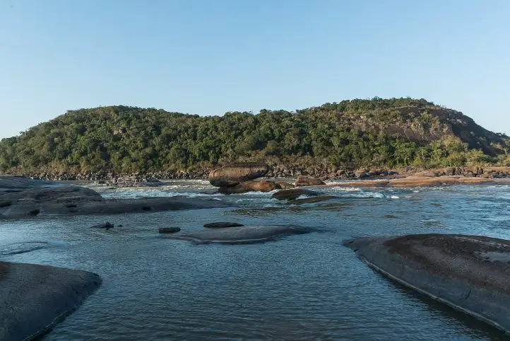
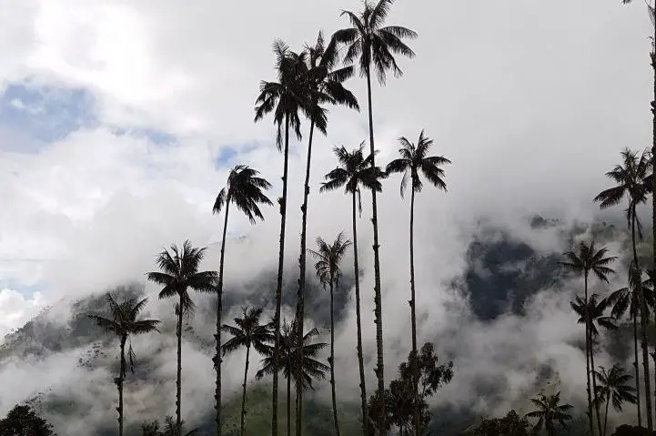
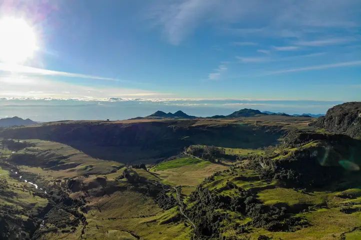
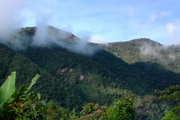
In west of the city of Cali you will find páramos, waterfalls, trails, mountains and rivers hidden in the  youngest rock formations of the Western Cordillera of the Andes: Farallones de Cali Natural National Park.

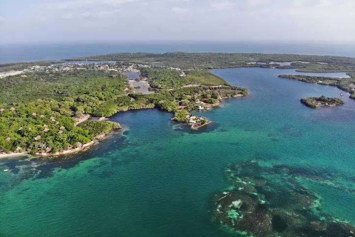
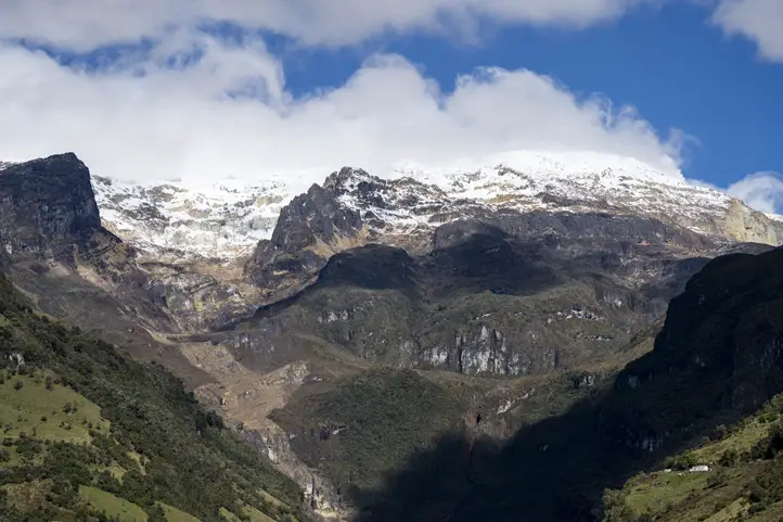
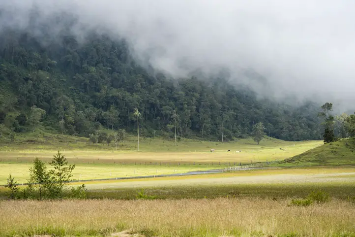
This protected area, distinguished by its majestic blue peaks that rise above a plain that separates the basins of the Pacific and the Cauca River, is recognized for its great natural wealth and therefore becomes a must-see destination when it comes to nature tourism in this region of the country.

Below you will get the information you need to enjoy and fall in love with the largest natural reserve in Valle del Cauca.

Discovering Farallones de Cali Natural National Park

Farallones de Cali National Park is located in southwestern Colombia, in the department of Valle del Cauca, between the municipalities of Cali, Jamundí, Dagua and Buenaventura, covering an area of 1,500 km².

The “farallones” are rock formations of about 20 million years ago, being the youngest of the Western Cordillera of the Andes, formed by the folding of the South American and Nazca tectonic plates.

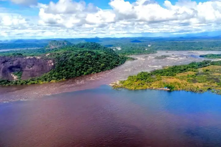
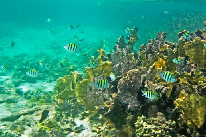
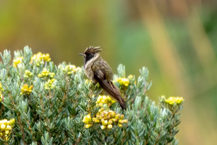
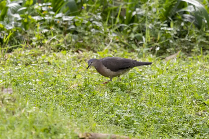
The protected area is the largest in Valle del Cauca and allows the conservation of more than 540 bird species and more than 30 rivers that originate there. The rivers and streams that originate in this area are divided into two basins: the Cauca and Pacific basins, and supply the southwestern part of Colombia.

Pance Peak, Farallones de Cali National Park, CC Parques Nacionales Archives

The elevation gradient is between 200 and 4,100 meters above sea level, where the following ecosystems are present:

  • Tropical Rainforest (200 and 1,200 meters above sea level);
  • Humid Sub-Andean Forest (1,200 and 2,000 meters above sea level);
  • Humid High Andean Forest (2,000 and 3,500 meters above sea level) and
  • Páramo (above 3,500 meters above sea level).

Farallones de Cali NNP has the only paramo ecosystem in Colombia that does not have frailejones. However, the park is considered one of the richest in flora and fauna Colombia.

How to get to Farallones de Cali Natural National Park

Bogotá-Palmira-Pance

Take a 145- minutes flight from El Dorado Bogotá (BOG) to Alfonso Bonilla Aragón International Airport (CLO) at Palmira city. Once at the airport, take an approximately 45- minutes ride to Pance at Centro de Educación Ambiental El Topacio.

What to do in Farallones de Cali NNP

Colombia’s National Natural Parks announced that as a contribution to the country’s economic reactivation and as a continuation of the reopening of protected areas with an ecotourism vocation, the Farallones de Cali National Natural Park reopened its doors so that visitors can enjoy its natural and cultural values.

Authorized sectors for entry

The organization, in charge of administering and managing the Natural Parks System and coordinating the National System of Protected Areas of Colombia, announced the following points that will be authorized for visitors:

  • Puesto de atención a visitantes el Topacio, located in Vereda el Topacio Corregimiento de Pance, Distrito de Cali, access to the attractive Pico de Loro.
  • Quebradahonda Visitor Service Station, located in the Quebradahonda Village, Corregimiento de los Andes, District of Cali, access to the Peñas Blancas attraction.
  • Km 81 Visitor Service Station, located in La Cascada, municipality of Dagua, access to the Cañón del Anchicayá attraction.

Schedules and measures to take into account

National Parks informed that visitors will be able to enjoy the protected area “in day trip mode” and it is important to follow the instructions of the park rangers, the National Police and members of the communities that provide ecotourism support.

The entrance hours are from 6:00 a.m. to 8:00 a.m. and the departure time should be no later than 5:00 p.m.

Biosecurity protocols

At the same time, the entity highlighted the recommendations and biosecurity protocols, which have been developed given the pandemic situation and among which are: maintaining social distance, permanent use of masks and glycerin alcohol, as well as avoiding crowds.

Additionally, the tourist load capacity of each of the trails has been reduced to 30% for this reopening stage, and also police accompaniment is provided.

What to enjoy in Los Farallones?

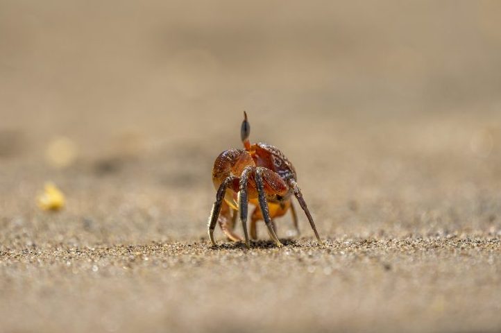
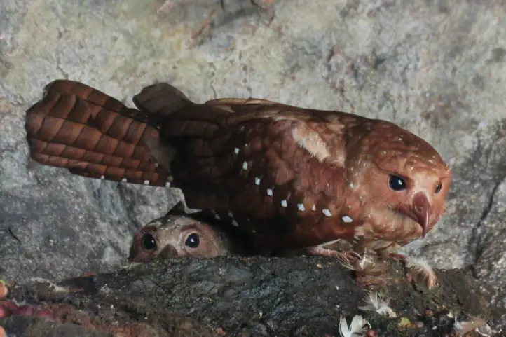
In this protected area you can spot species such as the spectacled bear and the anteater, along with guans, chachalacas, parrots and eagles.

Los Farallones de Cali National Natural Park, located in the Western Cordillera of Colombia, allows visitors to enjoy relaxing landscapes, which are also home to marsupials and monkeys, as well as camping and hiking activities.

Hiking

Hiking is an exciting activity in Farallones de Cali National Park. You can hike on 4 trails: Pico de Loro Trail; Burbujas Trail; Peñas Blancas Trail and Anchicayá Canyon.

  • Pico de Loro Trail: Starting point 1718 masl to 2860 masl arrival point. Difficulty level: Medium – High and maximum capacity of 50 people per day. (3 hours)
  • Burbujas Trail: Starting point 1676 masl to 1735 masl arrival point. Degree of difficulty: Low and maximum capacity of 267 people per day.
  • Peñas Blancas Trail: Starting point 1987 masl to 2886 masl arrival point. Degree of difficulty: Medium – High and maximum capacity of 50 people per day.
  • Anchicayá Canyon: It is a natural well with a depth of approximately 80 cm to 6 meters. Degree of difficulty: Low-Medium and maximum capacity of 200 people per day.
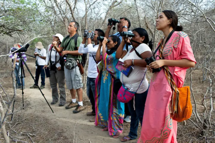
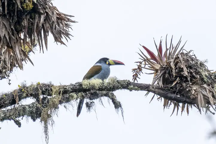
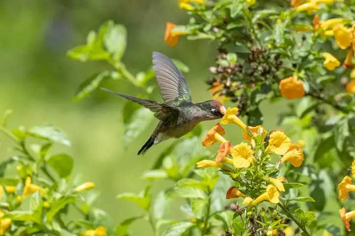
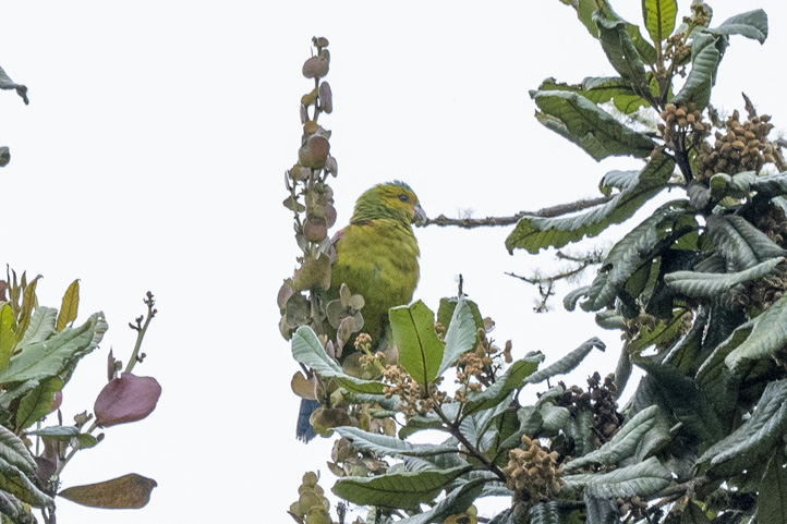
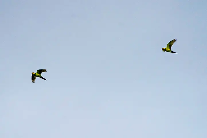
Birdwatching

Tororoi Bailador. CC Diego Calderón (Colombia Birding)

The most representative birds of the park are the:

  • Long-wattled umbrellabird (Cephalopterus penduliger);
  • Multicolored Tanager (Chlorochrysa nitidissima);
  • Yellow-green tanager (Chlorospingus flavovirens);
  • Cauca guan (Penelope perspicax);
  • Andean Cock-of-the-rock (Rupicola peruviana);
  • Banded ground cuckoo (Neomorphus radiolosus); and,
  • Baudó guan (Penelope ortoni).

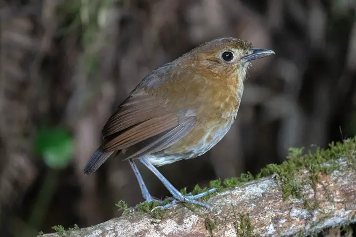
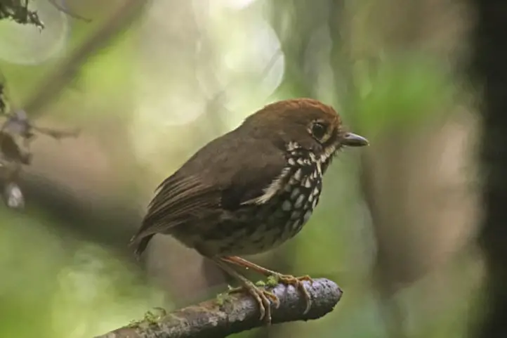
Land of the Tororoi Bailador, or the Dancing Grallaria

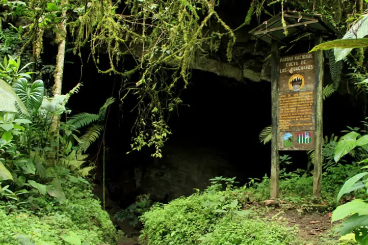
Species number 562 was named Tororoi Bailador, which was discovered in the Dagma conservation area, immersed in the Farallones de Cali National Natural Park.

Thus, the Tororoi Bailador is an endemic bird recorded in the park, and it is known to be present in five rural territories near the park.

Wildlife Tours

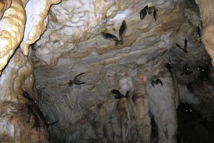
In Farallones de Cali NNP you can observe small bats up to pumas, in addition to panthers, ocelots, foxes and spectacled bears.

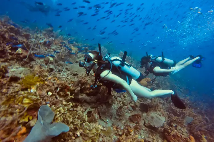
The amphibian community includes the Lehman’s poison dart frog, Oophaga lehmanni. Check our dart frogs tour here.

Orchids tours are also a very well developed activity to do in the park. Know more about orchids of Colombia in our entry The Richest Country in Orchids in the World: Colombia.

Where to stay in Farallones de Cali NNP

Thanks to the proximity of Farallones de Cali NNP with the city of Cali it is not necessary to stay overnight in the park.

We recommend you to stay in Cali, where there are plenty of nice hotels you can stay. Our recommendations for you are:

  • Hotel Casa del Hidalgo
  • Hotel Dann Carton Cali
  • Cali Marriot Hotel

Best time to visit Farallones de Cali NNP

We recommend that you visit the park during the 2 dry seasons, between the months of January and March, and between July and August.

Keep in mind that Farallones de Cali NNP has an average temperature of 25º C (77º F) in most of the marked trails but in the summits it has a temperature of 5º C (41º F).

Farallones de Cali NNP Entrance fees

Farallones de Cali NNP does not currently charge admission to visitors.

What to consider before visiting Farallones de Cali NNP

  • The park currently has regulated access, so you must request access to the following email farallones@parquesnacionales.gov.co.
  • The hours of entry and permanence of the trails allowed in the park are:
    • Pico de Loro Trail: Entrance from 6 am to 8 am; departure 4 pm maximum;
    • Burbujas – Pance: Entrance from 6 am to 5 pm;
    • Peñas Blancas Trail: Entrance from 6 am to 8 am; departure 4 pm maximum;
    • Anchicayá Canyon: stay from 7 am to 5 pm.
    • The Pico Pance trail is currently restricted because it is in an intangible zone.
  • The entry of pets or domestic animals is prohibited.
  • The use of flash when taking photographs is prohibited.
  • Use of binoculars to watch animals’ behavior is recommended.
  • Bring along valid identification documents and health insurance.
  • It is recommended to be vaccinated against yellow fever and tetanus.
  • If you take specific medications, take them with you a personal first aid kit.

Some prohibitions

Feeding, bothering or hunting animals, alcoholic drinks and drugs, throwing cigarette butts, burning garbage, felling, and capturing wildlife.

References
  • Parques Nacionales
  • Colombia.travel
  • Colparques
About the authors

Sara Colmenares

The current director of Sula. Doctor in Biological Sciences. Her main interests are to explore and understand the organism-environment interactions, taking advantage of emerging knowledge for the management and conservation of species and ecosystem services. She is currently working as a consultant in functional ecology, ecosystem services, and conservation projects in Colombia related to ecotourism and birdwatching.

Luisa Martin

Engineer, world traveler, amateur photographer, traveling blogger, and foody.

The Eight Wonder of the World at El Tuparro National Natural Park

A vast green savannah, large rivers, golden beaches, gallery forests and crystal clear waters is what you will find in the Tuparro National Natural Park, a jewel in the heart of the Orinoquia. In this publication you will find important information for your visit to Tuparro National Natural Park in Colombia.

Discovering Tuparro National Natural Park

El Tuparro National Natural Park is located in the Orinoco region of Colombia, and it is part of the department of Vichada. The Tuparro park is bathed by the Tomo River to the north, and the Tuparro, Tuparrito and Caño Maipurés rivers to the south.

Its landscapes expresses in its forms a typical image of the so-called Guiana Shield, one of the oldest geological formations of our planet shared by Brazil, Colombia, Venezuela and, of course, the Guianas.

Tuparro Biosphere Reserve of the World

The park was created in 1970 to advance scientific studies and conserve the region’s biodiversity. This led to its declaration as El Tuparro National Natural Park in 1980 with 548,000 ha. The cultural and biological richness of this region made it worth to be declared a national monument, and core area of a Biosphere Reserve. Know more about biosphere reserves of Colombia in our entry Next Travel Ideas? Visit the Biosphere Reserves of Colombia.

It is also considered an Important Bird Area (IBA) site because it is estimated that there are more than 320 species of birds, many of them associated with the water bodies.

A Sanctuary for All

The park is a sanctuary for birds, orchids, monkeys, snakes and toninas (pink freshwater dolphins). There is also an ancient cemetery that belonged to the Maipur indigenous nation, which is now extinct.

Besides, there are indigenous communities surrounding the protected area: Piaroa, Curripaco, Cuiba, Puinave and Guahibo, who preserve and maintain their traditions amidst the park’s tourism.

What does it mean Tuparro?

This park owes its name to the Tuparro River. Tuparro is the name given to the small hills, rocky outcrops, of less than 900 m. high, which are remains of the ancient Guyanese shield, composed of quartz and currently considered one of the oldest mountains on the continent.

The Raudales de Maipures on the Orinoco River and at the mouth of the Tuparro River, is one of its main attractions. The Orinoco river narrows in this area and its current flows thunderously between giant rocks that extend up to 5 km.

How to Get to Tuparro National Natural Park

Via Bogotá-Puerto Carreño

Take a 1-hour flight from El Dorado International Airport (BOG) Bogotá to German Olano (PCR) at Puerto Carreño city with Colombia´s state own airline: Satena.

Once at the airport, take an approximately 45- minutes ride to Casuarito Port. Once at the Port you should take an extra 10-minutes boat ride to Puerto Ayacucho (Venezuela). Finally in Puerto Ayacucho you should take an extra 15-minutes boat ride to Tuparro.

Via Bogotá- Villavicencio

Take a 1,2-hours flight from El Dorado International Airport (BOG) in Bogotá to Vanguadía Airport (VVC) at Villavicencio city with Satena Airline. In the airport take an approximately 1h1min flight to to German Olano (PCR) at Puerto Carreño city with Satena Airline.

Once at the airport, take an approximately 45- minutes ride to Casuarito Port. Once at the Port you should take an extra 10-minutes boat ride to Puerto Ayacucho (Venezuela). Finally in Puerto Ayacucho you should take an extra 15-minutes boat ride to Tuparro.

What to do in Tuparro National Natural Park

During the induction talk, visitors are informed about the activities carried out in El Tuparro National Natural Park, the conservation objectives, the services offered, and the ecotourism activities that can be carried out.

Hiking and Trekking

Hiking is the most exciting activity in Tuparro National Natural Park. The Attalea (Maipures) trail has a length of 3 km uphill through a palm forest and rocky outcrop. Moderate intesity. When you reach the highest point you can have the view of the Raudal Maipures. This trail is currently being managed by local indigenous communities.

The Eighth Wonder of the World Tuparro Natural Park

The Raudal de Maipures and the Balancín

Formerly called Quituna by the indigenous people of the region, the waters of the Maipures raudal belong to the great Orinoco River. There, this riverbed marks part of the extensive border limits that separate Colombia and Venezuela.

Maipures is one of the most impressive attractions that El Tuparro National Natural Park offers to its visitors. In the 19th century, specifically in 1800, the famous German naturalist Alexander von Humboldt passed through the Maipures stream. He called this place “the eighth wonder of the world”. Among its main attractions, undoubtedly, is the “Balancín”, in the sector of the Atarrayadero, a rock that remains suspended over another, despite the strong currents with which the great Orinoco lambastes there.

The best time to enjoy all the splendor that Maipures offers is during the summer months (low water season due to the few rains that fall in this region), that is, between the months of December and March.

Birdwatching and Wildlife Tours

El Tuparro National Natural Park is a perfect place for those interested in fauna and flora. However, it is not easy to spot wildlife because most of them have crepuscular habits (dawn and dusk) and are elusive.

Birdwatchers will be able to enjoy some of the species since there are records of more than 300 species of birds. Research and monitoring have found 74 species of mammals, 17 species of reptiles, 229 species of fish, and up to 828 species of plants in the protected area. Insects have not yet been surveyed, so all the data that you document during your visit (citizen science) will be of help to continue to nourish the park’s lists.

The main ecosystems present in the park are typical of the Orinoco, including dry and flooded savannah, gallery forests, riparian forests, and rocky outcrops.

Aquatic Tourism

Finishing the hiking activity through the Anaconda trail, you can go through a path in the savannah where meters ahead the visitor will find the attractive blue well, ideal for a refreshing swim. The bathing activity can also be developed in the attractions of Bocas del Tomo, Raudal del Tuparro and caño Peinillas. Kayak can also be practiced in the Raudal del Tuparro.

El Tuparro

Research and Environmental Education

The protected area’s exuberant biodiversity and its conservation status make it a suitable place for scientific research. In addition, activities related to the Environmental Communication and Education Plan are carried out in coordination with educational institutions and in the development of the lines prioritized for the fulfillment of the institutional mission.

Where to stay in Tuparro National Natural Park

Tuparro Natural National Park does not currently offer accommodation for travelers, but it is possible to stay in Puerto Carreño. Therefore we recommend the following hotels:

  • El Lago
  • Cacique Samanare
  • Voragine

Best Time to Visit Tuparro National Natural Park

The best time to visit El Tuparro is the dry season which starts at the beginning of June until late of September and from the beginning of April until late of November, with temperatures around 25º C (77 ºF).

Tuparro National Natural Park Entrance fees

The entrance fee varies depending on the nationality and age of the visitors. These are the entrance fees for 2021:

  • Colombians, resident foreigners and tourists from Bolivia, Ecuador and Peru (ages 5 to 25): COP 10,000
  • Colombians, resident foreigners and tourists from Bolivia, Ecuador and Peru (over 25 years old): COP 16,000
  • Non-resident foreigners (over 5 years old): COP 46,500
  • Children under 5 years old and Colombians over 65 years old have free entrance presenting their IDs.

Before Visiting Tuparro National Natural Park Consider:

  • The entrance of Visitors only will be allowed if it is accompanied by an authorized touristic operator that meets the law requirements, the visitor who enters the park without a touristic operator will be returned by the Staff of the protected area.
  • Due to the security of the visitors and uncomfortable situations that have been presenting with our neighboring country, national parks authorities recommend not traveling to Venezuela.
  • You should avoid taking harmful elements that go against biodiversity, such as aerosols, guns, alcoholic beverages and hallucinogen substances.
  • The staff of the Park reserves the right of entrance and/or permanence to the people that are not mentioned in the entrance permit, this measurement also works for the cases when the total number of people does not matches the number indicated in the permit.
  • Due to evacuation of BIODEGRADABLE trash (bottles, batteries, cans, etc.), it is necessary to carry plastics bags.
  • If you enter through Venezuela, you must do so through a registered tour operator and under their security.
  • Consider wearing personal protective items (sunscreen, sunglasses, towel, insect repellent, and hat).
  • Bring along valid identification documents and health insurance.
  • It is recommended to be vaccinated against yellow fever, measles and tetanus.
  • If you take specific medications, take them with you a personal first aid kit.
  • Photos or videos for commercial or publication purposes must have prior permission from Parques Nacionales. The use of DRONES is not permitted in the Protected Areas for filming and/or photography activities of a private-recreational nature, without prior authorization.

Some prohibitions

Feeding, bothering or hunting animals, alcoholic drinks and drugs, throwing cigarette butts, burning garbage, felling, and capturing wildlife.

References
About the authors

Sara Colmenares

The current director of Sula. Doctor in Biological Sciences. Her main interests are to explore and understand the organism-environment interactions, taking advantage of emerging knowledge for the management and conservation of species and ecosystem services. She is currently working as a consultant in functional ecology, ecosystem services, and conservation projects in Colombia related to ecotourism and birdwatching.

Luisa Martin

Engineer, world traveler, amateur photographer, traveling blogger, and foody.

Travel Guide to Macuira: The Cloud Forest Oasis in La Guajira Desert


Macuira is a National Natural Park of Colombia considered an oasis in the desert of Alta Guajira, in the Caribbean region of Colombia. It is a very special place because it has the contrast between sea, desert and jungle.

The park, with 25,000 ha, was declared in 1977 to protect and conserve the Serrania de la Macuira, which reaches 864 meters above sea level. It is not as high as the Sierra Nevada de Santa Marta, but it has a very special particularity which is the presence of cloud forest very close to the Colombian Caribbean coast and surrounded by a vast desert.

This is why being in the Macuira you can go from the blue of the ocean, through the yellow of the desert, to the green of the jungle. Among the most important characteristics of the Serranía de Macuira is the presence of forested mountains which are the only source of fresh water in the dessert.

Find here why you should visit this beautiful destination in Colombia, the Macuira National Natural Park in La Guajira.

Discovering Macuira National Natural Park

In 1977 and by means of Executive Resolution Nº 149, the National Government created the Macuira National Park, located northeast of the Guajira Peninsula, in the mountain range of the same name.

In practice, it covers an area of 24,103 hectares, corresponding to a mountainous massif that forms the northernmost mountain range in South America, with elevations ranging from 100 to 867 meters above sea level approximately, the Serranía de la Macuira.

This national park, located in Nazareth, in the municipality of Uribia, is ideal for birdwatching, as some 140 bird species have been recorded there, 17 of which are endemic. In addition, the reserve has several forest ecosystems.

The Serranía de Macuira

Serranía de Macuira is composed of three main mountains: Cerro Palúa (865 m), Cerro Huaresh (852 m) and Cerro Jihouone (753 m), which rise from the desert plain. Another isolated hill within the park is Cerro Oriore. There are several freshwater streams, which disappear when they reach the sand dunes at the eastern base of the Sierra.

Picture of Serrania de la Macuira by Luis Pérez, Flickr Creative commons Licence

The main characteristic of the Macuira, which makes it unique in the world, is that it has an evergreen dwarf cloud forest, an ecosystem very similar to the Andean forests located in the páramos. It is an area of great environmental importance because this unique cloud forest ecosystem functions as a water regulator for the region.

The cloud forests themselves are located at altitudes above 2,700 meters above sea level, but in Macuira National Natural Park they can be seen at only 550 meters above sea level and very close to the sea. Definitely, this is a must to see scenery in the world.  It is an oasis in the middle of aridity that supports a great diversity of fauna and flora, especially adapted to survive, grow and reproduce in this type of environment.

Why is there a cloud forest in the Macuira?

The Serrania de la Macuira forms a geological barrier where humidity from the Caribbean Sea condenses, causing the formation of fog that penetrates the forest and creates a humid enclave in the middle of the desert.

This is because the region has a low rainfall and high temperatures, which when combined with the trade winds from the sea and saturated with moisture, rise to meet the barrier of the Serrania, which is why it forms cumulus clouds in the day and nimbostratus in the afternoon.

Traveling to Macuira, Alta Guajira, Colombia

Characteristics of the Macuira Park

Macuira NNP has a territorial area of 250 km², and is located in the extreme north of the department of La Guajira, northwest of the municipality of Uribia, neighboring the small villages of Puerto Estrella, Nazareth, Waretpa, Punta Espada, Siapana and Tawaira.

The are four ecosystems in the park: Dwarf Cloud Forest, Dry Evergreen Forest, Dry Deciduous Forest and Tropical Dry Forest. As mentioned before, this is the most significant rarity of the park, because it has similar conditions to those present below the Andean paramo line around 2,700 meters above sea level. The presence of a cloud forest amidst the desert makes it a unique landscape, a real oasis in La Guajira dessert.

Regarding the dry evergreen forest, It is located at an altitude between 250 and 550 meters above sea level, this allows trees to keep their leaves (foliage) despite possible climate changes. At lower altitudes, there is the Dry Deciduous Forest, located at an altitude between 50 and 400 meters above sea level.

Finally, the Tropical Dry Forest, in the desert plains, is an ecosystem with unparalleled diversity of plants and animals that are adapted to extreme conditions. This ecosystem contains the largest number of endemic species of flora and fauna in the park.

Macuira as an Important Bird Area (IBA)

The entire IBA corresponds to Macuira National Natural Park, created in 1977. The park safeguards endemic and migratory bird species, with a record of 140 bird species, seven of which are endemic subspecies. This is why it was declared an Important Bird Area (IBA), or AICA in Spanish, in Colombia and the world in 2003.

The park is also an especially important scenario within the cosmogony, mythology, social and cultural order of the Wayuu ethnic group.

Presence of Indigenous Communities in Macuira

The indigenous communities present in the department of Guajira are the Wayuú, of the Arawak linguistic family, who have occupied this sector for centuries. They are distributed in communities throughout Guajira, but the most important settlement are in Nazareth or Akuwai, northeast of Guarece Hill.

@Colombiafrank Sharing time with the Wayuu people in Alta Guajira, Colombia

The economy of these communities is based on grazing activities, artisanal fishing, handicrafts and seasonal agriculture. In addition, the organization of National Natural Parks offers work on an annual basis to a representative of each clan.

Wayuu Handicrafts, La Guajira, Colombia

Two clans out of 7 are selected annually to provide information and orientation to the sanctuary’s visitors with the support of a representative from the national natural parks in the city of Bogota.

Uribía, one of the nearest towns from Macuira, is the most important Wayuu town in La Guajira and is considered the indigenous capital of Colombia.

How to Get to Macuira National Natural Park

Macuira National Natural Park is located in the extreme north of the department of La Guajira, northwest of the municipality of Uribia, is adjacent to the villages of: Puerto Estrella, Nazareth, Waretpa, Punta Espada, Siapana and Tawaira. In addition, it is totally overlapped with the reservation of Alta and Media Guajira.

Traveling in La Guajira

To get to the park from Riohacha, you must go by land to the city of Maicao, then continue to the town of Uribia, and from there to Puerto Portete, a town located on the bay of the same name. From there, a dirt road leads to the town of Nazareth. This trip takes between 6 and 8 hours in a four-wheel drive vehicle, as long as the weather conditions are favorable.

From Bogotá

Take a 1-hour flight from El Dorado International Airport (BOG) Bogotá to Almirante Padilla International Airport (RCH) at Riohacha city. Once at the airport, take an approximately 1,5- hours ride to Uribia. Then, in Uribia you should take a 2-hours ride to Bahía Portete. Finally, once in Bahía Portete you should take an extra 6-hours ride to Nazareth.

What to do in Macuira National Natural Park

As a visitor to the park you can hike through the Serranía de Macuira, you can visit the indigenous Wayú cemeteries, or you can also find handicrafts made by the inhabitants of the region in the surrounding municipalities.

Hiking and Trekking

Hiking is the most exciting activity in Macuira National Natural Park. The park has hikes of different degrees of difficulty (low and medium), where you can appreciate dunes, natural pools and temporary streams.

If you want to make the ascent to the Macuira mountain range you must be clear that the degree of difficulty is high, so you must have good physical condition and endurance for long walks of 5 to 7 hours.

Birdwatching and Wildlife Observation

Within the 5 ecosystems of the park, there are 140 bird species recorded and that can be appreciated, 7 of which are endemic subspecies:

  • Scrub Greenlet (Hylophilus flavipes)
  • Pectoral sparrow (Arremon taciturnus fratruekis)
  • Blue-crowned Motmot (Momotus momota)
  • Pale-breasted Thrush (Turdus leucomelas)
  • Red-legged honeycreeper (Cyanerpes cyaneus)
  • Buff-breasted Wren (Cantorchilus leucotis)
  • Rufous-vented chachalaca (Ortalis ruficauda)

Additionally, 10 of the species are reported to be migratory.

Besides birds, there are a significant number of insects at the Park, as well as a notable presence of amphibians (toads and frogs), iguanas, snakes and mammals, such as the White-fronted capuchin (Cebus albifrons), ocelot (Felis pardalis) and Jaguarundi (Herpailurus yagouaroundi).

Where to stay in Macuira National Natural Park

Macuira National Natural Park does not currently offer lodging for travelers. It is possible to stay in the nearby “rancheria” of Nazaret. In the rancheria of Nazaret there are 2 camping areas called Villa Inmaculada and Emerrare.

Rancherias in La Guajira

Moreover, if you wish to spend a night in a traditional Wayú ranchería, the village also offers a night full of tradition with the locals of the sector.

If you want to rest in a hotel we recommend: Hotel Mulamana

Best time to visit Macuira National Natural Park

Dry season starts at the beginning of December until late of March with weather around 30º C (86 ºF). In the higher parts of the Macuira mountain range there are persistent winds and in the lower parts the temperatures are higher and the humidity increases.

Macuira National Natural Park Entrance fees

The park does not currently charge admission fees, but visitors must register at the park’s facilities and stay for a defined period of time.

What to consider before visiting Macuira National Natural Park

  • Currently access to the cloud forest is not allowed, as it is a very fragile ecosystem and highly valued by the Wayuu people.
  • The ranchería of Pusheo is the only restaurant in the sector, since the distances are very long and it is necessary to buy enough food for the trips.
  • You should always travel accompanied by a Wayuu driver and/or guide with a good command of Wayunaiki and Spanish, as well as knowledge of the communities of Alta Guajira.
  • For tours inside Macuira National Park, a local Wayuu guide authorized by the park must be hired.
  • The use of flash when taking photographs is prohibited.
  • Use of binoculars to watch animals’ behavior.
  • Bring along valid identification documents and health insurance.
  • Be vaccinated against yellow fever, tetanus and covid-19.
  • If you take specific medications, take them with you a personal first aid kit.

Some prohibitions

Feeding, bothering or hunting animals, alcoholic drinks and drugs, throwing cigarette butts, burning garbage, felling, and capturing wildlife.

References
  • Colparques
  • Parques nacionales
About the authors

Sara Colmenares

The current director of Sula. Doctor in Biological Sciences. Her main interests are to explore and understand the organism-environment interactions, taking advantage of emerging knowledge for the management and conservation of species and ecosystem services. She is currently working as a consultant in functional ecology, ecosystem services, and conservation projects in Colombia related to ecotourism and birdwatching.

Luisa Martin

Engineer, world traveler, amateur photographer, traveling blogger, and foody.

Ultimate Travel Guide to the Utría National Natural Park

Discover the natural wonders of Utría National Natural Park in Colombia. It is possible to admire a series of mountainous spurs covered with exuberant tropical jungle, and bathed by the mysterious waters of the Pacific Sea. Its landscapes can be described with rainforest, mangroves, and gray beaches, and it is an ideal place for whale watching in Colombia.

Discovering Utría National Natural Park

This park locates in the Biogeographic Choco Forest, belonging to the Baudo mountain range, in the north of the Colombian Pacific coast, in the department of Choco. This region is known worldwide to be the rainiest, and it is also an important biodiversity hotspot.

The park has a unique peaceful boat ride way inset to the sounds of the jungle. A beautiful lagoon of marine water surrounded by mangroves and gray beaches welcomes you.

At Utría, you can evidence a fracture of the earth generated millions of years ago. This fracture allows seawater to flow for 7km inland.

The Baudó mountain range gives rise to the Boroboro, Jurubidá, Baudó, Chori and Bojayá rivers, as well as the giant Caribbean and Pacific hydrographic areas. The hydrographic representation of this area is 2,242 MMC.

Biodiversity

This protected area has 7 of the 10 species of mangroves and hidden rocky cliffs reaching heights of 1,400 meters above sea level. Depending on the season, mangrove roots protrude like land animals at low tide. When the tide rises, roots hide underwater, serving as a shelter for water animals that visit to mate.

The diversity of the park makes it a magical place to appreciate diverse environments and ecosystems. The contrast of tropical rainforest and reefs makes the flora and fauna of this protected area quite unique and diverse.

Ethnography

Utría is a territory populated by two communities that are strategic allies for the conservation and protection of the park.

On one side, the “Embera” natives, which live within the jungles of the province of Chocó, keeping their cultural traditions intact. Their presence is also noticeable in the provinces of Antioquia, Risaralda, Quindio, Caldas, Valle, Cauca, Cordoba, Putumayo, Caquetá and Nariño.

On the other side, the black afro-Colombian communities of the Pacific coast that are known for developing economic activities related to the art of the sea and are the ones that have the most contact with visitors of this protected area.

How to get to Utría National Natural Park

Bogotá-Medellín-Bahía Solano

Take a flight to Rionegro José María Córdoba (JMC) airport in Medellín. Take a taxi ride to Medellin´s alternative Olaya Herrera airport (OH) at the city center, about 40 minutes away.

From Olaya Herrera, you can take a flight to Bahia Solano using Colombia’s national airline, Satena. Finally, from Bahía Solano take a boat to Utria National Natural Park.

Bogotá-Quibdo-Bahía Solano

Take a 1-hour flight from Bogotá to El Caraño Airport (UIB) at Quibdo city. Once at the airport, you have to take a flight to Bahia Solano with Satena Airline. Finally, from Bahía Solano take a boat to Utria National Natural Park.

Cali-Buenaventura-Bahía Solano

Take a 145-minute flight from Bogotá to Alfonso Bonilla Aragón International Airport (CLO) at Palmira city. Once at the airport, take an approximately 3-hour ride to Buenaventura.

In Buenaventura, take a 6 hours boat trip to Bahia Solano. Lastly, from Bahía Solano take a boat to Utria National Natural Park.

Although these three routes exist, we recommend the Medellin-Bahia Solano route because it is the safest.

What to do in Utría National Natural Park

Utría National Natural Park is currently closed. Those who wish to visit Utría and carry out ecotourism activities may do so in the day trip mode, that is, enter the protected area in the morning and leave at the time arranged by the park.

The staff of Utría National Natural Park is the only one in charge of registering at the park’s entrance, giving induction talks, explaining the authorized sites, and providing recommendations for any activity within the protected area.

Utría National Natural Park, known as the ‘cradle of whales’, continues its whale season without any setbacks, as in previous years.

Hiking and Trekking

Hiking along any of the 3 available trails is the most exciting activity in Utría National Natural Park:

  • Cocalito Trail, the round trip is about 1 km, 1 hour and it’s of moderate level of difficulty.
  • Estero Grande Trail, the round trip is about 611 m, 40 minutes, low level of difficulty.
  • Water trip, about 1.1 km long, with a low degree of difficulty; it can be done by canoeing at high tide.

Diving and Snorkeling

Diving at Punta Esperanza and Punta Diego, an ecosystem rich in coral formations and marine life is a must-do. At Playa Blanca, there is a marked snorkeling area. Diving programs, rental equipment, and facilities are available on site.

Wildlife Observation in Utría

Utría hosts unique ecosystems on the planet and is ideal for observing a great amount of native fauna and flora. Regarding mammals, at the Utría Natural National Park it is possible to observe:

  • Giant anteater (Myrmecophaga tridactyla)
  • Jaguar (Panthera onca centralis),
  • Neotropical otter (Lontra longicaudis),
  • Gray-bellied night monkey (Aotus lemurinus zonalis),
  • Geoffroy’s spider monkey (Ateles geoffroyi),
  • Mantled howler (Alouatta palliata),
  • Baird’s tapir (Tapirus bairdii),
  • White-lipped peccary (Tayassu pecari),
  • Tamarins (Saguinus sp.),
  • Colombian white-faced capuchin (Cebus capuccinus),
  • Margay (Leopardus wiedii),
  • Agouti (Dasyprocta punctata),
  • Common opossum (Didelphys marsupialis),
  • South American coati (Nasua nasua),
  • Lowland paca (Cuniculus paca),
  • Red brocket (Mazama americana),
  • Tayra (Eira barbara) y
  • Hoffmann’s two-toed sloth (Chloepus hoffmanni)

With regards to marine life, it is worth noting that this point of the Pacific is ideal for animal mating and the birth of the amazing humpback whale (Megaptera novaeangliae), Orcas, or killer whales (Orcinus orca), and sperm whales or cachalot (Physeter macrocephalus).

Ocypode gaudichaudii, also known as the painted ghost crab or cart driver crab. Huina Beach, Bahía Solano, Chocó.

The area has 105 species of decapod crustaceans, where the painted ghost crab (Ocypode gaudichaudii) is a predominant species. There is also the presence of bivalves such as the Hacha (Pinna rugosa) and “piangua” (Anadara spp.), and mollusks such as the Eastern Pacific giant conch (Titanostrombus galeatus).

It is also possible to see endangered species of sea turtles on the beaches such as the olive ridley sea turtle (Lepidochelys olivacea), the hawksbill sea turtle (Eretmochelys imbricata), and the leatherback sea turtle (Dermochelys coriacea).

Bird Watching

Around 270 species of birds may be observed in Utria National Natural Park, being the most diverse watching spot in the area. The endemic birds in the Utria park are:

  • Choco tinamou or Chocó tinamou (Crypturellus kerriae)
  • The Harpy eagle (Harpia harpyja)
  • Great Green Macaw (Ara ambiguus)
  • The Great Curassow (Crax rubra)

Other bird species are Turkey vulture (Cathartes aura), Tricolored heron (Egretta tricolor), Yellow-crowned night heron (Nyctanassa violacea), Osprey (Pandion haliaetus), and many migratory shorebirds.

Where to stay in Utría National Natural Park

Utría National Natural Park offers shared accommodations within the Park. Additional accommodation alternatives are available close by. Our suggested choices are:

  • Ecolodge El Almejal is located in Bahia Solano, 24 km away from the protected area.
  • Hotel Costa Choco is in Bahia Solano, 30 km away from the protected area.
  • Coco Loco Lodge is in Bahia Solano, 23 km away from the protected area.

Best time to visit the Utría National Natural Park

Humpback whale watching season happens between July and November. Note that at Utría it rains for approximately 300 days a year, and October is considered the rainiest month.

Utría National Natural Park Entrance fees

The entrance fee varies depending on the nationality and age of the visitors. These are the entrance fees for 2021:

  • Colombians, resident foreigners, and tourists from Bolivia, Ecuador, and Peru (ages 5 to 25): COP 13,000
  • Colombians, resident foreigners, and tourists from Bolivia, Ecuador, and Peru (over 25 years old): COP 19,500
  • Non-resident foreigners (over 5 years old): COP 55,000
  • Children under 5 years old and Colombians over 65 years old have free entrance presenting their IDs.

What to consider before visiting Utría National Natural Park

  • To take any of the tours inside the park you must hire an authorized and certified guide.
  • Consider wearing personal protective items (sun blocker, sunglasses, towel, insect repellent, and hat).
  • The use of flash when taking photographs is prohibited.
  • Recommended the use of binoculars to admire animals’ behavior and beauty in their natural habitat.
  • Carry valid identity documents and health insurance. It is recommended to be vaccinated against yellow fever and tetanus.
  • If you take specific medications, take them with you. It’s never enough to carry a personal medicine kit.

Some prohibitions

Feeding, bothering, or hunting animals, alcoholic drinks and drugs, throwing cigarette butts, burning garbage, felling, and capturing wildlife.

References
About the authors

Luisa Martin

Engineer, world traveler, amateur photographer, traveling blogger, and foody.

Travel Guide to El Rosario and San Bernardo Corals National Natural Park

Meet the most iconic marine life paradise in Colombia, the El Rosario, and San Bernardo Corals National Natural Park. On the Caribbean coast of Colombia close to the coastal areas of the provinces of Bolívar and Sucre, and part of the jurisdiction of Cartagena, you will find the archipelago of El Rosario and San Bernardo Corals National Natural Park.

This archipelago is formed by 40 small islands, and it was declared a National Natural Park to protect the population of coral reefs and mangroves that are found in this area.

The crystal-clear waters and white beaches welcome those who visit the park to experience a large variety of flora and fauna. At the Rosario and San Bernardo islands, water activities such as canoeing, snorkeling, and diving are all must-do activities.

Discovering El Rosario and San Bernardo Corals National Natural Park

With an area of 1,200 square kilometers, the park has an underwater set of ecosystems that give life to the largest coral platform in the Colombian Caribbean. Thus, the park is host to the largest coral reef formations in Colombia. The three ecosystems you can find in the park are:

Coral reefs

These are the essential ecosystem that provides food and shelter for approximately 25% of the marine fauna present in the area.

Coral reefs, as in the rest of the world, are very vulnerable and need crystal waters, light, and stable substrates that do not affect their composition. The ideal temperature should be between 25º C (77º F) and 31º C (86ºF).

At San Bernardo, they take an area of 191.68 square kilometers, approximately 72% of the total amount of coral reefs in Colombia.

Mangroves

This marine-coastal ecosystem, formed by trees of different sizes with roots that protrude from the mud, is a powerful filter of salty water. Mangroves are by far the most productive ecosystem in these areas and an important source of flora and fauna resources.

More than 60% of the world’s tropical fish depend on this ecosystem for their survival. The park has four species of mangrove worth preserving:

  • Red mangrove (Rhizophora mangle),
  • White mangrove (Laguncularia racemosa),
  • Buttonwood or button mangrove (Conocarpus erectus); and
  • Black mangrove (Avicennia germinans).

Coral reefs and mangroves are also a powerful natural barrier to tsunamis and hurricanes.

Seagrass

The park has 30.35 square kilometers of sea pastures, serving as a food provider and shelter for several marine species.

Pastures depend on calm waters between 20 and 30 meters deep for their survival. This allows the circulation of nutrients that benefit them as well as the species that depend on them.

In the park, the most common seagrass species is the Turtle grass (Thalassia testudinum), providing firmness to the bottom of the ground where they live.

How to get to El Rosario and San Bernardo Corals National Natural Park

From Cartagena

When you arrive at Rafael Nuñez International Airport (CTG) take approximately 15 minutes to ride to the “La Bodeguita” dock (8 km). In “La Bodeguita” is necessary to take a boat trip of 2 hours to reach the facilities of the park in the archipelago of Our Lady of the Rosary (Nuestra Senora del Rosario).

From Santiago de Tolú

Take a 50 minutes flight from Bogotá to Las Brujas Airport (CTG) at Sincelejo city. From Sincelejo take an approximately 45 minutes ride to Santiago de Tolú (40 km).

Once at Santiago de Tolú is necessary to take a 1-hour boat trip to reach the facilities of the park in the archipelago of San Bernardo.

What to do in El Rosario and San Bernardo Corals National Natural Park

Diving and snorkeling

The underwater trails of Punta Brava and Luis Guerra in Isla Grande and Isla Tintipan are perfect for sea diving or snorkeling. A supervised company by authorized instructors is highly recommended.

We recommend staying within delimited marked areas.

Diving tours in the Rosario Islands, Cartagena ©https://divingplanet.org/

Sailing in the mangroves

The natural aquatic-terrestrial path of Isla Grande, the Lagoon of Silence, an ideal place to take photos and videos.

Help support Cangrejos Azules, the entity in charge of organizing ecotourism in the area with the help of local communities at Islas del Rosario.

Wildlife Observation

In the protected area it is possible to see 62 species of corals, including the blade fire coral (Millepora complanata), the thin leaf lettuce coral (Agaricia tenuifolia), and the massive starlet coral or round starlet coral (Siderastrea siderea).

In the case of decapod crustaceans, there are 153 species; mollusks with 244 species. No less than 153 species of echinoderms; 199 species of sponges and 513 species of fish.

Coral Reef Fishes at natural national park Corales del Rosario y de San Bernardo. Ph. ©Parques Nacionales

Finally, it is possible to find sea turtles such as the loggerhead sea turtle (Caretta caretta), the green sea turtle (Chelonia mydas), and the critically endangered hawksbill sea turtle (Eretmochelys imbricata).

Bird Watching

Within the park, it is possible to identify more than 60 species of birds. 31 of which are seabirds, including cormorants, gulls, frigates, and pelicans. There are also colonies of herons and ibis.

Where to stay in El Rosario and San Bernardo Corals National Natural Park

It is possible to find different accommodations. Suggested choices are:

  • Hotel Las Islas, a luxury ecolodge in Baru.
  • Coralina island is the perfect place to relax, in Isla Grande.
  • Gente de Mar Resort, Location, and service are exceptional, in Isla Grande.
  • Hotel San Pedro de Majagua, the staff is wonderful, and the rooms excellent, in Isla Grande.
Las Islas Hotel – Barú, Cartagena

Best time to visit El Rosario and San Bernardo Corals National Natural Park

The dry season that starts December until late March is the best to visit El Rosario and San Bernardo islands. It is also the peak season for national tourists, so be aware the place must be crowded.

Entrance fees

The entrance fee varies depending on the nationality and age of the visitors. These are the entrance fees for 2021:

  • Colombians, foreigners holding a valid residence permit, and tourists from Bolivia, Ecuador, and Peru (ages 5 to 25): COP 9,500
  • Colombians, foreigners holding a valid residence permit, and tourists from Bolivia, Ecuador, and Peru (over 25 years old): COP 9,500
  • Children under 5 and Colombians over 65 years old have free entrance provided they present their identification cards.

What to consider before visiting El Rosario and San Bernardo Corals National Natural Park

  • Guided tours must be taken with authorized and certified tourist guides
  • Consider wearing personal protective items (sun blocker, sunglasses, towel, insect repellent, and hat).
  • The use of flash when taking photographs is prohibited.
  • use of binoculars to admire animal behavior and beauty in their natural habitat is recommended
  • Carry valid identity documents and health insurance.
  • It is recommended to be vaccinated against yellow fever and tetanus.
  • If you take specific medications, take them with you. It’s never enough to carry a personal medicine kit.

Some prohibitions

Feeding, bothering, or hunting animals, alcoholic drinks and drugs, throwing cigarette butts, burning garbage, felling, and capturing wildlife.

References
  • Colparques Website
  • Parques Nacionales Website
About the authors

Luisa Martin

Engineer, world traveler, amateur photographer, traveling blogger, and foody.

Did you Know that the Oilbirds have their own National Park in Colombia?

The Southern part of the department of Huila holds the oldest and one of the best-preserved protected areas in Colombia-. It is an amazing place where various endangered species are still preserved and protected, such as the Oilbird. We are talking about the Cueva de Los Guácharos National Park (Oilbirds Cave).

The Oilbirds, or Guácharos

For reference, Oilbirds (Steatornis caripensis) are birds that spend all day in the depths of the caves and go out at night to hunt food, usually insects, fruits, and aromatic plants.

Same as bats, Oilbirds also use a quite precise natural echo localization system. Hence, they make a series of short and squealing sounds that serve as waves that are used for their localization.

According to the American Bird Conservancy about the Oilbird:

“it is named for the young birds, which are so fat that indigenous people and early settlers once collected and rendered them down to oil for lighting and cooking”.

The Oilbird, Steatornis caripensis, or Guácharo in Spanish. ©BirdsColombia

Discovering the Cueva de Los Guácharos Natural National Park

Cueva de Los Guácharos NNP was named after the Oilbird, which is called Guácharo in Spanish.

The Cueva de Los Guácharos NNP was created in 1960 and belongs to the “Biósfera Cinturón Andino”, Andean Belt Reserve declared by UNESCO in 1979.

Find out more about Colombian Biosphere Reserves in our entry Next Travel Ideas? Visit the Biosphere Reserves of Colombia.

It totals an area of 90 square kilometers and is located at the western flank of the Cordillera Oriental, between the departments of Huila and Caquetá. Also, the Cave of the Guácharos is very close to the Magdalena River.

Lastly, Cueva de Los Guácharos is considered part of “Andean Amazonian” transition ecosystems, having a great role as a water regulator, among other ecosystem services. Due to its unique characteristics, it is a nest and transitory refugee stop for a large number of migratory birds.

Weather

Cueva de Los Guácharos Park is between 1200 meters and 3800 meters above sea level and its temperatures vary between 19 °C and 26 °C, with very humid climatic characteristics.

How to get to the Cueva de Los Guácharos National Park

From Bogotá

Take a 1.5-hour flight from Bogotá to El Contador Airport (PTX) at Pitalito city. From Pitalito, take a 1-hour ride to Palestina, and an additional 1-hour car ride to La Mesura.

Once at Mesura, look for Cedar where the National Natural Parks access point to Cueva de Los Guácharos is located.

At this point, you can choose to take an 8.5 km hike (3.5 to 5 hours long) or take the transport service available to the accommodation area.

Bear in mind that Satena (Colombian national public airline) is the only one flying to Pitalito Saturdays and Mondays.

What to do in the Cueva de Los Guácharos National Park

Cueva de Los Guácharos National Natural Park has community-based ecotourism operators that provide lodging services in cabins and shared bathrooms for up to 50 people, a camping area for up to 24 people, restaurant service, horse rental, and guiding.

You must know that it is not possible to access or hanging around the park without the accompaniment of a local guide.

Hiking and Trekking

Within the area of the park, there are many canyons and labyrinths. The Cueva de Los Guácharos has caves formed by the chemical and mechanical action of the Sauza River and its tributaries.

Hiking is the most exciting activity in Cueva de Los Guácharos Park. You can hike only until the glacier edge along 4 trails:

  • Black Oak Trail with a 4-hour round trip (3.9 km) and high difficulty.
  • Giant’s Way Trail with a 2-hour round trip (2.7 km) and medium difficulty.
  • Rain of Crystals Trail with a 2-hour round trip (1.7 km) and medium difficulty
  • Waterfall of colors Trail with a 5-hour round trip (3.1 km) and high difficulty.

This activity allows you to admire the 2 caves of Oilbirds, the caves of calcareous formations, and the 2 natural bridges over the Rio Suaza. Also, the Cristales waterfalls, and the Lindosa waterfall.

Cueva de los Guacharos National Park. ©David Páez, Parques Nacionales Archives

Wildlife observation

Along the trails, you may spot the wonders of Cueva de Los Guácharos, among which stand out native species such as the Spectacled bear (Tremarctos ornatus), the Northern Pudu (Pudu mephistopheles), the cougar (Puma concolor), the long-tailed weasel (Mustela frenata), and the mountain tapir, also known as the Andean tapir or woolly tapir (Tapirus pinchaque).

Regarding flora, you will be able to appreciate almost extinct species in their natural state such as black oak (endemic), white oak, copper, black cedar, cumin, hayuelo pine, and the Colombian pine.

Birdwatching, and the Oilbirds Caves

Cueva de Los Guácharos is a permanent habitat for more than 300 species of birds including the Oilbird, the Andean cock-of-the-rock (Rupicola peruviana), and the Torrent Duck (Merganetta armata colombiana).

The Oilbird, Steatornis caripensis., or Guacharo in Spanish. ©BirdsColombia

Do not forget that depending on the season different migratory birds that inhabit this territory may be observed.

Where to stay in the Cueva de Los Guácharos National park

The park has a Visitor Center called Andakí. The community-based ecotourism operator, Fundación Cerca Viva, provides lodging for 50 people in multiple accommodations (cabins), distributed in 5 bedrooms with bathrooms.

Additionally, the park also offers a VIP cabin with accommodation for 8 people and a private bathroom.

There is also a classroom for environmental education activities.

Best time to visit Cueva de Los Guácharos

The dry season (December to late February) is climate-wise the most preferable choice, however, it is also a peak season for national tourists so be prepared.

Worth noting is that usually between March and April Oilbirds’ offspring begin to hatch, which is considered a very attractive natural phenomenon.

Entrance fees

The entrance fee to Cueva de Los Guácharos varies depending on the nationality and age of the visitors. These are the entrance fees for 2021:

  • Colombians, foreigners holding a residence permit, and tourists from Bolivia, Ecuador, and Peru (ages 5 to 25): COP 15,000
  • Colombians, foreigners holding a residence permit, and tourists from Bolivia, Ecuador, and Peru (over 25 years old): COP 19,500
  • Non-resident foreigners (over 5 years old): COP 51,500
  • Children under 5 years old and Colombians over 65 years old have free entrance presenting their IDs.

What to consider when visiting the Cueva de Los Guácharos National Park

  • Book reservation in advance with an authorized ecotourism operator.
  • Wear suitable clothing for cold and humid weather.
  • Take reusable water bottles along.
  • Keep away from making any marks on trees, stones, or infrastructure available.
  • Noises or sounds that disturb the environment are not allowed.
  • Return ALL garbage and dispose of it at the waste disposal sites.
  • Admission of children under 5 years old, pregnant women, people with heart or respiratory conditions is not recommended.
  • Tours inside the park must be taken with registered and authorized guides.
  • Avoid taking night walks on the trails.

Some prohibitions

Feeding, bothering, or hunting animals, littering, pets, horses alcoholic drinks and drugs, making bonfires, throwing cigarette butts, burning garbage, felling, and capturing wildlife.

References
  • National Parks Website
  • Local guides
About the authors

Luisa Martin
Engineer, world traveler, amateur photographer, traveling blogger, and foody.

Community-based Ecotourism in Colombia: A Bet for Local Development

Have you heard about community-based ecotourism? If not, here we will tell you about it. Community-based ecotourism aims at harmony between nature conservation and people, where ecotourism activities provide greater benefits to local communities.

For more than 10 years community-based ecotourism in Colombia exists, being promoted by the Colombian government and organizations such as the Ministry of Commerce, Industry and Tourism, National Parks of Colombia, USAID, and AUDUBON.

This whole process of tourism development hand in hand with local communities involves training, organizational strengthening, promotion, and marketing of destinations.

Over time, difficulties, lessons learned, and developing a process that involves a community-based private organization and public institutions have been revealed and overcome.

Visiting Usiacurí and Luriza Reserve

The Importance of Community-based Ecotourism

These are the great advantages of community-based tourism:

  1. Tourism generates opportunities outside the big cities,
  2. Helps preservation of the cultural and natural heritage of rural communities, indigenous peoples, and many other historically marginalized populations around the world.
  3. For many rural communities around the world, tourism is a major generator of employment and opportunity, especially for women and youth.
  4. In some places, ecotourism is one of the few viable economic and legal activities.
  5. Tourism also enables rural communities to celebrate their unique cultural heritage and traditions.
  6. Community-based ecotourismis a vital sector for safeguarding habitats and endangered species.
  7. Economic income goes directly to the native lodges, to the local transporter, to the people who carry out daily activities, such as traditional cooking workshops, or traditional fishing activities, etc.
  8. Communities are transformed by learning to do responsible, differentiated, and environmentally friendly tourism, and they are more and more convinced every day of having beautiful territories.
  9. From your side, you are contributing to cultural or wildlife conservation programs, such as sea turtles, whales, birds, or pink dolphins.
Community-based tourism Usiacurí, Atlantico, Colombia

The High Impact of the Pandemic

2020 has been a very hard year for this type of tourism. Many families dedicated to this business were ruined. Some communities are able to survive because they can return to their old trades such as agriculture and fishing.

However, many of them are eagerly awaiting the opportunity to reopen their doors to travelers. It depends not only on them but also on new challenges such as the implementation of biosecurity protocols on their part.

Communities within the Protected Areas of Colombia

In Colombia, many of the protected areas have communities within them or in their areas of influence, i.e., border zones. For example, Afro-descendant communities in Utria national park in the Pacific, or the indigenous communities living in the Sierra Nevada de Santa Marta national park in the Caribbean.

Indigenous People from the Sierra Nevada, picture by Banco de la Republica

These local communities have become valuable allies for the conservation of natural values in parks, reserves, and sanctuaries.

At the same time, the communities represent cultural values that in many cases are also object of conservation in the protected areas.

Who is involved, and what they do?

Entire families and young people establish community associations and are trained to provide eco-tourism services with the support of the Colombian National Parks System, or by foundations such as USAID or AUDUBON Society.

Thus, some learn about the natural values of the protected area to provide environmental interpreter services, others specialize as ecotourism guides, some improve their knowledge of typical gastronomy, and others explore handicraft production techniques.

Picture from Audubon: “Wayuu indigenous students and teacher Alvaro Jaramillo are bird watching in La Guajira, Colombia. The program teaches locals to become tour guides for travelers interested in spotting birds. Photo: Carlos Villalon”

Moreover, many of them are trained in the application of clean technologies that they will later use for the sustainable management of all ecotourism activities.

In recent years, the most successful processes have been the Colombian Birding Trails designed in the Caribbean and the Andean regions, where Audubon Society developed hand in hand with the local communities important birding trails around Colombia.

Ongoing projects are the Riqueza Natural Award, where local people, technology, and innovation were the main components to design new nature tourism offers in Colombia. Find out more about these destinations in our entry The Top Post-Covid-19 Destinations for Conservation Lovers in Colombia.

Community-based Ecotourism in Colombian National Parks

Today there are seven protected areas of the Colombian National Parks System that have the active participation of community organizations that offer their services to tourists. These areas have very diverse natural environments and a great variety of cultural manifestations:

  1. Iguaque Fauna and Flora Sanctuary, with the community organization Natural Iguaque, formed by farmers from the municipality of Arcabuco (Boyacá).
  2. Los Flamencos Fauna and Flora Sanctuary, with the El Santuario Association formed by residents of the village of Camarones (Guajira).
  3. Otún Quimbaya Fauna and Flora Sanctuary, with the Yarumo Blanco Association formed by a group of young people from the village of Floridablanca (Risaralda).
  4. Corales del Rosario and San Bernardo National Natural Park, with the community organization Nativos Activos, formed by inhabitants of the community of Orika (Isla Grande).
  5. Utría National Natural Park, with the Mano Cambiada Corporation, formed by inhabitants of the municipality of Nuquí (Chocó);
  6. Chingaza National Natural Park, Siecha sector, with the Asociación Ecoturistica Suasie, formed by young people from Vereda Trinidad (Cundinamarca).
  7. El Cocuy National Natural Park, with the Guías de Güican and Cocuy Association formed by farmers from the municipalities of Güican and Cocuy (Boyacá).

All of them offer several different services, such as multi-day packages to explore the region. You can book directly with them, or with our help. In general, the main objective is increasing sales of community products. In SULA, we help them, and you, making reservations more efficient.

La Guajira – Los Flamencos National Natural Park

Other Community-based Ecotourism Destinations in Colombia

Community-based tourism initiatives around Colombia, picture MinCIT, 2017

Of the many beautiful places that Colombia has, we recommend:

  1. Chocó, a unique place with indigenous and afro traditions, as well as a huge biodiversity richness. The Chocó municipalities of Nuquí, Bahía Solano, Capurganá, and Sapzurro are developing this kind of tourism.
  2. The islands of San Andres, Providencia, and Santa Catalina, with its Raizal community.
  3. In Valledupar with the communities of Pueblo Viejo, in the foothills of the Sierra Nevada de Santa Marta.
  4. La Guajira with groups of Wayuu women, who develop their activities within their tourist ranches.
  5. Birding trails such as:
    1. Northern Colombia Birding Trail,
    2. the Central Andes Birding Trail, and
    3. the Southwestern Andes Birding Trail.
  6. Mitu, Vaupes, with their ethnic touristic proposal.
  7. San Jose del Guaviare, with Econare, a local association of community-based tourism in charge of preserving the Amazon pink dolphins.
Indigenous handicraft, Mitú, Vaupès

Of course, there are many more places! If you want to plan your trip to Colombia do not hesitate to contact us, visit our Plan your trip page!

References
  • MinCIT
  • Procolombia.co
  • Radio Nacional
About the author

Sara Colmenares

The current director of Sula. Doctor in Biological Sciences. Her main interests are to explore and understand the organism–environment interactions, taking advantage of emerging knowledge for the management and conservation of species and ecosystem services. She is currently working as a consultant in functional ecology, ecosystem services, and conservation projects in Colombia related to ecotourism and birdwatching.


Tolima Birding Routes: from the Andean Snows to the Magdalena Valley

Birdwatching in Tolima is recognized as a new sustainable opportunity to develop local economies, while important ecosystems and bird species of the region are conserved. Find here the Tolima Birding Routes created for your visit, and why you should go there.

Conservation Efforts

In February 2021 Tolima department recognized 10 emblematic bird species, which are expected to contribute to promote birding tourism industry and bird conservation. The official administration announced the Draft Ordinance No 004 of 2021 by which:

“the emblematic birds of Tolima are declared as a symbol of ecological and cultural heritage, and their protection and conservation is promoted”

This resolution is part of the efforts made to know and protect Tolima’s birds and ecosystems. This set of special birds will be an object of conservation in the region.

Thus, public institutions, professionals and the local community will work together to develop activities to promote the knowledge, protection and conservation of the birds of the department of Tolima.

Among the programs, environmental education, citizen science and nature tourism have an essential role. Moreover, programs related to community based and birdwatching tourism are sustainable opportunities wich will contribute to the socio-economic growth of the region.

Tolima Ecosystems

Nevado del Ruiz view from the Tolima’s side

Tolima stands out among the most biodiverse destinations in the country. Its wide range of natural environments ranges from the snow-capped mountains of Tolima, Santa Isabel, Ruiz and Huila, to the dry and humid forests of the upper and middle basin of the Magdalena River. This allows the presence of a richness of bird species close to 800 species.

In the territory of Tolima, 22 endemic and 49 near-endemic species have been recorded. It is the winter habitat of 67 species of migratory birds.

On the other hand, 28 species of birds are threatened with extinction, and there is an urgency to preserve them.

Gray-breasted Mountain-Toucan – Andigena hypoglauca

Tolima Birding Routes

Tropical Dry Forest

It is distributed in the lower areas of the upper basin of the Magdalena Valley, and has a diversity of habitats for birds such as forest fragments, scrublands, grasslands and wetlands.

Destinations: Venadillo, Armero Guayabal, Coello, Ibagué, Prado, Lérida, Alvarado, San Luis, Piedras, Honda, Melgar, and Mariquita.

Tropical Rainforest

These forests go up to 1,000 m in elevation and have species representative of the Magdalena Valley.

Destinations: Honda, Falan, Mariquita, and Fresno.

Montane Forests

They are the best represented ecosystem in Tolima and occupy 20% of the department’s surface. They are located on the Andean slopes of the central and eastern mountain ranges, between 1000 and 2000 m above sea level. These forests are the habitat of most of Tolima’s emblematic endemic bird species.

Destinations: Juntas, Cajamarca, Chaparral, Planadas, Líbano, San Antonio, Villarrica, Cunday, Casablanca, and Ibagué.

High Andean forests and Páramo

These are strategic high mountain ecosystems, located between 2500 – 4000 meters above sea level, bordering the beginning of the glaciers of the department’s snow-capped volcanoes.

Destinations: Anzoátegui, Murillo, Cajamarca, Ibagué (Toche), and Roncesvalles.

Emblematic Birds of Tolima

Tolima Blossomcrown

Anthocephala berlepschi

Tolima Blossomcrown (Anthocephala berlepschi) visiting a Mermelada plant (Streptosolen jamesonii) at Ukuku Lodge, Tolima

Why it is important

This is an endemic hummingbird of Colombia. It distributes along the Colombia’s central Andes, and the eastern Andes, in the southern part of the country.

Where to find it

Ukuku Rural Lodge. Ukuku is a small rural ecolodge located in the beautiful Combeima River Canyon, in the municipality of Ibagué – Colombia.

It is a place surrounded by fauna and flora of the high Andean ecosystem. In fact, its name comes from a Quechua word meaning Spectacled Bear, a unique species of bear in the Andes.

This ecolodge reflects the life philosophy of its creators, a nice couple of biologists and mountaineers. They created a rural alternative for rest, adventure, relaxation and coexistence with nature.

The Tolima Blossomcrown visists their gardens every day in the mornig and in the afternoon. Their favorite plant is the Mermelada, Streptosolen jamesonii.

Yellow-headed Brushfinch

Atlapetes flaviceps 

Why it is important

This brushfinch is another endemic species of Colombia. It has a limited range of distrubution in the central and western Andes of Colombia.

Where to find it

In Tolima, you will find this bird when visiting the Combeima Canyon and the Ukuku Lodge, in the montane forests.

The Combeima Canyon is a buffer zone of Los Nevados National Park. It locates on the eastern side of the Central Andes between 1400 and 4200 meters above sea level.

The route to the Combeima Canyon is 18 km long from the Plaza de Bolivar, in the center of Ibagué, to the village of Juntas. The road runs along the banks of the Combeima River.

Rufous-fronted Parakeet

Bolborhynchus ferrugineifrons

Why it is important

This is a parakeet you will find only at very high elevations in Colombia’s central Andes. And, as if that were not enough, it is also a very scarce and difficult bird to watch.

Where to find it

In Tolima, the Rufous-fronted Parakeet can be observed in Los Nevados National Park, going up through the municipality of Murillo towards the Nevado del Ruiz snow-capped mountain.

Murillo is the highest municipality in the department of Tolima with 3,000 meters above sea level. Because of its proximity, it is very easy to appreciate the Nevado del Ruiz.

Velvet-fronted Euphonia

Euphonia concinna

Why it is important

This is a bird endemic to the Tropical Dry Forest in the Magdalena Valley in central Colombia. It is found from around 200 to 1,000 meters above sea level.

It is a difficult bird to observe, as it is uncommon within its range. In addition, it is commonly mistaken for Orange-bellied Euphonia.

Where to find it

It is possible to observe the Velvet-fronted Euphonia in the municipalities of Tolima placed around the Tropical Dry Forest of the Magdalena Valley such as Venadillo, Armero Guayabal, Coello, Ibagué, Prado, Lérida, Alvarado, San Luis, Piedras, Honda, Melgar, and Mariquita.

There are other interseting birds that can be observed in the tropical dry forests of Tolima, such as:

  • Apical Flycatcher (Myiarchus apicalis)
  • Colombian Chachalaca (Ortalis columbiana)
  • Burrowing Owl (Athene cunicularia tolimae)
  • Agami Heron (Agamia agami)
  • Whistling Heron (Syrigma sibilatrix)
  • Wood Stork (Mycteria americana)
  • Pheasant Cuckoo (Dromococcyx phasianellus)
  • Red-Billed Esmerald (Chlorostilbon gibsoni)
  • Shining-green Hummingbird (Lepidopyga goudoti)

Brown-banded Antpitta

Grallaria milleri 

Brown-banded Antpitta – Grallaria milleri

Why it is important

This is an antpitta restricted to cloud forest in Colombia’s central Andes. As many other antpittas, it spends most of the time on the forest floor, which makes it difficult to see.

If you like antpittas I recommend you to visit our entry 5 New Reasons to Come to Colombia to Watch Birds.

Where to find it

This bird is easy to see in the feeders of the Rio Blanco Ecological Reserve near Manizales. Yet, Tolima is working hard to become a destination to watch the Brown-banded Antpitta.

You can find it in the montane forests of Tolima, between 1000 to 2000 meters above sea level. Places with these kind of forests are: Cajamarca, Chaparral, Planadas, Líbano, San Antonio, Villarrica, Cunday, Casablanca, and Ibagué.

Other species you can find in the montane forests of Tolima are:

  • Tolima Dove (Leptotila conoveri)
  • Tolima Blossomcrown (Anthocephala berlepschi)
  • Indigo capped Hummingbird (Amazilia cyanifrons)
  • Moustached Antpitta (Grallaria alleni)
  • Crecent-faced Antpitta (Grallaricula lineifrons)
  • Yellow-headed Manakin (Choloropipo flavicapilla)
  • Yellow-headed BrushFinch (Atlapetes flaviceps)
  • Dusky-headed Brush Finch (Atlapetes fuscoolivaceus)
  • Masked Saltator (Saltator cinctus)
  • Red-bellied Grackle (Hypopyrrhus pyrohypogaster)
  • Grey-breasted Mountain Toucan (Andigena hypoglauca)
  • Yellow-browed Shrike-Vireo (Vireolanius eximius)

Sooty Ant-Tanager

Habia gutturalis

Why it is important

This bird is also endemic to northwestern Colombia. Occurs in lowlands up to about 1,100 m. Typically seen in pairs or small groups in the forest understory, often near water.

Where to find it

It is found in the humid forests of Tolima. This life zone is represented in the municipalities of Mariquita, Honda, Fresno and Falan in the beginning of the middle Magdalena Valley. These forests protect a large percentage of the country’s biodiversity.

Other species you can find in the humid forests of Tolima are:

  • Parker’s ant bird (Cercomacra parkeri)
  • Beautiful woodpecker (Melanerpes pulcher)
  • Yelow-tufted Dacnis (Dacnis egregia)
  • Chestnut-backed Antbirds  (Myrmeciza exsul)
  • White-mantled Barbet (Capito hypoleucus)
  • Sooty-headed Wren (Pheugopedius spadix)
  • Barred Puffbird (Nystalus radiatus)
  • Golden-headed Manakin (Ceratropipa erytrocephala)
  • White-bibbed Manakin (Corapipo leucorrhoa)

Indigo-winged Parrot

Hapalopsittaca fuertesi

Indigo-winged Parrot – Hapalopsittaca fuertesi

Why it is important

This is a rare and endangered parrot restricted to high elevations in the central Andes of Colombia.

Where to find it

The Indigo-winged Parrot is difficult to watch, yet recently it has been observed in Santa Rosa de Cabal in Risaralda department. Find out more about Risarald in our entry Top 7 Unmissable Birding Spots in Risaralda in the Coffee Triangle.

In Tolima, this bird can be seen in the high andean forests, between 2500 to 4000 meters above sea level, in the areas of Los Nevados and Las Hermosas National Parks, and Nevado del Huila, in the municipalities of Anzoátegui, Murillo, Cajamarca, and Toche.

Yellow-eared Parrot

Ognorhynchus icterotis

Yellow-eared Parrot – Ognorhynchus icterotis

Why it is important

This bird has lost much of its habitat, becoming confined to the small remnants of wax palm forests in Colombia. If you want to know more about the wax palm forests of Colombia visit our entries The Unique Wax Palm Forests Landscape Destinations in Colombia and The Wax Palm and Why it is a Must to See When Visiting Colombia.

Where to find it

In Tolima, this bird can be seen in the high andean forests, between 2500 to 4000 meters above sea level, in the areas of Los Nevados and Las Hermosas National Parks, and Nevado del Huila, in the municipalities of Anzoátegui, Murillo, Cajamarca, and Toche.

Wax Palm at Toche, Tolima

Roncesvalles was also a good place to watch this bird, but saddly this year one of the rangers Colombian conservationist of the area was killed. So, tourism is closed since then in this area. Know more about this story in the Audubon’s post Remembering Gonzalo Cardona, Protector of the Yellow-eared Parrot.

Buffy Helmetcrest

Oxypogon stuebelii

Buffy Helmetcrest – Oxypogon stuebelii

Why it is important

This is an endemic bird of the paramos of the Central Andes of Colombia. It is one of the 17 species of hummingbirds unique to Colombia. Know them all in our entry 17 Unique Hummingbirds of Colombia and Where to Find Them.

Where to find it

In Tolima, this bird can be seen in the paramo Los Nevados.

Another species that can be seen in the paramos and high andean forests of Tolima are:

  • Golden-plumed Parakeet (Leptosittaca branickii)
  • Purple-backed Thornbill (Ramphomicron microrhynchum)
  • Andean Condor (Vultur gryphus)
  • Carunculated Caracara (Phalcoboenus carunculatus)
  • Black- Chested Buzzard – Eagle (Geranoaetus melanoleucus)
  • Black-and-chestnut Eagle (Spizaetus isidori)
  • Andean Tit-Spinetail (Leptasthenura andicola)
  • Black-backed Bush Tanager (Urothraupis stolzmanni)

Tolima Dove

Leptotila conoveri

Tolima Dove – Leptotila conoveri

Why it is important

This is another unique species of the Andean cloud forest in the central Andes of Colombia. At the national and international level, it is listed as an Endangered species.

Where to find it

This bird is easy to see in the gardens of Ukuku Lodge, near to the Combeyma Canyon.

Now that you know about the wonderful birds of Tolima, you understand that this is an unmissable destination on your birding trip to Colombia, especially if you want to record some of the endemic species of our country.

Find more information about Tolima nature destinations in our entry Tolima, a Little Known Destination in Colombia with a Lot to Offer!

For more information about birding trips to Colombia and the birds of Colombia, visit our entry The Complete Colombia Birdwatching Guide: Tourism & Conservation.

If you want to know more about the most incredible natural destinations in Colombia, plan your trip with us!

References
  • Tolima Regional Autonomous Corporation – cortolima.gov.co
  • Anthocephala, Ornithology Association of Tolima.
About the author

Sara Colmenares

Current director of Sula. Doctor in Biological Sciences. Her main interests are to explore and understand the organism – environment interactions, taking advantage of emerging knowledge for the management and conservation of species and ecosystem services. She is currently working as a consultant in functional ecology, ecosystem services and conservation projects in Colombia related to ecotourism and birdwatching.

Tolima, a Little Known Destination in Colombia with a Lot to Offer!

Tolima is a department in Colombia where music is its distinctive expression… until now. In recent times, nature tourism has drawn the attention as a new attraction.

Birdwatching and nature tourism are new there, and emerged after the signing of the peace process. With it, people began to see bird watching and nature tourism as an economic opportunity.

Where is Tolima?

Tolima is located in the center-west of Colombia, in the Andean region. Its capital city is Ibagué, and it locates on the eastern flank of the Central Andes, in the center of the department. It is known as the Musical Capital of Colombia.

Tolima department borders to the north with Caldas, to the east with Cundinamarca, to the south with Huila and to the west with Valle del Cauca, Quindío and Risaralda departments.

So, if you are in the coffee region, or in Bogota or Cali, it will be very easy for you to visit this region by car, or by plane.

Perales National Airport is located in the east of the city of Ibagué and is the main airport in Tolima. It is in the process of becoming an international airport.

Rare food alert: One of the most famous meals in Colombia is the lechona. The lechona borned in Tolima. This is a dish based on pork meat, stuffed with peas and rice, and mixed inside the pork itself.

Lechona dish served in a Bijao leaf, with lemon and arepa.

It is baked in the oven, leaving the pork skin browned and toasted. It is served with a portion of the skin, in a Bijao leaf, previously passed through the fire, as a plate. This leaf is similar to the banana leaf, but it is not edible.

What does it mean Tolima?

The are several stories about the name Tolima. One of them tells that the word comes from the Panche term tolima, tulima or dulima, which means river of snow or cloud.

Another story refers to an indigenous woman called Tulima, or Yulima. Yulima was an indigenous queen and priestess who protected a religious sanctuary. This place was very rich in gold deposits, near Machín Volcano and Nevado del Tolima.

The Spaniards assaulted her and took her as a prisoner. They led her in chains to Ibagué, in whose main square the conquerors burned her alive.

While she was dying she received blessings from Father Cobos to help her soul elevates to heaven. The department preserved her legendary name as a perennial tribute to her martyrdom.

Tolima as a Nature Destination

Tolima covers an area of 149,800 hectares. It extends from the upper Magdalena valley in the east to the Tolima snow-capped mountain in the northwest.

Thus, the department of Tolima has a huge variety of ecosystems and life zones. There you will find tropical dry forests at 2800 meters above sea level, to the paramo life zone, at approximately 5280 meters above sea level.

Machín Volcano, Toche, Tolima, COlombia

This broad altitudinal variation arises into a great variety of climates and topographic aspects. This variation, in turn, results in a high number of habitats for a wide diversity of species, birds among them.

Additionally, the mountainous landscapes of Tolima makes it a very good region to visit for hiking.

Los Nevados Natural National Park in Tolima.

Also, the Magdalena River, the most important river of Colombia, crosses Tolima from south to north enriching the landscape. The city of Honda was one of its main ports in the colonial past (watch the video below).

The natural wealth of Tolima has allowed the development of several important tourist activities. Furthermore, several national natural parks belong to the department of Tolima and are reserves of water, flora and fauna: Los Nevados National Natural Park, Las Hermosas National Natural Park, and Nevado del Huila National Natural Park.

Aquatic Tourism

There are several aquatic parks in the lowland areas of Tolima you can visit with your family.  Also, you can do rafting on the Sumapaz river in Melgar, Carmen de Apicalá, Coello, Flandes and Suárez.


In the north, at Mariquita, Honda, Ambalema and Falan towns, you can combine historical colonial tourism with water parks.

Sport Fishing and Water Sports

To the south is the Prado reservoir focused on sport fishing and water sports. This region also has a lot of indigenous history. There you will find Amerindian expressions in ceramics made by the Pijao communities.

Prado reservoir, Tolima, Colombia

The area also has incredible landscapes such as the Pacandé Mountain and the northern side of the Tatacoa Desert.

Hiking and Trekking

In the center of the department, Ibagué, Murillo and Líbano towns are close to Los Nevados National Park. There, mountaineering is the main attraction.

Snow-capped mountain of Tolima

Check our tour to Nevado del Tolima here.

Birdwatching in Tolima

More and more people is discovering the biodiversity of birdlife in Tolima. Today, Tolima is 14 in the eBird’ species list of departments of Colombia, with 809 bird species reported.

Besides this, it is 8th in the Top 10 departments with more checklists, with around 14300.

5th Tolima Bird Festival – La Rivera Route ©Cortolima

In Tolima, a Bird Festival is also held every year. The most recent version was in 2019, being the fifth one. This festival features cultural and academic activities, as well as bird watching tours.

Tolima Birdwatching Routes

Private and public entities work together to protect and conserve the birds biodiversity of Tolima. Thus, since 2018, the Chamber of Commerce, the Ornithological Association Anthocephala, and Cortolima developed a total of 33 birdwatching routes in Tolima.

13 of these birding routes are near to Ibagué and the Río Viejo wetland in San Luis.

The main routes established in Tolima include:

  • Toche Canyon,
  • Combeima Canyon,
  • The northern route (Honda, Mariquita, Fresno and Falán),
  • Las Hermosas in Chaparral,
  • San Antonio,
  • Planadas,
  • Galilea forest,
  • Murillo – Armero route,
  • Roncesvalles,
  • Falán – Mariquita,
  • Clarita Botero en Ibagué
  • “Raúl Echeverry” Botanical Garden in Líbano, and
  • San Jorge Botanical Garden, among others.

One of the most important routes that you should not miss is the Toche Canyon Route. The Toche Canyon locates between the cities of Cajamarca and Ibagué.

Wax Palm at Toche, Tolima

There there are ten species of parrots, among them the Indigo-winged Parrot, the Yellow-eared Parrot and the Golden-plumed Parakeet. These species live in the ecosystem offered by the most conserved forest of wax palm in the country.

Top Birds of Tolima

Here’s a taste of what’s to come in a future post. The most representative bird species in Tolima are:

  1. Tolima Blossomcrown – Anthocephala berlepschi 
  2. Tolima Dove – Leptotila conoveri
  3. Indigo-winged Parrot – Hapalopsittaca fuertesi
  4. Yellow-eared Parrot – Ognorhynchus icterotis
  5. Velvet-fronted Euphonia – Euphonia concinna
  6. Crested Ant-Tanager – Habia cristata
  7. Yellow-headed Brushfinch – Atlapetes flaviceps
  8. Rufous-fronted Parakeet – Bolborhynchus ferrugineifrons
  9. Indigo-capped Hummingbird – Amazilia cyanifrons
  10. Apical Flycatcher – Myiarchus apicalis
  11. Brown-banded Antpitta – Grallaria milleri
  12. Buffy Helmetcrest – Oxypogon stuebelii
Tolima Blossomcrown – Anthocephala berlepschi at Ukuku Lodge, Tolima

Find the Tolima birding routes and highlights in our entry Tolima Birding Routes: from the Andean Snows to the Magdalena Valley.

So, don’t miss the opportunity to visit Tolima! In future posts we will tell you how we did during our visit.

For more information about birding trips to Colombia and the birds of Colombia, visit our entry The Complete Colombia Birdwatching Guide: Tourism & Conservation.

If you want to know more about the most incredible natural destinations in Colombia, plan your trip with us!

References
  • Tolima Regional Autonomous Corporation – cortolima.gov.co
  • Anthocephala, Ornithology Association of Tolima.
About the author

Sara Colmenares

Current director of Sula. Doctor in Biological Sciences. Her main interests are to explore and understand the organism – environment interactions, taking advantage of emerging knowledge for the management and conservation of species and ecosystem services. She is currently working as a consultant in functional ecology, ecosystem services and conservation projects in Colombia related to ecotourism and birdwatching.

What to do at El Cocuy National Natural Park in Colombia

Precious glaciers, snow-capped peaks and paramo ecosystems are some of the jewels to find at El Cocuy National Natural Park in northeastern Colombia. Mountain climbers and nature lovers will love paying a visit to this huge mountain range that is a water producer and biodiversity haven. 

In this post, you will find all the information you need to know to visit El Cocuy National Natural Park in Colombia, such as how to get there, what you can do in the park, where to stay, how much it costs and some recommendations for your trip. 

Discovering El Cocuy National Natural Park 

Colombia has lost 63% of its glaciers in 50 yearsaccording to IDEAM. This means there will be no glaciers in the country in some years if the trend continues. Meanwhile, the Eastern Andes is the privileged home to the largest glacier mass in Colombia: The Sierra Nevada de Güicán, El Cocuy and Chita 

In an area of 25 km long by 4 km wide, about 25 snow-capped peaks stand out on the top of two mountain ranges! The peaks go from 4,800 m (15,748 ft) to 5,330 m (17,486 ft) above sea level, and the renowned ones are Ritacuba Blanco, Pan de AzúcarPulpito del Diablo, Cóncavos and Güicán. The temperatures in the park range between 0 °C (32 °F) and 20 °C (68 °F) with a characteristic cold climate. 

El Cocuy National Park preserves ecosystems such as glaciers and paramos, as well as high Andean forests – seen in the valleys among the imposing mountainsand moist forests found in the Araucan foothills. Unfortunately, the climate change, livestock breeding and forest clearance (logging) are putting pressure on the protected area.  

This marvelous park is guarded by the U’wa indigenous peoples. These have traditionally inhabited the Eastern Andes range and now fight for the conservation of their sacred territory and culture. Fun fact: U’wa means ‘smart people who know how to talk’. 

El Cocuy – with its 306,000 hectares, is one of the National Natural Parks open for ecotourism in Colombia. All of them offer unique experiences in the world’s second-most biodiverse country! 

How to get to El Cocuy NNP 

There are three land routes to access the tourist area on the western side of the park: 

From Bogotá 

440 km – approx. 11 hours following the route Tunja  Duitama – Santa Rosa  Cerinza  Belén – Susacón, until reaching Soatá. From there, you can follow the Tipacoque or the Boavita routes that lead to El Cocuy or Güicán 

From Bucaramanga  

8 to 12 hours. Get to the town of Málaga, then to Capitanejo  El Espino  Panqueba and finally El Cocuy or Güicán. 

From Llanos Orientales 

10 to 12 hours on the route Yopal  Sogamoso Duitama Belén  Soatá and from there, El Cocuy or Güicán. Or 8 hours on the route Tame, Sácama, Chita until El Cocuy. 

From El Cocuy and Güicán, it takes about 2 hours to get to the main entrances of the park on unpaved roads, in regular condition, suitable only for campers and 4×4 vehicles. You can get by a private car, a shared taxi or public trucks that leave from El Cocuy square every morning. The 3 access points are Valle de Lagunillas (on the south), Hacienda la Esperanza (at the center) and Ritakuwas (on the north). 

What to do in El Cocuy National Natural Park 

Hiking and Trekking  

Hiking is the most exciting activity in El Cocuy Park. You can hike only until the glacier edge along 3 trails: Ritacuba, Laguna Grande de la Sierra and Lagunillas – El Pulpito del Diablo. This activity allows you to admire majestic landscapes with Frailejones, imposing mountains and crystalline water bodies. 

  • Ritacuba Trail goes from the height of 4,000 m (13,123 ft) to the glacier edge of the peak called Ritacuba Blanco. The round trip is about 13.8 km. 
  • Lagunillas – El Pulpito Trail goes from 4,000 m (13,123 ft), starting just above the cabin Sisuma and ends in the glacier edge of the Pulpito del Diablo peak. 
  • Laguna Grande de la Sierra Trail starts in a place known as Cuchumba and ends in the glacier edge of the Cóncavo snow-capped peak. This is the longest and hardest trail (21 km/13 mi). 

Expert mountaineers can do rock and snow climbing as well as high mountain trekking. 

There used to be multi-day treks in El Cocuy, but negative environmental impacts caused by tourists and concerned indigenous inhabitants resulted in the closing of various hiking trails. Now you can only do one-day hikes. 

Lagoons 

At different points in the park, you can gaze at 25 stunning lagoons including Laguna de la Plaza – which drains in the shape of a waterfall, and Laguna Grande de los Verdes – which stands out for its flashy color. 

Wildlife observation

Along the trails, you may spot white-tailed deer, tapirs, the endemic lizard Stenocercus lache and the double-banded false coral snake (Erythrolamprus bizona)The cougar also inhabits the park but it is quite difficult to find. 

Birdwatching 

El Cocuy Park is an Important Bird and Biodiversity (IBA) which means it is a key spot for bird conservation. Some of the species that inhabit the area are the Andean condor, the endangered Northern Helmeted Curassow (Pauxi pauxi) and the hummingbird Shining sunbeam (Aglaeactis cupripennis). 

Where to stay in El Cocuy National Park 

Staying in El Cocuy NNP is not allowedHowever, you can find cabins managed by locals at the starting points of the hiking trails. They offer accommodation and meals. 

Best time to visit El Cocuy National Park 

The dry season occurs from December to late January, but this is also a peak season for national tourists so the park or the tourist services may be crowded. 

El Cocuy NNP Entrance fees 

The entrance fee to El Cocuy National Natural Park varies depending on the nationality and age of the visitors. These are the entrance fees for 2020: 

  • Colombians, resident foreigners and tourists from Bolivia, Ecuador and Peru (ages 5 to 25): COP 21,000 
  • Colombians, resident foreigners and tourists from Bolivia, Ecuador and Peru (over 25 years old): COP 36,000 
  • Non-resident foreigners (over 5 years old): COP 73,500 
  • Children under 5 years old and Colombians over 65 years old have free entrance presenting their IDs. 

What you should consider when you visit El Cocuy National Park 

  • You must purchase an all-risk policy for entering and staying in the park. 
  • You must make your reservation and payment one month in advance. 
  • You must register and attend the introductory talk at the registration offices in El Cocuy or Güicán before entering the park. Here you can hire your local guide.  
  • The entrance to the park is from 5:00 a.m. to 9:00 a.m. and return is from 1:00 p.m. to 6:00 p.m. No tourist should be in the park after 6 pm.  
  • Remember that the park is sacred territory for the U’wa indigenous. Therefore, visiting the eastern side of the park and entering the indigenous reserve is prohibited. 
  • Wear cold weather, waterproof clothes in layers (so you can peel off when necessary). This includes hiking boots or rubber boots since the trails can be muddy. 
  • Use sunscreen! Even if you think you don’t need it because it is cloudy. Also, a pair of sunglasses is advised. 
  • Bring enough water – at least 2 liters per person per day. 
  • Beware of altitude sickness! Apart from hydration, sun protection and proper clothing, you need to take your time and keep your rhythm during the ascent. Regular rests and arriving in a high-altitude town some days before the trek are advised too for acclimatization. If you feel bad, descend immediately. 
  • Due to physical demands and altitude, the hike is not recommended for people with physical disabilities, heart or respiratory problems. 

Some prohibitions: Feeding, bothering or hunting animals, throwing any garbage, pets, horses alcoholic drinks and drugs, gunsstepping on, sliding on or touching the snow, the entrance of children under the age of 10, people with physical disabilities, heart or respiratory problems, pregnant women or senior adults. 


References 

  • Album Jet Vive la Aventura Colombia – Parques Nacionales Naturales de Colombia, National Geographic, Compañía Nacional de Chocolates 
  • Natural National Parks

 About the authors.

Ana María Parra

Current content writer for Sula. Modern Languages professional with emphasis on business translation. Interested in cultural adaptation of written and audiovisual content.  Passionate about knowing new cultures and languages, tourism and sustainable living.

[/vc_column_text][/vc_column][/vc_row]