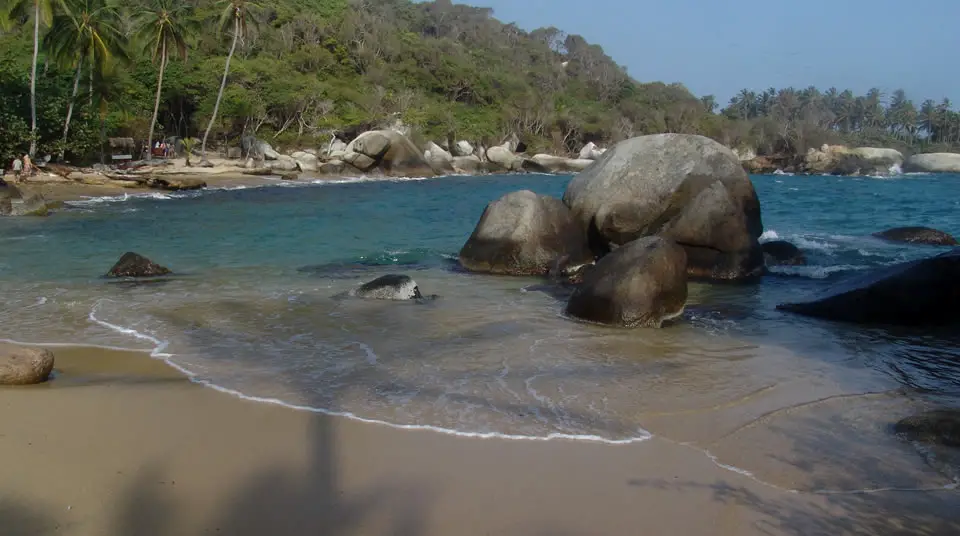
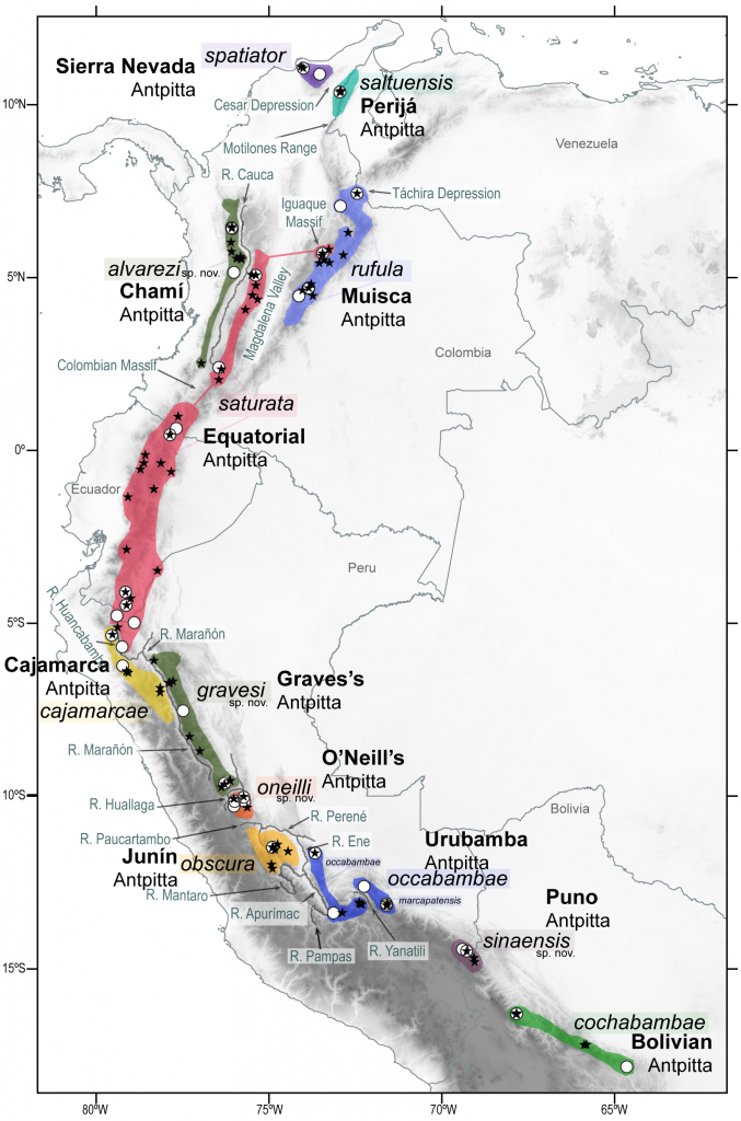
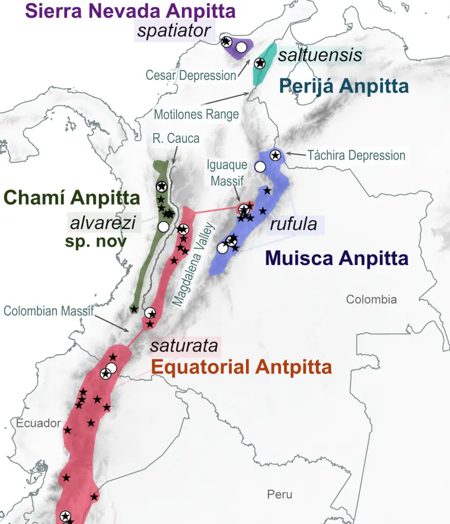
2-days Trip Hanging around Minca in Sierra Nevada de Santa Marta

In our entry Minca Ultimate Travel Guide, Sierra Nevada de Santa Marta we tell you all about this wonderful destination in the Sierra Nevada de Santa Marta. Two weeks ago (mid May 2021) I made a quick visit with my friends and here I will tell you how my experience was hanging around Minca.

To get to Minca initially I took a 1-hour flight from the city of Bogota at El Dorado International Airport (BOG) to the Simón Bolívar International Airport (SMR) in Santa Marta. From the airport I took a cab to Mamatoco, 17 km away (30 minutes). Once in Mamatoco I found there are 3 possibilities to get to Minca: bus, cab or motorcycle.

Getting to Minca

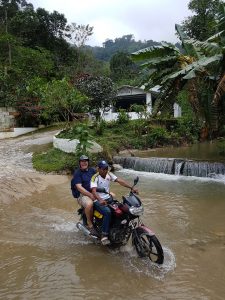
In my case I took the alternative of motorcycle, the fastest option. After 30 minutes and a distance of 16 kilometers I arrived at the village of Minca.

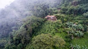
To get to the Costeño River Hostel the motorcycle had to travel on a dirt road for 10 minutes. There is an alternative to reach the hostel walking just 10 minutes walk, but you must cross the river Minca.

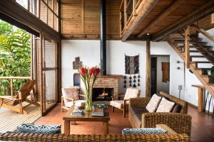
It is worth mentioning that the hostel is Gay Friendly. The atmosphere in its facilities and the management of the staff is very friendly with the guests. The hostel has private and shared rooms, in my case I took one that had a view of the river from the bathroom. There is not need for hot water since the warm environment keeps the water warm and suitable for bathing.

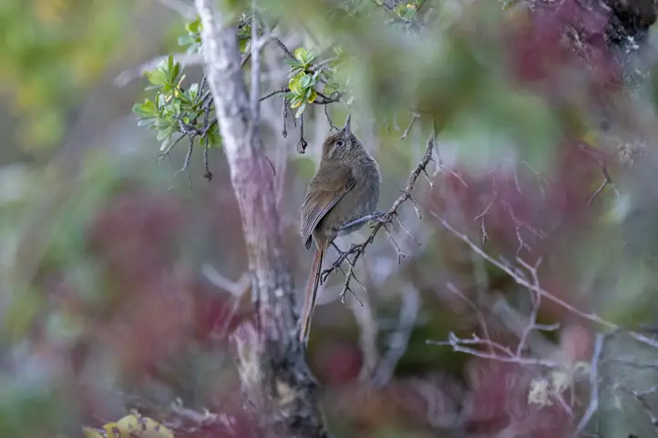
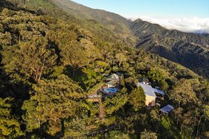
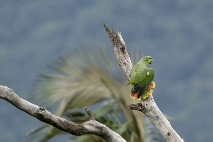
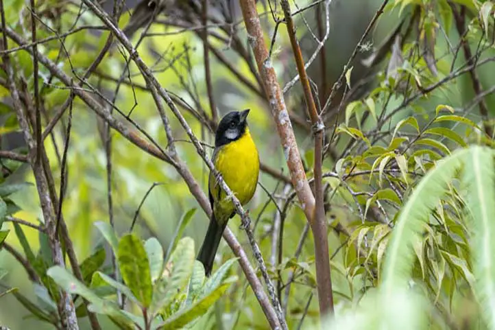
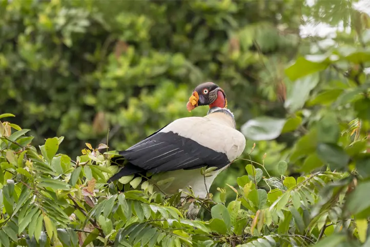
Costeño River has a space that has 2 terraces in the form of meshes where you can appreciate the mountains of the Sierra de Minca, besides being able to easily appreciate species such as Iguanas, Squirrels and Geckos.

The lodge administrators, in support of the inhabitants of Minca, offer the tours that can be done, supporting the ecotourism in Minca.

Hanging around Minca

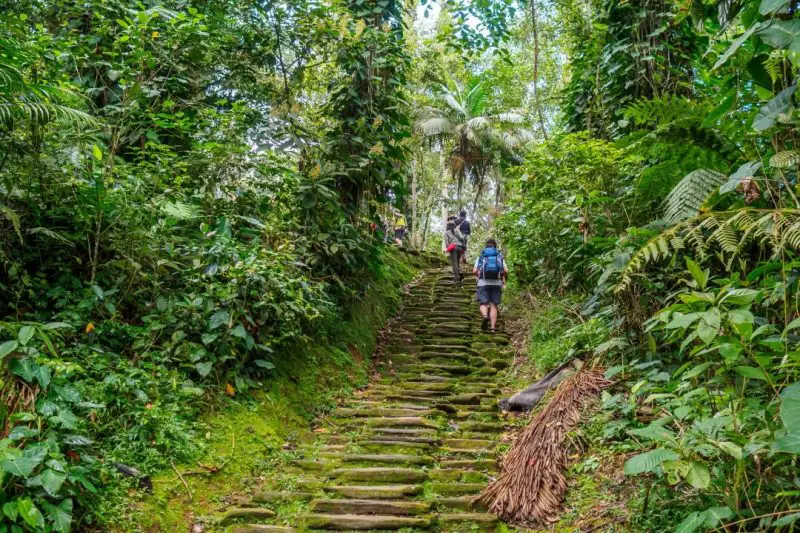
Hanging around Minca can be done on foot, but if you have little time you can do them on a motorcycle with a local guide. In my case I did the tour on a motorcycle, since I only had two days to visit all the places.
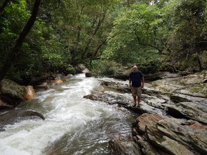
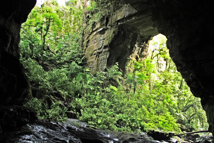
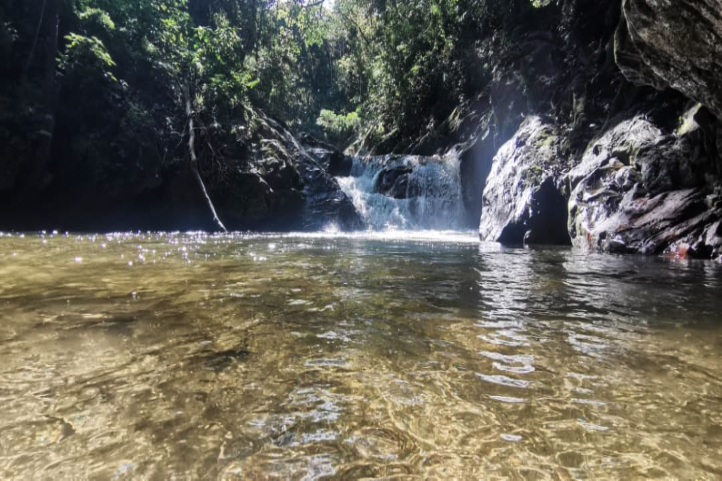
Pozo azul

Pozo azul is located a 45 minutes to walk from the center of the Minca with a medium intensity, the road reaches the entrance of the well 100 meters away from the contact with the water.

When you reach the entrance of the well you will find a bridge that is currently closed for maintenance, when you reach the well there is a waterfall of no more than 2 meters.

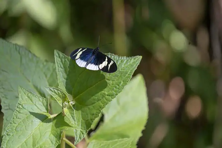
It is possible to appreciate different species of butterflies along with several coffee crops, the water is very cold in the well because the entrance of sunlight is scarce.

Pozo Azul, Minca, Sierra Nevada de Santa Marta

Finca La Victoria (Farm)

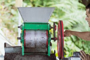
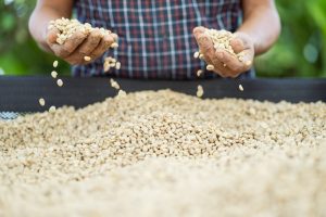
Finca La Victoria has its origin in 1892 as an association of 5 investors among them an English couple that after their admiration to Queen Victoria wanted to call it that way. The farm has 1223 hectares, 217 hectares are dedicated to the cultivation of arabica coffee, 300 hectares of pasture land.

Also the facilities of the farm is the craft brewery La Nevada, which is in operation since 2015; has 4 beers in its portfolio: black coca leaf-based (Happy Coca), golden (Happy Nebbi), red (Happy Tucan) and a coffee-based (Happy Colibri).

Happy Colibri is in the top 10 worldwide among the best craft beers and is only available between the months of December and March.

When you arrive at La Victoria Farm you can take a tour of the entire coffee production process from the cultivation to the packaging of the final product. At the end of the tour you can enjoy a delicious freshly ground coffee or a refreshing beer while you marvel at the view and tranquility that the farm has to offer. The entrance fee to the farm is COP 15,000 for the tour, if you do not wish to take the tour you can enter and consume any of the products offered.
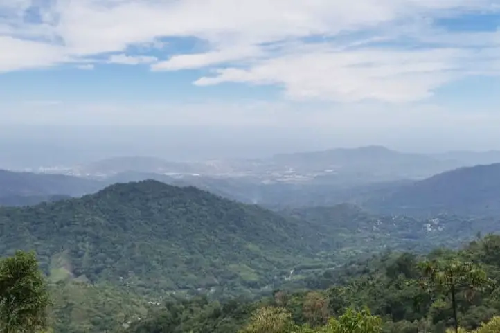
Mirador Los Pinos

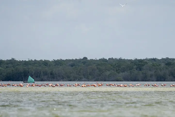
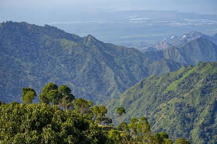
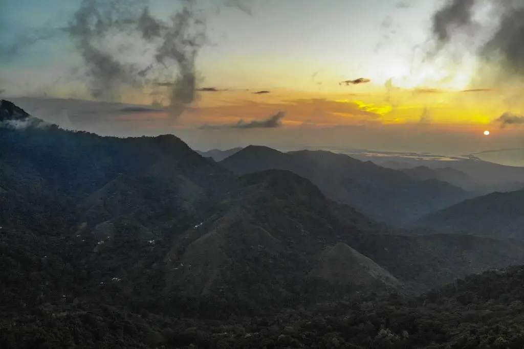
This viewpoint is located 11 km from Minca, about 30 minutes by car or motorcycle or 3 hours walking; it must be said that the intensity is high, as it is the highest part of today’s tour; from this point it is possible to see Minca, Santa Marta and the swamp.
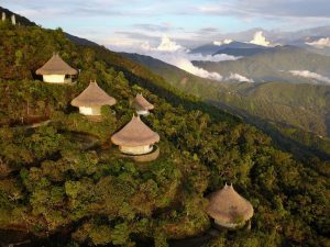
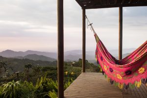
View from Minca, Sierra Nevada de Santa Marta

Sierra Minca Hostel

Sierra Minca Hostel is a beautiful hostel located in the middle of the sierra where in addition to the lodging they offer tours to travelers who wish to take a picture in the famous Mano de Dios which has a panoramic view of the entire mountain, it also has a mesh terrace where 15 people can be accommodated and hanging beds where you can lie down and feel like you are sleeping among the clouds.

The entrance fee to the hostel is COP 15,000 for unlimited time.
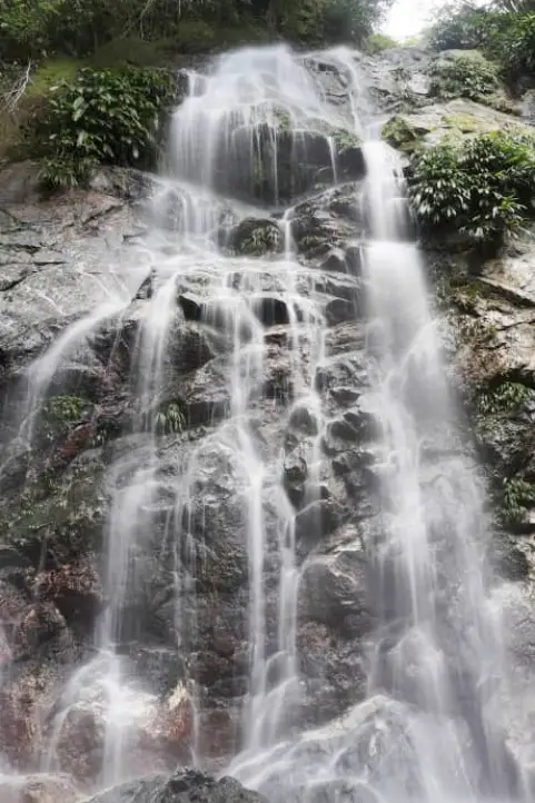
Marinka Waterfalls

Marinka Waterfalls are two falls of crystalline waters that at the end give rise to the Marinka Lagoon. Marinka in indigenous language means “Regenerate Body”, due to its beauty and tranquility.

To get to the Arimaca House-Farm, where is the access to the waterfalls, it is necessary to make a detour from the main road 500 m. There is a payment of COP 10,000 per person.

The distance is 3.3 km from the village, if you decide to walk, it is an hour’s walk with a medium intensity.

Waterfall in Marinka, Minca, Sierra Nevada de Santa Marta

Waterfall El Oido del Mundo

The origin of the name has 2 versions:

1. The indigenous people of the highlands said that at this point it was possible to hear what the mother earth, Pacha mama, wanted to tell men.

2. A foreigner after knowing it indicated that the rocks were shaped like ears and from there began to share this location as the “El Oido del Mundo”.

To get there is a 20 minutes walk from the town with a low difficulty.

The recommendations to enjoy these places is to wear a bathing suit, comfortable clothes and change at the end of the tour, insect repellent, sunscreen and plenty of water. At the end of the tour reach the center of Minca to taste the delicious pistachio ice cream at IL GELATO NEVADO, this artisan ice cream shop is the only one in town.
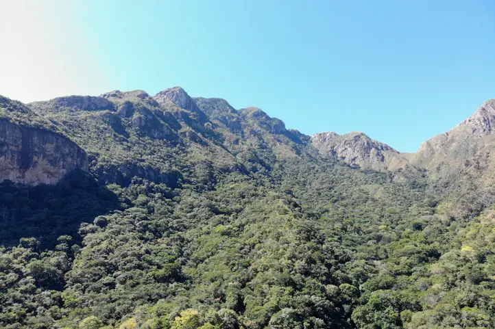
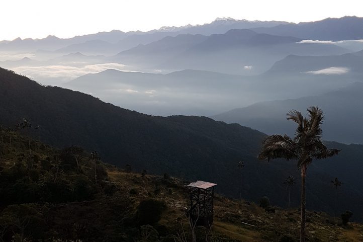
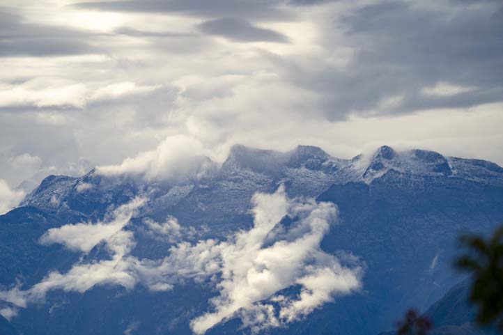
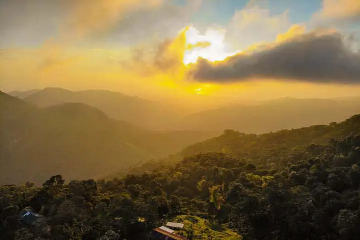
View from Minca, Sierra Nevada de Santa Marta

Cerro Kennedy

The next day I made the trip to Cerro Kennedy by motorcycle. Cerro Kennedy is the highest point of Minca, it is 3100 meters above sea level, below you can see the cloud forest, and the temperature ranges between 8º to 18º C. At this point there is a military post so it is safe to reach it.

Cerro Kennedy is located 26 km from Minca and there are 2 ways to get to this point:

1. Cerro Kennedy by walking

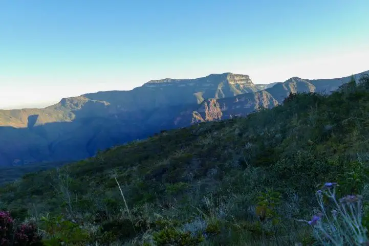
You can arrive walking, it will be 2 days with a high demand. At the end of the second day you will rest for a few hours, since you will start walking again at 4 in the morning to reach the summit before sunrise. From there you will be able to marvel at the bed of clouds covering the Sierra.

Also, from there you have a wonderful view of the peaks of the Simón Bolívar and Colón snow-capped mountains, Santa Marta and part of the Tayrona National Natural Park.

2. Cerro Kennedy by motorcycle or car

You leave the center of Minca at 3 am, as the road is unpaved and it is a difficult journey due to the fact that the road is not paved. The last part of the trip must be done on foot to reach the top.

At the end of the tour to Cerro de Kennedy and back to the hostel I decided to walk around the village, where I tasted Arabic food and some delicious French muffins in a small French bakery in town.

Final remarks

It is important to note that all the excursions I did in Minca were by motorcycle. The guides give you a protective helmet during the tours. The road is partially paved and belongs to the Cincinati trail, after the crossing at the El Campano store. The rest of the road is unpaved and very muddy.

During the rainy season, the guides told me that the difficulty of mobility increases, and recommended that those who walk the trail should wear rubber boots.

Finally, I returned to Mamatoco by bus. The trip lasted more than an hour, once there I continued my trip along the Magdalena department.

If you want to plan your trip to Colombia do not hesitate to contact us, visit our Plan your trip page!

About the authors

Luisa Martin

Engineer, world traveler, amateur photographer, traveling blogger, and foody.

The Northern Caribbean Birding Trail of Colombia


The north of Colombia borders the Caribbean Sea and has a continental area of almost 133,000 square km. Try not to get excited with this fantastic video about the northern birding route in the Colombian Caribbean: Northern Caribbean Birding Trail of Colombia!


Colombia’s Caribbean coast is home to some incredibly special birding hotspots. One of them is the highest coastal mountain range on the planet, the Sierra Nevada de Santa Marta, with a wide elevation gradient, offering all thermal floors and a great biodiversity, it concentrates a large number of endemic species.

In front of it, the Serranía de Perijá, another mountain range that also has a very different avifauna and is very rich in endemisms.

Between these mountains are the threatened dry forests of Cesar and La Guajira, which also harbor very special birds and ecosystems.

Fianlly, also located there, between the Caribbean Sea and the dry forest of La Guajira, is the Los Flamencos flora and fauna sanctuary, an area of coastal lagoons watered by streams. This is an important feeding area for the birds that give it its name: flamingos.

Thus, in the Northern Caribbean of Colombia you can find most of the ecosystems of the tropical fringe of the planet: Tropical dry forest, Tropical humid forests, Low dense forests, Mountain forests, Páramos, Grasslands, Savannas, Wetlands, Mangroves and Coral reefs in the Caribbean islands.

The Northern Caribbean Birding Trail

 The National Audubon Society the largest bird conservation organization, along with the US Agency for International Development (USAIDand the Colombian bird study and conservation association, Asociación Calidris developed a sustainable bird watching itinerary in Colombia in order to achieve economic development and nature conservation: the Northern Caribbean Birding Trail. 

Clink in the following link to see the suggested itinerary proposed by them: http://www.northerncolombiabirdingtrail.com/

Birding Spots of The Northern Caribbean Birding Trail

The birding spots included in the Northern Caribbean Birding Trail are:

  • Los Besotes Ecopark,
  • Serranía del Perijá, 
  • Los Flamencos Flora and Fauna Sanctuary,
  • Tayrona National Natural Park and
  • Sierra Nevada de Santa Marta.

In Serranía del Perijá, Los Flamencos and Sierra Nevada, birdwatchers and bird photographers will be delighted with the avian diversity and will be able to shoot unique and gorgeous species. 

Accomodation

Sierra Nevada de Santa Marta offers one of the most known birding lodges in Colombia and around the world, El Dorado Birding Nature Reserve. Located in the mountains of the Sierra Nevada, it is the best place to stay for a birdwatching tour in this area. 

Serranía del Perijá offers a simple birding lodge with basic amenities. It is called Chamicero del Perijá Reserve. However, if you dont mind to wake up very early in th morning to get to the highest area, you can stay at the lower part in the town of Manaure.

Finally, the accommodation in the cities of Valledupar and Riohacha is intended to be at local hotels. We recommend you Casa Rosalia Hotel Boutique in Valledupar and Hotel Taroa in Riohacha. 

Itinerary

The trip lasts 10 days, it starts in Valledupar and ends in Santa Marta, and includes experienced tour leaders and trained local guides in every location. 

Paramo and Dry Forest in Cesar

Los Besotes Eco Park

Ten kilometers from Valledupar, in the direction of Patillal, is the natural reserve Los Besotes, which treasures a large part of the fauna and flora of this region of the Colombian dry forest in the department of Cesar.

Los Besotes Eco Park, Valledupar, Cesar, Colombia.

Established in 1993 by the lawyer and historian Tomas Darío Gutiérrez, the ecological park is the result of an extraordinary, almost individual effort of a man with a passion for nature.

Toucans, macaws, chachalacas, condors and other typical Caribbean species live in this region. One of the most important highlights is the Blue-billed Currassow, Crax alberti.

The 14 kilometers of trails that run through the park allow you to circulate through the massif of the Sierra Nevada de Santa Marta, between the Murillo and Los Besotes hills, and access points of almost 2,000 meters high, such as the Alto del Condor.

Serranía del Perijá: Páramo

Cerro Pintado, Perijá Mountain Range, Manaure, Cesar

Perijá is an isolated offshoot of the Eastern Andes that forms the border with Venezuela and was a key spot during the Colombian internal conflict before turning into a paradise for birders all around the globe.

Since it has not always been accessible, scientists are still discovering and classifying many local species. The endemic species are  the Perijá Metaltail, Perijá Thistletail, Perijá Sierrafinch and Perijá Tapaculo.

Perijá Thistletail – Asthenes perijana, endemic

However, it has been found that common species such as the Rufous Spinetail and the local variety of the Yellow-breasted Brushfinch are endemic.

Other birds that can be spotted are Crested and Goldenheaded Quetzal, Barred Fruiteater, Andean Condor, Black-chested Buzzard-Eagle, Plushcap, Buffbreasted Mountain-Tanager, Hook-billed Kite, kinds of Lacrimose Mountain-Tanager and Golden-bellied Starfrontlet.

Luckily you may see  the White-rumped Hawk or even Black-and-chestnut Eagle. The Chamizero del Perijá Reserve is the birding lodge that receives tourists that want to explore this remote area full of avian surprises. 

Dry Forest and Wetlands of La Guajira

Los Flamencos Flora and Fauna Sanctuary 

In La Guajira peninsula, characterized by vast desert areas, this nature reserve has shallow ponds that fill with rain and evaporate during the dry season.

American Flamingo – Phoenicopterus ruber at Los Flamencos Fauna and Flora Sanctuary, Colombia

The salt water is the proper habitat for brine shrimp, which attract the American Flamingos —the stars of the sanctuary—, as well as Scarlet and White Ibis, gulls, terns and other shore birds.

Birds of La Guajira – Royal Tern – Thalasseus maximus

Caribbean Dry Forest

Orinocan Saltator – Saltator orenocensis at Camarones, La Guajira, Colombia

The bright-color pattern continues with the Vermillion cardinal found in the dry forest and other species that can be seen are the White-whiskered spinetail, the Chestnut piculet, the Slender-billed inezia, the White-tipped inezia, the Buffy Hummingbird and the Orinocan Saltator. 

Buffy Hummingbird – Leucippus fallax, Camarones, La Guajira, Colombia

Find out more details about these destinations in our entry Discover the Caribbean Dry Forest Birding Trail of Colombia.

Mountain Forest and Páramo of Santa Marta

Tayrona National Natural Park

Tayrona National Park is a place full of myths and legends of the ancient communities that inhabited the Sierra Nevada de Santa Marta. It is a place for those seeking new and amazing ecotourism experiences.

Tayrona Park, picture by David Paez

Around 396 species of birds have been recorded here, including Little tinamou (Cripturellus soui), King vulture (Sarcoramphus papa), Road hawk (Buteo magnirostris), Yellow-headed Caracara (Milvago chimachima) and Pale-vented Pigeon (Patagioenas cayennensis).

Find out more details about this destinations in our entries Best Time to Visit Tayrona Park to Avoid Crowds and Bad Weather and Travel Guide to The Lost City Trek – Ciudad Perdida – in Colombia.

Sierra Nevada de Santa Marta 

The Santa Marta mountain range is isolated from the Andes and the highest coastal mountain in the world! With 19 endemic bird speciesit is also among the most important endemism centers in the world

W Santa Marta Antbird – Drymophila hellmayri, endemic. Minca, Colombia

Many endemics have the Santa Marta moniker, such as  the Santa Marta Parakeet, Santa Marta Antbird, Santa Marta Foliage-Gleaner, Santa Marta Warbler, Santa Marta Woodstar and Santa Marta Brush-Finch.

There is a screech owl unnamed but endemic, and species such as the Santa Marta Wren, the Santa Marta Sabrewing and the Santa Marta Blossomcrown are difficult to spot.

Santa Marta Brushfinch – Atlapetes melanocephalus. Minca, Colombia

If you are lucky, you will see  Black-backed Thornbill,  Santa Marta Woodstar,  Santa Marta Antpitta and Black-fronted Wood-Quail, but there are others that are more common: Santa Marta Brushfinch, Yellow-crowned Redstart, and Rusty-headed Spinetail. 

Be ready to focus your lens on the stunning White-tipped Quetzal, Band-tailed and Sickle-winged guans, Rosy Thrush-Tanager and Golden-breasted Fruiteater. El Dorado Bird Reserve is the lodge where you will stay and relax while birds are not around. 

San Lorenzo Ridge – Sierra Nevada de Santa Marta

Watch our birding experience in Sierra Nevada de Santa Marta here. Find out more details about this destinations in our entry Colombia’s Prime Birding Destination: Sierra Nevada de Santa Marta.

As time goes by, the list of Colombian birding trails has grown and you can be sure that you will find fantastic birds in any region of the country.

Check all of our Birding Routes here

References 
 About the authors

Sara Colmenares

Current director of Sula. Doctor in Biological Sciences. Her main interests are to explore and understand the organism – environment interactions, taking advantage of emerging knowledge for the management and conservation of species and ecosystem services. She is currently working as a consultant in functional ecology, ecosystem services and conservation projects in Colombia related to ecotourism and birdwatching.

Ana María Parra

Modern Languages professional with emphasis on business translation. Interested in cultural adaptation of written and audiovisual content.  Passionate about knowing new cultures and languages, tourism and sustainable living.

Minca Ultimate Travel Guide, Sierra Nevada de Santa Marta

Minca is a small town located in the foothills of the Sierra Nevada de Santa Marta, 650 meters above sea level, and about 14 km from the center of the city of Santa Marta, in the department of Magdalena, northern Colombia.

Brief Intro about Minca

It is considered the ecological capital of the Sierra Nevada de Santa Marta. It is a region with a vocation for coffee, and for many years it attracted inhabitants from the north of Santander who took advantage of its land and climate for the cultivation of coffee.

Coffee Production in Minca, Sierra Nevada de Santa Marta

In the past, it was an area marked by armed conflict. Today it is a safe place. However, in Colombia, and everywhere, it is better not to give papaya. I recommend you not to go out without the accompaniment of a certified guide, especially if you go to the waterfalls or to the hotels outside the city, and at night.

Minca has a rich archaeological history and is an ecological paradise with the crystal clear Minca River and its immense green vegetation.

This place served in the past as a habitat for the Tayrona culture. Today they are found in the indigenous peoples belonging to the Kággaba (Kogi), Ijka (Arhuaco), Wiwa (Arzarios) and Kankuamo in the highlands.

Minca has multiple lodging sites, it is the corner of painters, sculptors and artisans. There are also several coffee producing haciendas that have opened their doors to tourism.

If you decide to visit Minca, in this blog you will find a travel guide to Minca, learn what to do in Minca, where to stay in Minca and more.

How to get to Minca

No matter where you come from, to get to Minca you will have to get to Santa Marta first.

Once in Santa Marta, you can book a private transfer to Minca from Santa Marta which does offer convenience. Some people prefer to arrive by cab or even by motorcycle.

Once in Minca, motorcycle or 4×4 car become the only transportation option, especially in the rainy season which is from October to December and from April to May.

Roads in Minca during rainy season

If you are going to the higher areas, it is necessary to go up by motorcycle or 4×4 car, since the road is not paved, it is narrow, and when it rains it becomes a river of water, and a reservoir of mud. But don’t worry, I promise you that the experience can be really fun!

What you can do in Minca

Thanks to its geographical position, Minca and its surroundings have different attractions.

It is a place where you can enjoy a cooler climate if you come from beach areas like Cartagena or Santa Marta.

There you can do everything related to nature tourism: hiking, mountain biking, bird watching, water tourism in rivers and waterfalls, adventure, rest and coffee.

Bird watching

Minca’s altitudinal gradient makes it a very interesting destination for bird watching, also because it is located in the Sierra Nevada de Santa Marta, which is a hotspot of endemism not only for Colombia, but worldwide.

Two hours by car from Mica is the El Dorado Natural Reserve, ideal for observing endemic species of the Sierra Nevada.

In its surroundings there are about 300 species of birds, both resident and migratory. It is a region of coffee plantations, with habitats ranging from dry forest, rain forest, cloud forest, and páramo (moorland) in the higher parts.

W Santa Marta Antbird – Drymophila hellmayri ENDEMIC

To learn more about birding in Mica and the Sierra Nevada de Santa Marta, visit our entry Colombia’s Prime Birding Destination: Sierra Nevada de Santa Marta.

Among the most striking species are Santa Marta Brush-finch, Sierra Nevada Brush-finch, Santa Marta Parakeet, Scarlet-fronted Parakeet, Santa Marta Warbler, Santa Marta Foliage-gleaner, Santa Marta Antbird, White-lored Warbler, Santa Marta Tapaculo, Brown-rumped Tapaculo, Whooping Motmot, Golden-winged Sparrow, Santa Marta Emerald Toucanet, White-tipped Quetzal, Santa Marta Blossomcrown, and many others.

Wildlife Watching

In addition to bird watching you can go on night safaris, especially around El Dorado Natural Reserve.
In Minca you can find the habitat of many species and there is a high concentration of endemic species, not only birds, but also frogs, reptiles, butterflies, plants and beautiful landscapes.

Butterfly watching in Minca, Sierra Nevada de Santa Marta

Hiking and Trekking

Minca is also an ideal destination for trekking. There are several routes, but among the most recognized are Las Piedras, Los Pinos and Cerro Kennedy.

The most recommended hike is of medium intensity, with one day of duration, and 11 km of route. It begins by leaving Santa Marta by land transport to Finca La Victoria, where you can learn about the process and history of coffee in this region.

From there you will continue walking and getting to know viewpoints and the diversity of bird species until you reach the area of Los pinos, 1,300 meters above sea level. From Los Pinos you will descend to the waterfalls of Marinka, being the final and refreshing point of the tour.

Views of the Sierra Nevada de Santa Marta from Minca

Cerro Kennedy is another good destination for trekking in Minca. Most travelers choose to do this route on foot, but for mountain bike fans, there is a mountain biking route as well as the option to go up by bike.

The hike to Cerro Kennedy is of a moderate to difficult level. It is a 25 km route from Minca, to go and back takes two days. You will go from 650 meters above sea level, to 2700 meters. There you will find fascinating views of the Sierra Nevada de Santa Marta.

Water Tourism

Visiting rivers and waterfalls in Minca

Pozo Azul

After a 45 minute walk from the center of Minca, you will find Pozo Azul, which crosses the Minca River.

Cascades of Marinka

They are found after a walk of 90 minutes from the center of the town. You will have to pay for a small admission fee.

At Marinka you will find two waterfalls, one of them with a natural pool. There are also bathrooms and a café.

Adventure

Cycling or Mountain Biking in Minca

There are many plans and routes in the mountains and around Minca. You will be able to live an incredible adventure full of adrenaline. There are tours from beginners to advanced.

Rappel down waterfalls.

You can practice rappelling in the Marika waterfalls.

Coffee and Beer Experiences

La Victoria Farm

La Victoria was founded in 1892 and is one of the largest and oldest coffee estates in northern Colombia. It is located about a 90 minute walk from the town of Minca.

Coffee Production in Minca, Sierra Nevada de Santa Marta

In addition to producing top quality organic coffee, La Victoria is home to Nevada, a small brewery that makes artisanal beer using pure mountain water and local products such as coffee and coca leaves.

La Victoria has also embraced tourism as an alternative source of income, offering guided tours that explain the history and operation of the coffee farm, you can learn the entire process of cultivation and preparation for export, and see their early 20th century machines that run on hydroelectric power.

The farm also has its own nature reserve for the enjoyment of bird watchers and nature lovers.

Where to stay in Minca

Minca has many houses, hostels and farms that offer their guests comfort and tranquility. They are available in all types and prices. Here I will recommend some of the best options:

#1 Birdlodge in Minca

El Dorado Birdlodge

El Dorado Birdlodge ©Booking.com

#1 Hostel in Minca

Casas Viejas Hostel Lodge

Relaxing at Minca

#1 Private House

Oropéndola House

Casa Oropendola, Minca

#1 Coffee Farm

Vista Nieve Farm

Vista Nieve Farm, Minca

Recommendations when visiting Minca

  • Go prepared for the heat, Minca has 80% average relative humidity, and 32 degrees average temperature.
  • Bring repellent, sunscreen, towel, bathing suit.
  • Wear proper walking shoes.

If you want to know more about the most incredible natural destinations in Colombia, plan your trip with us!

References
About the author

Sara Colmenares

Current director of Sula. Doctor in Biological Sciences. Her main interests are to explore and understand the organism – environment interactions, taking advantage of emerging knowledge for the management and conservation of species and ecosystem services. She is currently working as a consultant in functional ecology, ecosystem services and conservation projects in Colombia related to ecotourism and birdwatching.


Next Travel Ideas? Visit the Biosphere Reserves of Colombia

Did you know that Colombia has as many as 5 biosphere reserves? Biosphere Reserves are terrestrial and marine ecosystems protected by the Countries and by the World Network of Biospheres, whose main function is the conservation of the planet’s biodiversity and sustainable use.

The Biosphere Reserves are internationally recognized within the framework of the United Nations Education, Scientific, and Cultural Organization’s (UNESCO) Man and Biosphere Program (MAB).

The Biosphere Reserves form a Global Network in which each country participates on a voluntary basis. Additionally, UNESCO has defined operational guidelines for Biosphere Reserves as a way to ensure better international cooperation. This also takes into account national laws, which play an important role in the status of a biosphere reserve.

But What are Exactly the Biosphere Reserves?

The biosphere reserves are the central instrument of the Man and Biosphere Program (MAB) of the United Nations Educational, Scientific and Cultural Organization (UNESCO), which was established in 1976 to promote sustainable regional development.

Biosphere reserves are extensive and representative areas of natural and cultural landscape, which must be safeguarded in the long term.

Moreover, biosphere reserves must achieve the three fundamental objectives of conservation, development, and logistics as follows:

  • From conservation, the reserve must ensure the genetic heritage and the refuge of natural and cultural landscapes. In turn, it must safeguard ecosystem services (i.e. clean water, clean air, food, recreation).
  • From development, it aims to apply sustainable ecological and socioeconomic techniques in all economic sectors.
  • From logistics, it must facilitate multidisciplinary research and educational activities.

They represent a reservoir of genetic resources and ecosystems and are also areas of sustainable land use, spaces for education, research, and recreation. The biosphere reserves are like “laboratories” where the flora and fauna found in this area are subjects of natural and scientific interest. Additionally, the integrated management of land, water, and biodiversity is studied at these reserves.

The Biosphere Reserves of Colombia

Colombia’s location towards the north of South American region is naturally surrounded by open water from two sides, from the Caribbean Sea and the Pacific Ocean. It also counts with important ecosystems such as the Biogeographic Chocó, the Andean Mountain range, the Eastern plains of Orinoquía, and the Amazon jungle, among the biggest ones.

This privileged biogeographic position of Colombia provides an ideal habitat for a diverse range of flora and fauna to flourish, and that is why it has 5 biosphere reserves that protect important and unique ecosystems existing in the Colombian territory.

Colombia’s Biosphere Reserves Map modified from Google Maps

Needless to say, these reserves surely deserve a visit. Check out this list of the 5 biosphere reserves of Colombia:

The Andean Belt Biosphere Reserve, declared by UNESCO in 1979

Location

The Andean Belt Biosphere Reserve is located in the Colombian massif in the south of the Andes. The Andean belt includes three national parks: La Cueva de los Guacharos Natural National Park, Puracé Natural National Park, and Nevado del Huila Natural National Park.

Highlights

Cueva de los Guacharos Natural National Park

Cueva de los Guácharos NNP was the first area in Colombia to be declared a national park in 1960.

The Cueva de los Guácharos park protects the Andean forest and paramos, from 1200 to 3800 masl. What stands out most is the protection of the extensive and almost extinct areas of Andean oak (Quercus humboldtii Bonpl., Fagaceae) and the endemic oak Colombobalanus excelsa Lozano, Fagaceae, a new species of oak described in the park in 1979.

Cueva de los Guácharos ©Parques Nacionales Archive

The park owes its name to the guácharo bird (Steatornis caripensis, order Caprimulgiformes, family Steatornithidae). This is a frugivorous, nocturnal bird that lives in caves and hollows. Its name is onomatopoeic, it is derived from the Quechua huach and means to scream or cry, because of its characteristic song. Something very interesting about these birds is that, like bats, they are guided by a system of echolocation.

Puracé Natural National Park

Puracé National Natural Park is a volcanic zone and protects high mountain ecosystems, as well as nationally threatened species such as the Colombian pine (Podocarpus oleifolius), the oak (Quercus humboldtii), the wax palm (Ceroxylon spp), and the tree fern (Cyathea spp), and animals such as the Andean Condor.

Andean Condor

Its name, in the Quechua language, means “mountain of fire”. The main rivers of Colombia are born there: Magdalena, Cauca, Patía and Caquetá and also 30 calm and clear lagoons, ideal for contemplation.

Within its marvelous landscape, the Coconucos volcanic chain rises, also known as the Serrania de los Coconucos, composed of 11 volcanoes. Of these, the most outstanding are the Sugar Loaf (5,000 meters / 16,404 feet above sea level), the Puracé (4,780 meters / 15,682 feet  above sea level) that is the only active one, and the Coconuco (4,600 meters / 15,091 feet above sea level).

Nevado del Huila Natural National Park

This snow-capped mountain has the largest glacier in the central mountain range of the Colombian Andes and is the second largest glacier in the country, after Cocuy.

Huila snow-capped mountain ©Parques Nacionales Archive

The park shelters a volcanic area with paramo, subpáramo, and Andean forest vegetation. It also overlaps with indigenous reserves in the departments of Tolima and Cauca. This park is closed to tourists.

Tourist Activities

  • Birdwatching (take a look on our trip Upper Magdalena Birdwatching Tour).
  • Trekking.
  • Botanic and scientific tours.
  • Community-based tourism.
  • Cultural Heritage Observation.

El Tuparro Biosphere Reserve, declared by UNESCO in 1979

Location

El Tuparro Biosphere Reserve is located in the eastern part of Colombia in the region of Orinoco in the Vichada department. The reserve is surrounded by the Tomo River to the north and the Caño Maipurés to the south. It is one of the few places in the world where the Amazon pink dolphin lives.

The Eighth Wonder of the World: Tuparro Natural Park ©CommonsWikimedia

Highlights

The park has numerous trails for bird watching and hiking. In the year 1800, standing in front of the imposing torrent that the natives called Quituna, in awe, the naturalist Alexander von Humboldt, described as the “Eighth Wonder of the World” what is known today as the Raudal de Maypures, one of the main attractions of the protected area.

Tourist Activities

  • Birdwatching.
  • Trekking.
  • Note: It is prohibited to visit the park for sportfishing. Don’t be fooled by unscrupulous offers.

The Sierra Nevada de Santa Marta Biosphere Reserve, declared by UNESCO in 1979

The mountainous system called the Sierra Nevada de Santa Marta is conceived as the ‘Ancestral Territory’ of the original peoples Iku (Arhuaco), Kággaba (Kogui), Wiwa and Kankuamo.

The Sierra Nevada de Santa Marta Biosphere Reserve is a pyramidal territory, isolated from the Andes, and considered the highest coastal mountain in the world. It is located to only 42 kilometers from the sea, and it rises abruptly from the coasts of the Caribbean Sea until reaching a height of 5,775 meters (18,946 feet) in its snowy peaks Bolívar and Columbus.

Sierra Nevada de Santa Marta

Location

To the north it is bordered by the Caribbean Sea and the plains of the Guajira peninsula; to the southeast it is framed by the courses of the Ranchería and Cesar rivers, and to the west, it borders the great alluvial plain of the Magdalena river and the Ciénaga Grande de Santa Marta.

Highlights

For the variety of ecosystems, thermal floors next to the sea, its singular beauty and cultural richness constitute it a unique territory. Its main attraction is a sacred site for the four indigenous peoples of the Sierra, this is the Teyuna Archaeological Park “Lost City”.

Tourist Activities

  • Hiking and Trekking at Teyuna Archaeological Park “Lost City”. For more tourist information about Tayrona Park and “Lost City treks” check our entries Best Time to Visit Tayrona Park to Avoid Crowds and Bad Weather and Travel Guide to The Lost City Trek – Ciudad Perdida – in Colombia.  
  • Birdwatching in Minca and surrounds. If you are looking for birdwatching tourist information in Sierra Nevada de Santa Marta visit our post: Colombia’s Prime Birding Destination: Sierra Nevada de Santa Marta.
  • Note: Natural National Parks of Colombia and the four indigenous groups of the Sierra Nevada de Santa Marta: Kogui, Arhuaco, Wiwa, and Kakuamo remind us that in the high parts of the Sierra Nevada de Santa Marta, including the lagoons, the páramos and the snow-capped mountains, tourism activities are NOT allowed due to the fragility of these ecosystems and the cultural importance. Entering these sectors constitutes an environmental infraction, according to the provisions of Decree 622 of 1977 – included in Decree 1076 of 2015

Ciénaga Grande de Santa Marta Biosphere Reserve, declared by UNESCO in 2000

The Ciénaga Grande de Santa Marta Flora and Fauna Sanctuary, together with the Salamanca Island Parkway – VIPIS, constitute the Nucleus Zones of the UNESCO-declared Biosphere Reserve and Ramsar Wetland of the Ciénaga Grande de Santa Marta Deltaic Complex.

Both recognitions highlights the importance for conservation of the Ciénaga Grande de Santa Marta at a national and international level. Know more about Ramsar Areas of Colombia in our entry Wetland Destinations in Colombia: Ramsar Areas of Colombia.

Ciénaga Grande de Santa Marta seen from Minca, Sierra Nevada de Santa Marta

Location

This Ciénaga Grande de Santa Marta Biosphere Reserve is located in the Caribbean region of Colombia, in the Department of Magdalena. It covers the municipalities of Ciénaga, Pueblo Viejo, Sitio Nuevo, Remolino, Salamina, El Piñón, Cerro de San Antonio, Concordia, Pivijay, El Retén, and Aracataca.

Highlights

The Ciénaga Grande de Santa Marta Flora and Fauna Sanctuary is formed by progressive accumulations of sediments from the Magdalena River. In turn, it is made up of mangrove ecosystems, swamps, rivers, canals, and marshy areas. It is part of a water complex of more than 100 swamps that present different levels of sedimentation and salinity.

Tourist Activities

  • Birdwatching.
  • Community-based tourism.
  • Note: It is not recommended to camp, nor to spend the night nearby because of the mosquitoes. There is also no place to stay. It is recommended to visit during the day, and stay in Barranquilla or Santa Marta.

Seaflower Biosphere Reserve, declared by UNESCO in 2000

The Seaflower Biosphere Reserve has become one of the most representative icons of marine protection in Colombia.

Conserving this set of ecosystems in the San Andres Archipelago is important for food security. Its economic valuation, because of the environmental services it provides, is estimated at more than $267 billion a year.

Seaflower Meaningful Diving – Natural Wealth Award

Location

This reserve is located in the department of San Andrés, Providencia and Santa Catalina Archipelago.

Highlights

Seaflower is the largest Biosphere Reserve in the world with 180,000 square kilometers. It has all the marine and coastal ecosystems representative of the tropical zone: coral reefs, mangroves, reef lagoons, sea grasses, wetlands, beaches, open sea, and tropical dry forest.

Seaflower Facts

  • 78% of the Colombian coral areas are in Seaflower.
  • It has the third-largest barrier reef in the world.
  • It has 57 species of coral, of which 90% are on the Red List of threatened species of the International Union for the Conservation of Nature (UICN).
  • Also, Seaflower has 407 species of fish, of the 600 estimated to exist in the Caribbean, and is home to 157 species of birds, of which 55% are threatened.
  • Its white beaches, attractive for tourism, owe their beauty to the calcareous contributions of coral.
  • It is estimated that its waters annually produce about 156 tons of lobster and 182 tons of fish through traditional fishing.

Old Providence McBean Lagoon National Natural Park

The Old Providence McBean Lagoon National Natural Park is the only nationally protected area in the Oceanic Caribbean of Colombia. It was declared a protected area in 1995, and became part of the “Seaflower” Biosphere Reserve in 2000.

Old Providence McBean Lagoon is formed by a small hill known as Iron Wood Hill, and the McBean Mangrove. In its marine portion, the Barrier Reef stands out, protecting the coasts of Providence Island, which is the second largest in the Caribbean with 32 km in length, after Belize.

This great coral reef, together with the reef lagoon that forms in front of the McBean mangrove, gives the sea a spectacular range of colors that go from deep blue to a translucent aquamarine green. It is thanks to this unique coloring that the Sea of Providence is known as “The Sea of Seven Colors”.

Tourist Activities

If you want to know more about the most incredible natural destinations in Colombia, plan your trip with us!


References


About the author

Sara Colmenares

Current director of Sula. Doctor in Biological Sciences. Her main interests are to explore and understand the organism – environment interactions, taking advantage of emerging knowledge for the management and conservation of species and ecosystem services. She is currently working as a consultant in functional ecology, ecosystem services and conservation projects in Colombia related to ecotourism and birdwatching.

Colombia’s Prime Birding Destination: Sierra Nevada de Santa Marta

The Sierra Nevada de Santa Marta covers part of the departments of Magdalena, La Guajira and Cesar, and is the highest coastal mountain range in the world. It covers life zones from sea level to the snow belt. Because of the variety of ecosystems, thermal floors by the sea, its unique beauty and cultural richness, it is a unique territory to visit.

The Sierra Nevada de Santa Marta mountain range has been declared a Biosphere Reserve and World Heritage Site by UNESCO (1979), among other national categories. It is the most endemic rich, continental area in the World. 21 species (and several more subspecies) are confined to the area – many of them carry Santa Marta in their name. The isolated range’s avifauna bares similarities with both Venezuelan mountain ranges to the east, and Andean mountains to the south-west, all adding to the biogeographical complexity of these mountains. 

The Sierra Nevada de Santa Marta National Park (aka Santa Marta Mountainsis for long and by far Colombia’s prime birding destination. It’s the highest coastal mountain range in South America, the highest peaks – Cristobal Colon & Simon Bolivar – are at the same time the highest ones in Colombia. They tower 5575 meters above sea level. 

Within this mountainous massif there is an area of great cultural significance, considered a sacred place for the four indigenous peoples of the Sierra: the Arhuacos (or Ikas), the Wiwas, the Kogis, and the Kankuamos. This is the Teyuna Archaeological Park “Lost City”, which is administered by the Colombian Institute of Anthropology and History – ICANH.

Climate and seasonality

In the Sierra Nevada de Santa Marta you can find lowland rainforest (0-1,050 m), premontane rainforest (1,050-1,900 m), paramo (3,400-4,200 m), superparamo (4,200-5,100 m) and snow belt (5,100-5,770 m). The average annual temperature at sea level is 27º C, while at the top of the mountains it drops to 0º C. The annual precipitation is 3,000-4,000 mm and decreases with altitude. The dry season runs from October to November and from June to July.

Cuchilla de San Lorenzo (San Lorenzo Ridge)

The Cuchilla of San Lorenzo is an area within the Sierra Nevada that has been declared an Important Bird Area (IBA). It extends from the town of Minca (600 m), through an extensive area of shade coffee plantations, to the edge of the Sierra Nevada de Santa Marta National Natural Park.

The Cuchilla de San Lorenzo is very important for the migratory birds that cross the Caribbean. It also contains one of the highest concentrations of endemic species in Santa Marta with the presence of Santa Marta bush-tyrant (Myiotheretes pernix), Santa Marta Parakeet (Pyrrhura viridicata) and Santa Marta Blossomcrown (Anthocephala floriceps) among others.

Most endemic bird species are concentrated in the upper parts of the Cuchilla de San Lorenzo and Cerro Kennedy, a mountain that reaches 2,800 m. Cerro Kennedy has wooded patches, dominated mainly by bamboo and shrubs. This is one of the best areas in Santa Marta to observe endemic and rare species, since it presents 15 species of endemic birds, making it one of the highest concentrations of endemisms in the continent.

In the region, projects that involve the local population have been implemented towards the conservation of the environment. Strategies such as: the production of “Bird Friendly Coffee“, the creation of a “Bird Friendly Club” for children and young people of the region, the installation of monitoring stations for the bird populations and environmental education actions.

Vista de Nieve Farm at Sierra Nevada de Santa Marta

On our Sula Fam-Trip we first visited the beautiful coffeeplantation “Finca Vista de Nieve” which caters also for small groups of birders. It’s the ideal place to get away from it all, combine birding with relaxing holidays. Sipping delicious local coffee while watching a beautiful sunset over the Caribbean Sea shall sure do you good. 

The close surroundings of the farm consists of shade grown coffee plantations and some second growth forest – both excellent habitat for birding. With an elevation of about 1300 m. asl. Many of the Santa Marta foothill specialties are found here. During our comfortable 2-night stay the we observed exquisite species like Black-fronted Wood-QuailScaled PiculetSanta Marta AntbirdSlate-crowned AntpittaSanta Marta TapaculoSanta Marta Foliage-gleanerStreak-capped Spinetail, Sierra Nevada Brushfinch & White-lored Warbler. 

A walk down the access road to Vista Nieves through a mosaic of coffee plantations and second growth forest can turn up some nice mixed flocks and especially Spectacled Tyrannulet and Santa Marta Blossomcrown. The latter visits flowering plants in gardens of local farmers & roadside shops. 

In order to see most of the area’s endemics it’s necessary to visit different elevations.

El Dorado Lodge

The centerpiece of a visit to the Santa Marta Mountains is the El Dorado Lodge 2000 m. asl., owned and managed by the ProAves foundation. It has several trails into good forest, excellent hummingbird feeders and access to the Cuchilla San Lorenzo is way more convenient from here. The immediate area around the lodge is best for the recently described Santa Marta Screech-OwlWhite-tipped QuetzalBlack-throated Tody-TyrantGolden-breasted Fruiteater & Santa Marta Brushfinch. The lodge’s compost pile attracts regularly Band-tailed GuanBlack-fronted Wood-Quail and Sierra Nevada Brushfinch. The hummingbird feeders host large numbers of Brown VioletearCrowned Woodnymph and rarer species like Lazuline Sabrewing and even White-tailed Starfrontlet. 

From the lodge the road winds up the mountain and end at the exposed Cuchilla de San Lorenzo at 2600 m. asl. It’s only an 8 km long ride but on an extremely rough, bumpy road. This has the benefit that it prevents general tourism invading the area. Plans to build a concrete road up to the ridge have fortunately been stalled. The environmental impact would have been disastrous. The road ends at the ProAves reserve, which was established to protect the ParakeetsIt is the only accessible site to see this endangered species. If you stay at the lodge you have access to an observation tower, but you can see the Santa Marta Parakeet elsewhere along the ridge first thing in the morning. If you have a scope scan the Eucalyptus tree in front of the tower. At times they are frequented by Black-backed Thornbills. 

The view from here is one of the most impressive vistas in the country. You bird along a roughly 1 km long stretch on a trail in stunted elfin forest. Black-backed Thornbill (rare), Santa Marta Sabrewing (extremely rare)Brown-rumped Tapaculo, Santa Marta AntpittaRusty-headed Spinetail, Santa Marta Bush-Tyrant (rare) Hermit Wood-Wren, Black-cheeked Mountain-TanagerSanta Marta Brushfinch, Santa Marta WarblerYellow-crowned Redstart occur here and are all endemic! For Santa Marta Wren and Blue-bearded Helmetcrest you have to mount a multi-day expedition in order to access proper habitat. 

Unfortunately, the excessive use of playback by everybody have had impact on the birds. Several species don’t respond anymore to it at all, and got very difficult to see… 

Santa Marta Biological Station

If you’ve been efficient on the ridge or your time is limited you can visit the Santa Marta Biological Station on your way back. But you have to arrive there at 9am – that’s feeding time for Santa Marta AntpittaAt current state it is not possible to stay there overnightbecause of a turnover of the station’s manager. 

Minca

For those with a little more time, a visit to the lovely and touristy town of Minca might well be taken into consideration. It’s year-round spring-like climate, many hiking opportunities, good food & charming hotels offer something for everybody. There’s some good birding around Minca, too. Species like Military MacawScaled PiculetVenezuelan FlycatcherRosy Thrush-Tanager & Golden-winged Sparrow occur within close reach of town.  


References

  • BirdLife International (2020) Important Bird Areas factsheet: Cuchilla de San Lorenzo. Downloaded from http://www.birdlife.org on 25/08/2020.
  • System of National Natural Parks Website
  • Macaulay Library archive Website

About the authors

Sara Colmenares

Current director of Sula. Doctor in Biological Sciences. Her main interests are to explore and understand the organism – environment interactions, taking advantage of emerging knowledge for the management and conservation of species and ecosystem services. She is currently working as a consultant in functional ecology, ecosystem services and conservation projects in Colombia related to ecotourism and birdwatching.

Jérôme Fischer

Professional bird guide, swiss native, with more than 32 years of experience guiding hardcore birders and birdwatching tours. Jérôme has been focused in bird identification. He also travelled many countries,  starting in Switzerland. Then he traveled exploring south America, the most biodiverse continent in the world, becoming specialized in Neotropical birds.

5 New Reasons to Come to Colombia to Watch Birds

Colombia has 4 new bird species to add to its already large list. This is great news not only to encourage you to come to Colombia, but to visit the Neotropics for bird watching! Update your records, notebooks, and wishlists with the new Colombian Antpittas!

What is an Antpitta?

Brown-banded Antpitta (Grallaria milleri)

Antpittas are walker, vocal, small, round, stubby, long-legged, pale and grayish birds that live in the rainforests of the Andes. They look more like an egg with legs (and feathers)… This is a very particular group of species, and they are known as the ghosts of the forest, since you can hear them loud and clear, even feel that they are singing at your feet, but you can hardly ever see them.

As they are birds that move around on the forest floor looking for worms, their favourite food, they have plumages that are very difficult to differentiate from fallen leaves and trunks. Despite this, they are very docile animals that can be easily conditioned to visit “artificial” feeding grounds. However, a lot of commitment and punctuality is needed, as these birds are very regular in their daily journeys and always arrive at the same time to the visiting points.

So much so that when you go on a birding tour that includes a visit to a place with specialized feeding grounds for Grallarias, you have to be the most punctual in life! Because if you miss it, the bird doesn’t come back until the next day. And on these tours there is no next day in the same place, unless you want to. It is usual to see birders settling in up to an hour before the Grallarias cross the feeding points, making sure to have all their equipment ready for when the bird appears.

First it announces itself with its song, then it appears like a ballerina on stage, jumping through the foliage, until it reaches the point where its food has been placed. Sometimes, if there is a lot of noise, it appears in the biggest of silences, eats its worm and leaves without being noticed.

How many Colombian Antpittas are?

So far in Colombia, up to 27 species have been recorded within the family Grallariidae, with 4 endemic species and 16 endemic subspecies. But all that changed in July 2020, when two studies on the taxonomy and phylogenetic diversity of the Grallaria rufula complex changed everything (to the regret of many birders, once again the scientists messing things up!)

The Grallaria rufula blakei complex

The Grallaria rufula blakei complex was considered to consist of 2 species and 7 subspecies distributed from southern Peru to the Colombian Caribbean: the Rufous Antpitta, Grallaria rufula (Lafresnaye, 1843), and the Chestnut Antpitta, Grallaria blakei (Graves, 1987).

Plumage in the G. rufula blakei complex contributed heavily to the traditional classification and description of species and subspecies. Among plumage characteristics, the only characters that show appreciable variation are (1) color of the back, head, and breast, which ranges from olive-gray brown; (2) color or patterning of the belly, including the extent of white coloration; (3) in some cases a contrasting light feather tips and the presence of indistinct barring on the lower and (4) presence or absence of a dull whitish eye-ring.

New Discoverings

Studies on genetics and vocalization led to split this Grallaria rufula complex from two, G. rufula (Rufous Antpitta) and G. blakei (Chestnut Antpitta), to sixteen established species distributed along the Andean Mountain Range from southern Peru to the Colombian Caribbean. Seven of them had no name! Leaving Peru with 10 new species, 8 of which are endemic, and Colombia with 5 species, of which 4 are new species and two of them are endemic!

Approximate geographic ranges of all taxa in the Rufula-rufocinerea-blakei Complex as a reference to update your records, notebooks, and wishlists. From the two sister papers: Isler et al. Zootaxa 2020; Chesser et al. Auk 2020 @amcuervo

So, now Colombia has 32 species within the family Grallariidae, with 7 endemic species and 12 endemic subspecies, and more are coming!

Five New Reasons to come to Colombia!

The Rufous Antpitta was distributed throughout the three Andean mountain ranges of Colombia and in the Sierra Nevada de Santa Marta and Serranía del Perijá. With this study, it was found that practically every population in each mountain range and mountain system corresponded to a different species for the Colombian Antpittas group:

Maps with the approximate geographic ranges of the new Colombian Antpittas. From the two sister papers: Isler et al. Zootaxa 2020; Chesser et al. Auk 2020 @amcuervo

1. Perijá Antpitta – G. saltuensis.

481Perijá Antpitta – Grallaria saltuensis. Photo by @amcuervo

Almost endemic species which is only found in the Departments of La Guajira and Cesar in Colombia, and Zulia in Venezuela. It is found between 2500 and 3250 masl.

  • Where to find it? This species can be found in the sector of Manaure Balcón del Cesar, in the department of Cesar, in the Serranía del Perijá (watch our video). There are several places where you can stay there: Centro Turístico y Ecológico Villa Adelaida, in the lower part of the Serranía, or in the Perijá Thistletail natural bird reserve, towards the higher part.

2. Sierra Nevada Antpitta – G. spatiator

Sierra Nevada Antpitta – Grallaria Spatiator. Picture by @amcuervo

Endemic to the Sierra Nevada de Santa Marta in Magdalena, La Guajira and Cesar Departments of Colombia. It is found between 2200 and 2900 masl.

  • Where to find it? After the town of Minca, in Magdalena, arriving to the sector of the San Lorenzo Ridge. There are several lodging options in the region including a coffee farm Vista de Nieve, the nature reserve El Dorado, and even rural lodging closest to the San Lorenzo Ridge.

3. Muisca Antpitta – G. rufula

Muisca Antpitta – Grallaria rufula. Picture by @amcuervo

It is endemic to the Eastern Cordillera and with a distribution almost parallel to that of the indigenous people of the Muiscas. Its new english name honors this indigenous people of the Cundinamarca-Boyacá highlands.  It is found between 1850 and 3800 masl.

  • Where to find it? In Colombia it distributes from the Eastern Andes in Norte de Santander, and south to Cundinamarca and western Meta. This species can be found very close to Bogotá, in the national natural park Chingaza. And very probably in the surroundings of Bogotá in private Nature Reserves like El Encenillo.

4. Equatorial Antpitta – G. saturata

Equatorial Antpitta – Grallaria saturata. Picture by @amcuervo

Subspecies resurrected and elevated to species. It includes the population of the Iguaque Massif in Boyacá and the Central Cordillera from Caldas, through Ecuador, to northern Peru. It is found between 2550 to 3650 masl.

  • Where to find it? In Colombia you can find this species at the Coffee Axes. You can find it on the Jardín-Riosucio road, or on the road to the Nevado del Ruiz in Caldas. You have many lodging options in these regions, in addition to a large number of other bird species that you can observe there.  There is a very special place, where spaces have been adapted for the photography of this bird. It is called Hacienda el Bosque, a dairy farm that has also bet on conservation through ecotourism, just 30 minutes from the city of Manizales. The grallaria that arrives at its feeders is called Juliana.

5. Chamí Antpitta – G. alvarezi

Chamí Antpitta – Grallaria alvarezi Cuervo, Cadena, Isler & ChesserPicture by Eddie Williams @Eddiewilliams09 @amcuervo

It is the new endemic to the Western Cordillera of Colombia, from Paramillo, northwestern Antioquia, south to northwestern Cauca. It is distributed between 2350 to 3650 m.

  • Where to find it? It is distributed from Paramillo Natural National Park, through Urrao, Jardín-Riosucio road, and Tatamá, Farallones de Cali and Munchique Natural National Parks, in Risaralda, Valle del Cauca and Cauca respectively. You have many lodging options in these regions, in addition to a large number of other bird species that you can observe there. There is a very nice rural tourism initiative for bird watching in the town of Riosucio, department of Caldas, where you can observe these birds, it is called Bird Watching Mirador El Roble. There, some farmers installed feeders and receive an infinity of birds, including the Chamí Antpitta. Contact us if you want to know the details.

The Importance of Species Names

The Chamí Antpitta had no name, and the scientists took the opportunity to honor two very important people. The scientific name of the Chamí Antpitta honors Colombian ornithologist Mauricio Alvarez Rebolledo, leader of many biological expeditions during Colombia’s worst period of political instability in the 1990s and early 2000s. His role has been very important in the areas of conservation and education. Mauricio Alvarez pioneered bird song recording in the country and founded the Environmental Sounds Collection at the Alexander Von Humboldt Institute.

The english name, Chamí Antpitta, was also given to honor “the people of the mountains”, the indigenous community of the Emberá-Chamí that inhabits the foothills of the northwestern Andes in Colombia. Chamí means “mountain” in the Emberá language.

Ornithologist Andres Cuervo, one of the authors of the study, said that the English name assigned to these species (Muisca and Chamí) is intended to appropriate the species in the country. Also to associate them directly with its geographical location and with the cultural context of the region where they are distributed. It is very special that these indigenous communities still exist in Colombia and it is also important to recognize them in academic and tourism spaces.

Current list of endemic and near-endemic Colombian Antpittas

Endemic species of Colombian Antpittas

  1. Santa Marta Antpitta (Sierra Nevada de Santa Marta) Grallaria bangsi
  2. Cundinamarca Antpitta (Eastern Andes) Grallaria kaestneri
  3. Sierra Nevada Antpitta (Sierra Nevada de Santa Marta) Grallaria spatiator
  4. Muisca Antpitta (Eastern Andes)  Grallaria rufula
  5. Chamí Antpitta (Western Andes)  Grallaria alvarezi
  6. Urrao Antpitta (Western Andes) Grallaria urraoensis
  7. Brown-banded Antpitta (Central Andes) Grallaria milleri 

Endemic subspecies of Colombian Antpittas

  1. Ruffous-crowned Antpitta (Pacific Region) Pittasoma rufopileatum rosenbergi  Pittasoma rufopileatum harterti
  2. Giant Antpitta (Southern Central Andes) Grallaria gigantea lehmanni
  3. Moustached Antpitta (Western and Central Andes) Grallaria alleni alleni 
  4. Bicolored Antpitta (Central Andes) Grallaria rufocinerea rufocinerea
  5. Chestnut-naped Antpitta (Colombian Andes) Grallaria nuchalis ruficeps
  6. White-bellied Antpitta (Central and Eastern Andes) Grallaria hypoleuca hypoleuca
  7. Streak-chested Antpitta (Northern Andes) Hylopezus perspicillatus pallidior
  8. White-lored Antpitta (South Colombia Andes – Amazon foothills) Hylopezus fulviventris caquetae
  9. Thrush-like Antpitta (Eastern Andes and Serranía de la Macarena Foothills) Myrmothera campanisona modesta
  10. Ochre-breasted Antpitta (Western Andes west side and Northern Central Andes) Grallaricula flavirostris ochraceiventris
  11. Hooded Antpitta (Colombian Andes) Grallaricula cucullata cucullata
  12. Slate-crowned Antpitta (Eastern Andes) Grallaricula nana nana Grallaricula nana hallsi

Now, all that remains is to focus on getting to know these new species in depth, and developing effective conservation strategies for their habitats. There are rumors that there may be more splits and new species in this group. So we have to be prepared!

Nature tourism, once again, appears as a way to keep these species alive, which paradoxically are found in areas that require a high commitment to conservation. So don’t wait and come to Colombia to meet these Andean forest singers! 

References

About the author

Sara Colmenares

Current director of Sula. Doctor in Biological Sciences. Her main interests are to explore and understand the organism – environment interactions, taking advantage of emerging knowledge for the management and conservation of species and ecosystem services. She is currently working as a consultant in functional ecology, ecosystem services and conservation projects in Colombia related to ecotourism and birdwatching.

Travel Guide to The Lost City Trek – Ciudad Perdida – in Colombia 

Ciudad Perdida, or Teyuna, is the greatest archaeological finding in Colombia. This ancient indigenous civilization was built in the Sierra Nevada de Santa Marta by the Tayrona peoples.

It is located on the northern face of the mountain, in the upper area of the Buritaca river basin at 900 – 1,200 meters above sea level. The site is reportedly 12,000 square meters, although only 3,000 m2 are open for tourists. 

Over 200 stone structures including interconnected roads, stairs, terraces, canals, and ceremonial buildings are the remnants of the city, which was forcibly abandoned during the Spanish colonization. 

What remained of the stone roads and buildings is now claimed as a sacred territory of the Kogui, Arhuaco, Wiwa, and Kankuamo indigenous communities and also is an archaeological park, part of the Sierra Nevada de Santa Marta National Natural Park. 

Lost City – Tayrona Park, Santa Marta

A look into the past of Ciudad Perdida 

The Lost City -English for Ciudad Perdida- received this name because it remained hidden in the forest until the 1970s, when the government realized its existence after rumors of hidden treasures in the Sierra spread out.

Colombia’s Ciudad Perdida has been compared to Machu Picchu, and it was actually built around 600 years before the world-famous Peruvian ruins. The Tayrona architecture highlighted the circle as the main infrastructural element.

The preference for the circulation around the villages also stands out and is reflected in the extensive network of roads, stairs and platforms that allow internal mobility in the settlement. 

A Place of Archeological Richness

Out of the 26 archaeological sites found in the river basin, the Lost City was the largest and most important of all, since it was assumed to be the political and cultural center of all the nearby settlements.

Archaeologists say that in the 16th century, Teyuna may have had between 1,500 and 2,000 inhabitants belonging to different political units with a language, architectural and cultural unity – the Tayrona culture. 

The Conquest Period

The 16th century, when the Spaniards arrived on the continent was quite intense and the civilization faced intermittent periods of conflict and peace when the indigenous and Spaniards held exchange relationships.

The latter was never able to dominate the Tayrona civilization nor settle in the Santa Marta range. However, several factors – such as conflicts and new diseases, progressively destabilized and decimated the population.  

The Indigenous People of the Sierra Nevada de Santa Marta

Today, the Kogi, Arhuaco, Wiwa, and Kankuamo indigenous peoples, inhabitants of the Sierra Nevada de Santa Marta, claim their right to this territory as descendants of the populations that inhabited it in the past.

These communities have learned to share their sacred land since the Teyuna Archaeological Park opened in 1980, but they demand respect for their traditions and territory. 

Biodiversity of the Lost City Trek 

The Sierra Nevada de Santa Marta is an important biodiversity reservoir due to its location in the Caribbean region of Colombia and the changes in elevation, known as thermal floors.

In Colombian mountains, every 1,000-meter increase in altitude means an estimated 3.5°F temperature decrease. This means that the higher you go, the cooler it gets, and also the ecosystems change. 

The Santa Marta range presents a variety of wildlife including 90 species of fish, 49 amphibians, 92 reptiles, 184 mammals, and 631 species of birds!

Birding at the Sierra Nevada de Santa Marta

This is a paradise for birders since 36% of the Colombian avifauna -and 7% of the world’s avifauna- is found here.

Santa Marta Brushfinch – Atlapetes melanocephalus

Find out more about birdwatching in the Sierra Nevada de Santa Marta in our entry Colombia’s Prime Birding Destination: Sierra Nevada de Santa Marta.

It has Important Areas for Bird Conservation (AICAS) in different zones of the park, where you can spot the Andean Condor, the Santa Marta Parakeet, and the Blue-billed Curassow.  

The Lost City Trek 

Local tour agencies offer treks of 4, 5, or 6 days to Ciudad Perdida. In Sula, we have a 4-day tour. The journey starts in Santa Marta, where Jeeps pick up tourists and take them to the starting point of the Lost City Trek, El Mamey, which is about 3 hours from the city.  

You will Arrive on Foot

The only way to get to Teyuna is on foot, so consider your fitness level if you plan to embark on this journey. The trek is about 50 km, you have to ascend and descend 4 small mountains… twice.

The daily hikes are at least 4 hours but can go up to 5 or 6 hours. Some quite steep stretches leave you exhausted but there is always time to rest. If you are physically trained, it will be OK; as long as you tolerate humidity. 

Sendero en la Ciudad Perdida. Photo: Baquianos, travel and Adventure

You will have to cross the Buritaca river many times, sometimes –when the water is high, with the help of a rope. At one point of the climb, there is also a type of improvised, hand-operated cable car that helps trekkers cross the river one by one.

When your guide warns you it is the last time you have to cross the river, it means that the Lost City is really close. What separates you from the ancient civilization? Only a quite steep 1,200 step stone stairway! 

Throughout the whole climb, you enjoy breathtaking views over the Caribbean sea and the tropical forest with exotic wildlife. But getting to the Lost City is another level of excitement.

Accommodation

There are several stops during the trek where you are offered snacks and hydration. The camps where you spend the nights offer really basic accommodation in cabins with bunk beds or hammocks.

You can carry your own hammock with a mosquito net and hang it if you prefer. These campsites are managed by local farmers or indigenous, and they offer you fresh food as well. 

The Experiences

After the challenging trek, you will feel rewarded with the landscape and the peaceful atmosphere. This is the point where your guide talks about how the Tayronas build their civilization and lived kind of isolated in the forest.

It is a fascinating story that encourages you to go explore the ruins and, of course, take tons of pictures as souvenirs. One good thing is that Ciudad Perdida is not a massive tourist destination, so you won’t have to deal with hundreds of people disturbing your calm or ruining your selfie. 

After this accomplishment, it is time to return. Two days of hiking and crossing the river again await you and your group. 

Lost City

Recommendations 

  1. Get yellow fever and tetanus vaccines at least 10 days before your trip to the Lost City. 
  2.  You need to wear one good pair of hiking shoes with good traction and waterproof if possible
    • The type of shoes you wear is crucial since the weather is warm and humid, and the rain is always a possibility.
  3.  Wear long pants and breathable long-sleeved shirts to protect yourself from mosquito bites -these abound, and sunburns. 
  4. Pack enough underwear and sets of clothes, since you will get wet, whether because of the sweat or a well-deserved dip in the river. 
  5.  If you have trouble sleeping in strange beds and in packed rooms, consider carrying your own hammock. 
  6. Take into account that you have to carry your luggage, so don’t overpack. 
  7. Be careful when drinking water in the camps, there have been people poisoned because of the questionable quality of water up there in the mountain. 
  8. Respect nature and the privacy of the indigenous peoples and farmers of the region.
  9. Don’t throw garbage away.
  10. Don’t take pictures of the communities or their belongings without their permission. 
  11. Contact a local agency with knowledge of the region, the trip, and the requirements.

We, in Sula, are happy to help you organize your Lost City trek! 

The trekking to Ciudad Perdida in Colombia is an unrivaled experience for your soul and body. No need to say more, live the Lost City trek yourself! 

References 
About the author

Ana María Parra

Modern Languages professional with an emphasis on business translation. Interested in the cultural adaptation of written and audiovisual content.  Passionate about knowing new cultures and languages, tourism, and sustainable living.

Where to see the Andean Condor and the King Vulture in Colombia?  


Like the orchid is the Colombian national flower and the Quindio wax palm the national tree, Colombia has a flagship bird: the Andean Condor In this post you will learn about the main features of this iconic bird, of its relative the King vulture, which is also sought by birders, and where to see condors in Colombia. 

The Andean Condor (Vultur gryphus) 

This large scavenger bird belongs to the family Cathartidae and the genus Vultur, with no subspeciesIts wingspan can top 3 meters (10 ft), which makes it the largest bird in Colombia and the largest flying bird in the world -taking into account its average weight of 11 kg! Its name originates from the Quechua word kuntur. 

Although it is considered a national symbol, it is locally uncommon in Colombia. Actually it is listed as Near Threatened by the IUCN and as Critically Endangered in Colombia.

Andean Condor

The original population of the Colombian Andes is extinct, now what you can see there are introduced individuals. However, the largest native population is found in Santa Marta and Perijá ranges, to the north of the country. 

The Andean Condor takes to the air by mid-morning and soars over some high zones of the Andes range and Sierra Nevada de Santa Marta, reaching heights of up to 4,800 meters above sea level. You can find it perched on cliff edges in search of dead farm animals and in small groups, feeding on carrion of large carcasses.

Its bald head -males with a comb- may not be the prettiest, but its white ruff and white patches on its wings give the Andean Condor a majestic look. Seeing a flying condor is a great spectacle but it takes a bit of luck. 

The King Vulture (Sarcoramphus papa) 

Although not as mighty as the Andean condor, the King vulture is also sought by birders due to its distinctive colored head. Unlike the condor, this smaller scavenger inhabits tropical lowland forests below 2,500 meters above sea level and perches in the canopy.

It is more visible by mid-morning, when it undertakes its flying journey to search food. The King vulture is usually spotted in pairs and when it gets to a carcass, it displaces other lowland vultures -the ‘king’ moniker must have had a reason! 

The King Vulture (Sarcoramphus papa) – Casanare

The King vulture has an eye-catching look. Its body and flight feathers are half white to gray, half black. The bald head is colored in yellow, orange, blue, purple or red tones and the beak boasts a noticeable orange fleshy caruncle.

It inhabits most of Colombian territory, except for the Andes range, a part of the Pacific coast and the northern Guajira. However the Sarcoramphus papa is difficult to spot. 

Where to See Condors in Colombia 

Now that you know more about this impressive bird, you may be wondering where to see condors in Colombia. There are few spots where Andean condors can be spotted, read on to find more about them. 

Puracé National Natural Park

Southeast of Colombia, near the city of Popayan, Cauca, is this national park declared a UNESCO Biosphere Reserve in 1979.  Puracé NNP comprises Los Coconucos mountain range with 11 volcanoes, including Puracé (4,780meters above sea level) which is the only active one, and Pan de Azúcar (5,000 meters above sea level), the highest of all.

This place with steep canyons, river sources and lagoons is the best-known destination for watching condors in Colombia. There is a small population of Andean condors, together with hummingbirds, bluebirds, ducks and birds of prey.  

Three indigenous reserves belonging to the Kokonuko community are found in the region: Paletará, Coconuco and Puracé. They act as park rangers of Puracé and offer tourism services aiming to raise incomes for the conservation of the park and the condors that live there.

There are only 3 condors in the reserve -a pair and their offspring, which made part of the reintroduction program of the Andean Condor in Colombia in 1989. The worrying fact is that the couple has not had any more offspring in the last 20 years. 

For now, they can be seen approaching a big rock that serves as a feeding station every few days, after a member of the community leaves a modest offering such as chicken bones. This means you cannot always see condors here, although the natural beauty of the park is worth exploring.

To ensure their preservation, the community monitors the condors with tracking devices and provides environmental education during the tours. 

Sierra Nevada de Santa Marta

Of course the world’s highest coastal mountain and a Colombian landmark would also be home to the majestic Andean Condor. This mountain is separate from the Andes range, is located just 42 km from the deep blue Caribbean sea and reaches a height of 5,775 m in its highest snow-capped peaks Bolívar and Colón.

It is part of the Sierra Nevada de Santa Marta National Natural Park, which you can visit to enjoy ecotourism activities such as birdwatching, hiking and trekking, wildlife and flora observation.

Thanks to its huge biodiversity and cultural heritage, the Santa Marta range was declared Biosphere Reserve and World Heritage Site by the UNESCO in 1979. 

Minca, Sierra Nevada de Santa Marta

Like Purace, this great mountain is an indigenous ancestral territory, this time heritage of the Kankuamo, Kogui, Wiwa and Arhuaco ethnicities, descendants of the great  Tayrona indigenous civilization.

A trip to the National Park is an experience on another level that allows you to get in touch with the cultural heritage of the country, get lost in the lush forest and be awed by the biological richness of this natural reservoir.  

Of the nearly 150 condors currently estimated in Colombia, some 120 individuals are present in the Sierra Nevada de Santa Marta, the rest have migrated to other zones in the country. 

Serranía del Perijá

The 295 km long Perijá mountain range is in Colombia’s northern region, in the plains of the department of Cesar, and reaches Venezuelan territory.

You could consider it as the last extension -or the beginning- of the Andes. However, it has such distinctive features that it has been deemed as a unity in itself. Perijá is really close to the Santa Marta range, just 25 km away. 

Cerro Pintado, Perijá Mountain Range, Manaure, Cesar

Nearly 541 species and subspecies of birds have been found in Serranía del Perijá, including Brown tinamous, Cocoi and Great blue herons, hummingbirds, macaws, parrots, and birds of prey and scavengers such as eagles, the snail kite and the King vulture 

Manizales – Los Nevados Natural National Park

El Nido del Cóndor is an eco-lodge founded in 2017 in the Andes range, 17 km from Villamaría, Caldas, on the route to Nevado Santa Isabel. A plateau surrounded by two rivers and the typical green landscape of the Coffee Axis is where a pair of Andean condors nest, on a cliff edge.

This lodge is committed to sustainable practices from its building materials, energy sources, to its resources and waste management.

Also, the wooden building has a 360° landscape view!  Here, you will be able to see not only the pair of condors that soar over the canyons that make up the plateau, but 150 bird species approximately, including bird of prey, the Chestnut wood quail, the Yellow–eared parrot and the Black-and-chestnut eagle. Mammals such as the Crab-eating fox, armadillos and the mountain paca can be spotted too.  

See condors overflying the region from the comfort of your room’s balcony at this one-of-its-kind eco-lodge south of Manizales! 

Páramo del Almorzadero, Santander 

There are about 15 Andean condors in Paramo del Almorzadero, in the municipality of El Cerrito, Santander. These are 5 to 70 years old and represent approximately 30% of the national population.

Paramo del Almorzadero is a stunning ecosystem with 7 lagoons that originate several gorges, which then act as tributaries of the Orinoco river basin. Also, it has important endemic flora species.

The buffer zones of the paramo have been affected by peasant agriculture, since this is the only activity that locals have for subsisting.  

This place is not well-known in the tourism sector, nor has an adequate infrastructure for developing large tourism activities, there is only a not easily accessible high-mountain shelter called El Salto that takes care of the native condors.

However, for the Global Big Day 2018, 20 people were privileged to visit the paramo shelter at 3,400 meters above sea level to see the condors that nest there. Local farmers, governmental entities and pro-animal foundations made a deal for the protection and conservation of the national bird in this region. 


Learn more about Colombian birds field guides here.


References 


About the author.

Ana María Parra

Current content writer for Sula. Modern Languages professional with emphasis on business translation. Interested in cultural adaptation of written and audiovisual content.  Passionate about knowing new cultures and languages, tourism and sustainable living.