Colombia’s Kibbe-flavored Caribbean town: Santa Cruz de Lorica

Lorica or Santa Cruz de Lorica, is a heritage town of Colombia located on the banks of the Sinú River, bathed by the Ciénaga Grande del bajo Sinú, in the department of Córdoba. It has an enormous cultural value, both for the influence of the Sinu River and the different groups that have inhabited the region.

This town of Lorica receives several names such as the Ciudad Antigua y Señorial (i.e., Ancient and Lordly City), the Capital of Bajo Sinú, the Capital of Bocachico and even as Saudi Lorica, as a result of the arrival of Lebanese immigrants in the late nineteenth century.

Santa Cruz de Lorica is known by both its architectural majesty and by its gastronomy. Regarding gastronomy, the Bocachico fish is an elemental ingredient of typical dishes such as Bocachico Sinuano and Sancocho de Bocachico.

Besides, since the end of the XIX century and the beginning of the XX century, Lorica stood out as one of the great fluvial ports of the country. If you visit this town, we recommend you to visit the banks of the Sinu River, for a magical walk.

Below you will receive the necessary information you need to make the most of your wonderful visit to Santa Cruz de Lorica.

Heritage town of Colombia since 2010

The Land of Mixed Waters

Lorica was founded in 1740, and its historic center presents a mixture of Republican and Arabian styles, offering a beautiful spectacle to those who visit it. For its architectural beauty it was declared a National Monument in 1996.

In Lorica you can find beautiful places that transport the tourist to the Middle East, such as the Municipal Palace, the Cathedral and the Afife Matuk Building.

An emblematic place of Lorica, on the banks of the Sinu River, is its market square, also called the Ranchon, which not only offers the best of local cuisine, very varied indeed.

Lorica’s Jewels of architecture

Its architecture combines a style that merges the Republican with the vernacular and Mudejar, a mixture of Andalusian and Arabic constructions.  This place is a faithful exponent of a cultural legacy that shows the dynamics of the mid-twentieth century, product of the heyday of activities such as navigation and trade.

Its great architectural constructions are the legacy of some foreign settlers who imposed a unique stamp that has been maintained over the years. In fact, Syrian-Lebanese immigrants who, with the desire to build their own properties, gave shape to their culture and marked the identity of this region.

Sustainable Destination

In 2020, with support from FONTUR, the Historic Center of the municipality of Santa Cruz de Lorica was certified as a Sustainable Tourism Destination, after meeting the requirements of the Sustainable Tourism Sector Technical Standard NTS TS-001-1.

This represents a tool for the promotion and strengthening of the tourism sector in the destination, which allows to offer all visitors a quality tourism, generating confidence and satisfaction when walking the streets of this magical municipality.

Exploring Santa Cruz de Lórica

Santa Cruz de Lorica is on the list of “Network of Colombian Heritage Villages” a place full of history and culture. Lorica has a unique architecture between Republican and Lebanese, so it is charming to walk through its streets.

This town is located in the department of Córdoba, 60 km from Montería. It is recognized as the treasure of the Caribbean, for its important fluvial artery which is the Sinu River.

Bear in mind, the average temperature in Santa Cruz de Lórica is between 23 ºC (73ºF) to 35 ºC (95 ºF) and the best time of the year to visit Lórica is from mid-December to the end of March.

How to get to Santa Cruz de Lórica

Lorica that is located in the department of Córdoba, 63 kilometers from Montería and 55 from Sincelejo. There are two airports near to city you can arrive traveling from Bogota.

Bogotá – Monteria – Santa Cruz de Lórica

Take a 1,5-hours flight from El Dorado (BOG) in Bogotá to Los Garzones International Airport (MTR) at Monteria city. Once at in Monteria you take an approximately 1,5-hours ride (61 Km) to Santa Cruz de Lórica.

Bogotá – Tolú – Santa Cruz de Lórica

Take a 1.5 hour flight from El Dorado (BOG) in Bogotá to Golfo de Morrosquillo Airport (TLU) in the city of Tolú, with ADA Airlines. Once in Tolú, it takes approximately 35-minutes (30 km) to Santa Cruz de Lórica.

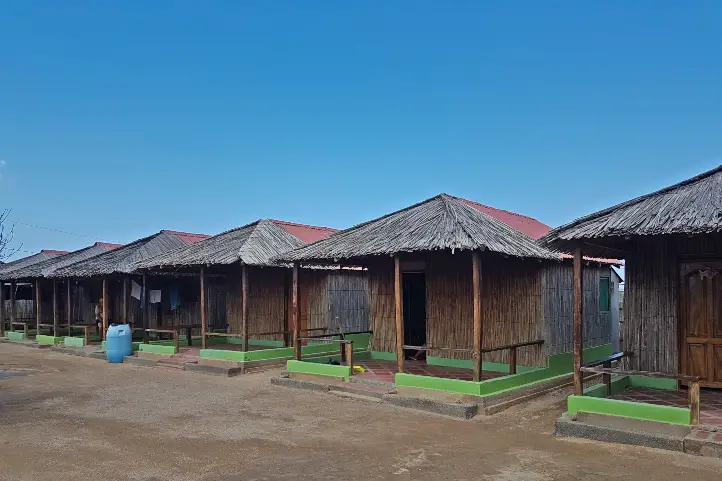
Where to stay in Santa Cruz de Lórica

In Santa Cruz de Lórica you can find hostels and hotels that preserve the local architecture, we recommend Hotel Boutique Beteska and Onoma Hotel.

Santa Cruz de Lórica Attractions and Activities

Historical Center

The most striking attraction with eclectic buildings of Arabic influence and similar to those found in the city of Cartagena. Their fine elements and details make them imposing.

Public Market

Built in 1929, this building of republican architecture with certain Arabian touches, covers an entire block of the historic center, located on the banks of the Sinu River. Due to its importance and uniqueness, the Government, in 1996, named it a national monument.

Parish of Santa Cruz de Lorica

Built before 1800, and had to be remodeled in 1896. An important fact for when you visit this parish is that its bells were brought from Portugal, the bronze images of the facade are of French origin, and the clock, brought from Italy, was donated by the Syrian-Lebanese colony around 1929.

Gonzalez Building

It was owned by one of the wealthiest families in the region. It has an area of 540 square meters and it displays a republican style which highlights the facade and its internal spaces. You can take beautiful pictures in this imposing building.

Lorica Club

It is located in a corner of the Plaza de la Cruz, formerly where the Syrian-Lebanese immigrants organized their social gatherings. Nowadays it is open to the population where nightly events are held.

Afife Matuk Building

Placed on the banks of the Sinu River and adjacent to the public market. This building was finished in 1929, and it remains intact to date. Inside, you will notice how the light blue and white colors stand out in small walls that separate each space, with arabesque figures. It also has a room with a large window where you can see the waters of the Sinu River.

The Malecon of Lorica

It is the complement of the patrimonial buildings of the Historical Center and the Public Market, it has an extension of 5 km around the banks of the Sinu River. It was declared of Cultural Interest in 1998; during your walk you will be able to appreciate the beauty of the river and the beautiful buildings.

Gastronomic delights in Lorica

Immigrants played an important role in Lorica’s gastronomy, so it is possible to enjoy very typical dishes of the region such as bocachico stew, the popular sarapa, mote de queso (whose main ingredient is Creole yam and coastal cheese) and food such as kibbes (prepared with ground beef, wheat, onion, mint, salt and pepper) that characterizes the immigrant culture.

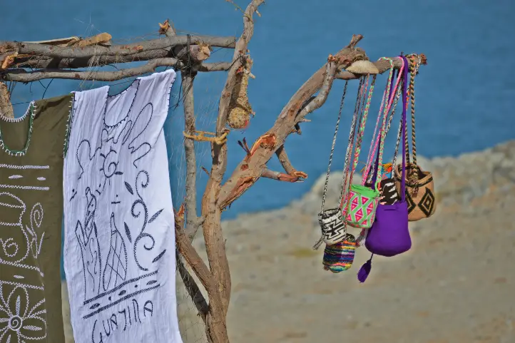
Craft traditions in Lorica

In Lorica, primitivist painting is its maximum artistic expression. It reflects the popular imagination, dishes, objects and colors of the peasant culture. Its main exponent was Marcial Alegría Garcés, a man who dedicate himself to painting. Marcial’s paintings are present in more than 18 countries, becoming one of the emblems of Lorica’s art and tradition. You will appreciate his history and works in the village of San Sebastian. Marcial also applies his art to ornate pottery pieces that are made and sold there, as well as canvas paintings and wooden frames.

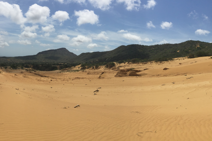
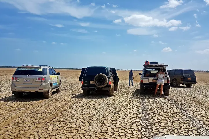
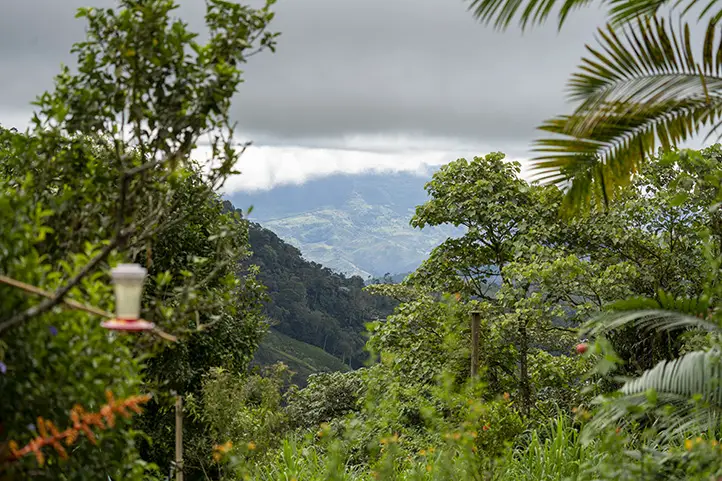
Nature Destinations Near Lorica

Lorica is surrounded by a complex landscape of swamps and marshes mixed with pastures with extensive cattle ranching and patches of flooded forests. The area is very susceptible to water level variations in the marshes and the Sinú River as a result of seasonal changes in rainfall. The main habitats in the region are swamps and marshes.

Visit the Nearby Marshes and Natural Reserves

34 km from the town you can visit the swamp of La Caimanera, with 2000 hectares of mangroves, herons and reptiles. it is possible to kayak and canoe along the river.

There is also La Leche swamp, ideal to see monkeys, snakes, tigers and deer.  Finally, the Sanguaré Natural Reserve, with 110 hectares of tropical dry forest surrounded by mangroves, coastal freshwater lagoons, sea grasses and reefs.

Ciénaga Grande de Lorica is another big swamp, which is home to numerous species of birds, mammals, fish and reptiles. It is shared by five municipalities and fed by lagoons and streams and the Sinu River. It has an extension of more than thirty thousand kilometers, and it is home to the Blue-winged Teal (Anas discors) when they arrive from Alaska.

Swamp complex of the western margin of the Sinú River

This region was declared Important Bird and Biodiversity Area (IBA). Despite conservation efforts, the land is mainly used for extensive cattle ranching and fishing, subsistence agriculture and timber extraction. From 1997 to 2002 a project on sustainable use of wildlife was developed in the Bañó swamp, where a community-based tourism program was key. However, the place has no the expected recognition as an ecotourism destination.
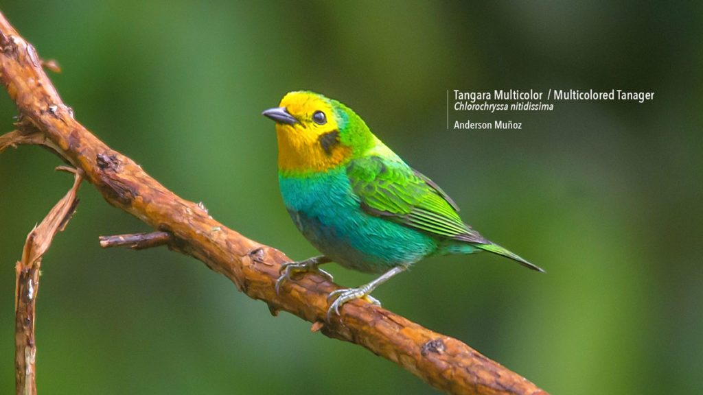
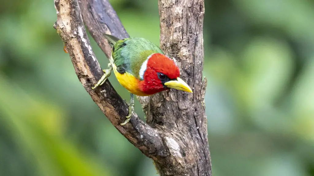
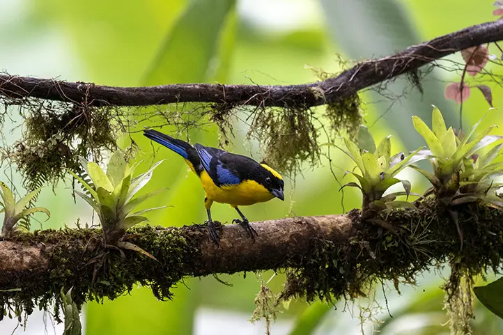
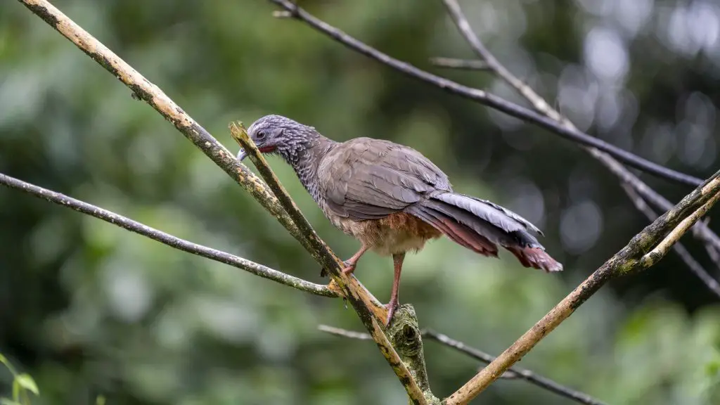
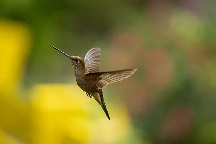
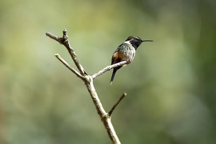
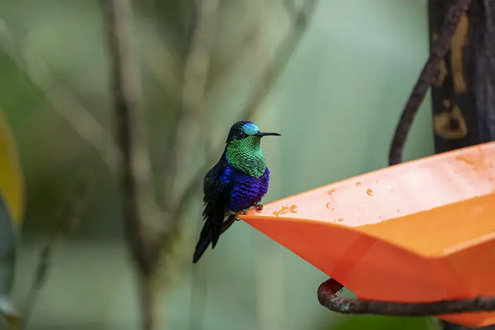
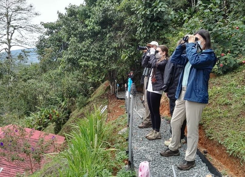
Birdwatching

Bañó marsh alone registers a total of 142 species of birds. However, the number of species may be higher, as many marshes remain uninventoried.

There are large flocks of Fulvous whistling duck (Dendrocygna bicolor), Black-bellied whistling duck (D. autumnalis), White-faced whistling duck (D. viduata) and a large number of waterfowl in general. The area is potentially important for reproduction and long-term maintenance of the Northern screamer (Chauna chavaria) population, as well as five other species of ducks. More than 20,000 waterbirds congregate there.

Other fauna

Besides birds, it is possible to find some threatened fauna species such as Neotropical otter (Lontra longicaudis) (DD), Gray-bellied night monkey (Aotus lemurinus griseimembra) (VU), Dahl’s toad-headed turtle (Phrynops dahli) (CR), Magdalena River turtle (Podocnemis lewyana) (EN), Hicotea (Trachemys scripta callirostris) (LR/nt). Two characteristic species of flora are: Pithecellobium lanceolatum and Thalia angustifolia.

Diving

There are more than 17 dive sites where you can admire the largest variety of virgin corals in the Caribbean, nurse and whitetip sharks, turtles, fire and brain corals. It stands out Bajo Bushnell, a reef where barracudas, giant gorgonians and horn coral colonies abound. Other interesting diving places are: Burbujas, Los Pargos, Grieta del Socorro, Fondo Loco, Bajo Mariajo, Los Venados, Los Bayones. Moreover, for advanced divers, Bartolo reef and El Orion.

Beatiful Beaches of Coveñas and Tolu

Thanks to its proximity you can visit Coveñas and Tolú. To get to Coveñas you must take a 45-minute (30 km) road trip. There you will be able to develop the following activities:

Relaxing at the beaches of Coveñas

The beaches you can visit in Coveñas are La Coquerita and Punta de Piedra. You can practice activities and sports such as jet skiing, scuba diving, donut riding, jet skiing, among others.

Marine Infantry Museum Park

It is a museum that has a very attractive architecture, where the work of the armed forces is exhibited as well as part of the history of the country. You can enjoy 22 exhibition rooms and other spaces where the history of the Colombian infantry is shown from independence to the present.

San Bernardo Archipelago

You can also visit this paradise, a group of islands in the Gulf of Morrosquillo where you can enjoy everything from gastronomy to water sports. For more information visit our blog Travel Guide to El Rosario and San Bernardo Corals National Natural Park.

Las Cuevas Toluviejo

There are 7 caverns where you can go spelunking and explore the mysteries hidden inside, also formed by millenary formations of stalactites, stalagmites and dolomites in its depths, dating from the Miocene and Pliocene periods.

If you want to plan your trip to Colombia do not hesitate to contact us, visit our Plan your trip page!

References
About the Authors

Sara Colmenares

The current director of Sula. Doctor in Biological Sciences. Her main interests are to explore and understand the organism-environment interactions, taking advantage of emerging knowledge for the management and conservation of species and ecosystem services. She is currently working as a consultant in functional ecology, ecosystem services, and conservation projects in Colombia related to ecotourism and birdwatching.

Luisa Martin

Engineer, world traveler, amateur photographer, traveling blogger, and foody.

Travel Guide to Macuira: The Cloud Forest Oasis in La Guajira Desert


Macuira is a National Natural Park of Colombia considered an oasis in the desert of Alta Guajira, in the Caribbean region of Colombia. It is a very special place because it has the contrast between sea, desert and jungle.

The park, with 25,000 ha, was declared in 1977 to protect and conserve the Serrania de la Macuira, which reaches 864 meters above sea level. It is not as high as the Sierra Nevada de Santa Marta, but it has a very special particularity which is the presence of cloud forest very close to the Colombian Caribbean coast and surrounded by a vast desert.

This is why being in the Macuira you can go from the blue of the ocean, through the yellow of the desert, to the green of the jungle. Among the most important characteristics of the Serranía de Macuira is the presence of forested mountains which are the only source of fresh water in the dessert.

Find here why you should visit this beautiful destination in Colombia, the Macuira National Natural Park in La Guajira.

Discovering Macuira National Natural Park

In 1977 and by means of Executive Resolution Nº 149, the National Government created the Macuira National Park, located northeast of the Guajira Peninsula, in the mountain range of the same name.

In practice, it covers an area of 24,103 hectares, corresponding to a mountainous massif that forms the northernmost mountain range in South America, with elevations ranging from 100 to 867 meters above sea level approximately, the Serranía de la Macuira.

This national park, located in Nazareth, in the municipality of Uribia, is ideal for birdwatching, as some 140 bird species have been recorded there, 17 of which are endemic. In addition, the reserve has several forest ecosystems.

The Serranía de Macuira

Serranía de Macuira is composed of three main mountains: Cerro Palúa (865 m), Cerro Huaresh (852 m) and Cerro Jihouone (753 m), which rise from the desert plain. Another isolated hill within the park is Cerro Oriore. There are several freshwater streams, which disappear when they reach the sand dunes at the eastern base of the Sierra.

Picture of Serrania de la Macuira by Luis Pérez, Flickr Creative commons Licence

The main characteristic of the Macuira, which makes it unique in the world, is that it has an evergreen dwarf cloud forest, an ecosystem very similar to the Andean forests located in the páramos. It is an area of great environmental importance because this unique cloud forest ecosystem functions as a water regulator for the region.

The cloud forests themselves are located at altitudes above 2,700 meters above sea level, but in Macuira National Natural Park they can be seen at only 550 meters above sea level and very close to the sea. Definitely, this is a must to see scenery in the world.  It is an oasis in the middle of aridity that supports a great diversity of fauna and flora, especially adapted to survive, grow and reproduce in this type of environment.

Why is there a cloud forest in the Macuira?

The Serrania de la Macuira forms a geological barrier where humidity from the Caribbean Sea condenses, causing the formation of fog that penetrates the forest and creates a humid enclave in the middle of the desert.

This is because the region has a low rainfall and high temperatures, which when combined with the trade winds from the sea and saturated with moisture, rise to meet the barrier of the Serrania, which is why it forms cumulus clouds in the day and nimbostratus in the afternoon.

Traveling to Macuira, Alta Guajira, Colombia

Characteristics of the Macuira Park

Macuira NNP has a territorial area of 250 km², and is located in the extreme north of the department of La Guajira, northwest of the municipality of Uribia, neighboring the small villages of Puerto Estrella, Nazareth, Waretpa, Punta Espada, Siapana and Tawaira.

The are four ecosystems in the park: Dwarf Cloud Forest, Dry Evergreen Forest, Dry Deciduous Forest and Tropical Dry Forest. As mentioned before, this is the most significant rarity of the park, because it has similar conditions to those present below the Andean paramo line around 2,700 meters above sea level. The presence of a cloud forest amidst the desert makes it a unique landscape, a real oasis in La Guajira dessert.

Regarding the dry evergreen forest, It is located at an altitude between 250 and 550 meters above sea level, this allows trees to keep their leaves (foliage) despite possible climate changes. At lower altitudes, there is the Dry Deciduous Forest, located at an altitude between 50 and 400 meters above sea level.

Finally, the Tropical Dry Forest, in the desert plains, is an ecosystem with unparalleled diversity of plants and animals that are adapted to extreme conditions. This ecosystem contains the largest number of endemic species of flora and fauna in the park.

Macuira as an Important Bird Area (IBA)

The entire IBA corresponds to Macuira National Natural Park, created in 1977. The park safeguards endemic and migratory bird species, with a record of 140 bird species, seven of which are endemic subspecies. This is why it was declared an Important Bird Area (IBA), or AICA in Spanish, in Colombia and the world in 2003.

The park is also an especially important scenario within the cosmogony, mythology, social and cultural order of the Wayuu ethnic group.

Presence of Indigenous Communities in Macuira

The indigenous communities present in the department of Guajira are the Wayuú, of the Arawak linguistic family, who have occupied this sector for centuries. They are distributed in communities throughout Guajira, but the most important settlement are in Nazareth or Akuwai, northeast of Guarece Hill.

@Colombiafrank Sharing time with the Wayuu people in Alta Guajira, Colombia

The economy of these communities is based on grazing activities, artisanal fishing, handicrafts and seasonal agriculture. In addition, the organization of National Natural Parks offers work on an annual basis to a representative of each clan.

Wayuu Handicrafts, La Guajira, Colombia

Two clans out of 7 are selected annually to provide information and orientation to the sanctuary’s visitors with the support of a representative from the national natural parks in the city of Bogota.

Uribía, one of the nearest towns from Macuira, is the most important Wayuu town in La Guajira and is considered the indigenous capital of Colombia.

How to Get to Macuira National Natural Park

Macuira National Natural Park is located in the extreme north of the department of La Guajira, northwest of the municipality of Uribia, is adjacent to the villages of: Puerto Estrella, Nazareth, Waretpa, Punta Espada, Siapana and Tawaira. In addition, it is totally overlapped with the reservation of Alta and Media Guajira.

Traveling in La Guajira

To get to the park from Riohacha, you must go by land to the city of Maicao, then continue to the town of Uribia, and from there to Puerto Portete, a town located on the bay of the same name. From there, a dirt road leads to the town of Nazareth. This trip takes between 6 and 8 hours in a four-wheel drive vehicle, as long as the weather conditions are favorable.

From Bogotá

Take a 1-hour flight from El Dorado International Airport (BOG) Bogotá to Almirante Padilla International Airport (RCH) at Riohacha city. Once at the airport, take an approximately 1,5- hours ride to Uribia. Then, in Uribia you should take a 2-hours ride to Bahía Portete. Finally, once in Bahía Portete you should take an extra 6-hours ride to Nazareth.

What to do in Macuira National Natural Park

As a visitor to the park you can hike through the Serranía de Macuira, you can visit the indigenous Wayú cemeteries, or you can also find handicrafts made by the inhabitants of the region in the surrounding municipalities.

Hiking and Trekking

Hiking is the most exciting activity in Macuira National Natural Park. The park has hikes of different degrees of difficulty (low and medium), where you can appreciate dunes, natural pools and temporary streams.

If you want to make the ascent to the Macuira mountain range you must be clear that the degree of difficulty is high, so you must have good physical condition and endurance for long walks of 5 to 7 hours.

Birdwatching and Wildlife Observation

Within the 5 ecosystems of the park, there are 140 bird species recorded and that can be appreciated, 7 of which are endemic subspecies:

  • Scrub Greenlet (Hylophilus flavipes)
  • Pectoral sparrow (Arremon taciturnus fratruekis)
  • Blue-crowned Motmot (Momotus momota)
  • Pale-breasted Thrush (Turdus leucomelas)
  • Red-legged honeycreeper (Cyanerpes cyaneus)
  • Buff-breasted Wren (Cantorchilus leucotis)
  • Rufous-vented chachalaca (Ortalis ruficauda)

Additionally, 10 of the species are reported to be migratory.

Besides birds, there are a significant number of insects at the Park, as well as a notable presence of amphibians (toads and frogs), iguanas, snakes and mammals, such as the White-fronted capuchin (Cebus albifrons), ocelot (Felis pardalis) and Jaguarundi (Herpailurus yagouaroundi).

Where to stay in Macuira National Natural Park

Macuira National Natural Park does not currently offer lodging for travelers. It is possible to stay in the nearby “rancheria” of Nazaret. In the rancheria of Nazaret there are 2 camping areas called Villa Inmaculada and Emerrare.

Rancherias in La Guajira

Moreover, if you wish to spend a night in a traditional Wayú ranchería, the village also offers a night full of tradition with the locals of the sector.

If you want to rest in a hotel we recommend: Hotel Mulamana

Best time to visit Macuira National Natural Park

Dry season starts at the beginning of December until late of March with weather around 30º C (86 ºF). In the higher parts of the Macuira mountain range there are persistent winds and in the lower parts the temperatures are higher and the humidity increases.

Macuira National Natural Park Entrance fees

The park does not currently charge admission fees, but visitors must register at the park’s facilities and stay for a defined period of time.

What to consider before visiting Macuira National Natural Park

  • Currently access to the cloud forest is not allowed, as it is a very fragile ecosystem and highly valued by the Wayuu people.
  • The ranchería of Pusheo is the only restaurant in the sector, since the distances are very long and it is necessary to buy enough food for the trips.
  • You should always travel accompanied by a Wayuu driver and/or guide with a good command of Wayunaiki and Spanish, as well as knowledge of the communities of Alta Guajira.
  • For tours inside Macuira National Park, a local Wayuu guide authorized by the park must be hired.
  • The use of flash when taking photographs is prohibited.
  • Use of binoculars to watch animals’ behavior.
  • Bring along valid identification documents and health insurance.
  • Be vaccinated against yellow fever, tetanus and covid-19.
  • If you take specific medications, take them with you a personal first aid kit.

Some prohibitions

Feeding, bothering or hunting animals, alcoholic drinks and drugs, throwing cigarette butts, burning garbage, felling, and capturing wildlife.

References
  • Colparques
  • Parques nacionales
About the authors

Sara Colmenares

The current director of Sula. Doctor in Biological Sciences. Her main interests are to explore and understand the organism-environment interactions, taking advantage of emerging knowledge for the management and conservation of species and ecosystem services. She is currently working as a consultant in functional ecology, ecosystem services, and conservation projects in Colombia related to ecotourism and birdwatching.

Luisa Martin

Engineer, world traveler, amateur photographer, traveling blogger, and foody.

Know the Winged Jewels Held by San Antonio Cloud Forest – Km 18

The San Antonio cloud forest and the wooded areas of the sector known as “kilometro 18” (Km. 18), are located between kilometers 14 to 23 of the Cali – Buenaventura road. The area belongs to the municipalities of Cali, in the townships of El Saladito, Felidia, and La Elvira and Dagua in the townships of San Bernardo, and Km. 26.

Multicolored Tanager – Chlorochryssa nitidissima ©Colombia Birdfair

More than 180 species of birds have been registered in San Antonio Forest – Kilometer 18. The presence of threatened species such as the Multicolored Tanager (Chlorochryssa nitidissima) and the Cloud-forest pygmy owl (Glaucidium nubicola) stands out, and raises the place as one of the best hotspots for birding near to the city of Santiago de Cali, in the department of Valle del Cauca.

Sustainable Destination

Red-headed Barbet – Eubucco bourcierii, La Minga Ecolodge, Valle del Cauca

The local community was interested in conserving the forests and following this aim they decided to creat the Asociación Rio Cali, together with the support of numerous allies. The Asociación Río Cali is a private non-profit organization that promotes and supports the maintenance of biodiversity and the sustainable use of natural resources by involving the local human communities of the Cali and Aguacatal river basin, where the San Antonio forest and km 18 are located.

The community supports biodiversity conservation initiatives from small rural farms through the planning and management of agroecosystems, generating income and employment through the production of primary goods and environmental services. It also seeks to protect birds and their habitat by generating economic income for rural communities through nature tourism focused on bird watching.

Scientific Research at San Antonio Forest

This forest was explored in the early 20th century by the famous naturalist, ornithologist and banker Frank M. Chapman of the American Museum of Natural History. He was the creator of the Christmas Bird Count (you should know this if you are a serious bird watcher … I am just kidding!) After him, more studies and explorations were carried by other ornithologists several times during the same century. Today, all this information has served to historically track birds that have become extinct in the area due to forest fragmentation. It also have been useful to support conservation initiatives implemented on the area.

San Antonio Cloud Forest – Km 18: Important Bird Area (IBA)

According to BirdLife International, the San Antonio cloud forest and the surrounding wooded areas at kilometer 18 were declared National Forest Reserve Areas in 1938 and 1943. Then, in 1948 and 1960 the area was ceded to the municipality of Cali for its management as a Forest Reserve Area. In 1998, the housing areas of the Forest Reserve Area were excluded.

It is in 2004, when members and researchers from the local community and the Asociación Río Cali, proposed to BirdLife International and the Alexander von Humboldt Institute for Biological Research, the declaration of the “Bosque de Niebla de San Antonio – Km 18” as an Important Area for the Conservation of Birds (IBA/AICA). Thus, kilometer 18 and the San Antonio cloud forest were designated as an Important Bird Area (IBA) for conservation, especially for hosting significant numbers of globally threatened species.

The Multicolored Tanager was choosen as the symbol of the IBA/AICA, because of being a unique species of the Colombian Andes, very easy to observe in the region, and being threatened to extinction due to habitat loss.

The Multicolored Tanager is the symbol of the IBA/AICA “Bosque de Niebla de San Antonio- Km 18” ©Asociación Rio Cali

Asociación Río Cali activities are also involved with monitoring the Birds of the AICA Bosque de Niebla de San Antonio and Km 18, studying native species and making inventories of plants, mammals, birds, amphibians and reptiles with the support of the local environmental authority (CVC).

Among the 180 species of this place, the following ones are of main importance to the IBA: Chestnut Wood-quail (Odontophorus hyperythrus), Yellow-headed Manakin (Chloropipo flavicapilla), Golden-winged Warbler (Vermivora chrysoptera), Cerulean Warbler (Setophaga cerulea), Purplish-mantled Tanager (Iridosornis porphyrocephalus) and the Multicolored Tanager (Chlorochrysa nitidissima).

Location

Cloud forest located in the western mountain range of Colombia.

The Cerro de San Antonio, also called Cerro de La Horqueta, is a montane summit (2100 m elevation) in the western andean mountain range in Colombia. It is localted 15 km west of the city of Santiago de Cali, on the road to Buenaventura, department of Valle del Cauca.

The cloud forests of San Antonio and its surrounding area, were heavily extracted during the first half of the past century (1900-1950). However, the remaining fragments stayed more or less pristine since the 1960s, and are distributed in a matrix of small farms and suburban houses.

What to do

Birding at San Antonio Cloud Forest – Km 18

In the San Antonio Cloud Forest – Km 18 you can observe more than 220 species of birds, both resident and migratory. Some of the species that can be seen are the Multicolored Tanager, the Blue-winged Mountain-Tanager, the Blue-naped Chlorophonia, the Green-and-black Fruiteater, the Colombian Chachalaca and 30 species of hummingbirds.

Blue-winged Mountain-Tanager – Anisognathus somptuosus
Colombian Chachalaca – Ortalis columbiana, Endemic, Valle del Cauca

You can find many highly recommended places to observe and photograph birds. Also ecolodges and birdlodges specialized in offering high quality accommodation in the area. Among the most famous and recommended places to go birding in the San Antonio Cloud Forest Km 18 in Valle del Cauca are:

Finca La Conchita: At Finca La Conchita west of the city of Cali you can have superb studies of hummingbirds, plus a wide variety of other birds such as the endemic Colombian Chachalaca.

Bronzy Inca – Coeligena coeligena
Purple-throated Woodstar – Calliphlox mitchellii – male-

La Minga Ecolodge: This is the prime destination to observe and photograph the Multicolored Tanager. Be sure that the best pictures of this bird were took at La Minga Ecolodge.

View to the San Antonio Cloud Forest from La Minga Ecologe

Finca Alejandría “El Paraíso de los Colibríes”: This is one of the most known and traditional palces for photographing tanagers and hummingbirds at Km 18, perhaps because it was one of the first to open. There you can find adequate trails with numbered drinking troughs, where the birds arrive. There are also gardens with feeders inside the forest.

Crowned Woodnymph – Thalurania colombica

Araucana Lodge: Eco-lodge specializing in bird watching, botanical tours and wellness. Organic farm on site. Know more about this place in our entry Complete Guide to the Best Eco lodges in Colombia.

©Araucana Lodge Website

Bosque de Niebla Birding & Nature: If you love nature and birds, you must know this place. It is a family business that offers its visitors bird watching and hiking tours, as well as birding workshops. It is located at Km 18, 30 minutes from Cali, and 2 kilometers from the entrance of Km 18 via Dapa. Its purpose is to help the conservation of the cloud forest of the National Protected Forest Reserve of La Elvira, thus promoting the conservation of the habitat of its birds.

Post Covid-19 Destination ©Bosque de Niebla Birding & Nature

If you want to know more about Colombian nature tours, or want to visit any Valle del Cauca, just check our Valle del Cauca tour, follow us, write us comments, or just contact us.


References


About the author

Sara Colmenares

Current director of Sula. Doctor in Biological Sciences. Her main interests are to explore and understand the organism – environment interactions, taking advantage of emerging knowledge for the management and conservation of species and ecosystem services. She is currently working as a consultant in functional ecology, ecosystem services and conservation projects in Colombia related to ecotourism and birdwatching.[/vc_column_text]