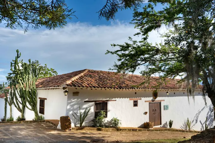
Macuira is a National Natural Park of Colombia considered an oasis in the desert of Alta Guajira, in the Caribbean region of Colombia. It is a very special place because it has the contrast between sea, desert and jungle.
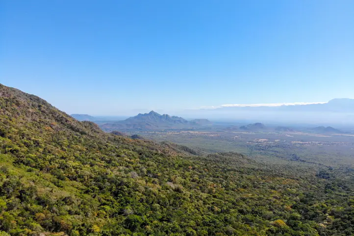
The park, with 25,000 ha, was declared in 1977 to protect and conserve the Serrania de la Macuira, which reaches 864 meters above sea level. It is not as high as the Sierra Nevada de Santa Marta, but it has a very special particularity which is the presence of cloud forest very close to the Colombian Caribbean coast and surrounded by a vast desert.
This is why being in the Macuira you can go from the blue of the ocean, through the yellow of the desert, to the green of the jungle. Among the most important characteristics of the Serranía de Macuira is the presence of forested mountains which are the only source of fresh water in the dessert.
Find here why you should visit this beautiful destination in Colombia, the Macuira National Natural Park in La Guajira.
Discovering Macuira National Natural Park
In 1977 and by means of Executive Resolution Nº 149, the National Government created the Macuira National Park, located northeast of the Guajira Peninsula, in the mountain range of the same name.
In practice, it covers an area of 24,103 hectares, corresponding to a mountainous massif that forms the northernmost mountain range in South America, with elevations ranging from 100 to 867 meters above sea level approximately, the Serranía de la Macuira.
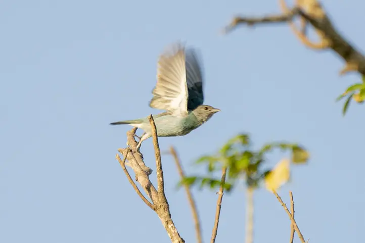
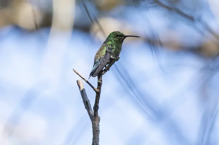
This national park, located in Nazareth, in the municipality of Uribia, is ideal for birdwatching, as some 140 bird species have been recorded there, 17 of which are endemic. In addition, the reserve has several forest ecosystems.
The Serranía de Macuira
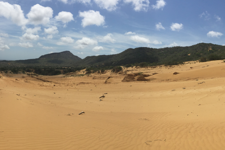
Serranía de Macuira is composed of three main mountains: Cerro Palúa (865 m), Cerro Huaresh (852 m) and Cerro Jihouone (753 m), which rise from the desert plain. Another isolated hill within the park is Cerro Oriore. There are several freshwater streams, which disappear when they reach the sand dunes at the eastern base of the Sierra.
Picture of Serrania de la Macuira by Luis Pérez, Flickr Creative commons Licence
The main characteristic of the Macuira, which makes it unique in the world, is that it has an evergreen dwarf cloud forest, an ecosystem very similar to the Andean forests located in the páramos. It is an area of great environmental importance because this unique cloud forest ecosystem functions as a water regulator for the region.
The cloud forests themselves are located at altitudes above 2,700 meters above sea level, but in Macuira National Natural Park they can be seen at only 550 meters above sea level and very close to the sea. Definitely, this is a must to see scenery in the world. It is an oasis in the middle of aridity that supports a great diversity of fauna and flora, especially adapted to survive, grow and reproduce in this type of environment.
Why is there a cloud forest in the Macuira?
The Serrania de la Macuira forms a geological barrier where humidity from the Caribbean Sea condenses, causing the formation of fog that penetrates the forest and creates a humid enclave in the middle of the desert.
This is because the region has a low rainfall and high temperatures, which when combined with the trade winds from the sea and saturated with moisture, rise to meet the barrier of the Serrania, which is why it forms cumulus clouds in the day and nimbostratus in the afternoon.
Traveling to Macuira, Alta Guajira, Colombia
Characteristics of the Macuira Park
Macuira NNP has a territorial area of 250 km², and is located in the extreme north of the department of La Guajira, northwest of the municipality of Uribia, neighboring the small villages of Puerto Estrella, Nazareth, Waretpa, Punta Espada, Siapana and Tawaira.
The are four ecosystems in the park: Dwarf Cloud Forest, Dry Evergreen Forest, Dry Deciduous Forest and Tropical Dry Forest. As mentioned before, this is the most significant rarity of the park, because it has similar conditions to those present below the Andean paramo line around 2,700 meters above sea level. The presence of a cloud forest amidst the desert makes it a unique landscape, a real oasis in La Guajira dessert.
Regarding the dry evergreen forest, It is located at an altitude between 250 and 550 meters above sea level, this allows trees to keep their leaves (foliage) despite possible climate changes. At lower altitudes, there is the Dry Deciduous Forest, located at an altitude between 50 and 400 meters above sea level.
Finally, the Tropical Dry Forest, in the desert plains, is an ecosystem with unparalleled diversity of plants and animals that are adapted to extreme conditions. This ecosystem contains the largest number of endemic species of flora and fauna in the park.
Macuira as an Important Bird Area (IBA)
The entire IBA corresponds to Macuira National Natural Park, created in 1977. The park safeguards endemic and migratory bird species, with a record of 140 bird species, seven of which are endemic subspecies. This is why it was declared an Important Bird Area (IBA), or AICA in Spanish, in Colombia and the world in 2003.
The park is also an especially important scenario within the cosmogony, mythology, social and cultural order of the Wayuu ethnic group.
Presence of Indigenous Communities in Macuira
The indigenous communities present in the department of Guajira are the Wayuú, of the Arawak linguistic family, who have occupied this sector for centuries. They are distributed in communities throughout Guajira, but the most important settlement are in Nazareth or Akuwai, northeast of Guarece Hill.
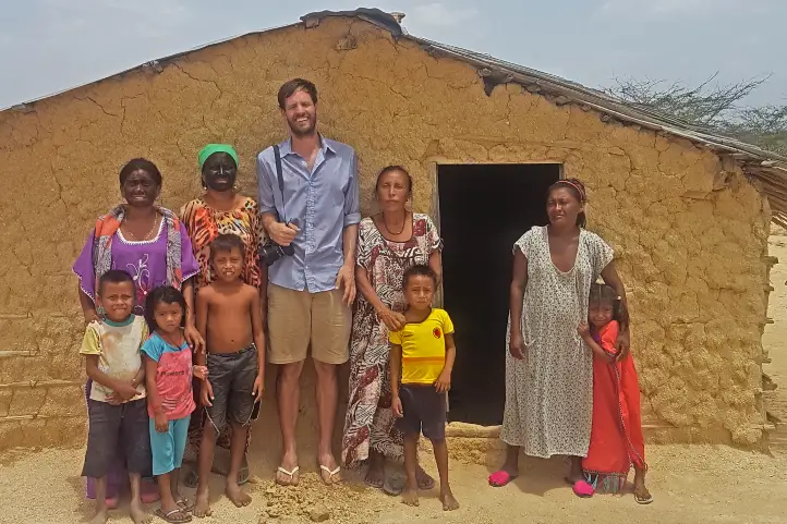
@Colombiafrank Sharing time with the Wayuu people in Alta Guajira, Colombia
The economy of these communities is based on grazing activities, artisanal fishing, handicrafts and seasonal agriculture. In addition, the organization of National Natural Parks offers work on an annual basis to a representative of each clan.
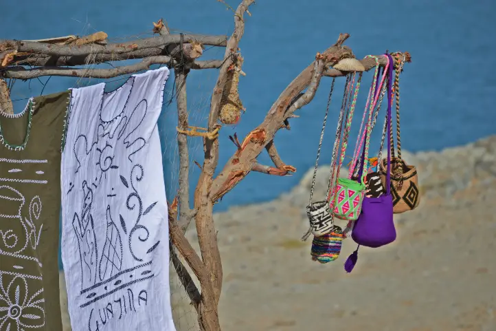
Wayuu Handicrafts, La Guajira, Colombia
Two clans out of 7 are selected annually to provide information and orientation to the sanctuary’s visitors with the support of a representative from the national natural parks in the city of Bogota.
Uribía, one of the nearest towns from Macuira, is the most important Wayuu town in La Guajira and is considered the indigenous capital of Colombia.
How to Get to Macuira National Natural Park
Macuira National Natural Park is located in the extreme north of the department of La Guajira, northwest of the municipality of Uribia, is adjacent to the villages of: Puerto Estrella, Nazareth, Waretpa, Punta Espada, Siapana and Tawaira. In addition, it is totally overlapped with the reservation of Alta and Media Guajira.
Traveling in La Guajira
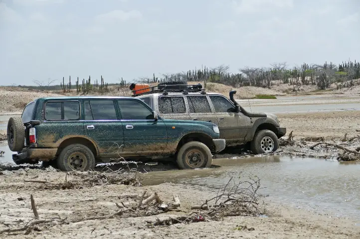
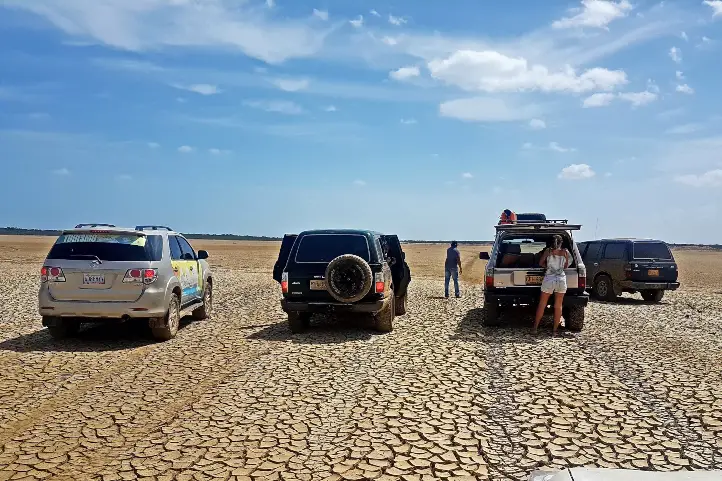
To get to the park from Riohacha, you must go by land to the city of Maicao, then continue to the town of Uribia, and from there to Puerto Portete, a town located on the bay of the same name. From there, a dirt road leads to the town of Nazareth. This trip takes between 6 and 8 hours in a four-wheel drive vehicle, as long as the weather conditions are favorable.
From Bogotá
Take a 1-hour flight from El Dorado International Airport (BOG) Bogotá to Almirante Padilla International Airport (RCH) at Riohacha city. Once at the airport, take an approximately 1,5- hours ride to Uribia. Then, in Uribia you should take a 2-hours ride to Bahía Portete. Finally, once in Bahía Portete you should take an extra 6-hours ride to Nazareth.
What to do in Macuira National Natural Park
As a visitor to the park you can hike through the Serranía de Macuira, you can visit the indigenous Wayú cemeteries, or you can also find handicrafts made by the inhabitants of the region in the surrounding municipalities.
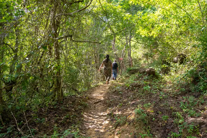
Hiking and Trekking
Hiking is the most exciting activity in Macuira National Natural Park. The park has hikes of different degrees of difficulty (low and medium), where you can appreciate dunes, natural pools and temporary streams.
If you want to make the ascent to the Macuira mountain range you must be clear that the degree of difficulty is high, so you must have good physical condition and endurance for long walks of 5 to 7 hours.
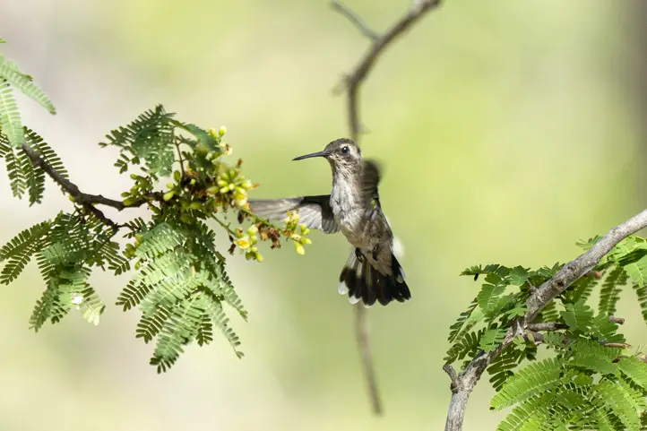
Birdwatching and Wildlife Observation
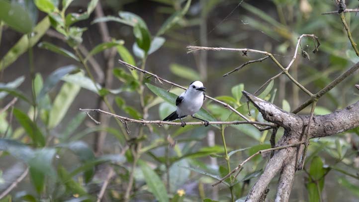
Within the 5 ecosystems of the park, there are 140 bird species recorded and that can be appreciated, 7 of which are endemic subspecies:
Scrub Greenlet (Hylophilus flavipes)
Pectoral sparrow (Arremon taciturnus fratruekis)
Blue-crowned Motmot (Momotus momota)
Pale-breasted Thrush (Turdus leucomelas)
Red-legged honeycreeper (Cyanerpes cyaneus)
Buff-breasted Wren (Cantorchilus leucotis)
Rufous-vented chachalaca (Ortalis ruficauda)
Additionally, 10 of the species are reported to be migratory.
Besides birds, there are a significant number of insects at the Park, as well as a notable presence of amphibians (toads and frogs), iguanas, snakes and mammals, such as the White-fronted capuchin (Cebus albifrons), ocelot (Felis pardalis) and Jaguarundi (Herpailurus yagouaroundi).
Where to stay in Macuira National Natural Park
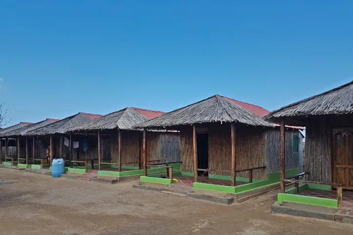
Macuira National Natural Park does not currently offer lodging for travelers. It is possible to stay in the nearby “rancheria” of Nazaret. In the rancheria of Nazaret there are 2 camping areas called Villa Inmaculada and Emerrare.
Rancherias in La Guajira
Moreover, if you wish to spend a night in a traditional Wayú ranchería, the village also offers a night full of tradition with the locals of the sector.
If you want to rest in a hotel we recommend: Hotel Mulamana
Best time to visit Macuira National Natural Park
Dry season starts at the beginning of December until late of March with weather around 30º C (86 ºF). In the higher parts of the Macuira mountain range there are persistent winds and in the lower parts the temperatures are higher and the humidity increases.
Macuira National Natural Park Entrance fees
The park does not currently charge admission fees, but visitors must register at the park’s facilities and stay for a defined period of time.
What to consider before visiting Macuira National Natural Park
Currently access to the cloud forest is not allowed, as it is a very fragile ecosystem and highly valued by the Wayuu people.
The ranchería of Pusheo is the only restaurant in the sector, since the distances are very long and it is necessary to buy enough food for the trips.
You should always travel accompanied by a Wayuu driver and/or guide with a good command of Wayunaiki and Spanish, as well as knowledge of the communities of Alta Guajira.
For tours inside Macuira National Park, a local Wayuu guide authorized by the park must be hired.
The use of flash when taking photographs is prohibited.
Use of binoculars to watch animals’ behavior.
Bring along valid identification documents and health insurance.
Be vaccinated against yellow fever, tetanus and covid-19.
If you take specific medications, take them with you a personal first aid kit.
Some prohibitions
Feeding, bothering or hunting animals, alcoholic drinks and drugs, throwing cigarette butts, burning garbage, felling, and capturing wildlife.
References
Colparques
Parques nacionales
About the authors
Sara Colmenares
The current director of Sula. Doctor in Biological Sciences. Her main interests are to explore and understand the organism-environment interactions, taking advantage of emerging knowledge for the management and conservation of species and ecosystem services. She is currently working as a consultant in functional ecology, ecosystem services, and conservation projects in Colombia related to ecotourism and birdwatching.
Luisa Martin
Engineer, world traveler, amateur photographer, traveling blogger, and foody.
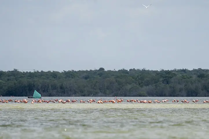
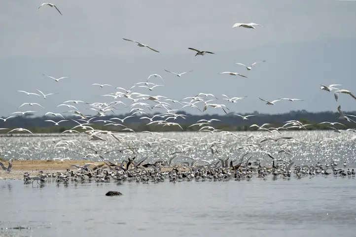
Los Flamencos Fauna and Flora Sanctuary is an important reserve with marshes, lagoons, and an important fragment of tropical dry forest created to protect a large population of American flamingos (Phoenicopterus ruber). This reserve is also the habitat of 185 other bird species, 80% of which are migratory.
Los Flamencos has shallow lagoons that fill up when the rains come and evaporate during the dry season. When the water evaporates, the marine salt concentrates, facilitating the growth of brine shrimp (Artemia sp.), which attracts American flamingos!
The local community consists mainly of Wayuu Indians. They are known for their colorful bags (mochilas), and handicrafts.
Discovering Los Flamencos Fauna and Flora Sanctuary
Los Flamencos Fauna and Flora Sanctuary is formed by four coastal swamps, with an area of 768. 2 square kilometers. It was declared Colombia’s National and Cultural Patrimony in 1992, being one of the smallest protected areas in the country, but one of the richest in a variety of resident and migratory birds. Moreover, it is home to algae, mollusks, crustaceans, and fish.
Temperature varies from 26 to 33 degrees celsius at its highest point.
Picture from Audubon: “Wayuu indigenous students and teacher Alvaro Jaramillo are bird watching in La Guajira, Colombia. The program teaches locals to become tour guides for travelers interested in spotting birds. Photo: Carlos Villalon”
Los Flamencos Sanctuary offers diverse cultural and gastronomic options, especially, from local Wayuu. Worth noticing is the ancestral dances and “make-up” worn by Wayuu people from the nearby rancherias tribes.
In the case of Los Flamencos Flamingo Fauna and Flora Sanctuary, they offer a year of work to a representative of each of the tribes present in the sector. There are 7 tribes and two of them are selected annually to provide information and orientation to the sanctuary’s visitors with the support of a representative from the national natural parks in the city of Bogota.
Food delicacies available include different types of fish, seafood, and goat meat, prepared with the region’s ancestral recipes.
The American Flamingo
These beautiful birds with pink feathers, long legs, and slender long- curved necks, are by far the most interesting attraction in this place. In fact, the park is named after these birds.
Flamingos are monogamous birds that lay only one egg per year. Their nests are mud mounds with a height of approximately 30 to 55 cm. Its hatchlings are born with white or grey feathers and they must wait 3 years for their feathers to turn pink.
Note that flamencos are easier to watch during the rainy season.
American Flamingo – Phoenicopterus ruber at Los Flamencos Fauna and Flora Sanctuary, Colombia
Why are Flamingos Pink?
Remember the shrimps we mentioned above? Flamingos get their pink color from the consumption of those brine shrimps, which are rich in beta carotene, a red-orange pigment.
Archaeological ruins
Other than flamingos, this place hosts archaeological ruins that confirm the presence of the “Guanebucans”, pre-colonial fishing and farming communities in the area that belong to the Arawak family.
These pre-colonial communities were forced to immigrate to the high areas in the Sierra Nevada, approximately 100 km west, after Spanish incursions.
How to get to Los Flamencos Fauna and Flora Sanctuary
From Bogotá
Take a 1.5 hours flight from Bogotá to Almirante Padilla International Airport (RCH) at Riohacha city. From Riohacha take an approximately 40 minutes ride to Camarones hamlet (20 km).
Once at Camarones hamlet you should walk along a trail for 3.5 km to the administrative center of the Park: Cabaña Guanebucane.
From Santa Marta
Take an approximately 2,5 hours ride to Camarones (165 km). From Camarones walk along 3.5 km trail to the administrative center of the Ministry of the Environment, Cabaña Guanebucane.
What to do in Los Flamencos Fauna and Flora Sanctuary
Hiking
Los Flamencos Fauna and Flora Sanctuary have a 2-hour trail through the Navio Quebrado lagoon. Then, hop on a water canoe and adventure yourself. During the tour enjoy the wonderful Caribbean Sea and the snow peaks of Colón and Bolivar, both part of the Sierra Nevada de Santa Marta.
Wildlife Observation
At Los Flamencos Sanctuary it is possible to find mixt of fresh and saltwater, which makes the whole ecosystem very diverse. Unique habitats such as tropical dry forest and tropical very dry forest that host wonderful species are present.
The sanctuary is characterized as an important migratory stop for turtles such as the leatherback sea turtle (Dermochelys coriacea), the loggerhead sea turtle (Caretta caretta), the hawksbill sea turtle (Eretmochelys imbricata), and the green sea turtle (Chelonia mydas)
At the time of rising tides, the shrimps begin their reproductive migration process.
In the rainy season, it is possible to appreciate the foliage of the beautiful yellow flower of the Puy (Handroanthus billbergii). Additionally, the place is host to the most diverse ecosystem of plants, such as the black mangrove (Avicennia germinans), the Dulce (Conocarpus erectus), the white mangrove (Laguncularia racemosa), and, to a lesser extent, the red mangrove (Rhizophora mangle).
Birdwatching
It is possible to appreciate the pink flamingos (Phoenicopterus ruber ruber) resident in the sanctuary. However, there are plenty of birds you can see around. Ibis, gulls, terns, and many migratory shorebirds are to be found at Los Flamencos.
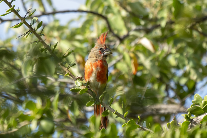
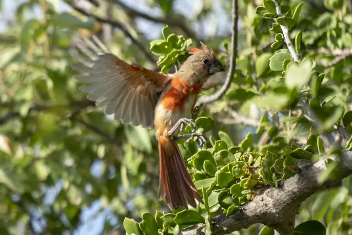
Vermilion Cardinal – Cardinalis phoeniceus
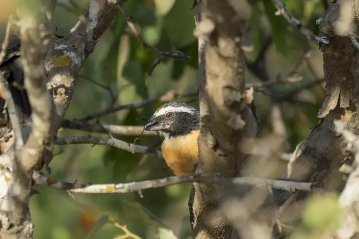
In the forest, you will find specialties restricted to NE Colombia and NW Venezuela, including Rufous-vented Chachalaca, Bare-eyed Pigeon, Buffy Hummingbird, Russet-throated Puffbird, Chestnut Piculet, White-whiskered Spinetail, Slender-billed Inezia, Orinocan Saltator, Pileated Finch, Tocuyo Sparrow, Crested Bobwhite, Blue-crowned Parakeet, Brown-throated Parakeet, Green-rumped Parrotlet, Black-crested Antshrike, White-fringed Antwren and Northern Scrub-Flycatcher, and the Vermillion Cardinal.
The Vermilion Cardinal is called “Rey Guajiro” (“King of the Guajira”) by the Wayuu people, and it is very important for their culture and traditions.
Where to stay in Los Flamencos Fauna and Flora Sanctuary
Camarones town offers different types of accommodation. Our suggested choices are:
Playa Samara Hostel, 14 kilometers away from the Sanctuary entrance.
Mar Azul-Playa Hotel, 12 kilometers away from the Sanctuary entrance.
You can also stay in Riohacha. Our suggested choice is Hotel Taroa.
Best time to visit Los Flamencos Sanctuary
The dry season is around December to late April and from July to late August and is the most convenient. But the dates when you will see the largest amount of pink flamingos is from October to late November.
Entrance fees
The entrance fee to The Flamencos Fauna and Flora Sanctuary is free. However, since it is located inside an indigenous territory, they ask you for a little representative payment.
What to consider before visiting Los Flamencos Sanctuary
Return ALL garbage you generate during the tour with you and dispose of it at the waste disposal sites.
Entrance for children under 5 years old, pregnant women, people with heart or respiratory conditions are not recommended.
Any guided tours must be done with authorized and certified tourist guides.
Always travel along the paths and trails marked by local authorities.
Be respectful of the Wayuu culture, its territories, and nature.
Consider wearing personal protective items (sun blocker, sunglasses, towel, insect repellent, and hat).
Carry reusable water bottles.
Bring along enough water for the journey (at least 1.5 liters).
Do not use flash when taking photographs.
Use of binoculars to admire animal behavior and beauty in their natural habitat.
Carry valid identity documents and health insurance.
It is recommended to be vaccinated against yellow fever and tetanus.
If you take specific medications, take them with you. It’s never enough to carry a personal medicine kit.
Some prohibitions
Feeding, bothering or hunting animals, alcoholic drinks and drugs, littering, burning garbage, felling, and capturing wildlife.
Engineer, world traveler, amateur photographer, traveling blogger, and foody.
Sara Colmenares
The current director of Sula. Doctor in Biological Sciences. Her main interests are to explore and understand the organism–environment interactions, taking advantage of emerging knowledge for the management and conservation of species and ecosystem services. She is currently working as a consultant in functional ecology, ecosystem services, and conservation projects in Colombia related to ecotourism and birdwatching.
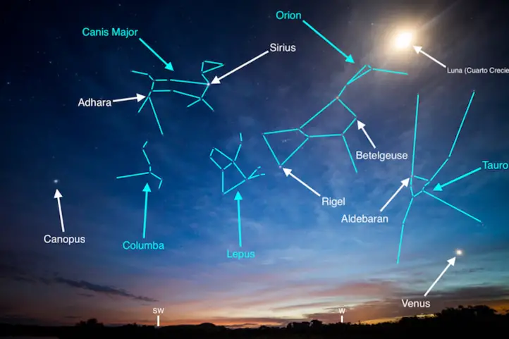
In Colombia, you can experience the unique and rare emotion of stargazing. The whole country offers the conditions to make astronomical tourism throughout the year, from the Andes to the Caribbean Sea.
Before telling you which are the best stargazing spots in Colombia, based on tourism facilities and beauty, I will promptly mention some topics of special attention.
The Light Pollution Menace
Sadly, almost a third of humanity cannot see the Milky Way when they look at the sky at night.
There are many sources of light on Earth that emit light particles into the atmosphere, causing the skies to become hazy.
Today there is more awareness of this phenomenon, and more people are mobilizing to promote the use of cleaner light installations.
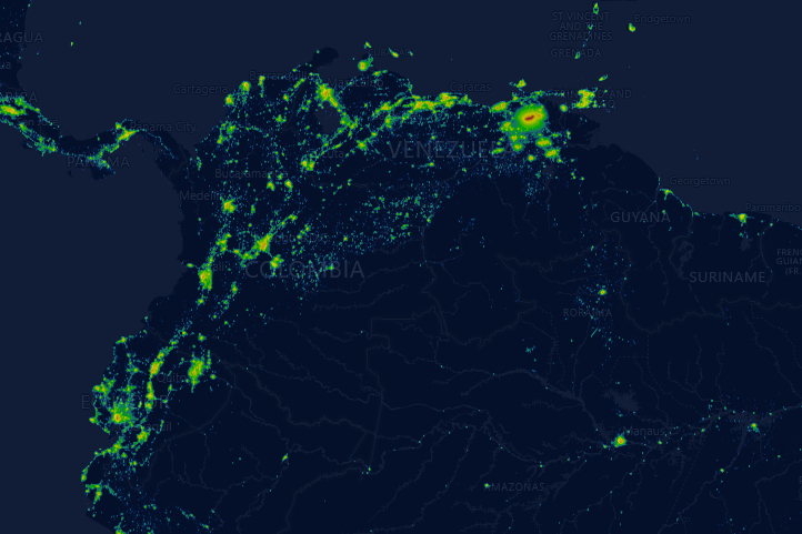
Light Pollution Map, Colombia – Powered by https://lighttrends.lightpollutionmap.info/
Effects of excessive light
According to the NGO Globe at Night, the light-dark cycle, when interrupted, affects ecological dynamics, and is a serious threat to nocturnal wildlife in particular.
Light pollution can also lead to sleep disorders and other health problems. In addition, health effects are not only due to over-illumination or excessive exposure to light over time.These are also produced by inadequate spectral composition of light (e.g., excessive blue light from cellphones).
With regard to energy waste, over-illumination can be a waste of energy, especially at night. Therefore, it generates increases in costs and carbon footprint.
Nevertheless, the NGO Globe at Night explains that light pollution can easily be reduced by doing simple things like:
protecting the lights properly so that the light does not go up,
only using light when and where it is needed,
use only the amount needed,
install low energy bulbs, and
choose bulbs with spectral power distributions appropriate to the task at hand.
Astrotourism is also a way to protect the night sky from increasing light pollution. It works through the recognition and protection of areas that still have low or no light pollution.
Astrotourism or Stargazing
Let’s start with some basic tips.
Basic Tips for an Amazing Stargazing Night
Before going out for stargazing consider the following points:
1.Weather
Try to find the most accurate information about wind speed, wind pressure, cloud forecast, and temperature. Atmospheric pressure is also something important to check. The higher the pressure, the clearer the conditions.
2. Transparency
Dust or moisture ruin the fun of the stargazes since they make the skies hazy. Try to find the best season, which in Colombia, means avoiding the rainy season. But also, going to the driest regions and the higher places.
3. “Seeing”
The later you go out, the better sight. I found an interesting paper in Science Magazine you can read later. It talks about a light pollution tracking tool ideated by a physicist. With this tool you can check whether the night sky is getting brighter. It is called the Radiance Light Trends Website.
4. High Spot
It can be a mountain or a building. This will help avoid light pollution effects.
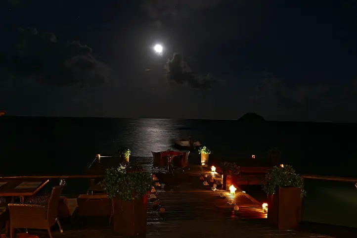
5. The Moon
The Gibbous or crescent phase of the moon is best for stargazing. A brilliant moon will overshadow the stars and planets.
6. Prepare for the night
Dress appropriately for the weather
Let your eyes relax and enter into dark adaptation
Avoid devices with white light, astronomers recommend using devices with the red light option.
Bug spray, needless to explain, but worth recalling, especially in Colombia, where it is always summery.
Best Stargazing Spots in Colombia
Any place without light pollution is a good place to see the stars. Colombia has many places that offer beautiful starred and cleaned skies, far from the contamination of the cities. However, not all the places offer the appropiate tourism facilities.
Here I will list the best stargazing spots in Colombia, based on tourism facilities and beauty.
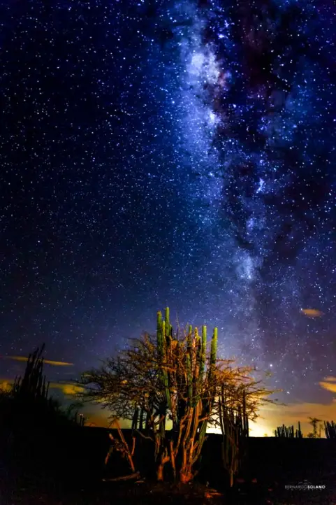
The most recommended destination for astrotourism is the Tatacoa Desert in Huila. This is the only destination in Colombia with a Starlight Certificate, nominated in 2019.
Besides its intrinsic desertic beauty, it makes you feel like observing the stars from mars, or the moon. The ochre and grayish tones of its landscapes contrast with the clear sky.
The desert has very low light contamination, and it has three different astronomic observatories, with telescopes, which are open to the public offering educational activities and nocturnal expeditions.
The epicenter of astronomical tourism in this region is the municipality of Villavieja, in Huila, where the Tatacoa Astronomical Observatory is located. In this place, visitors can participate in talks about astronomy and see the stars through the astronomical telescope.
Additionally, in the month of August you can witness the ‘Rain of the Perseids’, a beautiful stellar spectacle in which you can see up to 200 stars per hour.
Where to stay: Yararaka Hotel Boutique
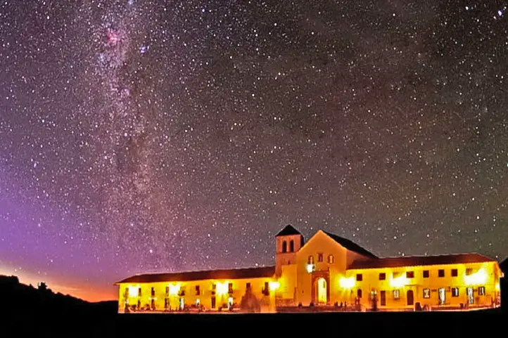
Villa de Leyva
Night at Villa de Leyva – Facetas Boyacá
Also a good place for astrotourism is this beautiful town in Boyacá. Every year Villa de Leyva is the meeting point for the amateur astronomers. They gather for their annual meeting, the Astronomy Festival, which is the most important amateur event in Latin America.
Villa de Leyva features a high elevation and a dry environment, which also facilitates the observation.
It also has a very good infrastructure to receive tourists.
This town is located in Santander. It is also a destination with very good infrastructure and also it offers ideal conditions to watch the sky, because of its dry environment.
La Guajira is a magical place in Colombia. It is another desertic area, but placed in the Caribbean region. Cabo de la Vela, in the northern territory of Guajira, also offers a very good infrastructure for tourism, and also clean and dark skies.
Here you will hear the sea waves and learn more about the mysteries of the universe from the Wayúu community.
In Cabo de la Vela, the desert landscape merges with the sea, and the night skies are filled with shooting stars and constellations, thanks to the absence of artificial lighting from nearby towns.
In addition, if you love nature, take a visit to the Flamingo Sanctuary or a tour of the Taroa Dunes are good extras.
The Lagos de Menegua Bioreserve is one of the few privileged places that still have black skies. Its privileged location allows simultaneous observation of the northern and southern hemispheres.
The reserve has a calendar of astronomical events with free registration. It also offers this activity exclusively for companies and specific groups.
Between the months of December and March, the probability of 100% clear skies increases, making the best time to visit.
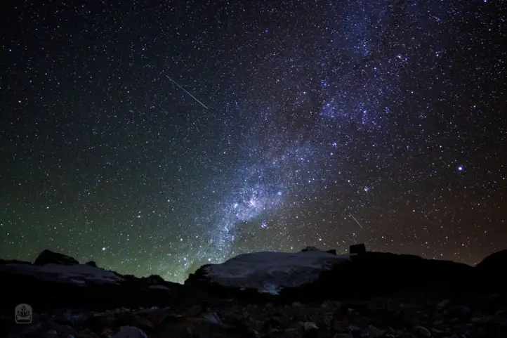
After 9 pm, on a very clear night at 4,444 meters above sea level, on the shores of La Laguna Grande in the Sierra in El Cocuy Natural Park (Colombia), the Milky Way rises behind the mountain. The cold can get to your bones, but the view is wonderful.
Rodrigo Bernal Diaz
This national natural park, located in the center-east of the country, on the border between the departments of Boyacá and Arauca, is another of Colombia’s tourist sites where people can experience an unforgettable night looking at the stars. Of course, if you don’t mind to camp.
In fact, the U’wa Indians of the Sierra Nevada del Cocuy created the Astronomical Observatory on the ancestral Camino de Mal Paso. In this place tourists can marvel at the spectacular clear nights and see the stars, and, at the same time, interact with the U’wa community.
Where to stay: Camping zone.
Suesca and Tominé near to Bogotá
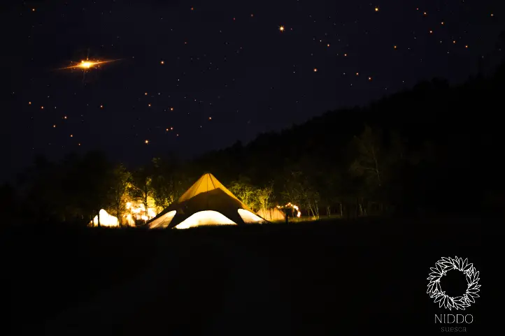
Niddo – Suesca
Near to Bogotá are the town of Suesca and the Tominé reservoir. All this region has a very good tourism infrastructure and also, they have altitude, with more than 2500 meter above sea level.
Altitude is fundamental because there are fewer atmosphere layers above you, so you are nearer to the sky.
Current director of Sula. Doctor in Biological Sciences. Her main interests are to explore and understand the organism – environment interactions, taking advantage of emerging knowledge for the management and conservation of species and ecosystem services. She is currently working as a consultant in functional ecology, ecosystem services and conservation projects in Colombia related to ecotourism and birdwatching.
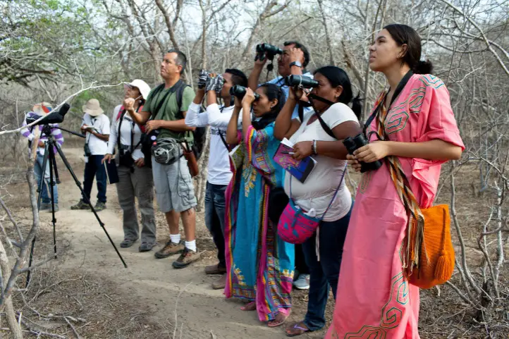
We visited parts of Colombia’sCaribbean Dry Forest (Departments of Atlántico, Magdalena, La Guajira and Cesar). From a birding perspective,especially the department of Magdalena encompassesprobably the best-established birding routes in the Country.But other areas in this region are yet to be fully explored by birders, and more sites will be put on the radar in close future.
From a cultural point of view, the famous colonial city of Cartagena and the carnival of Barranquilla have been frequently visited by tourists for a long time. There are also interesting and low explored destinations as indigenous experiences with the Wayuu tribe in La Guajira and musical experiences in Valledupar, the city of Vallenato music a popular folk music genre of the Colombia’s Caribbean region. Vallenato literally means “born in the valley”, which makes reference to the city of Valledupar. Its name, Valle de Upar (Valley of Upar), was established in honor of the Amerindian cacique who ruled the valley; Cacique Upar… but let’s not get off topic.
The Caribbean Tropical Dry Forest
According to Colombia’s Instituto Humboldt, the tropical dry forest is a dense forest with palms and tall trees where epiphytes, ferns and vines abound. The tropical dry forests in Colombia were originally extensive. They covered much of the geographic valleys of the Cauca and Magdalena rivers, the Caribbean Coast, and the Llanos Orientales; today they are on the verge of disappearing. Only 8 % remain.
In the Caribbean region, the tropical dry forest is distributed in the sector of the Guachaca River, in the Sierra Nevada de Santa Marta ecoregion (Magdalena) with 45,000 hectares. It also distributes in the sector of the Caribbean coastal plain in Montes de María and Piojó (at Atlántico and Bolívar Departments), Cartagena, Caracolcito, Ariguani-Cesar, Baja Guajira-Alto Cesar (in La Guajira and Cesar Departments). This region is known as the Pre-Caribbean Arid Belt and has an area of 6’046.376 hectares.
The Colombian Caribbean region is part of the “Endemic Bird Area Caribbean Colombia and Venezuela“, including tropical dry forests from the lowlands of the Guajira peninsula, Alto – Cesar, the bases of the Sierra Nevada de Santa Marta to the Bolivar and Atlantic departments in Colombia.
Importance of the Caribbean Tropical Dry Forests of Colombia
Although this is one of the most threatened ecosystems, it is also one of the least known. Many do not know that, for example, the passion flower used as a sedative, or the cactus and its tunas, cocoa, corn, beans and totumo are part of this biome.
According to studies conducted by the NGO Alliance for Critical Ecosystems (ALPEC), the remnants of tropical dry forests are key areas because of their great potential for the conservation of migratory birds. Because of their geographical location, these islands of natural habitat are strategic places for these birds as they are seasonal and refuge points on their way to the Andes or to the east of the continent. The tropical dry forests are the first forest ecosystem to be found by millions of terrestrial migratory birds (60 species) after their journey over the Caribbean Sea on the Colombian Caribbean coast.
Ecotourism has recently been used as an additional economic source by local communities that receive support from NGOs and government entities for their development. Infrastructure improvements (trails, observation towers, accommodation) have been made in some protected areas, and educational material has been produced. It is expected that the promotion and marketing of local artisanal products and ecotourism, associated with conservation, will ensure the functioning of protected areas to improve natural resource management and to protect the habitat of migratory birds in the long term.
Our Visit to the Caribbean Tropical Dry Forest for Birding
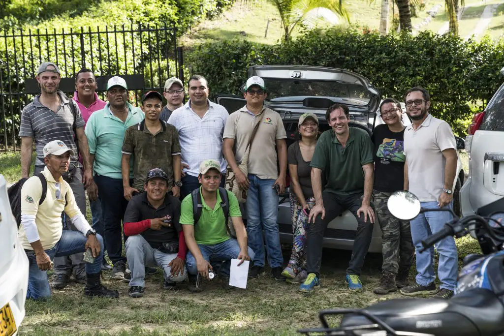
We had the opportunity to visit these places thanks to the collaboration of our local partners in each of the regions. We thank the support of the association Atlántico Birding, Yaneth Bautista, as well as the Government and the Secretary of Tourism in the Atlantic. Also we thank the support of Gabriel Utría in Magdalena, José Luis Pushaina in La Guajira and, last but not least, of Luis Ropero and Tomás Darío Gutiérrez in Cesar.
Atlántico Department
Visiting Usiacurí and Luriza Reserve in the company of our local partners and the local community.
With the help of local authorities & guides, we first explored the reserves of Luriza and Los Charcones. Both are relatively close to the city of Barranquilla and host a number of interesting species of the northern Colombia’s dry forest biomes.
Both these reserves still lack a bit of infrastructure for visiting birders, but big efforts are undertaken by privates and the government to promote birding tourism at these places.
Usiacurí
Usiacuri is a small picturesque town. It is known as the Nativity of the Atlantic Department. There, the crafts are made from iraca palm (Carludovica palmata) and are the livelihood of many families who, by weaving, sustain an ancestral tradition learned from the indigenous people who inhabited the region.
Usiacurí is located 40 minutes from Barranquilla along the Via Cordialidad. It is 95 meters above sea level and its average temperature is 28°C. A quiet place, which has recently been catalogued as a sustainable tourist destination.
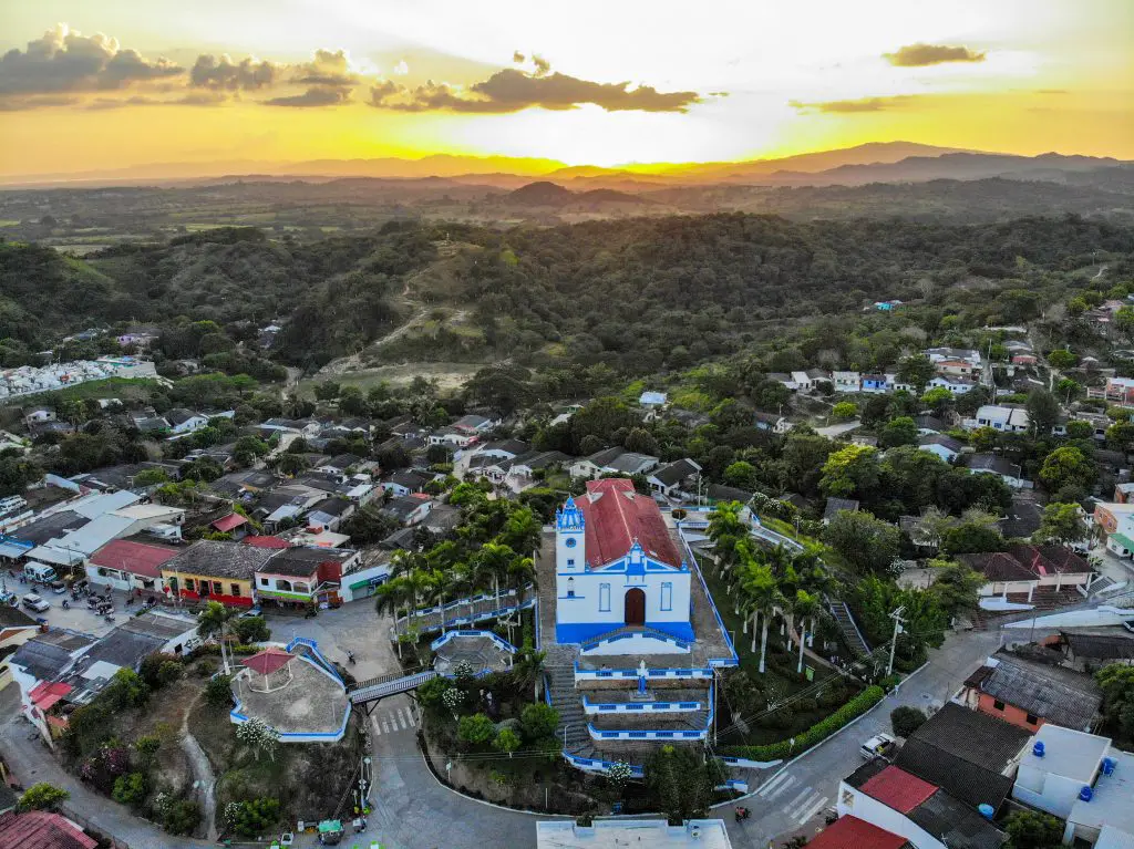
722Santo Domingo de Guzmán Church. Usiacurí is a municipality and town in the Colombian department of Atlántico.
In Usiacurí there is a monument called the Weaver Muse (Musa Tejedora), a monument made of stainless steel that commemorates the town’s artisan tradition and is inspired by the poem La Araña (The Spider) by Julio Flórez.
Usiacurí must be visited on foot, because in its streets you can find its inhabitants walking on donkeys, or simply passing by a house where the crafts are being woven, or observing the landscape and the greenness of the forest.
You can visit the mineral wells of Usiacurí, very close to the main square of the town. This is a natural trail surrounded by dry forest that borders a stream that leads to the healing wells that made Usiacurí famous in the early 20th century. The waters of these mineral wells cannot be drunk, but they can be used for various medicinal treatments. Bird watching is also possible on this trail.
You can enter the Iraca palm handicraft shops where local artisans sell multicolored products such as bags, chests, hand fans, baskets, placemats, necklaces… which the inhabitants of Usiacurí make with their own hands, and which you can buy to help the local economy and keep this beautiful tradition alive.
Finally, we recommend visiting the church of Santo Domingo de Guzmán, which stands on a hill and from where it is possible to observe the geography of the whole town. Also visit the house museum of the poet Julio Flórez, who died in the village and went to live there in search of the medicinal waters.
Regional Integrated Management District Luriza
The name of the protected area honors the spring that crosses it and has the same name as the “Luriza” village.
It is located in the municipality of Usiacurí, 6 kilometers from the center of Usiacurí town. It has an extension of 837.17 hectares where approximately 17 families live. This a magical place is surrounded by giant trees and howler monkeys with mineral water wells. The Luriza Natural Reserve is an ideal destination for bird watching and hiking.
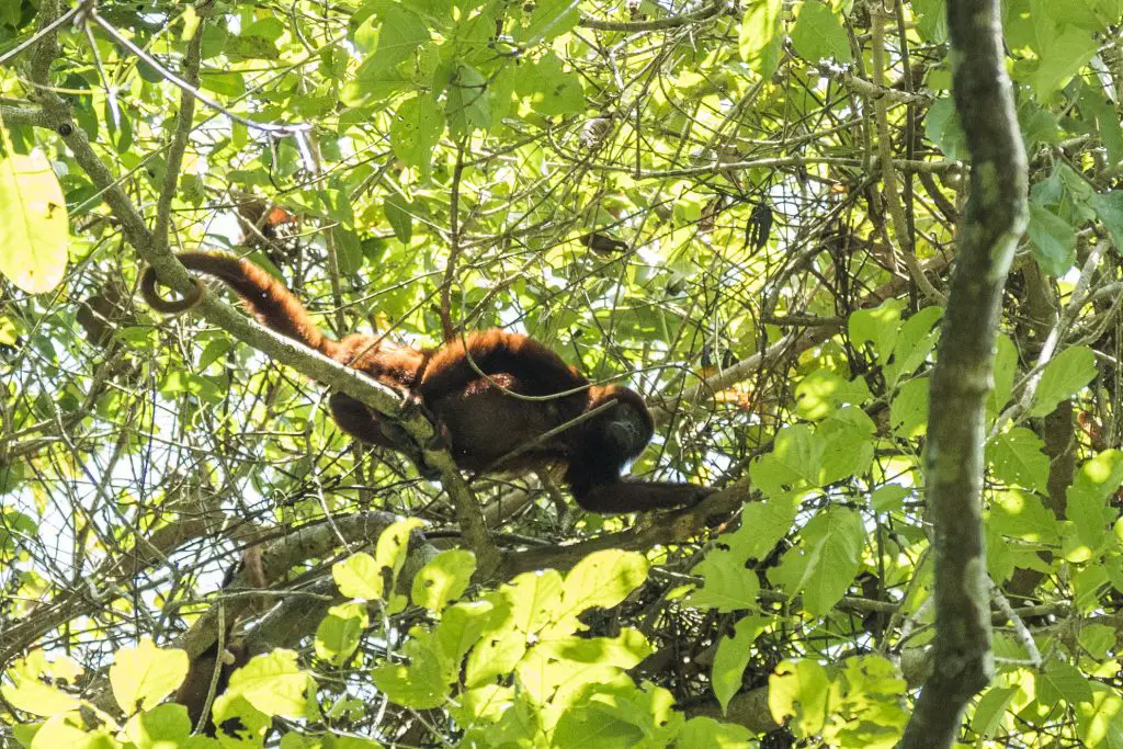
Red Howler Monkey – Alouatta seniculus. Observed at Luriza.
The management plan of this area, among its conservation objects, contemplated the artisan tradition as one of the main activities to protect. These artisan activities depend on the fibers of species such as the iraca palm (C. palmata). This species used to be in decline due to over-exploitation, but today it is protected. Other objects of great importance for conservation are the Carreto tree species (Aspidosperma polyneuron), the typical bird communities of the Tropical Dry Forest, the bodies of water, and the ancestral knowledge of medicinal plants.
Birding at Luriza
The access trail is steep in the beginning, leading through scruby area with scattered trees. Black-crested Antshrike, White-whiskered Spinetail & Glaucous Tanager were spotted. By the time we made it to the lower parts of the reserve it was already past 9 a.m. and hot. The forest in this area is taller, in better condition and there are trails that run along a nice creek and elsewhere into dry forest.
Without doubt birding potential there is great. Endemics like Chestnut-winged Chachalaca and Chestnut Piculet both occur. Every now and then the attractive Lance-tailed Manakin called from the forest undergrowth. These dry forests host a variety of good Tyrant-Flycatchers, too. Slender-billedTyrannulet, Venezuelan Flycatcher, Pale-eyed Pygmy-Tyrant, Pearly-vented Tody-Tyrant, Yellow-breasted Flycatcher to name but a few.
We heard the beautiful song of Rufous-and-white Wren, eventually we coaxed one out into view. We were offered a nice lunch at a newly established “visitor center” run by local families.
Piojó
The next day we travelled to the town of Piojó. Piojó is a town with an agricultural economy. The municipality was founded long before the arrival of the Spaniards by the indigenous people of the Mocaná tribe. Before the Spanish invasion, the region was ruled by Cacique Phión, which gave rise to the current name, Piojó.
The territory has the highest elevations in the department of Atlántico, with Cerro de la Vieja standing out at 530 meters above sea level, which corresponds to the last extensions of the Sierra Nevada de Santa Marta.
Civil Society Nature Reserve “Los Charcones”
The Civil Society Nature Reserve “Los Charcones”, is the first and only one in the department of Atlantico, registered and recognized by Natural National Parks of Colombia as a Civil Society Nature Reserve. Know more about Colombian Civil Society Nature Reserves here.
Civil Society Nature Reserve Los Charcones – Caribbean Tropical Dry Forest
Los Charcores Nature Reserve is located two kilometers from the rural area of the municipality of Piojó, and 46 kilometers from the urban area of the city of Barranquilla, on the highway to the sea. It has a total of 42.98 hectares of Tropical Dry Forest, with water alternation, and relics of secondary forest in good state of conservation. It is located in the middle of a topography full of mountains, hills and rocks. It has excellent trails and natural pools up to 7 meters deep.
Its main water supply is the underground water of the Municipality of Piojó, a system called ‘Lagunaje’, where freshwater and springs flow. Without a doubt, a jewel of nature of unquestionable landscape, environmental and ecological importance.
Protecting this relict of the forest was the initiative of a group of citizens from the municipality of Piojó concerned about the situation of poverty, low quality of life, lack of opportunities and stagnation of progress of its inhabitants. They took the decision to the implementation of the creation of the reserve, with the aim of preserving the environment, and in turn provide the opportunity for sustainable development to local communities.
Birding at Los Charcones
This reserve reaches slightly higher elevations than Luriza, is larger and a bit more varied.While eating some breakfast outside the reserve, we logged some Keel-billed Toucans, Prothonotary Warblers and Grey Kingbirds. Our group visiting the site quickly expanded to about 20 or so, mostly non-birder people, much to the chagrin of our local guide. He did his best to show some chosen few (including me) a family group of Chestnut-winged Chachalaca. A pair of Rufous-tailed Jacamar posed for pictures.
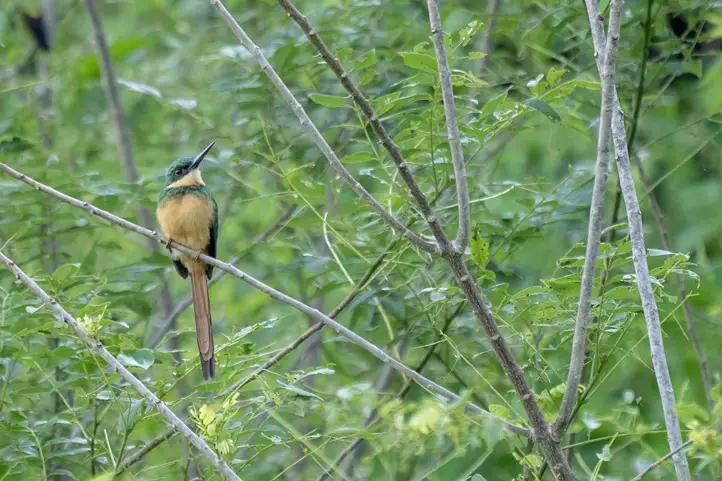
Rufous–tailed Jacamar – Galbula ruficauda
Then totally unexpectedly, the local guide’s enthusiasm for the reserve and exploring spirit broke through with him. He dragged parts of the party through pathless, thorny scrub forest to show us some remote parts of the reserve. As the morning processed and the sun bashed mercilessly on us, some people “rebelled”to go any further and insisted to get back! What a relief… We saw many Crested Oropendolas flying by, but nothing else.
Once we crawled back to the ridge, we persuade our local guide to do one of the established trails of the reserve where we could focus on some birding.There we logged Pale-tipped Tyrannulet, White-bellied Antbirdand a vocal Striped Cuckoo. The non-birders of our group, opted from some refreshing (and well deserved) dip into water pools.
A delicious soup and typical dishes of the region were offered for lunch and a little siesta in a hummock rounded off this unexpectedly adventurous visit to Los Charcones.
Magdalena Department
The most known birding destination in the department of Magdalena is Minca, in the Sierra Nevada de Santa Marta. We will talk about it in another blog, since it no longer corresponds to tropical dry forest.
Vía Parque Isla Salamanca
However, we can visit the tropical dry forest in the Vía Parque Isla Salamanca. This area, together with the Flora and Fauna Sanctuary of the Ciénaga Grande de Santa Marta, was declared in 1998 as a Ramsar Site of world importance. In November 2000, it was also declared as a Man and Biosphere Reserve by UNESCO. Both constitute the core zone of the Ciénaga Grande de Santa Marta Lagoon Complex Biosphere Reserve because they are representative of the Magdalena River delta, considered a strategic ecosystem.
The island of Salamanca is an extraordinary group of beaches, marshes and forests that occupy the old estuary of the Magdalena River. The coastal mangroves are one of the last refuges for the critically endangered South-American Manatee. It is crossed longitudinally by the road that connects the cities of Barranquilla and Santa Marta, so its lake and mangrove landscapes can be perfectly appreciated on the way. It is for this reason that it has been given the category of “Via Parque”, unique in the System of National Natural Parks of Colombia.
Birding at Vía Parque Isla de Salamanca
The next day we dawned at Salamanca Island Road Park (Spanish: Vía Parque Isla de Salamanca) national park. It’s only about a 40-minute drive from Barranquilla. This small site offers some easy access to a mix of habitats. It encompasses the typical dry forest of the area along with access to mangroves, via wooden boardwalk.
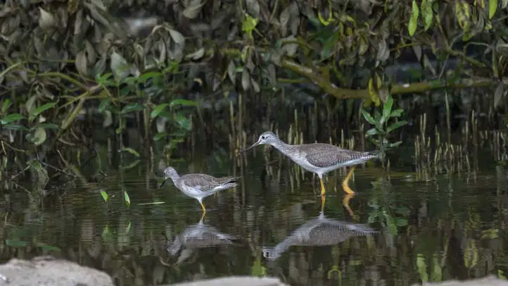
Lesser and Greater Yellowlegs – Tringa flavipes and Tringa melanoleuca at Via Parque Isla de Salamanca
A Northern Scrub-Flycatcher sang, and on a small pond we compared Greater– and LesserYellowlegs, alongside a Spotted Sandpiper side by side. We were shown a singing Sapphire-bellied Hummingbird, a taxon of much debate. Some consider it to be a hybrid with Sapphire-throated Hummingbird, others claim it to be a plumage stage of latter species. Hopefully, further studies will clarify its taxonomic status soon. Despite seeing the bird at close range, we were unable to discern any colors because of bad light, thus incapable of checking the few known identification criteria. Butaccording to the park guard the individual we saw, was one of theSapphire-bellied Hummingbird’s known steak out perches.
Putative Sapphire-bellied Hummingbird – Lepidopyga lilliae at Via Parque Isla de Salamanca
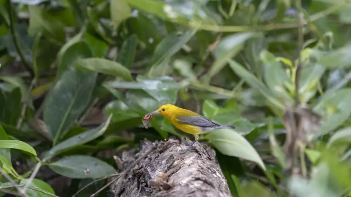
In the mangroves we observedGolden-green-, Red-crowned-, Red-rumped-, Spot-breasted Woodpecker,Straight-billed Woodcreeper, an obliging Pied Water-Tyrant,Prothonotary-, Yellow Warbler, Bicolored Conebill.Aquatic birds abound too. We spotted 5 Heron-species,Limpkin, Woodstork and Large-billed Terns. Russet-throated Puffbirds are always a treat to look at.
Pied Water-tyrant – Fluvicola pica at Via Parque Isla de Salamanca
Prothonotary Warbler – Protonotaria citrea at Via Parque Isla de Salamanca
Mid-morning, we visited a small marsh near Palomino where we found a typical scatter of that habitat. We were looking for Northern Screamer but no cigar…
La Guajira Department
East of the Santa Marta Mountains & famous Tayrona National Park, the Guajira Peninsula extends to Colombia’s most northern point, bordering Venezuela. This (together with the Tatacoa Desert) represents the country’s driest area. Tropical Dry forests – in parts the area appears almost like a desert – are the main habitat there. Several near-endemic species only to be found in this part of the country, are the main targets.
Most of the Guajira Peninsula and the areas interesting for birders lie within the territory of the Wayuu-tribe – the largest indigenous tribe in Colombia. Their territory extends wellinto Venezuela. The communities here are among the poorest in Colombia. It is advisable to visit all sites with the aid of local guides. Several of them have been trained by the Audubon Society and are among the most experienced local guides in Colombia!
Birding at Camarones & Flamencos Flora and Fauna Sanctuary
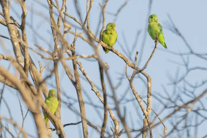
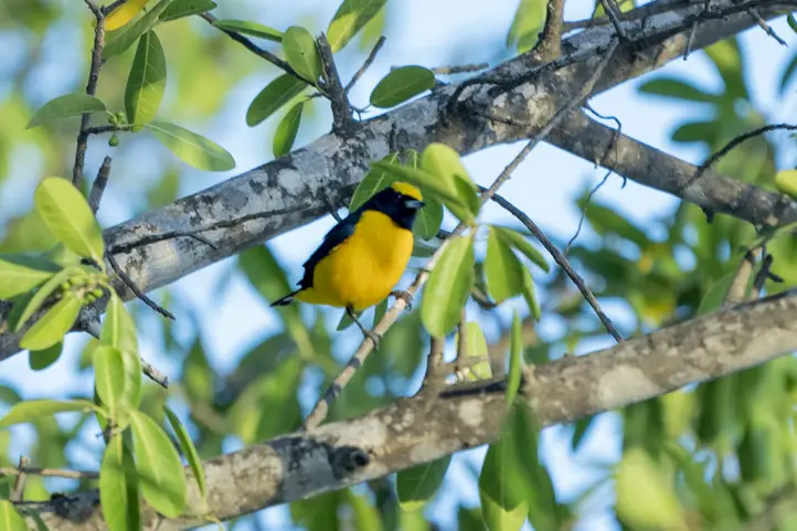
With the help of Jose Luis Pushaina, a local birding guide, we started the day earlyat Camarones. In a fruiting tree we saw Trinidad Euphonia and Green-rumped Parrotlet.
Green-rumped Parrotlet – Forpus passerinus
Trinidad Euphonia – Euphonia trinitatis
Glaucous Tanager – Thraupis glaucocolpa
Little later we’ve seen the regional endemic birds Buffy Hummingbird, Chestnut Piculet(national endemic),Orinocan Saltator, Vermillion Cardinal & Glaucous Tanager alongside with White-whiskered Spinetail, Slender-billed Tyrannulet and Russet-throated Puffbird.
Access to the beach at the hamlet of Camarones provided us with views ofScarlet Ibis,Roseate Spoonbill, American OystercatcherSemipalmated Plover and Semipalmated–, Least Sandpiper,Sanderling, Willet, Black Skimmer, Royal-, Caspian- and Sandwich Tern. In the afternoon we checked a large brackish lagoon where – depending of the time of year – large numbers of American Flamingo gather. They commute between here and their breeding site in the Venezuelan Maracaibo-Basin! We tried for Tocuyo Sparrow, too. But no luck at this time of the day.
Fauna and Flora Sanctuary Los Flamencos
There’s a new communal-based project in Camarones hosting visiting birders. The recently opened Mar Azul lodge is the first and so far only site, where birders can stay overnight within the park’s limit. It’s right next to the sea and they set up feeders where Buffy Hummingbirds, Vermilion Cardinal, Orinocan Saltator, Yellow Oriole & more visits!
Vermilion Cardinal – Cardinalis phoeniceus
Orinocan Saltator – Saltator orenocensis
Buffy Hummingbird – Leucippus fallax
Cesar Department
Ten kilometers from Valledupar, in the direction of Patillal, is one of the great attractions of this department. It is neither a colonial monument nor a modern building, but something even more relevant: the natural reserve of the civil society Ecoparque Los Besotes. Established in 1993 by the lawyer and historian Tomás Darío Gutiérrez, the ecological park is the result of an extraordinary, almost individual, effort by a man passionate about nature.
In its 20 years of life, the park has known a successful growth and has always maintained a philosophy of independence and rigor. This has facilitated that 92% of the territory is dedicated to conservation, and that the secondary regeneration forest, which comprised approximately 40% of the area, takes more than 10 years to recover naturally.
Ecoparque Los Besotes, department of Cesar, Colombia
Key plant species that can be found at the park are Caracolí (Anacardium excelsum), Camajón (Sterculia apetala), Ceiba blanca (Hura crepitans), Ceiba (Ceiba pentandra), Guaímaro (Brosimun alicastrum), Indio desnudo (Bursera simaruba), Guayacán (Bulnesia sp) and Pivijay (Ficus sp).
Among the fauna, the following stand out: Jaguar (Pantera onca), Puma (Pantera concolor), Tiger (Felis pardalis), Tapir (Tapirus terrestris), Red brocket deer (Mazama americana), Taíno (Tayassu tajacu), Cattle monkey (Alouatta seniculus), Capuchin monkey (Cebus capuchino), Night monkey (Aotus lemurinus). The following threatened mammal species have been recorded: Panthera onca (NT), Tapirus terrestris colombianus (VU), Aotus lemurinus griseimembra (VU).
Birding at Ecoparque Los Besotes
Los Besotes Ecopark
We visited and toured the park with our local guide Jose Luis Ropero. The more than 1000 hectares distributed between the townships of Los Corazones and Rio Seco, offer a dense and varied vegetation of Tropical Dry Forest, that hosts more than 250 species of birds (migratory and native) throughout the year.
The 14 kilometers of trails that run through the park like small veins allow visitors to travel through the Sierra Nevada de Santa Marta massif, between Mount Murillo and Mount Los Besotes, and access points almost 2,000 meters high on the top of the Condor. Each of these trails offers unexpected gifts for visitors: viewpoints, observatories, forests, hills, streams and waterfalls that fill visitors with joy and amazement.
The presence of the Blue-billed Curassow (Crax alberti), the Military Macaw (Ara militaris) and the Andean Condor (Vultur gryphus) is noteworthy. Another species are Lance-tailed Manakin (Chiroxiphia lanceolata), Whooping Motmot (Momotus subrufescens), Tocuyo Sparrow (Arremonops tocuyensis), among others.
IBAs are sites of international importance for bird conservation:
They are practical tools for biodiversity conservation.
They should provide, where possible, all the requirements for the bird populations for which they have been identified.
They are different in character, habitat or ornithological importance from the surrounding land.
And. IBAs are part of an integrated and broader approach to biodiversity conservation, BirdLife’s conservation strategy, which also includes species and habitat protection.
Shining–green Hummingbird – Lepidopyga goudoti
If you want to know more about birding trips in Colombia, stay tuned or contact us!
Current director of Sula. Doctor in Biological Sciences. Her main interests are to explore and understand the organism – environment interactions, taking advantage of emerging knowledge for the management and conservation of species and ecosystem services. She is currently working as a consultant in functional ecology, ecosystem services and conservation projects in Colombia related to ecotourism and birdwatching.
Jérôme Fischer
Professional bird guide, swiss native, with more than 32 years of experience guiding hardcore birders and birdwatching tours. Jérôme has been focused in bird identification. He also travelled many countries, starting in Switzerland. Then he traveled exploring south America, the most biodiverse continent in the world, becoming specialized in Neotropical birds.
An off-the-beaten-track destination that has slightly become a must-visit in the Colombia travelers’ lists – this is Cabo de la Vela. Cabo de la Vela is a small coastal village in the northernmost region of Colombia and South America, exactly in the department of La Guajira, known for its golden beaches and strong indigenous traditions. Traveling to Cabo de la Vela is an adventurous experience you should consider if you are planning a trip to Colombia’s Caribbean coast.
In this post, you will find all the information you need to know before traveling to Cabo de la Vela. Why you should visit it, how to get there, where to stay, the best time to visit, and also what other attractions you can find along the La Guajira desert.
Discovering La Guajira and Cabo de la Vela
La Guajirais the northernmost departmentof the 32 departments that make up Colombia. It is part of the Colombian Caribbean natural region and borders the deep blueCaribbean Sea to the north and east, and Venezuela to the east. With a population of over 900,000 inhabitants in an area of 20,800 km2(8,049 sq mi), you could say it is not the most densely populated zone in the country. Despite that, the department is home to a variety of ethnicities, the indigenous being the largest. The Wayuu indigenous community is the most representative, but there are the Kogui, Ika, Kankuamo and Wiwa that inhabit the Sierra Nevada de Santa Marta. You can find Muslim population too. This ethnic melting pot causes that Spanish is not the only language spoken but Wayuunaiki and other dialects.
Another aspect that characterizes this region is the climate. La Guajira’s climate is arid, dry and has high temperatures – it is actually the driest region in the country. The average temperature ranges from 22 to 30 °C, rising up to 42 °C. You can find mostly desert areas, with savannas, dry and rain forests in some points. Part of the Sierra Nevada and the Serranía del Perijá belong to La Guajira and to the north you find also Serranía de Macuira, which are biodiversity hotspots in the middle of the desert. Because of its location, La Guajira has great potential for electricity production from solar radiation and wind.
La Guajira is divided into 15 municipalities including Riohacha – the capital. Cabo de la Vela is a headland in the northern part of the peninsula where some people settled down and formed a small village. The Wayuu believe that Jepirra – as they call it, is a sacred place where the spirits of their deceased arrive to journey into the “unknown”. Today it is an important destination for ecotourism in the Caribbean region of Colombia, where travelers can enjoy amazing landscapes and interact with the local culture.
1. How to get to Cabo de La Vela
Bogota – Riohacha
The first step is to get to Riohacha, the capital of La Guajira. There are about 2 to 3 direct flights from Bogota to Riohacha’s Almirante Padilla International Airport with Avianca and Viva Air airlines. The trip is 1,044 km (648.7 mi) and 1 hour 40 minutes long.
From the main cities on the Caribbean coast – such as Santa Marta and Cartagena, you can travel there by bus. From Santa Marta, the trip takes 4 hours approximately.
From other cities in central and southern Colombia, the best option is to fly to Bogota and then to Riohacha (most flights make a stop in Bogota anyways).
Riohacha –Uribia –Cabo de la Vela
This is where the adventure begins since it is not as simple to get to Cabo de la Vela on your own. In Riohacha, you should take a shared taxi to Cuatro Vias which is a crossroad where informal transport is arranged. This takes you almost an hour.At Cuatro Vias, you mostly find Jeeps / shared taxis that leave once full and charge around 15,000 COP. These drop you off in Uribia about 30 minutes later. There, you have to get on a 4×4 truck with other people and tons of load to finally arrive at Cabo de la Vela. This last stretch of the trip takes 1.5 to 2 hours and costs 15-20,000 COP.
So, the whole journey from Riohacha to Cabo de la Vela takes 3 hours or more, as it is nearly 200 km to the north. There are direct private transfers organized by hotels in Riohacha – it might be easier considering this option.
2. Where to stay in Cabo de la Vela
Finding accommodation in Cabo de la Vela is easy. However, you should keep in mind that there is no running water and no electricity. Power is produced by a generator and for showering, sometimes you will have to use a bucket.
Sleeping in hammocks is the most common choice. You find these in the rancherías, the typical Wayuu huts where they live and offer tourist services. You can also choose to sleep in a chinchorro, a larger hammock. Prices range from 10,000 COP to 20,000 COP per person per night, but if you take breakfast it should be more than that.
Some beachfront hostels offer basic private rooms for about 30,000 COP or the hammocks option too.
If you are more the always-looking-for-comfort person, you should probably stay at a hotel in Riohacha and take a one-day tour to Cabo de la Vela.
3. Best time to travel to Cabo de la Vela
As La Guajirais still undiscovered by most Colombians and foreign tourists, you can have a nearly private experience traveling to Cabo de la Vela, but a general recommendation is to plan your Colombian trips avoiding the high seasons, which usually go from June to early August and from November to February, also during Holy Week.
As for the weather, the dry season is during the first 4 months of the year and the rainy season goes from September to November. Traveling to Cabo de la Vela during the rainy season can make the journey quite difficult, so it is better to visit the cape in other months.
4. What to do in Cabo de la Vela
Pilón de Azúcar
Visiting Pilón de Azúcar is usually the first activity of tours in Cabo de la Vela; you can get in 20 minutes by moto-taxi. It is a small, grayish hill from where you have a 360° view of the blue-green Caribbean Sea, the adjacent beach and the desert. You can climb the hill in 10-15 minutes and feel the strong winds at the top. There is an altar of the Virgin of Fatima, but the importance of this place is related to the Wayuu cosmogony – this is where their ancestors’ spirits get to rest. Pilón de Azúcar beach is excellent, it has golden sand and waters apt for swimming.
Ojo de Agua beach
This is another beach where you can have a refreshing dip but it is average. The name comes from a freshwater pool in the coastal rocks.
El Faro
This small lighthouse is a great spot to watch the incredible Caribbean sunset of La Guajira, so finish your day here.
Arcoiris beach
This is the northernmost point of Cabo de la Vela and is a beach where you see a rainbow when the waves hit strongly the coastal rocks under a direct sunray. This is possible in the afternoon; however, you cannot always see it.
Kitesurfing and windsurfing
Adventurous travelers find joy in La Guajira because the winds are pretty strong, meaning the sea here is perfect for practicing kitesurfand windsurf. There are several schools managed by Wayuu people that offer 1-hour to full-day classes.
Wayuu Culture
Buying handicrafts from the Wayuu is a must. Their mochilas (handmade bags) and other knitted souvenirs take a lot of effort and time from the Wayuu women. Knitting a handbag can take up to a week! Each product has a unique design and bright colors. Also, this is an important income source for the population.
Manaure salt mines
On the road to Cabo de la Vela, you can make a stop at the Manaure salt mines, near Uribia.These are known for being the largest salt mines in Colombia, there you see large piles of salt and clear pools in between.
Punta Gallinas
By traveling a couple of hours more towards the north, Punta Gallinasreceives the most daring tourists. This is the northernmost tip of the continent where you find the amazing Taroa dunes, another lighthouse/viewpoint and more rancherías.
5. What you should consider when traveling to Cabo de la Vela
Although it is possible to travel to Cabo de la Vela independently, it is better to book with a local agency to avoid any hassles and feel safer. This way you just need to worry about having fun.
Bring enough water for the trip. Buy water and snacks in Uribiaas there is more variety of products.
Consider the weather in the region to pack your clothes. Also, always use sunscreen and a cap.
Support the local communities using their services and paying fair prices for their products. This includes trying not to give away food or money. Tourism is the main income source for the inhabitants of La Guajira, which are impoverished and lack government presence.
This was the essential information for traveling to Cabo de la Vela in La Guajira, Colombia. We hope this was useful and encouraged you to visit this beautiful country.
Current content writer for Sula. Modern Languages professional with emphasis on business translation. Interested in cultural adaptation of written and audiovisual content. Passionate about knowing new cultures and languages, tourism and sustainable living.