Brief Guide to Discover the 5 Deserts of Colombia
Colombia has 5 deserts throughout its territory, which have very different characteristics due to their location. Besides, the deserts present in Colombia are arid and dry during most of the year, generating amazing landscapes, experiences that will leave you happy with your visit.
In this guide you will learn everything to enjoy exploring the deserts you can find in Colombia to the fullest.

La Guajira Desert
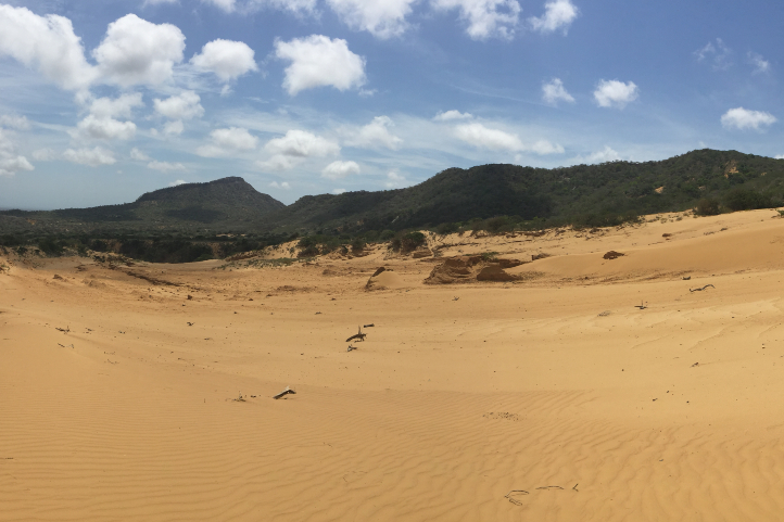
Located in the north of the country, in the department of Guajira. It is one of the most striking deserts thanks to the combination of the magical environment of the desert and the Caribbean Sea. The desert is divided into 3 sub-regions:
- Alta Guajira: where its enormous dunes, cliffs, its enigmatic rock formations and its beaches of romantic and quiet atmosphere stand out; besides you can visit the Macuira National Natural Park.
- Media Guajira: in this sub-region what stands out the most is the red sand that contrasts with the blue Caribbean sea. It is also very close to the Flamingo Flora and Fauna Sanctuary in the Boca de Camarones area and the Musichi Natural Reserve.
- Baja Guajira: it is characterized for being the most humid area of the desert, located very close to the Sierra Nevada de Santa Marta. It is the birthplace of several sources of fresh water, such as the Ranchería River.
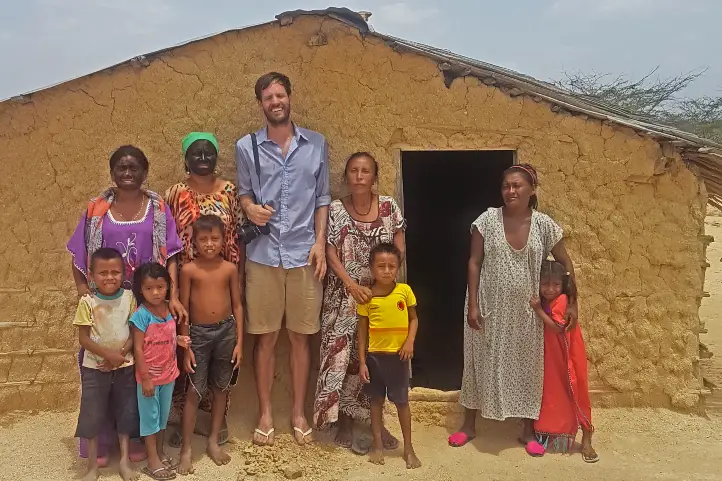
In your tour in this desert you will be able to know the wisdom of the Wayú, one of the most important indigenous communities in the country.
How to get to La Guajira Desert
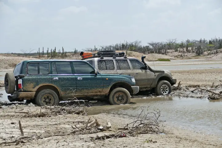
Take a 1-hour flight from El Dorado International Airport (BOG) Bogotá to Almirante Padilla International Airport (RCH) at Riohacha city. Once at the airport, take an approximately 1,5- hours ride to Uribia. Once at Uribia you should take an extra 2-hours ride to Desierto de la Guajira.
Where to stay in La Guajira Desert
La Guajira desert does not currently offer accommodation for travelers. Therefore we recommend you to stay at Cabo de la Vela or at Riohacha:
- Hotel Taroa
- Utta Ranch
If you want to know more about activities you can do near the Guajira Desert check out our blog Travel Guide to Los Flamencos Fauna & Flora Sanctuary in Colombia, Travel Guide to Macuira: The Cloud Forest Oasis in La Guajira Desert.
La Candelaria Desert (between Raquira and Villa de Leyva towns)
It is located in the department of Boyacá, 7 km from the municipality of Ráquira and 32 km from the municipality of Villa de Leyva; also known under the name of “the desert of souls”, because it is away from all noise and offers an atmosphere of tranquility.
One of the most important characteristics is that its winds are very cold, since it is located in an area of moorland; however it has the geological conditions to be considered as a desert even has areas of fertile land where there is abundant vegetation making a wonderful contrast.
In this area of the department of Boyacá important archaeological findings have been made, so it is possible to find valuable cave paintings during your tour.
How to get to La Candelaria Desert
To get to the sanctuary you must take a 3.5 -hour road trip from the city of Bogotá to the town of Ráquira, total distance of 183 km.
When you are in Ráquira you must take a 10-minutes road trip of 7 km to Desierto de La Candelaria.
0 Where to stay in La Candelaria Desert
Due to the proximity of the desert to the town of Ráquira we recommend you to stay there:
- Casona 1865
- Between Rocks and Crystals
- Mirkeland Cabana Balcony
- Duir House – Vintage House
- Gran Sirius Hotel
If you want to know more about activities you can do near the Candelaria Desert check out our blogs Discover the Natural Attractions of Villa de Leyva, Colombia, The Paleontologist’s Perfect Fossil Trip in Villa de Leyva and The Muisca Legend of the Origin of Life at Iguaque Flora and Fauna Sanctuary.
La Tatacoa Desert
This beautiful desert is located in the department of Huila near the municipality of Villa Vieja, being one of the most visited natural attractions in Colombia. It is also known as “The Valley of Sorrows” named this way thanks to the conquistador Gonzalo Jimenez de Quesada.
In addition the Tatacoa desert is a place of great importance for astronomy lovers because it has an ideal geographical location thanks to its low light pollution which facilitates the observation in detail of the stars and other phenomena of the universe such as meteor showers. Find out more about stargazing in our blog best places for stargazing in Colombia.
If you want to stay until night you can easily observe the stars and take beautiful pictures or if you want you can go to the astronomical observatory that the desert has.
By the way, the desert has 2 colors in different sectors; ocher in the Cuzco sector and gray in the Los Hoyos sector. When you are doing your tour in the Cuzco sector you will be able to reach an oasis in the middle of the desert where you will be able to take a refreshing bath.
How to get to La Tatacoa Desert
Take a 40-minutes flight from El Dorado (BOG) in Bogotá City to Benito Salas Airport (NVA) at Neiva city. Once at the airport, take an approximately 1-hour ride to Villa Vieja Town. At Villa Vieja take an extra 20- minutes boat ride to Desierto de la Tatacoa.
Where to stay in La Tatacoa Desert
Inside the desert there is a hotel where you can stay if you prefer instead of going to Villa Vieja: Bethel Bio Luxury Hotel.
La Tatacoita Desert in Nemocón.
Very close to the capital of the country, Bogota, is the Tatacoita desert, also known as “Checua”, which has a great geographic variety that you will discover when you get there.
The desert has gullies, sinkholes, estoraques and a canyon; in addition the colors that are presented in the strata mark the labyrinths present in the desert.
It is possible to make the tour of this desert in a couple of hours since its extension is small and reaches a maximum altitude of 2,000 meters above sea level. We recommend that you do the tour in the morning hours so you can see the change in color of the rocks when they come in contact with the sun’s rays.
How to get to La Tatacoita Desert
To get to the sanctuary you must take a 1 -hour road trip from the city of Bogotá to the town of Nemocón, total distance of 59 km.
When you are in Nemocón you must take a 35-minutes road trip of 11 km to Desierto de La Tatacoita.
Where to stay in La Tatacoita Desert
Due to the proximity of Bogotá to the town of Nemocón we recommend you to stay in Bogotá.
Occidente Desert, Santa Fe de Antioquia
Located in the department of Antioquia very close to the municipality of Santa Fe de Antioquia, being the most extensive arid area of the department.
It is possible that if you make the desert tour at midday you can experience temperatures above 35º C (95 ºF), also its heights are between 430 to 1300 meters above sea level.
How to get to Occidente Desert
Take a 1,5-hours flight from El Dorado (BOG) in Bogotá to José María Córdoba International Airport (MDE) at Rio Negro city.
Once at in Rio Negro you take an approximately 3,5-hours ride (56 Km) to Santa Fe de Antioquia. Antioquia. When you are in Santa Fe de Antioquia you must take a 10-minutes road trip of 11 km to Desierto de Occidente.
Where to stay in Occidente Desert
Due to the proximity of the desert to the municipality of Santa Fe de Antioquia we recommend you to stay there:
Know more about activities that you can do near the Occidente Desert visit our blog about Tourism in Santa fe de Antioquia.
If you want to know more about Colombia, or wants to book your trip, please contact us.
References
- Colombia Travel.
About the author
Luisa Martin
Engineer, world traveler, amateur photographer, traveling blogger, and foody.