Where to Spot the Spectacled Bear in Colombia?

One of the smallest bear species, the Spectacled Bear or Andean Bear is recognized as the guardian of the Andes and gardener par excellence. We invite you to discover this species that inhabits the Colombian territory and other South American countries.

Spectacled bear Facts

  1. South America: The spectacled bear or Andean bear (Tremarctos ornatus) is native to South America;
  2. Endemic: It is the only species of bear that inhabits South America, and it is endemic to the tropical Andes.
  3. Ancient: It has inhabited South America for more than five million years.
  4. Last of its kind: It is the only living representative of the short-nosed bears, a group that inhabited only the American continent.
  5. Big Territories: This bear needs large areas to be able to feed and look for mates.
  6. Forest Engineer: The Andean bear has an efficient role as a seed disperser, making it fundamental for paramo and the Andean Forest.
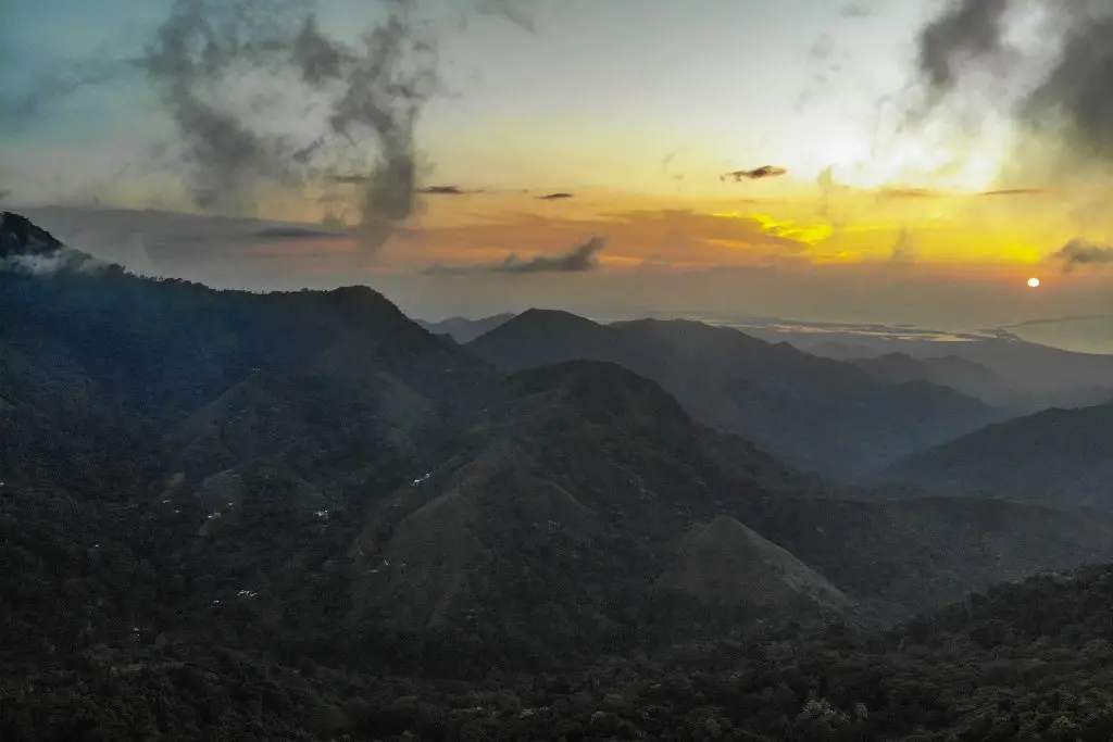
  7. Wide distribution: The spectacled bear is present in the forests of Venezuela, Ecuador, Peru, Bolivia, Argentina (in the northern forests) and Colombia (with presence in the 3 mountain ranges, in protected areas).
  8. Highlander: They are able to live at altitudes of up to 4,750 meters above sea level and it is not normal for them to frequent altitudes below 2000 meters.
  9. Bioindicator: the presence of Spectacled bears indicates the availability of water and that nearby forests are in perfect condition.

Characteristics of the Spectacled Bear

Spectacled Bear rescued at La Planada Nature Reserve. Itd name is Arcoiris (Rainbow)
Spectacled Bear rescued at La Planada Nature Reserve. Its name is Arcoiris (Rainbow)

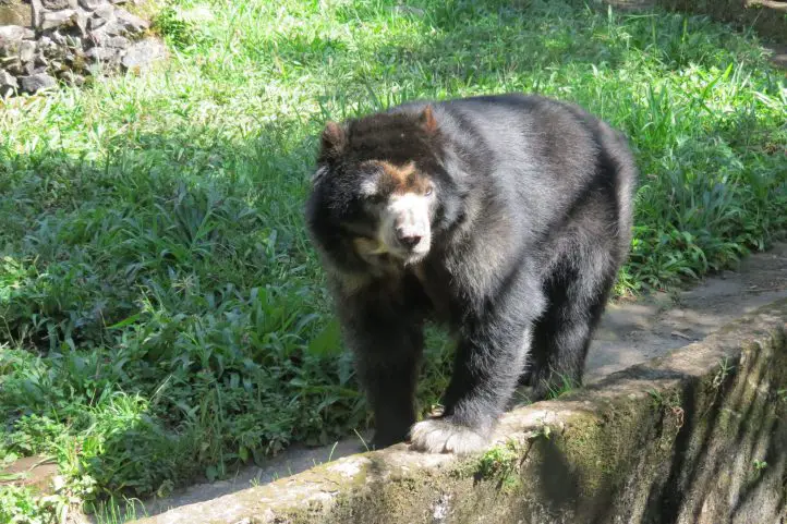
One of the most important characteristics is the presence of white fur around the eyes in a circular shape, making its shape like that of a pair of glasses. There are many specimens where this white fur extends to the chest.

The size, coloration and shape of these white spots are usually different in each individual and are characteristics that are often used for identification at this level. The rest of their body fur is dark brown or black.

They are a very small species of bear; adult males reach a size of 100 to 200 kilograms while adult female spectacled bears weigh only 30 to 85 kilograms.

It is a species that normally remains alone, only when the female is in mating season can be observed accompanied. Spectacled bears only remain with their mother until they are one and a half years old, after which they separate from the litter.

Spectacled bears reach sexual maturity between 4 and 7 years of age. It is known that they can mate at any time of the year, although the highest reproductive activity is registered in April and June. Usually a female gives birth to a litter of 2 cubs, but sometimes 3 cubs are born after a gestation period of 5.5-8.5 months.

It is not aggressive, you may be surprised to find a bear that by instinct will stand on two legs when it feels invaded in its space or confused by the intruder in its habitat, but it will not try to attack if it sees a distant and clueless individual.

Where to Find the Spectacled bear in Colombia

There are many places in Colombia where the Andean bear is distributed, but seeing it is a fortuitous event. The places where you can have more luck to see the Spectacled bear in Colombia are:

Natural National Park Chingaza

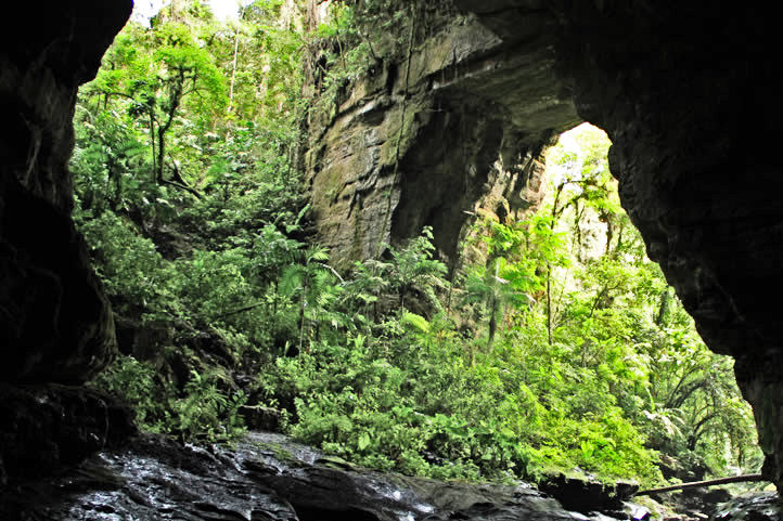
During hiking activities in the páramo it is possible to see Andean bears directly or indirectly. Also on the trails you may be able to see tracks on the ground, scratches on the trees, territory marking, bedding and feeding troughs.

Surroundings of the Natural National Park Las Orquideas

Since 2016 there is registration in this protected area of the bear, so that in the stipulated trails there is evidence of the presence of bears; on very few occasions visitors have been able to make a direct sighting; the park caretakers if they have had the opportunity to see families of bears.

El Verjón, Near Bogota

This is the first time that the spectacled bear has been seen so close to an urban area; last July. 2021, a surprising spectacled bear was seen walking in the Cerros Orientales of the city of Bogotá. The sighting of the animal was recorded in a security camera video.

Municipality of Íquira

In the buffer zone of the Cerro Banderas Ojo Blanco Regional Integrated Management District (DRMI) and Nevado del Huila National Natural Park, a male bear was spotted by camera traps. In the department of Huila there are other municipalities where records of this endangered species have been documented in Santa María, Garzón, Guadalupe, Neiva, Algeciras, Colombia, Palermo, Teruel, Pitalito and San Agustín.

Threats to the Spectacled Bear

Currently, human encroachment on the spectacled bear’s habitat has caused a high percentage of deforestation, due to the increase of the agricultural frontier, which has caused the bears to move to higher and higher areas in the mountain range.

The International Union for Conservation of Nature (IUCN) and the Ministry of Environment and Sustainable Development have catalogued the spectacled bear as a species vulnerable to extinction.

Biological Corridor in Colombia for the Spectacled Bear

When we talk about a biological corridor is habitat for different species of wildlife, this time we will tell you the one that has the spectacled bear, tremarctos ornatus by the southwest and west of the department of Antioquia. This corridor can be identified in the following municipalities:

  • Jardín – Tamesis ( 28061 ha).
  • Andes – Betania – Ciudad Bolivar ( Farallones del Citará 30875 ha)
  • Salgar – Betulia (Cuchilla cerro plateado alto San José 8900 ha)
  • Urrao (29870 ha)
  • Anzá- Caicedo – Santa Fe de Antioquia (10087 ha)
  • Las Orquideas NPP (32000 ha )
  • Frontino ( 30139 ha)
  • Abraqui – Cañas Gordas – Giraldo ( 6900)

Currently the department of Antioquia is promoting a project for the conservation of the spectacled bear corridor, promoting:

  • The restoration of the forests
  • The protection and monitoring of the species present.
  • Establishing limits of the biological corridor and monitoring compliance.
  • Controlling the expansion of the agricultural frontier.
  • Constant education of the community in the conservation and protection of the biological corridor.
  • Development of projects for sustainable agricultural practices.

Ecological importance and importance in cultural and nature tourism

In addition to its ecological importance, the Andean bear has also been an emblematic animal, involved in the development of many of the indigenous and peasant cultures in the Andean countries. For many it is sacred, for others the big brother of the human being. In the oral traditions of the peoples, the bear is found in legends, tales, songs and myths.

The Andean bear is reflected in the common names of some plants, such as “la mano de oso” (Oreopanax bogotensis) and “la hierba del oso” (Xerophyllum tenax).

It is also very common to find sites or places that receive their names honoring the Andean bear: Alto del Oso (Colombia), Cueva del Oso (Ecuador), Quebrada El Oso (Colombia, Peru, Venezuela), Vereda del Oso (Colombia), among others. Thus, the Andean bear is part of the cultural heritage and worldview of the countries of the Andean region.

References
About the author

Luisa Martin

Engineer, world traveler, amateur photographer, traveling blogger, and foody.

Sara Colmenares

The current director of Sula. Doctor in Biological Sciences. Her main interests are to explore and understand the organism-environment interactions, taking advantage of emerging knowledge for the management and conservation of species and ecosystem services. She is currently working as a consultant in functional ecology, ecosystem services, and conservation projects in Colombia related to ecotourism and birdwatching.

Did you Know that the Oilbirds have their own National Park in Colombia?

The Southern part of the department of Huila holds the oldest and one of the best-preserved protected areas in Colombia-. It is an amazing place where various endangered species are still preserved and protected, such as the Oilbird. We are talking about the Cueva de Los Guácharos National Park (Oilbirds Cave).

The Oilbirds, or Guácharos

For reference, Oilbirds (Steatornis caripensis) are birds that spend all day in the depths of the caves and go out at night to hunt food, usually insects, fruits, and aromatic plants.

Same as bats, Oilbirds also use a quite precise natural echo localization system. Hence, they make a series of short and squealing sounds that serve as waves that are used for their localization.

According to the American Bird Conservancy about the Oilbird:

“it is named for the young birds, which are so fat that indigenous people and early settlers once collected and rendered them down to oil for lighting and cooking”.

The Oilbird, Steatornis caripensis, or Guácharo in Spanish. ©BirdsColombia

Discovering the Cueva de Los Guácharos Natural National Park

Cueva de Los Guácharos NNP was named after the Oilbird, which is called Guácharo in Spanish.

The Cueva de Los Guácharos NNP was created in 1960 and belongs to the “Biósfera Cinturón Andino”, Andean Belt Reserve declared by UNESCO in 1979.

Find out more about Colombian Biosphere Reserves in our entry Next Travel Ideas? Visit the Biosphere Reserves of Colombia.

It totals an area of 90 square kilometers and is located at the western flank of the Cordillera Oriental, between the departments of Huila and Caquetá. Also, the Cave of the Guácharos is very close to the Magdalena River.

Lastly, Cueva de Los Guácharos is considered part of “Andean Amazonian” transition ecosystems, having a great role as a water regulator, among other ecosystem services. Due to its unique characteristics, it is a nest and transitory refugee stop for a large number of migratory birds.

Weather

Cueva de Los Guácharos Park is between 1200 meters and 3800 meters above sea level and its temperatures vary between 19 °C and 26 °C, with very humid climatic characteristics.

How to get to the Cueva de Los Guácharos National Park

From Bogotá

Take a 1.5-hour flight from Bogotá to El Contador Airport (PTX) at Pitalito city. From Pitalito, take a 1-hour ride to Palestina, and an additional 1-hour car ride to La Mesura.

Once at Mesura, look for Cedar where the National Natural Parks access point to Cueva de Los Guácharos is located.

At this point, you can choose to take an 8.5 km hike (3.5 to 5 hours long) or take the transport service available to the accommodation area.

Bear in mind that Satena (Colombian national public airline) is the only one flying to Pitalito Saturdays and Mondays.

What to do in the Cueva de Los Guácharos National Park

Cueva de Los Guácharos National Natural Park has community-based ecotourism operators that provide lodging services in cabins and shared bathrooms for up to 50 people, a camping area for up to 24 people, restaurant service, horse rental, and guiding.

You must know that it is not possible to access or hanging around the park without the accompaniment of a local guide.

Hiking and Trekking

Within the area of the park, there are many canyons and labyrinths. The Cueva de Los Guácharos has caves formed by the chemical and mechanical action of the Sauza River and its tributaries.

Hiking is the most exciting activity in Cueva de Los Guácharos Park. You can hike only until the glacier edge along 4 trails:

  • Black Oak Trail with a 4-hour round trip (3.9 km) and high difficulty.
  • Giant’s Way Trail with a 2-hour round trip (2.7 km) and medium difficulty.
  • Rain of Crystals Trail with a 2-hour round trip (1.7 km) and medium difficulty
  • Waterfall of colors Trail with a 5-hour round trip (3.1 km) and high difficulty.

This activity allows you to admire the 2 caves of Oilbirds, the caves of calcareous formations, and the 2 natural bridges over the Rio Suaza. Also, the Cristales waterfalls, and the Lindosa waterfall.

Cueva de los Guacharos National Park. ©David Páez, Parques Nacionales Archives

Wildlife observation

Along the trails, you may spot the wonders of Cueva de Los Guácharos, among which stand out native species such as the Spectacled bear (Tremarctos ornatus), the Northern Pudu (Pudu mephistopheles), the cougar (Puma concolor), the long-tailed weasel (Mustela frenata), and the mountain tapir, also known as the Andean tapir or woolly tapir (Tapirus pinchaque).

Regarding flora, you will be able to appreciate almost extinct species in their natural state such as black oak (endemic), white oak, copper, black cedar, cumin, hayuelo pine, and the Colombian pine.

Birdwatching, and the Oilbirds Caves

Cueva de Los Guácharos is a permanent habitat for more than 300 species of birds including the Oilbird, the Andean cock-of-the-rock (Rupicola peruviana), and the Torrent Duck (Merganetta armata colombiana).

The Oilbird, Steatornis caripensis., or Guacharo in Spanish. ©BirdsColombia

Do not forget that depending on the season different migratory birds that inhabit this territory may be observed.

Where to stay in the Cueva de Los Guácharos National park

The park has a Visitor Center called Andakí. The community-based ecotourism operator, Fundación Cerca Viva, provides lodging for 50 people in multiple accommodations (cabins), distributed in 5 bedrooms with bathrooms.

Additionally, the park also offers a VIP cabin with accommodation for 8 people and a private bathroom.

There is also a classroom for environmental education activities.

Best time to visit Cueva de Los Guácharos

The dry season (December to late February) is climate-wise the most preferable choice, however, it is also a peak season for national tourists so be prepared.

Worth noting is that usually between March and April Oilbirds’ offspring begin to hatch, which is considered a very attractive natural phenomenon.

Entrance fees

The entrance fee to Cueva de Los Guácharos varies depending on the nationality and age of the visitors. These are the entrance fees for 2021:

  • Colombians, foreigners holding a residence permit, and tourists from Bolivia, Ecuador, and Peru (ages 5 to 25): COP 15,000
  • Colombians, foreigners holding a residence permit, and tourists from Bolivia, Ecuador, and Peru (over 25 years old): COP 19,500
  • Non-resident foreigners (over 5 years old): COP 51,500
  • Children under 5 years old and Colombians over 65 years old have free entrance presenting their IDs.

What to consider when visiting the Cueva de Los Guácharos National Park

  • Book reservation in advance with an authorized ecotourism operator.
  • Wear suitable clothing for cold and humid weather.
  • Take reusable water bottles along.
  • Keep away from making any marks on trees, stones, or infrastructure available.
  • Noises or sounds that disturb the environment are not allowed.
  • Return ALL garbage and dispose of it at the waste disposal sites.
  • Admission of children under 5 years old, pregnant women, people with heart or respiratory conditions is not recommended.
  • Tours inside the park must be taken with registered and authorized guides.
  • Avoid taking night walks on the trails.

Some prohibitions

Feeding, bothering, or hunting animals, littering, pets, horses alcoholic drinks and drugs, making bonfires, throwing cigarette butts, burning garbage, felling, and capturing wildlife.

References
  • National Parks Website
  • Local guides
About the authors

Luisa Martin
Engineer, world traveler, amateur photographer, traveling blogger, and foody.

Next Travel Ideas? Visit the Biosphere Reserves of Colombia

Did you know that Colombia has as many as 5 biosphere reserves? Biosphere Reserves are terrestrial and marine ecosystems protected by the Countries and by the World Network of Biospheres, whose main function is the conservation of the planet’s biodiversity and sustainable use.

The Biosphere Reserves are internationally recognized within the framework of the United Nations Education, Scientific, and Cultural Organization’s (UNESCO) Man and Biosphere Program (MAB).

The Biosphere Reserves form a Global Network in which each country participates on a voluntary basis. Additionally, UNESCO has defined operational guidelines for Biosphere Reserves as a way to ensure better international cooperation. This also takes into account national laws, which play an important role in the status of a biosphere reserve.

But What are Exactly the Biosphere Reserves?

The biosphere reserves are the central instrument of the Man and Biosphere Program (MAB) of the United Nations Educational, Scientific and Cultural Organization (UNESCO), which was established in 1976 to promote sustainable regional development.

Biosphere reserves are extensive and representative areas of natural and cultural landscape, which must be safeguarded in the long term.

Moreover, biosphere reserves must achieve the three fundamental objectives of conservation, development, and logistics as follows:

  • From conservation, the reserve must ensure the genetic heritage and the refuge of natural and cultural landscapes. In turn, it must safeguard ecosystem services (i.e. clean water, clean air, food, recreation).
  • From development, it aims to apply sustainable ecological and socioeconomic techniques in all economic sectors.
  • From logistics, it must facilitate multidisciplinary research and educational activities.

They represent a reservoir of genetic resources and ecosystems and are also areas of sustainable land use, spaces for education, research, and recreation. The biosphere reserves are like “laboratories” where the flora and fauna found in this area are subjects of natural and scientific interest. Additionally, the integrated management of land, water, and biodiversity is studied at these reserves.

The Biosphere Reserves of Colombia

Colombia’s location towards the north of South American region is naturally surrounded by open water from two sides, from the Caribbean Sea and the Pacific Ocean. It also counts with important ecosystems such as the Biogeographic Chocó, the Andean Mountain range, the Eastern plains of Orinoquía, and the Amazon jungle, among the biggest ones.

This privileged biogeographic position of Colombia provides an ideal habitat for a diverse range of flora and fauna to flourish, and that is why it has 5 biosphere reserves that protect important and unique ecosystems existing in the Colombian territory.

Colombia’s Biosphere Reserves Map modified from Google Maps

Needless to say, these reserves surely deserve a visit. Check out this list of the 5 biosphere reserves of Colombia:

The Andean Belt Biosphere Reserve, declared by UNESCO in 1979

Location

The Andean Belt Biosphere Reserve is located in the Colombian massif in the south of the Andes. The Andean belt includes three national parks: La Cueva de los Guacharos Natural National Park, Puracé Natural National Park, and Nevado del Huila Natural National Park.

Highlights

Cueva de los Guacharos Natural National Park

Cueva de los Guácharos NNP was the first area in Colombia to be declared a national park in 1960.

The Cueva de los Guácharos park protects the Andean forest and paramos, from 1200 to 3800 masl. What stands out most is the protection of the extensive and almost extinct areas of Andean oak (Quercus humboldtii Bonpl., Fagaceae) and the endemic oak Colombobalanus excelsa Lozano, Fagaceae, a new species of oak described in the park in 1979.

Cueva de los Guácharos ©Parques Nacionales Archive

The park owes its name to the guácharo bird (Steatornis caripensis, order Caprimulgiformes, family Steatornithidae). This is a frugivorous, nocturnal bird that lives in caves and hollows. Its name is onomatopoeic, it is derived from the Quechua huach and means to scream or cry, because of its characteristic song. Something very interesting about these birds is that, like bats, they are guided by a system of echolocation.

Puracé Natural National Park

Puracé National Natural Park is a volcanic zone and protects high mountain ecosystems, as well as nationally threatened species such as the Colombian pine (Podocarpus oleifolius), the oak (Quercus humboldtii), the wax palm (Ceroxylon spp), and the tree fern (Cyathea spp), and animals such as the Andean Condor.

Andean Condor

Its name, in the Quechua language, means “mountain of fire”. The main rivers of Colombia are born there: Magdalena, Cauca, Patía and Caquetá and also 30 calm and clear lagoons, ideal for contemplation.

Within its marvelous landscape, the Coconucos volcanic chain rises, also known as the Serrania de los Coconucos, composed of 11 volcanoes. Of these, the most outstanding are the Sugar Loaf (5,000 meters / 16,404 feet above sea level), the Puracé (4,780 meters / 15,682 feet  above sea level) that is the only active one, and the Coconuco (4,600 meters / 15,091 feet above sea level).

Nevado del Huila Natural National Park

This snow-capped mountain has the largest glacier in the central mountain range of the Colombian Andes and is the second largest glacier in the country, after Cocuy.

Huila snow-capped mountain ©Parques Nacionales Archive

The park shelters a volcanic area with paramo, subpáramo, and Andean forest vegetation. It also overlaps with indigenous reserves in the departments of Tolima and Cauca. This park is closed to tourists.

Tourist Activities

  • Birdwatching (take a look on our trip Upper Magdalena Birdwatching Tour).
  • Trekking.
  • Botanic and scientific tours.
  • Community-based tourism.
  • Cultural Heritage Observation.

El Tuparro Biosphere Reserve, declared by UNESCO in 1979

Location

El Tuparro Biosphere Reserve is located in the eastern part of Colombia in the region of Orinoco in the Vichada department. The reserve is surrounded by the Tomo River to the north and the Caño Maipurés to the south. It is one of the few places in the world where the Amazon pink dolphin lives.

The Eighth Wonder of the World: Tuparro Natural Park ©CommonsWikimedia

Highlights

The park has numerous trails for bird watching and hiking. In the year 1800, standing in front of the imposing torrent that the natives called Quituna, in awe, the naturalist Alexander von Humboldt, described as the “Eighth Wonder of the World” what is known today as the Raudal de Maypures, one of the main attractions of the protected area.

Tourist Activities

  • Birdwatching.
  • Trekking.
  • Note: It is prohibited to visit the park for sportfishing. Don’t be fooled by unscrupulous offers.

The Sierra Nevada de Santa Marta Biosphere Reserve, declared by UNESCO in 1979

The mountainous system called the Sierra Nevada de Santa Marta is conceived as the ‘Ancestral Territory’ of the original peoples Iku (Arhuaco), Kággaba (Kogui), Wiwa and Kankuamo.

The Sierra Nevada de Santa Marta Biosphere Reserve is a pyramidal territory, isolated from the Andes, and considered the highest coastal mountain in the world. It is located to only 42 kilometers from the sea, and it rises abruptly from the coasts of the Caribbean Sea until reaching a height of 5,775 meters (18,946 feet) in its snowy peaks Bolívar and Columbus.

Sierra Nevada de Santa Marta

Location

To the north it is bordered by the Caribbean Sea and the plains of the Guajira peninsula; to the southeast it is framed by the courses of the Ranchería and Cesar rivers, and to the west, it borders the great alluvial plain of the Magdalena river and the Ciénaga Grande de Santa Marta.

Highlights

For the variety of ecosystems, thermal floors next to the sea, its singular beauty and cultural richness constitute it a unique territory. Its main attraction is a sacred site for the four indigenous peoples of the Sierra, this is the Teyuna Archaeological Park “Lost City”.

Tourist Activities

  • Hiking and Trekking at Teyuna Archaeological Park “Lost City”. For more tourist information about Tayrona Park and “Lost City treks” check our entries Best Time to Visit Tayrona Park to Avoid Crowds and Bad Weather and Travel Guide to The Lost City Trek – Ciudad Perdida – in Colombia.  
  • Birdwatching in Minca and surrounds. If you are looking for birdwatching tourist information in Sierra Nevada de Santa Marta visit our post: Colombia’s Prime Birding Destination: Sierra Nevada de Santa Marta.
  • Note: Natural National Parks of Colombia and the four indigenous groups of the Sierra Nevada de Santa Marta: Kogui, Arhuaco, Wiwa, and Kakuamo remind us that in the high parts of the Sierra Nevada de Santa Marta, including the lagoons, the páramos and the snow-capped mountains, tourism activities are NOT allowed due to the fragility of these ecosystems and the cultural importance. Entering these sectors constitutes an environmental infraction, according to the provisions of Decree 622 of 1977 – included in Decree 1076 of 2015

Ciénaga Grande de Santa Marta Biosphere Reserve, declared by UNESCO in 2000

The Ciénaga Grande de Santa Marta Flora and Fauna Sanctuary, together with the Salamanca Island Parkway – VIPIS, constitute the Nucleus Zones of the UNESCO-declared Biosphere Reserve and Ramsar Wetland of the Ciénaga Grande de Santa Marta Deltaic Complex.

Both recognitions highlights the importance for conservation of the Ciénaga Grande de Santa Marta at a national and international level. Know more about Ramsar Areas of Colombia in our entry Wetland Destinations in Colombia: Ramsar Areas of Colombia.

Ciénaga Grande de Santa Marta seen from Minca, Sierra Nevada de Santa Marta

Location

This Ciénaga Grande de Santa Marta Biosphere Reserve is located in the Caribbean region of Colombia, in the Department of Magdalena. It covers the municipalities of Ciénaga, Pueblo Viejo, Sitio Nuevo, Remolino, Salamina, El Piñón, Cerro de San Antonio, Concordia, Pivijay, El Retén, and Aracataca.

Highlights

The Ciénaga Grande de Santa Marta Flora and Fauna Sanctuary is formed by progressive accumulations of sediments from the Magdalena River. In turn, it is made up of mangrove ecosystems, swamps, rivers, canals, and marshy areas. It is part of a water complex of more than 100 swamps that present different levels of sedimentation and salinity.

Tourist Activities

  • Birdwatching.
  • Community-based tourism.
  • Note: It is not recommended to camp, nor to spend the night nearby because of the mosquitoes. There is also no place to stay. It is recommended to visit during the day, and stay in Barranquilla or Santa Marta.

Seaflower Biosphere Reserve, declared by UNESCO in 2000

The Seaflower Biosphere Reserve has become one of the most representative icons of marine protection in Colombia.

Conserving this set of ecosystems in the San Andres Archipelago is important for food security. Its economic valuation, because of the environmental services it provides, is estimated at more than $267 billion a year.

Seaflower Meaningful Diving – Natural Wealth Award

Location

This reserve is located in the department of San Andrés, Providencia and Santa Catalina Archipelago.

Highlights

Seaflower is the largest Biosphere Reserve in the world with 180,000 square kilometers. It has all the marine and coastal ecosystems representative of the tropical zone: coral reefs, mangroves, reef lagoons, sea grasses, wetlands, beaches, open sea, and tropical dry forest.

Seaflower Facts

  • 78% of the Colombian coral areas are in Seaflower.
  • It has the third-largest barrier reef in the world.
  • It has 57 species of coral, of which 90% are on the Red List of threatened species of the International Union for the Conservation of Nature (UICN).
  • Also, Seaflower has 407 species of fish, of the 600 estimated to exist in the Caribbean, and is home to 157 species of birds, of which 55% are threatened.
  • Its white beaches, attractive for tourism, owe their beauty to the calcareous contributions of coral.
  • It is estimated that its waters annually produce about 156 tons of lobster and 182 tons of fish through traditional fishing.

Old Providence McBean Lagoon National Natural Park

The Old Providence McBean Lagoon National Natural Park is the only nationally protected area in the Oceanic Caribbean of Colombia. It was declared a protected area in 1995, and became part of the “Seaflower” Biosphere Reserve in 2000.

Old Providence McBean Lagoon is formed by a small hill known as Iron Wood Hill, and the McBean Mangrove. In its marine portion, the Barrier Reef stands out, protecting the coasts of Providence Island, which is the second largest in the Caribbean with 32 km in length, after Belize.

This great coral reef, together with the reef lagoon that forms in front of the McBean mangrove, gives the sea a spectacular range of colors that go from deep blue to a translucent aquamarine green. It is thanks to this unique coloring that the Sea of Providence is known as “The Sea of Seven Colors”.

Tourist Activities

If you want to know more about the most incredible natural destinations in Colombia, plan your trip with us!


References


About the author

Sara Colmenares

Current director of Sula. Doctor in Biological Sciences. Her main interests are to explore and understand the organism – environment interactions, taking advantage of emerging knowledge for the management and conservation of species and ecosystem services. She is currently working as a consultant in functional ecology, ecosystem services and conservation projects in Colombia related to ecotourism and birdwatching.