9 Destinations for Trekking and Mountaineering in Colombia

Trekking and mountaineering in Colombia are becoming more popular among all tourists, not only backpackers. This is because these activities provide a different experience that allows people to connect with nature while discovering incredible places. Both require a good physical condition though, so think of this when planning an expedition!
Colombia offers many trails for go trekking or mountaineering, from the world’s highest coastal mountain in the Caribbean coast to rock hills in the Amazon and some of the greatest snowy peaks in the imposing Andes mountain range that splits into 3 branches in Colombian ground.
If you are an adventurous traveler, you need to know the diverse trails for trekking and mountaineering in Colombia. Here they are!


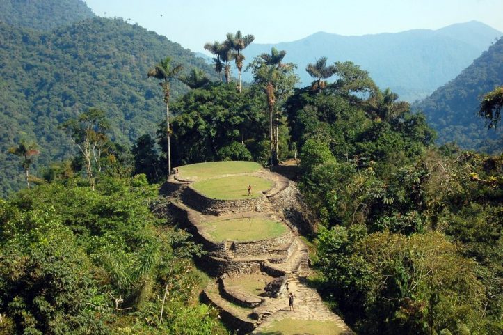
Lost City, or Teyuna, is the greatest archaeological finding in Colombia. This ancient indigenous civilization was built in the Sierra Nevada de Santa Marta, along the Buritaca river, by the Tayrona culture.
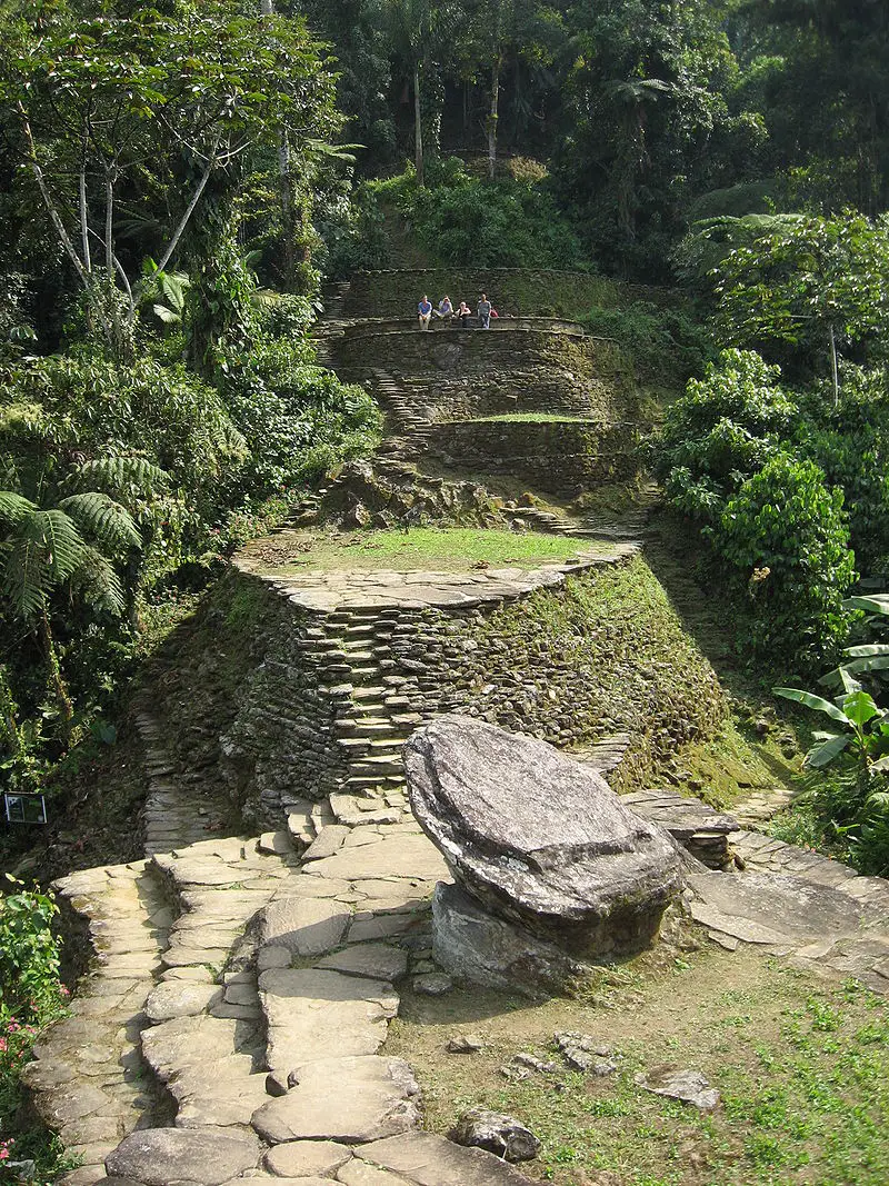
Over 200 stone structures including interconnected roads, stairs, terraces, canals, and ceremonial buildings are the remnants of the city, which was forcibly abandoned during the Spanish colonization.
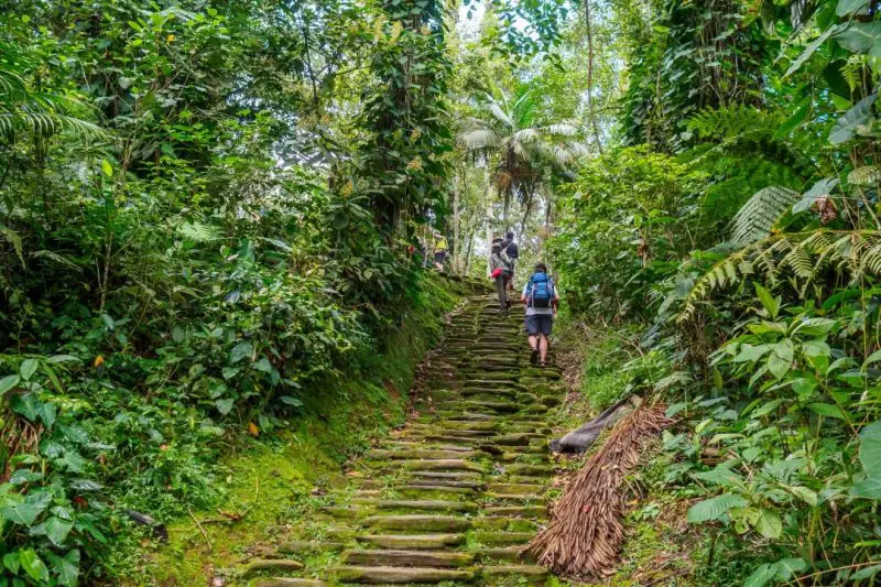
The round trip is 50 km long approximately and to enter, you must climb a 1,200 step stone stairway through the forest. This unique trek experience takes an average of 4 days but goes up to 6 depending on your physical level and stops done during the trip.
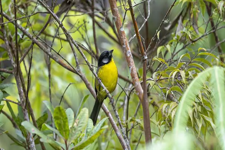
You will not only challenge your body but get to interact with Kogui local indigenous group and discover the immense biodiversity that inhabits this sanctuary. No need to say more, live the Lost City trek yourself!
The foothills of Sierra Nevada de Santa Marta merge into the intense blue-colored Caribbean sea, forming gorgeous white sanded beaches surrounded by mangroves and dense jungle with many endemic fauna and flora species. This is the breathtaking landscape you can appreciate in Tayrona.
To get to the camping zone from the entrance, you need to take a 2-hour hike and there are other trekking trails:
- The Kogui trail or Knowledge route from Cañaveral to Arrecife lasts 1 hour and has a low difficulty level.
- The Arrecifes – Boca del Saco trail, also moderate and 2-hour long, in which you can pass by Playa Arrecifes, La Piscina and Cabo de San Juan del Guia.
- Another popular trek is Pueblito, something like the mini version of Lost City where Kogui families live.
Los Nevados National Natural Park is in the Central mountain range of the Andes and comprises the three coldest thermal floors.
This means that here you can get to know Andean forest, paramo, and glacier ecosystems. 38 nearby municipalities and crop fields are provided with water thanks to the rivers that descend from the paramos and glaciers in the park.
The snowy mountains that belong to this protected area are Ruiz, Tolima, Santa Isabel, and El Cisne, Quindio, and Santa Rosa paramillos, which form the greatest volcano complex in the country.
Many tourists visit this park to climb to the highest peaks of these mountains that go up to 5,300 meters above sea level!
Currently, Nevado del Ruiz presents volcanic activity so access is restricted. Here are the two snowy mountains within the park you can climb to.
With its peak at 5,220 MASL, Nevado del Tolima is one of the two currently available options for mountaineering in Colombia.
The excursions take 4 days in total and usually start from Ibague or Salento. When you get to the summit, a view over Los Nevados Park and the Magdalena valley will take your breath away -on sunny days, of course.
This is one of the most demanding treks in Colombia because of its steep slopes and only experienced mountaineers should attempt to climb to the 2.8 km2 glacier.
Located between the snowy volcanoes of Tolima and Ruiz, Santa Isabel is the lowest snowy mountain in Colombia.
Unlike others, it does not have a conic structure with a crater but a set of domes created by lava outpouring that allows the glacier thermal floor to existing. Poleka Kasue, as the Quimbaya indigenous culture called it, has its highest peak on the central summit at 4,968 meters above sea level.
Unfortunately, it suffered deglaciation in recent years, passing from 1.9 km2 to 0.5 km2 in 10 years. In fact, IDEAM studies have determined that it would take only a decade for this glacier to become extinct.
The trip to Santa Isabel’s summit starts from Pereira, Santa Rosa de Cabal, or Manizales and takes 1 or 2 days to the summit.
Among the attractions of the trek is the viewpoint of Laguna del Otún and Paramillo del Quindío, and the gorgeous paramo landscapes that boast a frailejones valley and endemic flora and fauna species.
Once again, it is recommended to have experience in mountaineering and take all the safety precautions.
Another Andean volcanic zone, this time declared a UNESCO Biosphere Reserve, this is Puracé NNP.
The Coconucos volcanic range has 11 volcanoes, among which Puracé is the only active one. The Magdalena, Cauca, Patía, and Caquetá rivers (some of the main rivers in Colombia) originate in this mountain, along with around 30 crystalline lagoons and several sulfur springs for hot baths.
It is located in the Cauca department and its name means “fire mountain” in the Quechua language, spoken by the homonymous indigenous culture that protects the territory. Puracé is a privileged spot for those looking for the majestic Andean condor, which soars over the paramo ecosystem.
Departing early from Popayan, a road takes you to the park entrance, where you will find various trekking trails: one directly to the volcano and others with lower difficulty that pass by its beautiful water bodies and are 20 km long approximately. The landscape is stunning and the park is quite calm.
Sierra Nevada of Güicán, El Cocuy, and Chita is the largest glacier mass in Colombia: within two mountain ranges it has over 20 snow peaks from 4,800 to 5,330 meters above sea level, Ritacuba Blanco being the highest.
It is located in the departments of Arauca and Boyacá and is sacred territory for the Uwa indigenous community, because of this there are some restricted areas.
This trek is particularly stunning cause you can find waterfalls, lagoons, important rivers such as the Magdalena or the Orinoco, frailejones, Andean condors, spectacled bears, and white-tailed deer! An unbelievable view.
Mountain climbers of all levels visit the park to go trekking for 5 days usually, although now there are simpler trails for one-day hikes that start from El Cocuy municipality. However, it is better to be in good shape for any trekking trail, especially at such high altitudes.
Notice: Since February 10th, 2020, El Cocuy NNP closed temporarily due to public order issues. Check its status on the web page before your trip.
Chingaza páramo is a National Natural Park on the Eastern range of the Andes, between the departments of Cundinamarca and Meta.
Here you will face a cloudy environment hiding the blue sky, which reflects on the lakes surrounded by frailejones. Plus, it is possible to spot spectacled bears, deer, pumas, páramo tapirs, Andean condors, and Andean Cock-of-the-rock in the lower areas near Villavicencio.
Trekking trips start from Guasca or La Calera municipalities and depending on the starting point, you will get to different lagoons. These water bodies were sacred to the former inhabitants, Muisca indigenous communities.
Among the most famous ones are the Siecha Lagoons, three small glacial lakes with high biodiversity around them. The maximum height you can reach is 3,800 meters above sea level and the route to the lagoons can be done in 1 day. This is an excellent option for practicing trekking near Bogota.
In the Guainia department, part of the Colombian Amazon region, three majestic rock hills rise from a pristine jungle by the Inirida river.
El Mono, El Pajarito, and Mavecure belong to the millenary Guiana Shield and can be reached by boat on a 3-hour trip from Puerto Inírida, the capital. Out of the three majestic black rounded hills, you can only climb Mavecure, which is 170 meters high.
Although it is not a really demanding hike that takes about an hour, the experience of sailing the river for hours and exploring a remote natural territory makes it a whole adventure.
Take into account that this is a tropical zone and the weather here is hot, therefore you should be vaccinated against tetanus and yellow fever, also you should dress properly (long pants and rain boots) and keep with you a piece of basic safety equipment.
Just 30 minutes away from Bogota, this eco-park covered by cloud forest offers several hiking trails for all adventurers. Although the routes individually do not take much time, there are over 20 km (12.5 miles) of hiking trails that you can complete in over 1 day, if you stay there, whether in camping zones, the hostel, cabins, or treehouses.
After going into the forest, you can get to the Eagle’s peak, a viewpoint at 2,290 MASL from where you can see the Tequendama region and the snow-capped peaks of Los Nevados NNP on clear days.
Other trails are:
- Roquedal, 667-meter long trail of high difficulty;
- Butterflies, 1.6 km trail that leads to the hostel;
- Oak Forest, 2.5 km trail surrounded by 30-meter oak trees;
- Waterfall, 3.5 km long trail of high difficulty with a 70-meter high gorge; and the
- Colonial trail, 1.5 km long which was used by Muisca and Panche natives to connect the Bogota plateau with the Magdalena valley in the pre-Columbian era.
It is worth visiting Chicaque park on the outskirts of Colombia’s capital.
These were 10 destinations to go trekking and mountaineering in Colombia in different regions of the country: the Caribbean coast, the Andes mountain range in the central region, and the Amazon jungle to the south.
From tropical to cloud forests, moorlands, and glaciers, trekking in Colombia is always a new adventure!
If you want to know more about the most incredible natural destinations in Colombia, plan your trip with us!
References
About the author.
Ana María Parra
Modern Languages professional with an emphasis on business translation. Interested in the cultural adaptation of written and audiovisual content. Passionate about knowing new cultures and languages, tourism, and sustainable living.