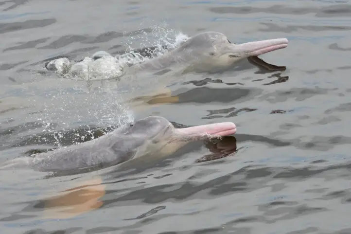
Best Amazon River Dolphin Spots in Colombia ( A.k.a. Pink River Dolphin)

Dolphins are undoubtedly wonderful creatures, worthy of our affection and wonder. That is why many of us want to meet them in person. Moreover, true river dolphins, commonly known as the Amazon River Dolphin, the Pink River Dolphin, Tonina, or Boto, are much more attractive, mysterious, and charismatic. They are among the rarest and most endangered of all vertebrates in the world.

In this post, we will present you where to see the Amazon River Dolphins (Inia geoffrensis) or as many people call them, the pink dolphins, in Colombia.

Pink dolphin – Inia geoffrensis, picture by Fundacion Omacha

Amazon River Dolphin Facts

  1. The Amazon River Dolphin is the largest freshwater cetacean in the world, it manages to reach lengths of up to 2.80 meters long and a maximum weight of 200 kilograms.
  2. Its color varies depending on age, young dolphins and females show grayish colors while adults, and principally the males, turn pink, which gives them their characteristic name.
  3. There are many theories to explain its color, but many agree it is a result of the wear and tear of their skin, and some scars.
  4. Scientists discovered that river dolphins come from a very ancient lineage that inhabited the seas.
  5. Its behavior is very different from sea dolphins. They use to have a solitary life, sometimes in small groups composed of a maximum of four members.
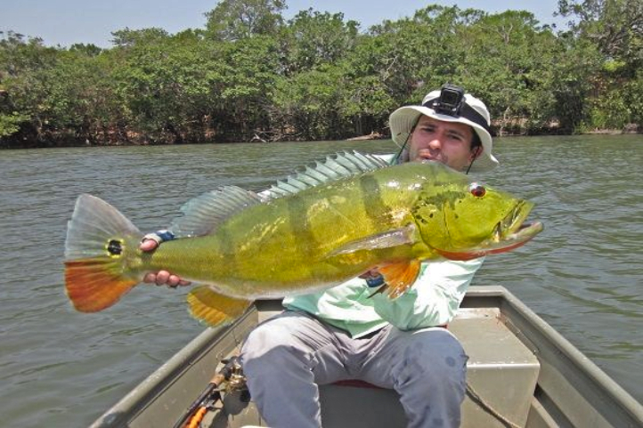
  6. Their food consists of crabs, river turtles, piranhas, and other river fish.
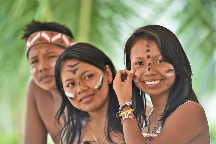
  7. The pink dolphin is part of the folklore of the inhabitants of the Amazon and there are many legends and myths around this animal.

Myths and Legends around the Pink Dolphin

These legends generally attribute supernatural powers to the dolphins. One of the most famous legends tells that the pink dolphin was a young and very handsome indigenous warrior who awoke the envy of one of the gods for his masculine attributes.

This god decided to transform the warrior into a dolphin, condemning him to live in the rivers and lakes of the Amazon. It is said that the attractive dolphin dances perfectly and no woman can flee before his charms.

Pink Dolphins are Endangered Species

According to the classification of the International Union for Conservation of Nature (IUCN), the Amazon river dolphin is endangered, with only one category below the risk of extinction.

People kill them on behalf of their cultural traditions, or because they are competitors for fish. Other threats faced by the pink dolphin include accidental fishing, habitat loss, being killed for fish bait, and contamination.

With scientific research and responsible tourism, many people became aware of the importance of the conservation of these animals. In Colombia, NGOs as OMACHA and ECONARE are doing a great job to protect and conserve these animals.

Where You Can Find the Pink River Dolphin

These dolphins are widely distributed in South America and can be found in Brazil, Peru, Bolivia, Venezuela, Ecuador, and Colombia.

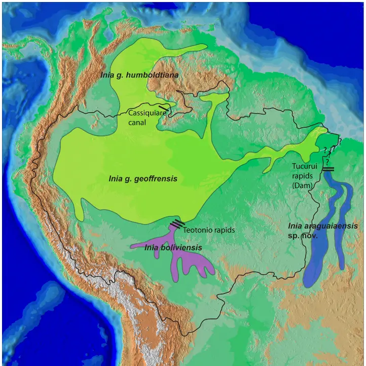
Scientists have not agreed on how many subspecies of pink dolphin exist, but certainly, they are not similar among the different regions. The IUCN recognizes three subspecies:

  • I. g. geoffrensis (Amazon river dolphin)
  • I. g. boliviensis (Bolivian river dolphin)
  • I. g. humboldtiana (Orinoco river dolphin)

While the Committee on Taxonomy of the Society for Marine Mammalogy only recognizes the first two of these.

Distribution map of all known species and subspecies of Inia. Black outline denotes the limit of the Amazon basin. Question marks denote uncertainty as to which species occurs in the Tocantins River downstream of the Tucuruí dam which potentially delimits the distributions of I. geoffrensis and I. araguaiaensis sp. nov. Bars on the Madeira River represent a series of rapids that delimit the distribution of I. geoffrensis and I. boliviensis. The single bar on the northern limit of the Amazon basin represents the Casiquiare canal which connects the Amazon and Orinoco basins, and is thought to delimit the I. g. humboldtiana subspecies from I. g. geoffrensis.
https://doi.org/10.1371/journal.pone.0083623.g001

To see how little is known about the pink dolphin, a relatively recent scientific study proposes a new species living in southeastern Brazil, the Inia araguaiaensis. They even propose the Bolivian subspecies should be recognized as a separate species, I. boliviensis. Take a look at the map above.

Where to See Pink River Dolphins in Colombia

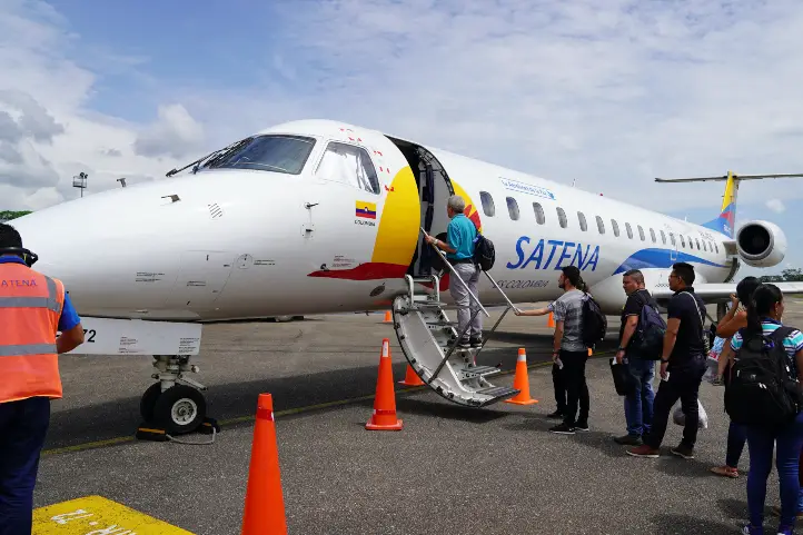
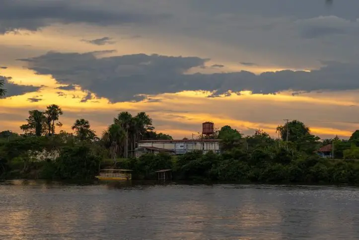
Many people who contact us wanting to plan their trip to see the pink dolphin believe that it is only possible to see it in Leticia, the capital of the department of Amazonas in Colombia.

However, the Amazon as a region encompasses many more departments, not only the Amazon but also Vaupes, Guainia, Guaviare, Caqueta, and Putumayo.

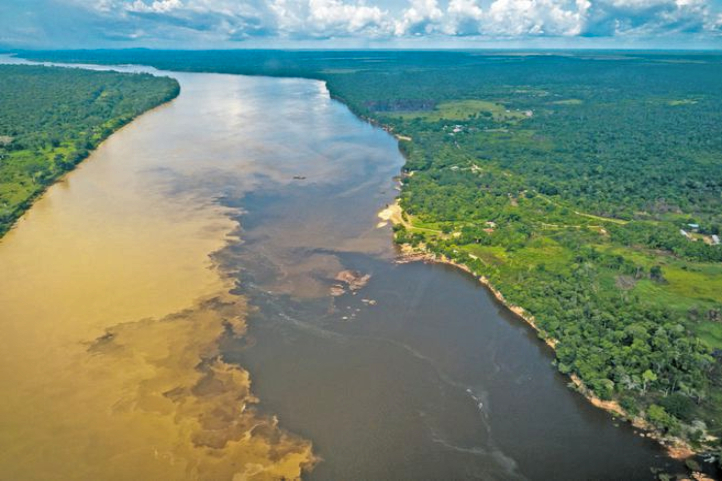
On the other hand, all these departments are connected by a dense network of rivers and canals that run not only through Colombia, but all neighboring countries. And this is how the pink river dolphin manages to expand throughout the region.

Map of distribution of Inia geoffrensis in Colombia. ©Trujillo, F., Crespo, E., Van Damme, P.A. & J.S. Usma (Editors). 2010. The Action Plan for South American River Dolphins 2010 – 2020. WWF, Fundación Omacha, WDS, WDCS, Solamac. Bogotá, D.C., Colombia. 249 pp.

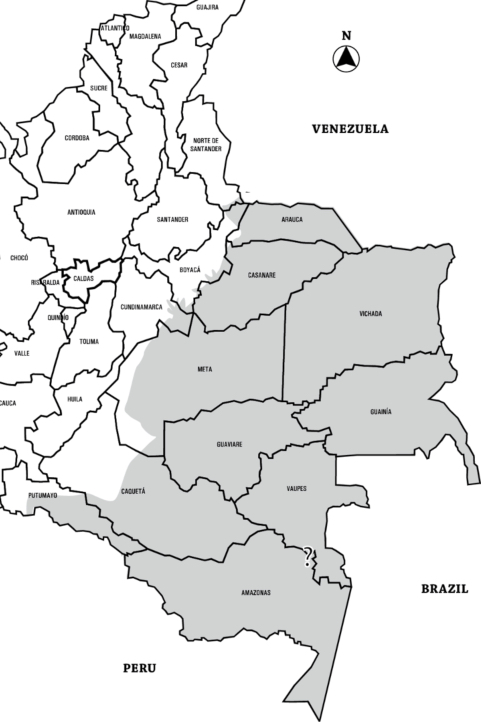
Thus, the pink river dolphin is not only distributed throughout the Colombian Amazon region but also reaches the eastern plains and the Guyanese shield, in the departments of  Amazonas, Putumayo, Caqueta, Vaupes, Guaviare, Guainia, Vichada, Meta, Casanare, and Arauca. Take a look at the map above to find your way around.

Despite its wide distribution, you can only visit a few places to meet the pink dolphin in Colombia.

Amazon river dolphin (Inia geoffrensis), also known as the boto, bufeo or pink river dolphin, Puerto Nariño

Amazonas

You can visit Leticia and Puerto Nariño on short boat trips along the Amazon river. However, we recommend you go to Puerto Nariño.

Puerto Nariño

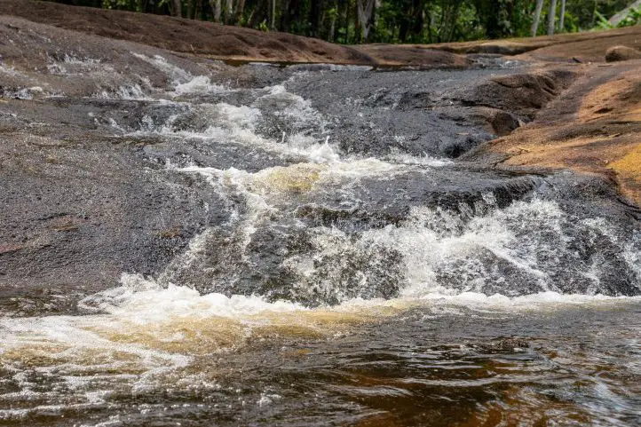
The city of Puerto Nariño is the destination to see the river pink dolphins in the department of Amazonas. Here you have to navigate the Correo and Tarapoto lakes to see the wonderful pink dolphins up close.

Zacambu and the Three Frontiers

You can also depart from Leticia on a river tour on the majestic Amazon River. It is a tour towards the Zacambu village and the three frontiers region.

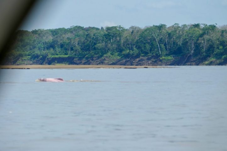
During the navigation through the river, you will be able to appreciate the flooded jungle. Arriving at the border with Peru, you will find Islandia (Peru), known as the Venice of the Amazon. This is a town that floods periodically, and that is why its houses are elevated as well as its streets. Once in the lakes of Zacambu, it will be possible to see river dolphins.

Where to Stay

Waira Suites Hotel – Leticia

Vichada

The department of Vichada is a known destination for sportfishing. However, it is also possible to go there and see the pink river dolphin. There the Meta, Bita, and Orinoco rivers converge, and there are tours in a boat to watch the pink dolphin departing from Puerto Carreno, the main city of Vichada.

Where to Stay

Carreño Plaza Hotel – Puerto Carreno

Meta

The “Ruta del Amanecer llanero” is the best way to see the pink dolphins in Meta. Visit our entry #1 Llanos Experience near Bogotá: The Llanero Dawn Route in Meta, to know more about this route.

The city of Puerto Gaitán, located 194 km south of Villavicencio, is bathed by the waters of the Manacacías river. Boat tours to watch the dolphins are an almost every day offer.

Puerto Gaitan is the most recommended destination if you do not have enough time to travel to far destinations such as Leticia, or Puerto Carreno. It is also the nearest to Bogota, the capital city of Colombia.

Where to Stay

Lagos de Menegua Hotel and Bioreserve

Mururito Natural Reserve

Guaviare

In the Nare Lagoon, very close to the city of San Jose del Guaviare, pink dolphins live and you will have the opportunity to swim with them.

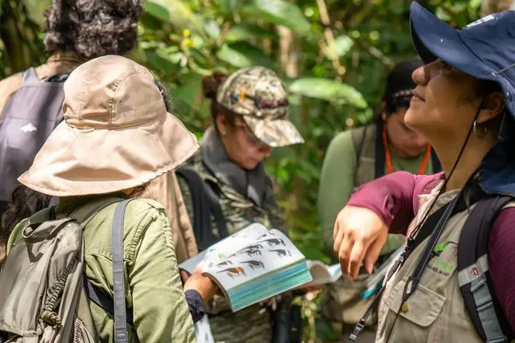
There, with the help of local guides, you will learn the story of how they got there. You can also observe different species of fauna and flora throughout the tour.

With this trip, you will be directly helping the families that are part of ECONARE. Econare is a local association of community-based tourism in charge of preserving the nature of the area and the safety of the dolphins that inhabit the lagoon. You will also help all those people who make it possible for you to live these experiences.

Where to Stay

Quinto Nivel Hotel

How is a Pink Dolphin Tour?

Dolphins can only be observed from a certain distance on wooden platforms or in boats. Sportfishing adjacent to their hunting areas is prohibited and along with this, feeding them is forbidden as it would cause human dependence.

Best Time to Visit the Pink Dolphin

All year round in Colombia, especially in Guaviare and Meta.

Recommendations for your visit

  • Take yellow fever and tetanus vaccines before arrival.
  • Do not forget the mosquito repellent, it is highly recommended.
  • Rubber boots, raincoat, long-sleeved shirts, sunscreen.
  • Leave no trace.

If you want to plan your trip to Colombia do not hesitate to contact us, visit our Plan your trip page!

References
  • OMACHA Foundation.
  • Hrbek T, da Silva VMF, Dutra N, Gravena W, Martin AR, Farias IP (2014) A New Species of River Dolphin from Brazil or: How Little Do We Know Our Biodiversity. PLoS ONE 9(1): e83623.
  • Trujillo, F., Crespo, E., Van Damme, P.A. & J.S. Usma (Editors). 2010. The Action Plan for South American River Dolphins 2010 – 2020. WWF, Fundación Omacha, WDS, WDCS, Solamac. Bogotá, D.C., Colombia. 249 pp.
  • Status and conservation of river dolphins Inia geoffrensis and Sotalia fluviatilis in Colombia. Available from: https://www.researchgate.net/ [accessed Apr 15 2021].
About the author

Sara Colmenares

The current director of Sula. Doctor in Biological Sciences. Her main interests are to explore and understand the organism–environment interactions, taking advantage of emerging knowledge for the management and conservation of species and ecosystem services. She is currently working as a consultant in functional ecology, ecosystem services, and conservation projects in Colombia related to ecotourism and birdwatching.

Discover the gateway to the Colombian Amazon, the city of Mitú on the banks of the Vaupes River


Mitú, the capital of the department of Vaupés, located between 50 to 120 minutes by plane from Bogotá, is the ideal destination to immerse yourself in the depths of the jungle, where birds, nature, and ancestral culture allow you to leave aside the daily routine of modern life.

This is a unique destination, where the distance and the little communication with the rest of the country, has made it possible to maintain a large part of the culture and nature of the region.

The Ethnic Richness of Mitu

About 70% of the territory has been declared as an indigenous reserve, and for this reason, visitors and access must have the permission of the indigenous leaders.

Mitú has a population that is mostly part of ancestral indigenous tribes such as the Tukano, Guananos, Yurutíes, Cubeos, Piratapuyos, Desanos, and many others. There are 26 communities in total, and about 29 dialects, which represents the amazing ethnic richness in this region of Colombia.

The Vaupes River is the connector of these communities. People move in boats and canoes transporting local people, agricultural products, merchandise, and tourists.

Get to know Mitú

It is a simple and small city, located on the banks of the Vaupés River, surrounded by freshwater streams and the thick Amazon jungle.

When you arrive in the city, you can stroll through the main square Parque Santander, where you will find the Governor’s Office, the María Inmaculada Cathedral and the monument to the “Guio”, which pays homage to the origin of the indigenous peoples who live there. Guio means anaconda.

In this square, it is common to find food, handicrafts, and the typical gastronomic offer of the region.

The Fabio Alberto Leon Bentley Airport is the main gateway for travelers arriving to discover the territory. The Satena airline is the only one with flights to Mitu from Bogota or Villavicencio.

Satena airline offers flight to Mitu from Bogota and Villavicencio.

Places to Enjoy in Mitu

The trip to Mitú is ideal if you like bird watching. In Vaupes you will find more than 570 bird species, which offer a unique spectacle. Local guides specialized in the subject will give you all the information about the birds that you can find in the city.

Find more information about birding in Vaupes in our entry Vaupes, a Must to Visit Birding Destination in the Colombian Amazon.

Birdwatching at the Colombian Amazon, Mitú, Vaupés

It is also possible to walk along special trails outside the city center to enjoy a wide variety of species, not only birds but also flora and different types of animals, always accompanied by local guides.

To visit these places, you will have to access the territory of the communities, and you can only do so if you have permission from the leader of the community and if you are accompanied by a local guide.

The Malecon

The Malecon has a pedestrian walkway that runs one kilometer along the Vaupes River. It has small squares and kiosks adorned with gardens of local vegetation, where many birds arrive.

The Food Market and Port

This is a very rustic square, located next to the river where you can find typical food of the region prepared by the hands of indigenous women in wood and charcoal stoves. Here you can enjoy traditional dishes for very cheap prices.

Food Maloka, Mitu, Vaupes, Colombia

There are about 15 food stalls where you can find “borugo en caldo”, “lapa”, fish, cassava, manioc, among other foods provided by the jungle. The natives take advantage of the permitted hunting seasons to obtain the animals to eat.

Lapa soup, Mitu, Vaupes, Colombia

Around this place, indigenous gather to offer many kinds of products. Every Friday, people from different communities arrive in the place, bringing their products to sell in the market. It is possible to find cassava flour, casabe, pichuna grapes, quinapira, copoazu, fish, and reptiles that are used as food.

Hiking and River Trips in Vaupes

There are trails for hiking and river trips that will take you to the indigenous communities, open to tourists with their ancestral vision of the birds and other animals of the region.

Hiking Routes Around Mitu

The ecological walks established around the city have as a special destination different high hills, or tepuis, from where we suggest you to observe the jungle that expands from and towards the river.

Mituseño Urania

Five kilometers from the city you can visit the Mituseño Urania community. It is a small village with two important sacred places: the chair of the god Cubay and the hill of Urania.

The Odocabeba (Urania) Hill, is a rocky outcrop 200 meters high, where you will observe the jungle, and share the day with the Cubeo indigenous people, owner of this beautiful viewpoint of the jungle.

You will also visit the territory of the Cubeo’s god Cubay, and a rock traditionally called the “Silla de Cubay” from where, according to legend, the deity observes the jungle.

Once you reach the top, you will find a jungle landscape crossed by the waters of the Vaupes river that carries small boats with goods and tourists in the middle of the jungle.

Ceima Cachivera

6 kilometers from Mitú is the Ceima Cachivera community. This community opened to visitors following the motivation of its captain Sergio Gutierrez, which is a professional tourist guide formed at SENA, the national institute of learning.

Sergio cordially welcomes visitors who want to get to know the treasures of the jungle. After an introduction about the characteristics of the territory and the community, he leads the expeditions that last an average of two hours.

There are different stops during the hike, the first one is the raudal of Cachivera Tucunare, a waterfall. Then you will continue towards a series of caves and rocky formations, sacred for the Cubeos, such as the Tiger Cave or the Toad Cave, where the Guianan Cock-of-the-Rock is usually observed.

Cerro Flecha Mitú, Vaupés

Finally, there is Cerro Flecha, a hill with a spectacular 360 view of the jungle. It is also a sacred place for the Cubeos, since this hill was the place from which its god Cubay prayed over the region.

Trekking Cerro Flecha Mitú, Vaupés

Cerro Guacamayas

Cerro Guacamayas is another jungle viewpoint. To reach its summit you must take a path through swamps and through the Chagras, or small spaces for the sustenance of the indigenous communities, where they plant and establish a series of relationships with the land.

As the trail is rough, you should bring along food and drinks, swamp boots, long-sleeved shirts, and insect repellent. The entire route is flat until you reach the hill, a gigantic rock that encloses an ecosystem in which characteristics shrubs and vegetation grow.

Inselberg, Cerro Guacamaya, Mitú, Vaupés

You may climb up the rock with the help of a harness, or if you feel confident, you can reach it by your own. Once you reach the top you will find the entire Amazon rainforest at your feet.

Amazon forest – Cerro Guacamaya – Mitú, Vaupés

Once you descend from the viewpoint, you will reach the Caño Sangre, a natural “jacuzzi” of terracotta color, fruit of the vegetation that grows at the bottom of the pipe.

Mitú, Vaupés

River Trips

Before continue, I must tell you that for the indigenous people, the Vaupes River is sacred. For them, under the waters of the river resides the world of the gods. It is a place where the ancestral cycle of the anaconda takes place.

Vaupés River, Mitú, Vaupés, Colombia

The anaconda gives identity to the community, and plays a central role in their mythology and genesis of their people. We recommend you to watch the documentary El Sendero de la Anaconda to better understand the sacred relationship that the indigenous people established with the river. It is available on Netflix.

Cachivera Cerro Flecha Mitú, Vaupés

You can visit several streams and pipes that connect with the Vaupes River. Among them, one of the closest is the Raudal Tatu Chachivera, a ravine feared for its strength.

It is important to be accompanied by a local guide who knows very well how to overcome these ravines. Generally, the indigenous people of the Trubon community are in charge of guiding you through this part of the Vaupes River.

Another place, very close to Mitu, is the Cucura bathing place, where the huge stones form natural pools.

Learning about different cultures

The most interesting thing about Mitú is that it is possible to share with some communities their traditions, observe their costumes and learn about their customs. You will be received in a Maloca, in the famous festivities of Yuruparí, where you will be invited along with the children to participate in a traditional dance.

Jerico Community

Here you can interact with the culture and tradition of the Tatuyo people. This community is located two hours from Mitu. There you will be welcomed by the wise man of this community called Agustin Munoz.

The main attraction is the colorful Maloca of the community. There you will enjoy an opiparous banquet prepared in the traditional way with typical foods such as cassava, fish muquiado, fish with caruru, and copoazu and azai juices. Everyone can help themselves to the food they want.

Traditional food served in handmade dishes, Mitu, Vaupes, Colombia

Afterwards there will be a protection ritual, where with a reddish powder called carayuru, the women will paint your face with a set of lines on your forehead and cheeks.

Protection Ritual, Mitu, Vaupes, Colombia

Mambe is also offered to the attendees. It is a powder obtained by toasting, grinding, and sifting the coca leaf, which is mixed with ashes from a cecropia tree. Don Agustin will explain to you the benefits of consuming this preparation.

Beware that the Mambe is a stimulant that should only be chewed, so don’t eat it!

Souvenirs

The handicrafts of Vaupes are beautiful. The indigenous people capture their culture and tradition in these unique handicrafts. You can find clay pots polished with river stones, plates, blue clay vessels with traditional engravings, trays, and baskets handwoven with vegetable fibers, vases, etc. All worked in fibers such as cumare or guarumo, clay and wood.

Indigenous jewerly from Mitu, Vaupes, Colombia

These handicrafts greatly represent the Colombian Amazon and are a source of pride for the inhabitants of Vaupes.

Handicrafts of Vaupes

Recommendations for your visit

  • Take yellow fever and tetanus vaccines before arrival.
  • Do not forget the mosquito repellent, it is highly recommended.
  • Rubber boots, raincoat, long-sleeved shirts, sunscreen.
  • Leave no trace.

If you want to plan your trip to Colombia do not hesitate to contact us, visit our Plan your trip page!

References
  • Colombia Travel
  • SINCHI – Institute of Scientific Reseach of the Amazon.
  • Satena
About the author

Sara Colmenares

The current director of Sula. Doctor in Biological Sciences. Her main interests are to explore and understand the organism–environment interactions, taking advantage of emerging knowledge for the management and conservation of species and ecosystem services. She is currently working as a consultant in functional ecology, ecosystem services, and conservation projects in Colombia related to ecotourism and birdwatching.

Jirijirimo Waterfall and the Anaconda Trail in Vaupes, Amazon Region, Colombia

The Raudal de Jirijirimo (or Jirijirimo waterfall) is a regional nature reserve between the limits of the amazonian departments of Vaupes and Amazonas in Colombia. It is located in the middle-lower course of the Apaporis river.

The reserve is named after the waterfall that is located there, the Jirijirimo, which is one of the most beautiful and impressive in Colombia.

The Apaporis River: The Anconda Trail

The Apaporis River rises in Mesa de Pardos, in the municipality of La Macarena, department of Meta. It results from the union of the Tunia and Ajajú rivers, and has a length of 1,200 kilometers.

This river serves as the northeastern limit of the department of Caquetá with the department of Guaviare. It is of black water and has a general NW – SE direction throughout its course.

In the upper part of its course it serves as a natural boundary between the departments of Caquetá and Vaupés.

It bathes the lands of Caquetá, Guaviare, Vaupés and Amazonas and serves as Colombia’s border with Brazil. It is little used for navigation because of its streams, among which is the Jirijirimo.

Raudal de Jirijirimo (or Jirijirimo Waterfall)

Jirijirimo is a waterfall in the form of gigantic steps, and it is about 100 meters wide and almost 100 meters high.

The word “Jirijirimo” is an indigenous word that means “Bed of the guio”. The guio is an indigenous word to call the Anaconda. They are aquatic boas, which can measure up to 10 meters and feed on large animals. Their scientific name is: “Eunectes“. The Anacondas are often found in this place.

The Apaporis River at this point reaches a width of 100 meters. It splits in two by surrounding an island in the middle of the river. Just there, the Raudal de Jirijirimo (Jirijirimo Waterfall) begins. There, the river falls furiously through a rocky and deep gorge. It is a route of impressive waterfalls and rapids.

It is a sacred place of the Macuna, Tanimuka, Letuama, Cabiyari, Barazano, Yujup Maku and Yauna peoples of the Apaporis, who are spread out in about twenty communities along the river.

The spiritual practices of the indigenous people and their management of the territory have made this region one of the best preserved natural destinations in Colombia.

The river closes at about 40 meters beyond, and rushes between rocky walls with impressive force. Then, it runs for several kilometers until it reaches a tunnel where it backwaters.

The Apaporis Tunnel

Either because the river found it, or because the river itself carved it, the fact is that, after the Jirijirimo, the Apaporis ends in a tunnel about 60 meters high, 20 meters long and 10 meters wide.

It is the mythical tunnel of the Apaporis, which is also sacred to the indigenous people of the region and the subject of many legends.

It is an impressive place due to the scene formed by the black rocks, the vegetation, and the light crossing the tunnel. The river, which before rushing down the waterfall was several hundred meters wide, is now reduced to a mere 10 meters and therefore the depth is incalculable.

Local people affirm that the depth of the Apaporis is several tens of meters inside the tunnel.

Morroco Mountain Range

Near the raudal flows the black water river called Cananari. In the background, the Morroco mountain range frames the landscape of the river. This mountain extends for 5 km, and reaches a height of 500 meters above sea level.

The Morroco Range breaks the Apaporis River to form the Jirijirimo waterfall, a few kilometers from the mouth of the Cananari River.

You can hike to the top of the Morroco mountain range. From the top, it is possible to observe the landscape of the raudal of Jirijirimo, the Apaporis river and the jungle in all its splendor and extension.

There are many macaws in Morroco, and these have become emblematic birds of the destination.

Expeditions to the Jirijirimo

Since the late 19th century, Jirijirimo has been admired by travelers, scientists and tourists. One of its most famous visitors was the British botanist Richard Evan Schultes, in the 1940s. And most recently, the botanist Wade Davis, who made a documentary, along with Martin von Hildebrand.

In the documentary they follow the steps of Schultes through the jungles and rivers of the Colombian Amazon. The documented journey is called El Sendero de la Anaconda, which is available on Netflix.

El Sendero de la Anaconda – Trailer from Laberinto Producciones on Vimeo.

In the last Colombia Bio expedition, which results were presented in July 2019, scientists recorded around 2,335 species of flora and fauna, and 228 of which were new records for the country.

In the reserve is possible to observe the exotic Amazonian fauna. It is perfect to find anacondas, macaws, deers and large mammals such as Amazonian tapirs.

How to get to Jirijirimo

To get there you will have to take a plane from Bogota to Mitu, the capital of Vaupes. From there, you have to take another plane to the region where the raudal is located. The flight covers 179 km from Mitú to the municipality of Taraira.

You can also arrive by boat from the municipality of Pacoa in the Amazon. The trip lasts 4 hours.

Weather at Jirijirimo

The climate in the region is warm and humid, with a temperature between 25 and 30 degrees Celsius (+/- 83 F).

Best time to visit Jirijirimo

The best time to visit this place is between November and January, after the rainy season. Before is not recommended since it can be very dangerous, and the landscape get lost below the strong waters.

This destination is part of the deep Colombia, and it is a place that recently opened its doors to tourism. For this reason, and for being in the middle of indigenous settlements, the environment is preserved unaltered.

Sometimes, visits are restricted or closed, so it is important you get informed about that in advance.

Do not expect to find hotels, or a great infrastructure. You will have to stay in the nearby towns to spend the night, or you can also camp in the places allowed by the indigenous community.

The Cabiyari indigenous people inhabits these area of the reserve. They will be your guides, and you will learn a lot about their customs and traditions.

Recommendations for your visit

  • Take yellow fever and tetanus vaccines before arrival.
  • Do not forget the mosquito repellent, it is highly recommended.
  • Rubber boots, raincoat, long-sleeved shirts, sunscreen.
  • Leave no trace.

If you want to plan your trip to Colombia do not hesitate to contact us, visit our Plan your trip page!

References
  • Colombian Airforce Website
  • Colparques Website.
  • Caracol TV Youtube Channel
About the author

Sara Colmenares

Current director of Sula. Doctor in Biological Sciences. Her main interests are to explore and understand the organism – environment interactions, taking advantage of emerging knowledge for the management and conservation of species and ecosystem services. She is currently working as a consultant in functional ecology, ecosystem services and conservation projects in Colombia related to ecotourism and birdwatching.

Ultimate Guide to Visit Guainía: Jungle, Rivers and Astounding Views

Two events have consolidated Guainía in the minds of travelers, the first, the signing of the peace agreement and the second, the launch of the Ciro Guerra’s film The Embrace of the Serpent (El Abrazo de la Serpiente), winner of multiple awards around the world.

Guainía

Guainía in the Yuri language means “Land of many waters”. Its capital is Inírida, and it is located in the east of the country. The temperature of the region oscillates between 25 and 30 degrees centigrade.

Most of its territory is made up of flat extensions, although there are some elevations, mainly the so-called tepuis, which are remnants of the Guiana shield, the oldest mountainous formation on the planet.

The most famous hills are the Mavecure, but there are others hills and mountains like the so-called Aracuari, Canapiari, Guasacavi, Mavicure, Pajarito, Rana, Salvaje, Sáquiras, Sardinas, and the mountains of Caranacoa and Naquén, with heights slightly above 500 meters above sea level.

In the past this was a region afflicted by armed conflict and violence, but this situation is now in the past and the community has found in tourism an opportunity for life.

Communication Routes and Transportation in Guainía

In the department of Guainía, the main communication route is the rivers, which are the road axes of access. Roads are scarce and only passable in the dry months.

It is also important the air transport. There are two airports located in Inírida and in the town of Barranco Minas. 

Tourism in Guainía

In Guainía one of the main attractions is its people, whose population is mostly composed of indigenous people (65%), who come from almost 30 different communities and belong to ethnic groups such as the puinave, curripaco, tukano, wanano, desano, piratapuyo, piapoco and yeral.

Guainía’s people

Other attractions are the Cerros de Mavecure, the Las Brujas lagoon, the Sapuara stream and the fluvial star. You can also find the Puinawai National Natural Reserve; the Pavón, Payara and Matevení Lakes, which together with the Inírida River, are destinations where you can practice water sports and sport fishing.

How to get to Guainía

You have to arrive by plane from Bogota to Puerto Inirida. The distance in straight line from Bogota is 720 Km, and it translates into 1 hour 10 min of flight.


It is recommended that you stay at least 4 days in the region to enjoy this majestic and sacred place.

In Inirida you can find several hotel offers, and all trips are made to and from the city by boat on the Inirida River and its tributary streams.

Below you will find the best destinations in Guainía.

Guainía Destinations

The Mavecure or Mavicure Hills

The Mavecure Hills are part of what we know today as deep Colombia. Embedded in the Amazon, they have become one of the most emblematic tourist destinations in Colombia.

In a study published about Ciro Guerra’s El Abrazo de la Serpiente, the Hills of Mavecure and surrounds are described as a landscape of enormousness, limitlessness, extraordinariness, and grandeur.

Mavecure Hills – Picture courtesy by Andrés Rodríguez, local indigenous guide.

The hills of Mavicure are three hours away from Puerto Inírida, the capital of Guainía. There are three tepuis called Mavicure, Mono and Pajarito that serve as an impressive viewpoint to the Guainía’s jungles.

From the top of the hills you can appreciate large extensions of jungle inhabited by indigenous communities such as the Puinaves and Curripacos.

According to Puinave Tomás Corda Medina, a native of the Barranco Tigre community, in an interview for a national newspaper:

“in the curripaco language, Mavecure comes from the words ‘mavi’, which is a palm used to make different utensils, and from ‘cure’, a poison that the ancestors took from a tree and put on the tips of their arrows for hunting with blowpipes.”

It is said that the hills were considered a magical space where humans could communicate with their gods.

The hills of Mavecure are 55 kilometers west of this city. To reach them you must take a speedboat that takes about 2 hours to travel the 55 kilometers through the Inírida River.

Climbing the Mavecure Hills

After arrival, you will have to spend the night in the El Remanso or in the El Venado indigenous communities placed at the foot of the hills.

You will need a guide to accompany you to the highest part of the hills, along the only trail suitable for walking and which does not require climbing equipment.

To reach the viewpoint, at 250 meters high, the only conditions are imposed by the weather and your physical condition. You must watch every step, and always go with a certified guide.

It is recommended to go up at a sunny moment. This is because, when it rains, the stone ground becomes slippery, and the slope makes the water run forming strong currents on the way down, which makes it very dangerous.

Once at the top you can see Pajarito and Mono; on their skirts you can see the dark green of a jungle that hides anteaters, water dogs, armadillos, limpets, chigüiros, tapirs, deer and tigers. In the distance, there are the caños that the river Inírida bathes, and other fluvial courses.

Mavecure Hills – Picture courtesy by Andrés Rodríguez, local indigenous guide.

The activities that you can do in the Mavicure Hills are bird watching, hiking, photography, and nocturnal fish watching on the banks of the Inírida River where you can see rays, guaracus, palometas, agujones and cuchas.

Find more details about Mavecure in our entry 5 Things you Should Know Before Visiting the Mavecure Hills in Colombia.

Las Brujas Lagoon

The Laguna de Brujas or Chalchuapa (in the language of the natives) is defined by the locals as an oasis of peace. It is a quiet place where you can escape to feel the sounds of birds and nature in all its splendor.

Situated 10 minutes by boat from Puerto Inírida, you will feel overwhelmed by the beauty of the surrounding forest. Laguna de las Brujas is announced as the preferred habitat of the pink dolphins.

Las Brujas Lagoon © Toninas Tours

A variety of stories are told among the natives, such as the legend of the “Pink Dolphin” which tells that spiritual leaders arrived there to talk to the pink dolphins about the future of the Amazon and its communities.

Others say that it was named after a legend about some witches who stole the water from another place known as “Hoyos de la caldera” (boiler holes), but during the trip they dropped the water in the air, forming the Brujas Lagoon.

The truth is that, regardless of their origins, tourists and locals can take tours through this splendid landscape in canoes, accompanied by an indigenous guide.

Caño Bocón

It is the paradise of fishing. Bocón is one of the main tributaries to the Inírida River. It is bordered by jungle.

This river is located in the territory of the Puinave ethnic community, thanks to which the river, and its lagoons, with its Peacock Bass and the large Payaras that live in it, are cared for and watched over.

Caño Bocón ©adsfishingconcept

Thanks to an agreement with the Puinave, fishing is allowed for a maximum group of 10 people, you will not see anyone else in fishing action during your week.

The fishing is fast and abundant: Peacocks, Payaras, Catfish, Palometas, Bocones, Morocotos, etc.

Viejita Lagoon

Another paradise for fishing in Colombia. Downstream from Puerto Inírida, where the river delivers its waters to the Guaviare.

After two hours of navigation towards the east, you can leave the river and walk around 15 minutes through the jungle until you reach the Viejita lagoon.

On a floating raft you go around the lagoon completely. From the raft you will witness epic sunsets and landscapes.

The Fluvial Star of Inírida (Estrella fluvial del Sur)

This is a must see in Colombia. This is a place where the rivers Guaviare, Atabapo and Inírida converge and swell the Orinoco River, one of the longest rivers in south American, and one of the top five largest rivers in the world.

Estrella fluvial del Sur, with its many rivers and lagoons, has been declared as a Ramsar Territory in 2014. This gave it recognition as a wetland of international importance, whose ecological and social value transcends the borders of a single country and benefits humanity.

The declaration of the Inírida River Star demand research efforts and substantial investments to safeguard the ecological integrity of the area. Ecotourism  appears as a sustainable practice and activity compatible with the rational use promoted by the Ramsar Convention.

Estrella Fluvial del Sur ©El Espectador

Estrella Fluvial del Sur Facts

  • The River Star is home to 34% of Colombia’s wealth in freshwater fish species.
  • Colombia has the second largest number of freshwater fish species in the world. 
  • The River Star is home to 70% of the known avifauna in Eastern Orinoco, 476 species of birds, two of which are exclusive to the place.
  • In the Inírida River Star there are 903 species of plants, 200 of mammals and 40 of amphibians.
  • The otter, the jaguar and the pink dolphin, present in the Fluvial Star, are in critical danger.
  • In the area there are two indigenous peoples, Puinave and Curripaco, five resguardos and 15 communities that inhabit them, who support and legitimize the decision of the declaration as a Ramsar territory.

The Flower of the Inírida

It is an endemic plant of Guainía that grows in humid savannas and whose petals are red tips. Technically, the flower of the Inirida is two species of monocotyledonous herbs belonging to the family Rapateaceae. Both species are endemic to white-sanded savannas, with extremely poor, precarious soil conditions that are hostile to any plant.

Flowers of Inírida, winter Guacamaya superba, and summer Schoenocephalium teretifolium.

There are winter and summer ones and one is bigger than the other. The Winter Flower of Inírida (Guacamaya superba), the bigger one, blooms mainly during the rainy season in the region (June – October). On the other hand the Flower Summer of Inírida (Schoenocephalium teretifolium) blooms mainly during the season of drought (December – March).

Guainianos love and protect it and travelers admire it. It can be seen in all its magnificence in the savannahs on the way to Caño Bitina. During the flowering season, the savannah is dyed red because of the abundance of flowers.

Alto de Caño Mina

The Raudal Alto de Caño Mina, one of the tributaries of the Inírida River, is one of the most overwhelming in the Colombian Amazon.

This is one of the most emblematic destinations of this Secret Colombia. It has has a 15-meter waterfall of black, red and yellow waters. Its color is produced due to a great load of tannins it has. 

It is necessary to go up the Inírida River for two days. Then you leave the Inírida River and enter through the Caño Mina.

Other Plans in Guainía

Ancestral writings (Coco Viejo Indigenous Community)

  • Explanation of the ancestral writings by an interpreter of the Curripaco people and field trip where you will have contact with these writings.
  • Know the petroglyphs.
  • Typical gastronomy of the communities.
  • Wooden handicrafts, natural fiber weaving, ceramics.

Visit ndigenous communities of Caño Vitina, Sabanitas, Guamal, Concordia.

  • Experiential tourism.
  • Ecological Tourism.
  • Ecological Walk.
  • Bird watching.
  • Typical gastronomy of the communities.
  • Wooden handicrafts, natural fiber weaving, ceramics.

Caño San Joaquín

  • Sport Fishing.
  • Ecological Tourism.
  • Ecological Walk.
  • Bird watching.

Raudales de Zamuro and Cualet

  • Sport Fishing.
  • Ecological Tourism.
  • Ecological Walk.
  • Bird watching.
  • Experiential tourism.
  • Typical gastronomy of the communities.
  • Wooden handicrafts, natural fiber weaving, ceramics

Wildlife observation

  • Toninas (pink dolphins) and bird watching. 
  • Visit the ornamental fish farms.

Water tourism and adventure

  • Practice water ports such as skiing, diving and sport fishing.
  • Camping or hammock nights.

Hiking and trekking

  • Hiking through the forest to the indigenous community of Venado.

Recommendations 

This is a trip to the jungle, so you have to be prepared for BASIC conditions of accommodation, food, transport etc. You will not find luxury things especially at night, because you will have to sleep in the community.

Additionally, take into account that the itinerary can vary according to the changes that the flights can have, the circumstances of the climate or unforeseen last minute.

Things you will need: 

  • Wear comfortable, light-colored and lightweight clothing, hopefully waterproof.
  • Bring hats or caps for protection from the sun and wear a long-sleeved shirt.
  • Wear hiking shoes, preferably waterproof, and extra tennis shoes.
  • Photo or video camera to not lose any detail of these beautiful landscapes.
  • Abundant hydration for the walks, sunscreen and repellent.
  • A raincoat to cover yourself in case it rains.
  • Small backpack for the daily walks.
  • Flashlight.
  • Sleepwear. It is recommended to take a light sleeping, at night it can be cold.
  • Personal hygiene equipment in small quantities.
  • Tape, micropore and anti-irritation creams.
  • Camping equipment (tent, mattress) or hammock with ropes and tarp, depending on your preference for the first night.
  • Swimwear.

If you want to know more about the most incredible natural destinations in Colombia, plan your trip with us!

References
About the author

Sara Colmenares

Current director of Sula. Doctor in Biological Sciences. Her main interests are to explore and understand the organism – environment interactions, taking advantage of emerging knowledge for the management and conservation of species and ecosystem services. She is currently working as a consultant in functional ecology, ecosystem services and conservation projects in Colombia related to ecotourism and birdwatching.

The Most Spectacular Rivers and Waterfalls of Colombia

The water resource abounds in the Colombia rivers and waterfalls. For starters, it has two coasts that are bathed by the Pacific ocean and the Caribbean sea. On top of this, Colombia is among the privileged countries to have the páramo ecosystem, where rivers are born.

Rivers flow through the diverse landforms of the country regulating the life of those who inhabit the river banks and occasionally, when encountering a cliff, they form beautiful waterfalls.

Colombia’s aquatic wealth allows for many activities related to water tourism such as diving, surfing, rafting, kayaking, sportfishing, whale watching, diving in coral reefs.

At the same time, it provides a rich landscape for other nature tourism activities such as hiking, photography and safaris.

In this post, we will talk about the main rivers and waterfalls in Colombia.

Due to the abundant rainfall and the topography, Colombia is blessed with many rivers: it has 1,200 permanent rivers, taking into account only the ones with basins over 100 km2!

Basins of Colombia

According to the place where the basins’ waters flow into, there are 5 drainage basins in the country: Caribbean, Pacific, Orinoco, Amazon and Catatumbo.

Fluvial Stars of Colombia

Also, there are 8 “fluvial stars” (geographic zones, mostly in mountain massifs, where several rivers are born due to ice melting): Colombian Massif, Caramanta Hill, Santurbán Páramo, Sumapaz Páramo, Guachaneque Páramo, Sierra Nevada de Santa Marta, Nudo de Paramillo and Nudo de Huaca.

Colombian Rivers

As in any other region, rivers play a vital role in the life around them. Riverside communities subsist thanks to the water and fish the river provides them, and also plant and animal life depend on these water bodies. Read on to know the most important rivers in Colombia!

Magdalena river

Río Grande de la Magdalena is the most important waterway and the longest river in Colombia. It is born in the Colombian Massif and runs from south to north until flowing into the Caribbean sea.

It is 1,558 km long, however only 1,290 km are navigable. The Magdalena basin is over 250,000 km2 and receives water from 500 tributaries, among which the Cauca river is the main one.

Importance of the Magdalena River

It was the protagonist of the settling in America. Caribbean canoes and European caravels entered through its mouth in search of agricultural and mining supplies, as well as places to settle and proclaim dominance.

The river connected the interior of the Andean territory with the Caribbean Sea and, since the 19th century, it became the commercial axis of the Colombian territory.

Today, the Magdalena has vast livestock and agriculture extensions in its valleys and it is a place for hydrocarbons and minerals extraction. It boasts natural beauty and continues to be key in the country’s development.

Cauca river

The Cauca river is the main tributary of the Magdalena river. Also born in the Colombian Massif, it is 1,350 km long and flows between the Central and the Western Andes ranges by 7 Colombian departments: Cauca,  Valle,  Risaralda,  Caldas,  Antioquia,  Sucre and Bolivar, where it meets the Magdalena.

Its navigable area is about 620 km; anyway, it is the second longest river in Colombia. Along the river, productive activities such as sugar cane, cacao, corn, rice and coffee growing, farming, mining and hydroelectric activities are developed, which support the regional economy.

Atrato river

This mighty river, over 700 km long with 500 km navigable, is the main communication path in Choco and has a basin of 35,000 km2, which is rich in gold and wood, being a very fertile region.

It originates in Cerro Plateado, in the Western cordillera and flows northward through a humid valley into the Gulf of Urabá in the Caribbean Sea. Riosuio, Murri, Arquia and Truando are its most renowned tributaries.

The city of Quibdo in Choco, is the main port of the Atrato river.

Amazon river

Born in the Peruvian Andes, the Amazon river traverses 6,788 kilometers (4,211 miles) before flowing into the Atlantic Ocean.

Its 7 million km2 (2 million square miles) basin is the largest in the world and is covered by the largest tropical rainforest on the planet: the Amazon rainforest.

Out of the 6,788 km, 116 km (72 mi) belong to Colombian territory, from the mouth of the Atacuari river to the confluence of the San Antonio gorge.

Puerto Nariño

 If you fly to Leticia, the capital of the Colombian Amazon department, you can get to sail the river up to Puerto Nariño. Your breath will be taken away by the life surrounding the Amazon: ants, tigers, pumas, tapirs, monkeys, crocodiles, turtles, snakes, all kinds of birds and fish.

Several indigenous groups inhabit and preserve the ecosystem that is being harmed by uncontrolled exploitation of natural resources.

The Amazon river and its basin are a paradise of life and history in the South American continent. Visiting its greatness is something that every human being should do once in their lifetime.

Caquetá river

Páramo de las Papas, in the Colombian Massif, is the source of the Caquetá river, which is 2,200 km long, but only 1,200 km traverse Colombian territory.

It flows to the east through the southern part of Colombia, where it meets the Amazon river, before reaching Brazil and adopting the name ‘Japura’. It has a great basin of nearly 200,000 km2 and its main tributaries are Apaporis, Caguan and Orteguaza rivers.

Putumayo river

Being a main tributary of the Amazon river, the Putumayo river serves as a border with Peru and Ecuador. Its source is Nudo de los Pastos, from where it runs about 2,000 km eastwards, through Colombian territory mostly.

Since 1,650 km are navigable, the Putumayo river is used as a transportation path. Among the productive activities carried out in its basin, cattle farming and rubber trade stand out.

Orinoco river

The Orinoco river originates in Venezuela, in Sierra Parima, and flows through 2,900 km, of which over 1,900 are navigable. This makes it one of the longest rivers in South America.

The Orinoco basin, of over 750,000 km2, is one of the greatest in America! The river drains into the Atlantic Ocean, on Venezuelan ground, with about 50 mouths.

Although most of it is in Venezuela, the Orinoco has several Colombian tributaries, among which are Arauca, Meta, Vichada and Guaviare rivers.

It houses an immense biodiversity, including the unique Orinoco crocodile.

Meta river

In the Colombian LLanos Orientales, or Eastern Plains, the Meta river is the most important. Its length is 1,000 km and is navigable for the most part.

The stunning Sumapaz Páramo, in the Eastern Cordillera, is the place where the Humea, Guayuriba and Guatiquia rivers get together to originate the Meta river.

It runs towards the northeast of Colombia until its mouth at the Orinoco river. Also, it is useful for commerce in the region. Cravo Sur, Casanare, Cusiana, Upia and Manacacias are some of its tributary rivers.

Guaviare river

1,350 km in length make the Guaviare river the longest in the Orinoco region in Colombia. Its basin has an area of over 160,000 km2 and small vessels can navigate through 620 km.

It originates from the junction of the Ariari and Guayabero rivers, which come from the Eastern Cordillera, and then flows into the Orinoco river.

The plains and the jungle are delimited by the Guaviare river, whose main tributary is the Inirida river, a 1,300 km long river with black waters that bathe the Guainia department.

San Juan river

In the Pacific drainage basin, the San Juan river basin is the most important one, with 15,000 km2.

The river originates in the department of Antioquia, in the Cerro de Caramanta, and runs 380 km through Risaralda, Choco and Valle del Cauca before flowing into the Pacific Ocean.

Colombian Waterfalls

We know the rivers themselves might not be that appealing to all tourists. However, the waterfalls that originate from them are! Here are 5 waterfalls you should visit in Colombia.

La Chorrera

The highest tiered waterfall in Colombia and the 6th highest in South America, with a 590 mt fall, is called La Chorrera and is located in the municipality of Choachí, Cundinamarca. This is about 1 hour from Bogota by road, at 2,500 MASL approximately.

To get there, you can take a bus to Choachi for COP$8,000 and get off at La Victoria, where you will see a banner of the adventure park La Chorrera.

There you will find locals that offer to take you to the entrance for COP$25,000 (if more than 5 people, each one will pay COP$5,000), but that is not all. From the point where the car leaves you to the actual entrance, there is a steep path you walk in about 10 minutes.

The facilities are simple but cozy, in the ticket office you can buy different packages that can include extreme activities such as the zip line, rappel, Tibetan bridge or an Indiana Jones-like bridge.

Hiking

Hiking to La Chorrera waterfall is a must, evidently. The round trip takes 3 to 4 hours, depending on your rhythm.

It is an amazing hike, a bit demanding by the way, in which you will witness an ancient royal road that connected Villavicencio with Bogota, a cloud forest ecosystem with high trees and several bird species, a smaller waterfall of 55 m called El Chiflon, a cave with hanging stone formations called Cueva de los Monos and finally, after several ups and downs, the majestic La Chorrera appears in the landscape.

The sight from the viewpoint rock is amazing and the water splashes on your face. However, take into account there is a dry season, from late November to March, more or less, so you might get disappointed if you visit and don’t find the mighty waters running down the mountain.

You can still go hiking and enjoy the other activities in the park anyway.Salto de Bordones

In the department of Huila, the Purace National Natural Park hosts this marvelous  400 meter waterfall, ranked as the highest uninterrupted fall of Colombia.

Salto de Bordones originates from the Bordones river, in the border of Isnos and Saladoblanco municipalities. Its name is due to the bordones (Spanish for staffs) used by former settlers to cross the river from one shore to the other.

You can walk down a road to the base of the waterfall in the village Alto Medianias, to enjoy the view and the water splashing. There is a namesake hotel where you can spend the night.

Salto de Mortiño

A nearby waterfall you can also visit is Salto de Mortiño, located in the municipality of Isnos too. Born in the Colombian Massif, La Chorrera gorge forms this Salto, with a 170 m fall. The landscape is amazing: a huge cliff, topped with green, which emanates pure water.

El Duende

Huila is so rich that it has another touristic waterfall between Bordones and Mortiño: El Duende. Although it is smaller, you will be amazed when you get to see the 22 meter cascade surrounded by lush vegetation and hanging nests from the Yellow-rumped Cacique (Cacicus cela).

Salto del Tequendama

Some Muisca tales say that the Salto del Tequendama was created by divine action to drain the water that once flooded the Bogota savanna. Who knows?

This famous waterfall is located in the municipality of Soacha, Cundinamarca, about 30 km southeast of Bogotá. Its 157 meter fall, fed by the Bogotá river, is known to have been traversed by Gonzalo Jiménez the Quesada (founder of the capital), José Celestino Mutis during his Botanical Expedition and even the German scientist Alexander von Humboldt.

The other attraction of the place is the spooky abandoned hotel that lies on the roadside, opened in 1928 and now turned into a museum.

Salto del Tequendama has had bad times, since its flow has decreased over the years and the pollution of the river has caused unpleasant odors in the area.

However, tourists keep visiting this waterfall, perhaps because they are interested in the stories of indigenous mythology, the many suicides that happened in the past century right there or perhaps because they just want to appreciate the natural beauty of this place.

Fin del Mundo Waterfalls

In the Amazonian department of Putumayo, of pristine jungles and biologic wealth, the Fin del Mundo waterfalls impress everyone who travels to the region.

This land of humid tropical climate is home to 12 indigenous communities and many natural treasures, such as this fall of 75 meters that flows between the mountains that separate Mocoa from Villagarzon towns.

To get there, you must cross a wooden suspension bridge over the Mocoa river that leads to the Huaca family house, owners of the territory.

There you hear a 20 minute talk about the history of the community tourism system of the area and you can rent horses and rubber boots.

The road amid the jungle goes up and down, but the highest point is only at 800 MASL. After one hour hiking, a natural pool announces the proximity of the waterfall.

The pozo negro is 8.5 meters deep and you can bathe in it. Then, a natural stone bridge helps you cross over the Dantayaco gorge, after passing by the Almorzadero cascade.

The 4 km journey ends where the mountain ends, this is the end of the world: the water has no alternative but to fall from 75 meters into the void. The peace you feel on the edge of the mountain is indescribable and the violence that once afflicted these lands is gone.

Salto del Indio

13 kilometers south, Salto del Indio receives adventurous tourists that want to dive into the cold water pool that is formed after falling for 35 meters. The indigenous settlements around give the waterfall its name.

Now, 27 km north of Fin del Mundo, you will find the stunning Mandiyaco canyon, whose rock formations have animal and human shapes with mythological background.

These were just some of the most representative rivers and waterfalls you find in Colombia. If we were to talk about all of them, we would probably have to publish an entire book. Anyway, we hope this post has left you eager to visit the gorgeous rivers and waterfalls of Colombia!

References
About the author

Ana María Parra

Modern Languages professional with emphasis on business translation. Interested in cultural adaptation of written and audiovisual content.  Passionate about knowing new cultures and languages, tourism and sustainable living.