Travel Guide to the “Ciudad Vanidosa”: Ciénaga, Magdalena, Colombia

Ciénaga is considered one of the most beautiful towns in Colombia, it was the setting for the inspiration of the book One Hundred Years of Solitude by Gabriel Garcia Marquez.

Walking through the streets, squares, and houses of Cienaga you can bring to life the characters and events that are narrated in the book.

Founded in 1751, its historic center, consisting of 76 blocks, was declared National Heritage in 1994. Ciénega was also declared a Heritage Town in 2012 for its history, culture, and architectural richness, which further boosted tourism.

Within its architectural heritage, you can find the Templete, the Chapel of the Santa Teresa School, the Old Railroad Station, the Church of San Juan Bautista, the Masonic Lodge, and the Casa del Diablo (House of the Devil).

At the cultural level, its main events are the Cienaguero Cayman Festival held every January 20th and the National Guitar Music Festival that pays tribute to Guillermo Buitrago every June.

Besides, Cienaga has the magic to make you travel back in time for its historical, architectural, urban, environmental, and social values. In this guide, you will receive the necessary information to make the most of your visit to this special heritage town.

Exploring Ciénaga

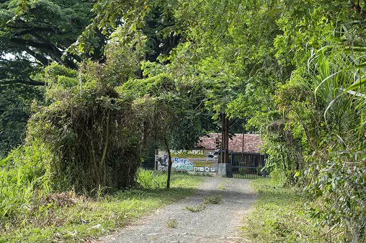
This town and its surroundings have gone through difficult situations of violence and armed conflict in the past. Today, ecotourism, cultural tourism, and community-based tourism are economic bets for the people of the region.

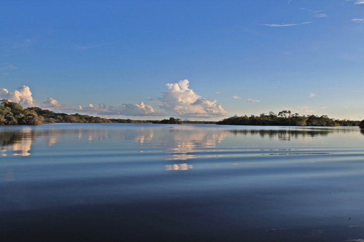
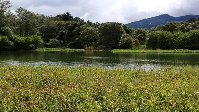
Ciénaga Magdalena is known as the “Ciudad Vanidosa” because it has an endless number of water mirrors around it that reflect its beauty from any point you look at it.

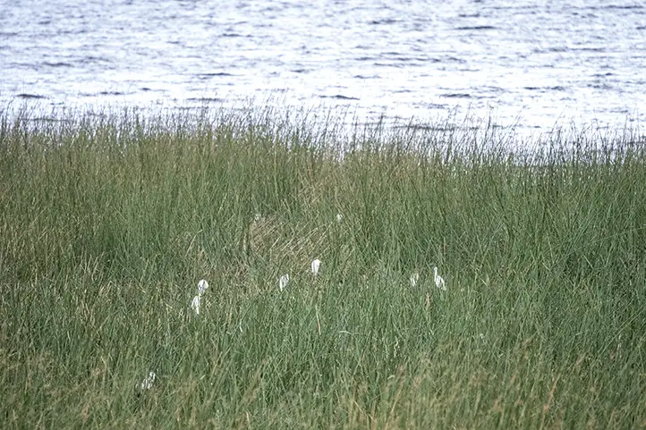
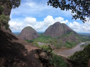
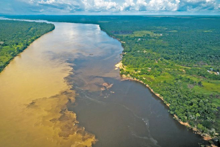
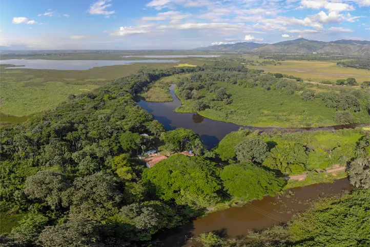
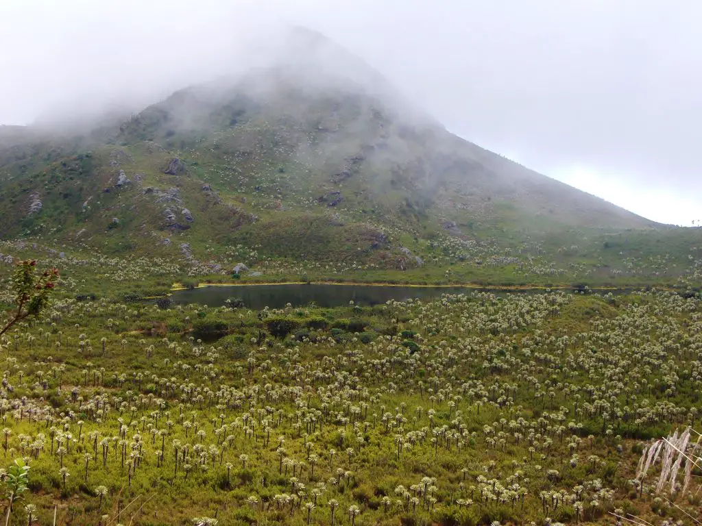
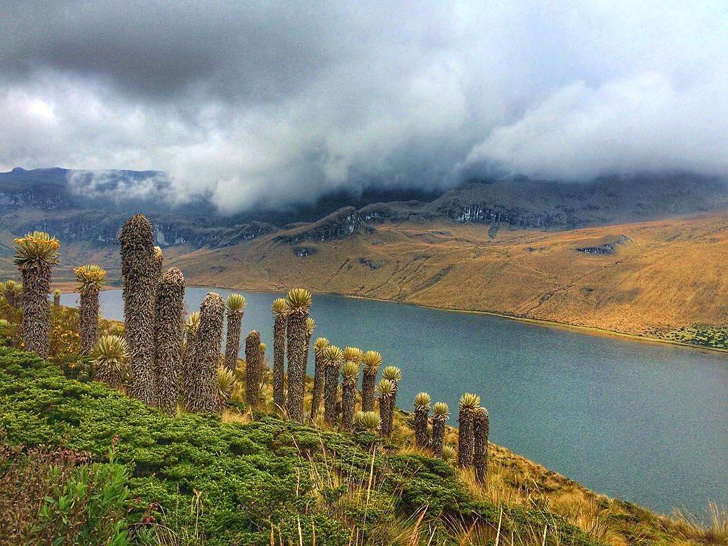
It is located in the department of Magdalena, 33 km from Santa Marta, on the shores of the Caribbean Sea, and next to the Sierra Nevada de Santa Marta, at the northeastern end of the Ciénaga Grande de Santa Marta, a Ramsar area of Colombia and one of the biosphere reserves present in Colombia.

Ciénaga is wealth in water, with reserves coming from the Caribbean Sea, the Ciénaga Grande de Santa Marta, the Toribío and Córdoba rivers. It also has the hot springs Volcano, located in the village of Cordobita, just ten minutes from Ciénaga, which is the only hot spring in the Caribbean region.

The average temperature in Cienaga is between 23 ºC (73ºF) to 35 ºC (95 ºF) and the best time of the year to visit Lórica for hot activities is from mid-December to the end of February.

How to get to Cienaga Magdalena

  • Bogotá – Santa Marta– Cienaga

Take a 1,5-hours flight from El Dorado (BOG) in Bogotá to Simón Bolivar International Airport (SMR) at Santa Marta city. Once at in Santa Marta you take an approximately 40 – minutes ride (33 Km) to Cienaga Magdalena.

  • Bogotá – Barranquilla – Cienaga

Take a 1.5 hour flight from El Dorado (BOG) in Bogotá to Ernesto Cortissoz International  Airport (BAQ) in the city of Barranquilla. Once in Barranquilla, it takes approximately 1,5 – hours (72 km) to Cienaga Magdalena.

Where to stay in Cienaga Magdalena

Ciénaga has a low hotel demand but we recommend the hotel: Casa D’remedios La Bella Hotel Boutique.

Thanks to its proximity to the city of Santa Marta we recommend these hotels in the city:

  • Hotel Nueva Granada,
  • Oasis Fresh Hotel,
  • Placita Vieja Hotel Boutique,
  • Hotel Boutique Don Pepe and
  • Hotel Santorini Casablanca Santa Marta.

Attractions and Activities in Ciénaga, Magdalena

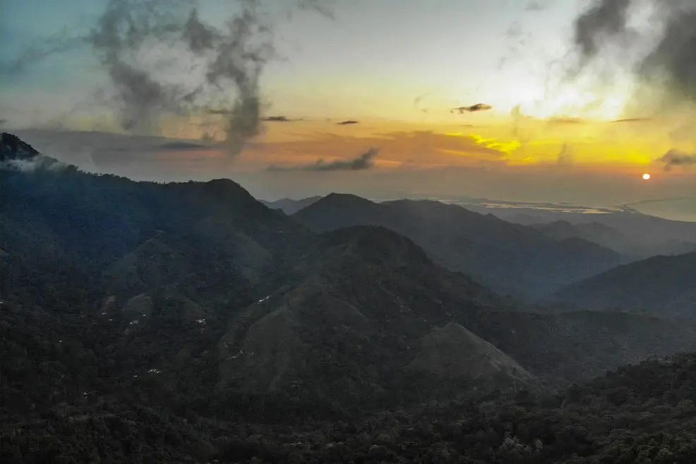
This beautiful town is a place where you can still breathe colonial air and where you can see the most beautiful landscapes due to its location at the foot of the Sierra Nevada de Santa Marta.

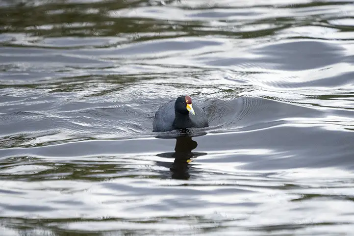
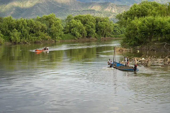
Visit the Cienaga Grande, Biosphere Reserve of Humanity 

Ciénaga del Magdalena - Sierra Nevada de Santa Marta
Ciénaga del Magdalena view from Sierra Nevada de Santa Marta

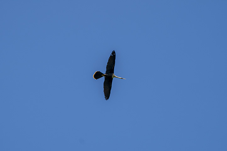
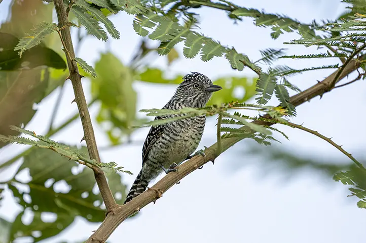
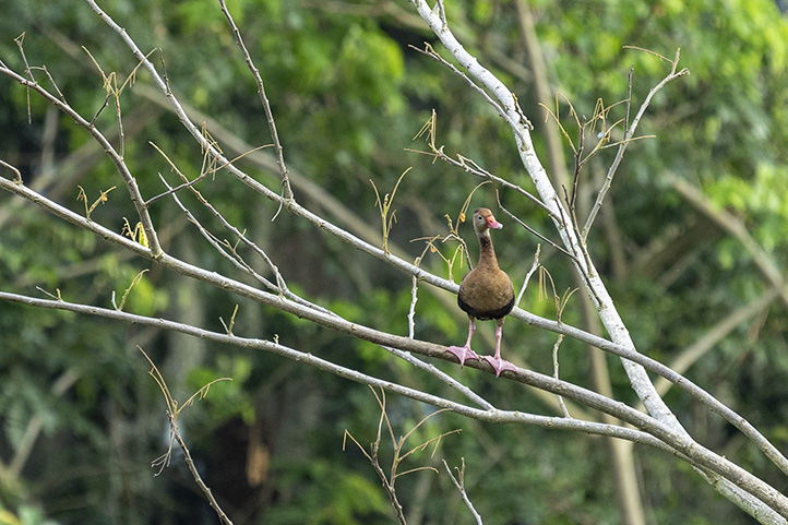
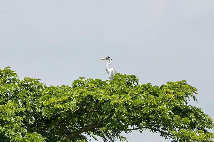
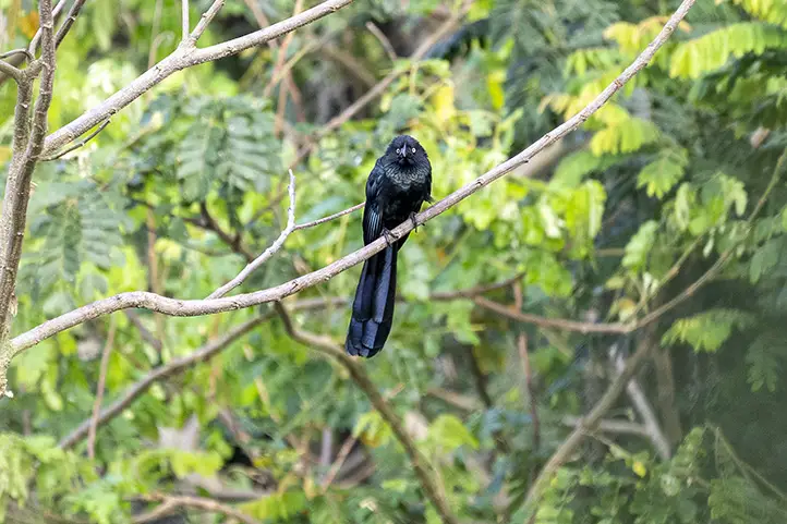
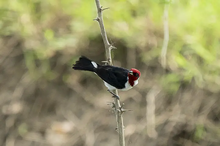
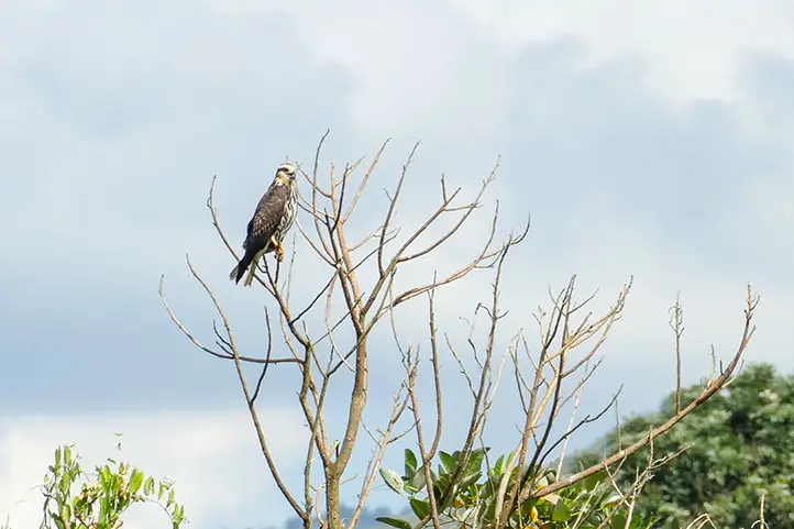
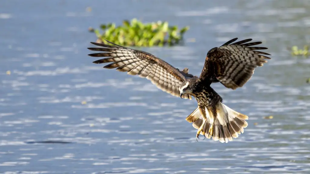
It is possible to enjoy this beauty, thanks to a tour called The Tour of Nature, which allows you to visit all the rivers that are tributaries of the swamp complex which concentrates a large number of important species of flora and fauna.

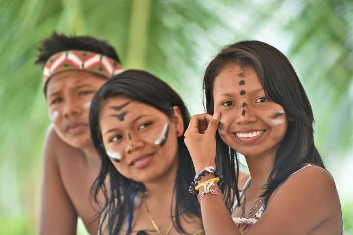
Visit the Palafito Villages of the Ciénaga Grande

Here you will experience a cultural exchange with fishing communities on a trip that includes land and boat transportation. The palafito villages of the Ciénaga Grande de Santa Marta have colorful wooden houses, and canoes are a vital part of the landscape.

Nueva Venecia, Buenavista and Trojas de Cataca are the only palafit towns in Colombia. Their streets are made of water and can only be moved by canoe, the only bridge that exists connects the school and the church.

Nueva Venecia

It is a magical town on the water, where you can discover a different reality in the country, with a surprising lifestyle. To get there you must do it by the river, it takes approximately 2 hours from the point of Tasajera.

Walking through its streets in canoes you will be able to explore and get to know a new reality. This place has an infinity of species in flora and fauna; it has its own Flora and Fauna Sanctuary, a magical place to connect with nature.

Nueva Venecia is completely fluvial, amphibious, and palafitic. To cross the town, visit neighbors, go to the store or to the police station, you must necessarily go by canoe.

Cultural and Architecture Places

Ciénaga, Magdalena, Colombia. Photo by Edgardo Perez Diaz, CC BY-SA 4.0

Historic Center of Ciénaga

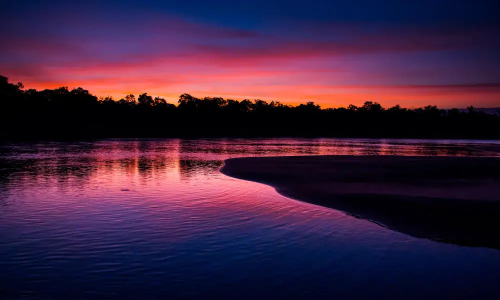
Touring the historic center is to marvel at the magical realism that inspired the Nobel Prize winner in literature to recreate Macondo, the splendor of its buildings, there are also corners and moments taken as if from a book. You can enjoy sunsets with shades of yellow, red, and orange painted in the sky.

The Santa Cruz de Papar Farm

This is one of the places you can’t miss, it will transport you to colonial times thanks to its architecture. It was a hacienda where sugar was planted and alcohol was produced for export.
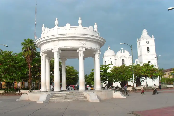
Centenario Square

This square has an ecclesiastical style, giving it the shape of an eight-pointed star, designed by the French architect Eduardo Carpentie. You will also be able to appreciate four water fountains, donated by the Italian colony, bordering this square.

San Juan Bautista Church

It was built in 1612 at the request of the indigenous people of Ciénaga to the representatives of the Spanish crown. The walls of this church have stucco murals. According to historians, its construction lasted several decades, due to the multiple battles that plagued the town.

Municipal Palace

It has a republican style, it was built in four stages. Its plans were designed by the firm Parrish of Barranquilla. What stands out the most is its tones have varied between a strong yellow and white, color that is already established for the buildings that are the heritage of the country. What will impress you the most are its arches, wooden doors, and floor.

Ruins “Casa del Diablo”

It is a corner mansion with two floors and republican style, white facade with 14 Roman columns and crowned by a pediment with zither shapes, built by Manuel Varela.

Its name is due to the fact that the inhabitants of Cienaga say that every year Manuel Varela sacrificed a worker from his banana plantation to Satan as payment for the prosperity granted to him.

Despite being a possible myth, other versions speak of some 300 dead, and some estimate that there were thousands, a tragedy that remained in the history of Colombia as “The Massacre of the Banana Plantations”.

Gabriel García Márquez was also tempted by this myth and therefore also referred to this event, unreal or not, in his book One Hundred Years of Solitude.

References
About the Authors

Sara Colmenares

The current director of Sula. Doctor in Biological Sciences. Her main interests are to explore and understand the organism-environment interactions, taking advantage of emerging knowledge for the management and conservation of species and ecosystem services. She is currently working as a consultant in functional ecology, ecosystem services, and conservation projects in Colombia related to ecotourism and birdwatching.

Luisa Martin

Engineer, world traveler, amateur photographer, traveling blogger, and foody.

Visit the Smallest Protected Area in Colombia: Isla de la Corota Flora Sanctuary

The Isla de la Corota Flora Sanctuary, which from a distance looks like the shell of a large turtle about to emerge from the water, is located in the north of Lake Guamués or Laguna de la Cocha, in the department of Nariño in southwestern Colombia. It is a beautiful island full of orchids as nowhere in the whole in the country.

In this publication you will find the information and recommendations you need for your visit to the smallest protected area in Colombia.

Discovering Isla de la Corota Flora and Fauna Sanctuary

La Cocha Lagoon, where is placed Isla de la Corota, is a wetland of international importance declared by the Ramsar Convention, for more information about RAMSAR sites in Colombia click here. The lagoon was formed by tectonic movements and later filled with water from the paramos and surrounding areas. Placed in the middle is Isla de la Corota island, formed million of years ago by volcanic activity, standing out as an immense tortoise shell.

La Cocha Lagoon is the second largest in Colombia and one of the largest in the Andes. Learn more about the lagoons and lakes of Colombia in our entry Top 11 Lakes of Colombia: From the Andes to the Amazon.

Isla de la Corota has a total area of just 0.16 km² and is part of the jurisdiction of the municipality of Pasto, the capital city of Nariño, located in the town El Encano, where El Puerto is located, a picturesque pier surrounded by lodgings and restaurants whose specialty is the preparation of rainbow trout.

The sanctuary is part of the Andean insular lacustrine forest ecosystem, which leads to the formation of a very humid forest and its thermal floor is also very cold, which is why there is constant rainfall in this sector. The oval island is surrounded by a fringe of reeds (Schoenoplectus californicus) and although it is the smallest protected area in the country, it is part of the important and complex environmental system of the Cocha Lagoon.

Cultural Importance of Isla de la Corota

Isla de la Corota is the smallest protected area in the country, for being a wetland of great importance, it is part of the complex environmental system of the Laguna de la Cocha. Its recognition is not only due to its natural value, but also to its cultural and historical value for the indigenous people and traditional doctors.

The island is a source of energy recognized by Putumayo’s indigenous people and traditional doctors. It also has a chapel that is an important pilgrimage site for Catholics, especially during the Feast of the Virgin of Lourdes.

How to get to Isla de la Corota Flora and Fauna Sanctuary

Bogotá – Pasto

Take a 1,5-hours flight from Bogotá to Antonio Nariño Airport (PSO) at Pasto city. Once at the airport, take an approximately 2-hours ride to El Encano Town. At El Encano take an extra 20- minutes boat ride to Isla de la Corota Flora Sanctuary.

What to do in Isla de la Corota Flora and Fauna Sanctuary

You can take a boat tour through the waters of La Cocha, and enjoy hiking and birdwatching activities. Enjoy the nature that embellishes this place. Once there, you will find the Sanctuary has a 500-meter long trail that crosses it from side to side through the dense forest. You will find typical trees of the Andean forest, as well as orchids and ferns that complete a beautiful natural picture.

Hiking

For hiking lovers, this Sanctuary has the El Quiche Trail (550 m, medium difficulty) that crosses the island from north to south through a dense forest of cold thermal floor, and the La Torota Trail (200 m, low difficulty), which allows observing the aquatic ecosystem with its diverse species.

El Quiche trail

It has a distance of 500 meters of medium intensity, where you can tour the island from north to south and visit the beautiful viewpoint where you can appreciate the beauty and immensity of the Laguna La Cocha along with the sounds of birds.

La Totora Trail

This trail has 200 meters of low intensity, where you can appreciate the aquatic ecosystem as well as visit the sanctuary’s resident and migratory bird sanctuary. Totora refers to the reeds (Schoenoplectus californicus) that surround Isla de la Corota Sanctuary

Fringe of reeds (Schoenoplectus californicus) around Isla de la Corota Sanctuary

Sanctuary of the Virgin of Lourdes

On the island there is also a Sanctuary of the Virgin of Lourdes, where devotees go to pray and serves as gathering for thousands of believers that annually come to pay their respect to the Virgin.

Birdwatching and Wildlife Observation

Despite the sanctuary’s size, it has an important presence of birds. There is a variety of species that live there, such as sparrows, cockatoos, and blackbirds, among others. There also inhabit three species of bats and one species of wild mice. The sanctuary has a record of 77 bird species, 22 of which are aquatic species and the remaining 55 are terrestrial.

Slate-colored Coot – Fulica ardesiaca at La Cocha Lagoon

Also, depending on the season in which you visit the sanctuary, you will be able to see migratory birds.

You will also find a great variety of butterflies and 8 species of amphibians belonging to the Pristimantis genus.

Orchids Tour

Moreover, the sanctuary has 341 species of flora belonging to 87 families, including bromeliads, anthuriums, ferns, mosses, lichens, and orchids. In the case of orchids there are 36 species that can be seen on your tour.

Where to stay in Isla de la Corota Flora and Fauna Sanctuary

Around La Cocha lagoon it is possible to stay according to your preferences. Available accommodation options include the  Sindamanoy Hotel, In Vereda El Puerto, 370 meters from the sanctuary’s shore, with a Swiss architecture offering single and multiple accommodations.

Best time to visit Isla de la Corota Flora Sanctuary

The sanctuary can be visited all year round, but since it is a cold climate it can rain almost every month. July to September is when it rains the least, with an average temperature of 14º C (57 ºF).

Isla de la Corota Flora Sanctuary Entrance fees

The entrance fee varies depending on the nationality and age of the visitors. The transportation service from El Puerto has a cost of $35.000 round trip in handmade boats.

These are the entrance fees for 2021:

  • Colombians, foreigners holding valid residence permits and tourists from Bolivia, Ecuador and Peru (ages 5 to 25): COP 5,500.
  • Colombians, foreigners holding valid residence permits and tourists from Bolivia, Ecuador and Peru (over 25 years old): COP 5,500.
  • Non-resident foreigners (over 5 years old): COP 10,500.
  • Children under 5 years old and Colombians over 65 years old have free entrance presenting their IDs.

What to consider before visiting Isla de la Corota Flora and Fauna Sanctuary

  • Wear warm clothes, gloves and scarf, comfortable shoes, preferably closed, tennis shoes or boots without high heels for the El Quiche trail.
  • Avoid consuming food or beverages of any kind during the tour on the trail.
  • The use of electronic devices that produce noise and disturb the tranquility of the place is prohibited.
  • Since the La Totora trail also serves as a dock for visitors to disembark, it is very important to be careful with children during the tour since there are only handrails on the inner side of the trail.
  • Be careful with personal objects (bags, clothes, cell phones, cameras, etc.); the administration is not responsible for objects left in the protected area.
  • Only walk along the marked trails; going into the forest causes impacts that go against the conservation objectives.
  • The entrance of pets or domestic animals (dogs, cats, etc.) is prohibited because of their natural behavior, they create impacts on the little fauna in the forest, we recommend looking for alternatives to not include them in your visit.

Some prohibitions

Feeding, bothering or hunting animals, alcoholic drinks and drugs, throwing cigarette butts, burning garbage, felling, and capturing wildlife.

References
  • Castro J, Jojoa R, Delgado D, Villarreal M F (2020). Avistamiento de aves en el Santuario de Flora Isla de la Corota. Parques Nacionales Naturales de Colombia. Occurrence dataset https://doi.org/10.15472/xyzi2q accessed via GBIF.org on 2021-06-30.
  • Parque Nacionales Website
  • SITUR Nariño
About the authors

Sara Colmenares

The current director of Sula. Doctor in Biological Sciences. Her main interests are to explore and understand the organism-environment interactions, taking advantage of emerging knowledge for the management and conservation of species and ecosystem services. She is currently working as a consultant in functional ecology, ecosystem services, and conservation projects in Colombia related to ecotourism and birdwatching.

Luisa Martin

Engineer, world traveler, amateur photographer, traveling blogger, and foody.

Ultimate Guide to Visit Guainía: Jungle, Rivers and Astounding Views

Two events have consolidated Guainía in the minds of travelers, the first, the signing of the peace agreement and the second, the launch of the Ciro Guerra’s film The Embrace of the Serpent (El Abrazo de la Serpiente), winner of multiple awards around the world.

Guainía

Guainía in the Yuri language means “Land of many waters”. Its capital is Inírida, and it is located in the east of the country. The temperature of the region oscillates between 25 and 30 degrees centigrade.

Most of its territory is made up of flat extensions, although there are some elevations, mainly the so-called tepuis, which are remnants of the Guiana shield, the oldest mountainous formation on the planet.

The most famous hills are the Mavecure, but there are others hills and mountains like the so-called Aracuari, Canapiari, Guasacavi, Mavicure, Pajarito, Rana, Salvaje, Sáquiras, Sardinas, and the mountains of Caranacoa and Naquén, with heights slightly above 500 meters above sea level.

In the past this was a region afflicted by armed conflict and violence, but this situation is now in the past and the community has found in tourism an opportunity for life.

Communication Routes and Transportation in Guainía

In the department of Guainía, the main communication route is the rivers, which are the road axes of access. Roads are scarce and only passable in the dry months.

It is also important the air transport. There are two airports located in Inírida and in the town of Barranco Minas. 

Tourism in Guainía

In Guainía one of the main attractions is its people, whose population is mostly composed of indigenous people (65%), who come from almost 30 different communities and belong to ethnic groups such as the puinave, curripaco, tukano, wanano, desano, piratapuyo, piapoco and yeral.

Guainía’s people

Other attractions are the Cerros de Mavecure, the Las Brujas lagoon, the Sapuara stream and the fluvial star. You can also find the Puinawai National Natural Reserve; the Pavón, Payara and Matevení Lakes, which together with the Inírida River, are destinations where you can practice water sports and sport fishing.

How to get to Guainía

You have to arrive by plane from Bogota to Puerto Inirida. The distance in straight line from Bogota is 720 Km, and it translates into 1 hour 10 min of flight.


It is recommended that you stay at least 4 days in the region to enjoy this majestic and sacred place.

In Inirida you can find several hotel offers, and all trips are made to and from the city by boat on the Inirida River and its tributary streams.

Below you will find the best destinations in Guainía.

Guainía Destinations

The Mavecure or Mavicure Hills

The Mavecure Hills are part of what we know today as deep Colombia. Embedded in the Amazon, they have become one of the most emblematic tourist destinations in Colombia.

In a study published about Ciro Guerra’s El Abrazo de la Serpiente, the Hills of Mavecure and surrounds are described as a landscape of enormousness, limitlessness, extraordinariness, and grandeur.

Mavecure Hills – Picture courtesy by Andrés Rodríguez, local indigenous guide.

The hills of Mavicure are three hours away from Puerto Inírida, the capital of Guainía. There are three tepuis called Mavicure, Mono and Pajarito that serve as an impressive viewpoint to the Guainía’s jungles.

From the top of the hills you can appreciate large extensions of jungle inhabited by indigenous communities such as the Puinaves and Curripacos.

According to Puinave Tomás Corda Medina, a native of the Barranco Tigre community, in an interview for a national newspaper:

“in the curripaco language, Mavecure comes from the words ‘mavi’, which is a palm used to make different utensils, and from ‘cure’, a poison that the ancestors took from a tree and put on the tips of their arrows for hunting with blowpipes.”

It is said that the hills were considered a magical space where humans could communicate with their gods.

The hills of Mavecure are 55 kilometers west of this city. To reach them you must take a speedboat that takes about 2 hours to travel the 55 kilometers through the Inírida River.

Climbing the Mavecure Hills

After arrival, you will have to spend the night in the El Remanso or in the El Venado indigenous communities placed at the foot of the hills.

You will need a guide to accompany you to the highest part of the hills, along the only trail suitable for walking and which does not require climbing equipment.

To reach the viewpoint, at 250 meters high, the only conditions are imposed by the weather and your physical condition. You must watch every step, and always go with a certified guide.

It is recommended to go up at a sunny moment. This is because, when it rains, the stone ground becomes slippery, and the slope makes the water run forming strong currents on the way down, which makes it very dangerous.

Once at the top you can see Pajarito and Mono; on their skirts you can see the dark green of a jungle that hides anteaters, water dogs, armadillos, limpets, chigüiros, tapirs, deer and tigers. In the distance, there are the caños that the river Inírida bathes, and other fluvial courses.

Mavecure Hills – Picture courtesy by Andrés Rodríguez, local indigenous guide.

The activities that you can do in the Mavicure Hills are bird watching, hiking, photography, and nocturnal fish watching on the banks of the Inírida River where you can see rays, guaracus, palometas, agujones and cuchas.

Find more details about Mavecure in our entry 5 Things you Should Know Before Visiting the Mavecure Hills in Colombia.

Las Brujas Lagoon

The Laguna de Brujas or Chalchuapa (in the language of the natives) is defined by the locals as an oasis of peace. It is a quiet place where you can escape to feel the sounds of birds and nature in all its splendor.

Situated 10 minutes by boat from Puerto Inírida, you will feel overwhelmed by the beauty of the surrounding forest. Laguna de las Brujas is announced as the preferred habitat of the pink dolphins.

Las Brujas Lagoon © Toninas Tours

A variety of stories are told among the natives, such as the legend of the “Pink Dolphin” which tells that spiritual leaders arrived there to talk to the pink dolphins about the future of the Amazon and its communities.

Others say that it was named after a legend about some witches who stole the water from another place known as “Hoyos de la caldera” (boiler holes), but during the trip they dropped the water in the air, forming the Brujas Lagoon.

The truth is that, regardless of their origins, tourists and locals can take tours through this splendid landscape in canoes, accompanied by an indigenous guide.

Caño Bocón

It is the paradise of fishing. Bocón is one of the main tributaries to the Inírida River. It is bordered by jungle.

This river is located in the territory of the Puinave ethnic community, thanks to which the river, and its lagoons, with its Peacock Bass and the large Payaras that live in it, are cared for and watched over.

Caño Bocón ©adsfishingconcept

Thanks to an agreement with the Puinave, fishing is allowed for a maximum group of 10 people, you will not see anyone else in fishing action during your week.

The fishing is fast and abundant: Peacocks, Payaras, Catfish, Palometas, Bocones, Morocotos, etc.

Viejita Lagoon

Another paradise for fishing in Colombia. Downstream from Puerto Inírida, where the river delivers its waters to the Guaviare.

After two hours of navigation towards the east, you can leave the river and walk around 15 minutes through the jungle until you reach the Viejita lagoon.

On a floating raft you go around the lagoon completely. From the raft you will witness epic sunsets and landscapes.

The Fluvial Star of Inírida (Estrella fluvial del Sur)

This is a must see in Colombia. This is a place where the rivers Guaviare, Atabapo and Inírida converge and swell the Orinoco River, one of the longest rivers in south American, and one of the top five largest rivers in the world.

Estrella fluvial del Sur, with its many rivers and lagoons, has been declared as a Ramsar Territory in 2014. This gave it recognition as a wetland of international importance, whose ecological and social value transcends the borders of a single country and benefits humanity.

The declaration of the Inírida River Star demand research efforts and substantial investments to safeguard the ecological integrity of the area. Ecotourism  appears as a sustainable practice and activity compatible with the rational use promoted by the Ramsar Convention.

Estrella Fluvial del Sur ©El Espectador

Estrella Fluvial del Sur Facts

  • The River Star is home to 34% of Colombia’s wealth in freshwater fish species.
  • Colombia has the second largest number of freshwater fish species in the world. 
  • The River Star is home to 70% of the known avifauna in Eastern Orinoco, 476 species of birds, two of which are exclusive to the place.
  • In the Inírida River Star there are 903 species of plants, 200 of mammals and 40 of amphibians.
  • The otter, the jaguar and the pink dolphin, present in the Fluvial Star, are in critical danger.
  • In the area there are two indigenous peoples, Puinave and Curripaco, five resguardos and 15 communities that inhabit them, who support and legitimize the decision of the declaration as a Ramsar territory.

The Flower of the Inírida

It is an endemic plant of Guainía that grows in humid savannas and whose petals are red tips. Technically, the flower of the Inirida is two species of monocotyledonous herbs belonging to the family Rapateaceae. Both species are endemic to white-sanded savannas, with extremely poor, precarious soil conditions that are hostile to any plant.

Flowers of Inírida, winter Guacamaya superba, and summer Schoenocephalium teretifolium.

There are winter and summer ones and one is bigger than the other. The Winter Flower of Inírida (Guacamaya superba), the bigger one, blooms mainly during the rainy season in the region (June – October). On the other hand the Flower Summer of Inírida (Schoenocephalium teretifolium) blooms mainly during the season of drought (December – March).

Guainianos love and protect it and travelers admire it. It can be seen in all its magnificence in the savannahs on the way to Caño Bitina. During the flowering season, the savannah is dyed red because of the abundance of flowers.

Alto de Caño Mina

The Raudal Alto de Caño Mina, one of the tributaries of the Inírida River, is one of the most overwhelming in the Colombian Amazon.

This is one of the most emblematic destinations of this Secret Colombia. It has has a 15-meter waterfall of black, red and yellow waters. Its color is produced due to a great load of tannins it has. 

It is necessary to go up the Inírida River for two days. Then you leave the Inírida River and enter through the Caño Mina.

Other Plans in Guainía

Ancestral writings (Coco Viejo Indigenous Community)

  • Explanation of the ancestral writings by an interpreter of the Curripaco people and field trip where you will have contact with these writings.
  • Know the petroglyphs.
  • Typical gastronomy of the communities.
  • Wooden handicrafts, natural fiber weaving, ceramics.

Visit ndigenous communities of Caño Vitina, Sabanitas, Guamal, Concordia.

  • Experiential tourism.
  • Ecological Tourism.
  • Ecological Walk.
  • Bird watching.
  • Typical gastronomy of the communities.
  • Wooden handicrafts, natural fiber weaving, ceramics.

Caño San Joaquín

  • Sport Fishing.
  • Ecological Tourism.
  • Ecological Walk.
  • Bird watching.

Raudales de Zamuro and Cualet

  • Sport Fishing.
  • Ecological Tourism.
  • Ecological Walk.
  • Bird watching.
  • Experiential tourism.
  • Typical gastronomy of the communities.
  • Wooden handicrafts, natural fiber weaving, ceramics

Wildlife observation

  • Toninas (pink dolphins) and bird watching. 
  • Visit the ornamental fish farms.

Water tourism and adventure

  • Practice water ports such as skiing, diving and sport fishing.
  • Camping or hammock nights.

Hiking and trekking

  • Hiking through the forest to the indigenous community of Venado.

Recommendations 

This is a trip to the jungle, so you have to be prepared for BASIC conditions of accommodation, food, transport etc. You will not find luxury things especially at night, because you will have to sleep in the community.

Additionally, take into account that the itinerary can vary according to the changes that the flights can have, the circumstances of the climate or unforeseen last minute.

Things you will need: 

  • Wear comfortable, light-colored and lightweight clothing, hopefully waterproof.
  • Bring hats or caps for protection from the sun and wear a long-sleeved shirt.
  • Wear hiking shoes, preferably waterproof, and extra tennis shoes.
  • Photo or video camera to not lose any detail of these beautiful landscapes.
  • Abundant hydration for the walks, sunscreen and repellent.
  • A raincoat to cover yourself in case it rains.
  • Small backpack for the daily walks.
  • Flashlight.
  • Sleepwear. It is recommended to take a light sleeping, at night it can be cold.
  • Personal hygiene equipment in small quantities.
  • Tape, micropore and anti-irritation creams.
  • Camping equipment (tent, mattress) or hammock with ropes and tarp, depending on your preference for the first night.
  • Swimwear.

If you want to know more about the most incredible natural destinations in Colombia, plan your trip with us!

References
About the author

Sara Colmenares

Current director of Sula. Doctor in Biological Sciences. Her main interests are to explore and understand the organism – environment interactions, taking advantage of emerging knowledge for the management and conservation of species and ecosystem services. She is currently working as a consultant in functional ecology, ecosystem services and conservation projects in Colombia related to ecotourism and birdwatching.

Top Wetland Destination in Valle del Cauca for Birding: Laguna de Sonso

Laguna de Sonso is a lake, and it is one of the most important ecosystems in the department of Valle del Cauca. Since 1987 it is a nature reserve that covers 2,045 hectares. Of this area, 745 hectares are in the lagoon zone and 1,300 hectares correspond to the buffer zone.

In 2018 we were with Juancho getting to know the Laguna de Sonso. Juancho told us about many places that you can visit in Valle del Cauca to see incredible, unique and beautiful birds of the Colombian western Andes and the Pacific. On this trip we were with his father Luis Eduardo Camacho, a guide specialized in bird watching in Valle del Cauca, and with our friends from the Hotel La Huerta, which is just 30 minutes by car far from Laguna de Sonso.

Visit our Youtube Channel for more videos!

Ecological Importance of Sonso Lake

Laguna de Sonso is associated to a complex of 24 wetlands of the Upper Cauca River, and is inserted into the Tropical Dry Forest ecosystem.

This place is a biological corridor that favors the migration of species between the Central and Western Andean mountain ranges of Colombia, and also receives boreal migratory birds. At the same time, it is a refuge for local resident species, not only birds, but also plants and animals.

According to Ramsar Sites Information Service, 39 species of plants are registered in this place, from which 25 present some category of threat. There are also 186 species of birds and 5 species of endemic fish: the boquiancha (Genycharax tarpon); the roño (Callichthys fabricioi); the micudo (Pimelodella macrocephala); and two sardines (Hyphessobrycon poecilioides and Gephyrocharax caucanus). It also has 24 species of amphibians and reptiles, and 50 species of mammals.

Sonso is also an important source of food for nearby human communities, which have in this ecosystem their only source of income.

Laguna de Sonso, Valle del Cauca, Colombia

Until very recently, less than 5 years ago, this ecosystem was under a serious environmental crisis, exposed to continuous drainage to plant sugar cane. Also to the excessive input of organic matter from domestic and industrial waste, which contaminate the water.

Studies carried out by the National University of Colombia, showed that the Laguna de Sonso presents a high degree of contamination, product of human activities, which has led this area not suitable for primary contact such as swimming, nor is it secondary as in the case of nautical activities.

As a result of community action and government efforts, this wetland was declared a Wetland of International Importance in 2017, meeting the requirements of the Convention on Wetlands (Ramsar).

With the international category, the activity of bird watching appears as a sustainable option for the conservation of the lake and its wetlands, and as a source of economic resources for the local community. Laguna de Sonso also offers environmental education and research facilities.

Birdwatching at Laguna de Sonso

“Buitre de Ciénaga” Environmental Education Center,

In Laguna Sonso is the “Buitre de Ciénaga” Environmental Education Center, whose name celebrates the Horned Screamer. The environmental education center offers the visitor an auditorium, and toilet services.

There is a land tour around the lagoon to observe birds of the swamp and beach area. It is also possible to do kayak or boat trips on the lake. The reserve has an observation tower on the Mata Zarza peninsula, a forest on the eastern side of the lagoon and a panoramic viewpoint over the Cauca River on the western side.

For bird watching, the entrance to the center starts at 6:00 a.m. Birding guide services are offered by local communities and have a cost associated with the size of the group and the time dedicated to the experience.

Depending on the environmental conditions, up to 60 species of birds can be observed in one morning. There are different trails, and species associated with aquatic and marsh systems, such as forest species, can be observed.

The possibilities of photography are moderate, considering that there may be a lot of cloudiness, increasing the contrast in white background.

Checklist of Laguna de Sonso. Here there are some of the birds we saw when we visited Laguna de Sonso:

Anhinga Anhinga anhinga
Bar-crested Antshrike Thamnophilus multistriatus
Black-bellied Whistling-Duck Dendrocygna autumnalis
Cocoi Heron Ardea cocoi
Greater Ani Crotophaga major
Masked Cardinal Paroaria nigrogenis
Snail Kite Rostrhamus sociabilis juvenile

How to get to Laguna de Sonso

Laguna de Sonso Wetland Complex

The Laguna de Sonso or Laguna del Chircal is a body of water located in the department of Valle del Cauca, Colombia, about 65 kilometers north of the city of Santiago de Cali. It covers 14.1 square kilometers among the municipalities of Buga, Yotoco and Guacarí, on the right bank of the Cauca River.

To get there you must drive on the Buga-Mediacanoa road, and 250 meters before crossing the Cauca River, you must turn left on an open road at the site called Puerto Bertín, 1.5 km away is the Buitre de Ciénaga Environmental Center.

Recommendations

  • Wear a hat,
  • use comfortable clothes,
  • use waterpfof shoes,
  • take sunscreen,
  • take insect repellent.


References

  • El Tiempo. 2017. La Laguna de Sonso ahora tiene sello internacional ‘Ramsar’.
  • Revista Semana. 2019. Laguna de Sonso, en el Valle, presenta altos niveles de contaminación.
  • Ramsar Sites Information Service.
  • cvc.gov.co 

About the author

Sara Colmenares

Current director of Sula. Doctor in Biological Sciences. Her main interests are to explore and understand the organism – environment interactions, taking advantage of emerging knowledge for the management and conservation of species and ecosystem services. She is currently working as a consultant in functional ecology, ecosystem services and conservation projects in Colombia related to ecotourism and birdwatching.

Wetland Destinations in Colombia: Ramsar Areas of Colombia

What is a Wetland?

Wetlands are low-lying areas of land where water settles, gathers, and stays at or near the surface of the soil. They are kind of an “in-between” place for water. According to NOAA, there are five general types of wetlands: marine (ocean), estuarine (estuary), riverine (river), lacustrine (lake), and palustrine (marsh). Among them we can find those that we know and name as “marshes, estuaries, mangroves, mudflats, mires, ponds, fens, swamps, deltas, coral reefs, billabongs, lagoons, shallow seas, bogs, lakes, floodplains…” It depends on soil, topography, climate, water chemistry, and vegetation. But know the difference: if water runs off, then it’s just regular old land, but if the water is too deep then it might be a pond or a lake, or the sea, although many wetlands are associated with the latter.

Benefits of Wetlands

Wetlands come with some really great benefits: they collect flood water, help stem its flow, and it slowly releases it, so it doesn’t do so much damage, providing flood and erosion control. In fact, for this very reason, people who convert wetlands for human use are now required to offset their impact with water retention systems, at least in the USA.

Wetlands are also a great nursery for wildlife. Many of the threatened and endangered species depend on wetlands for survival in the early stages of their life, or during migration in the case of birds. Wetlands also play a huge role as filters of water. Within wetlands live lots of bacteria and other microorganisms that are continually breaking down matter. In addition to organic matter, wetlands absorb oil, nitrogen, phosphorus, sewage, sediments, and other pollutants before they reach rivers, lakes, and other water bodies.

Wetlands also offer several recreational activities like boating, hiking, sport fishing, nature photography, birdwatching, contemplation, among others.

Tourism in Wetlands

Wetlands, on a global scale, have offered significant opportunities for tourism and recreation, providing economic benefits to the governments, the tourism industry, the local communities, and the wetlands conservation itself (Ramsar and UNWTO, 2012).

It is estimated that half of all international tourists travel to wetlands, especially to the coast, and many wetlands are not just holiday destinations but are also tourist attractions themselves. Thus, tourism is an important and visible value provided by wetlands.

The integration of tourism in wetland conservation can be found globally. Examples are the Camargue Wetland in France, an epicenter for birdwatching in Europe, the Nabugabo Wetland in Uganda, the London Wetland Centre in the UK, the Danube Delta in Romania, or the Esteros de Iberá in Argentina with luxury accommodations such as the Rincón del Socorro reserve, among others.

The increased demands for tourism expansion have risen the alarm on the potential negative impacts on the health of wetlands. Although tourism in wetlands offers positive opportunities, it represents many challenges as well. Avoiding the direct impact of tourists on wetland ecosystems resulting from garbage accumulation, noise pollution, excessive trampling, disturbance of wild species, amongst others, is one of them. So, the necessity of a formally addressed wetland tourism with sustainable management is of huge importance. Wetlands bear recreational values and, if conserved and managed properly, they motivate visitors and generate resources needed for the development of local communities.

Wetlands in Danger

People who drain and fill wetlands have in mind they are rescuing land for more “useful purposes” like cropland, pastures, roads, homes, businesses, waterways, canals, and reservoirs. This thinking made the wetlands decrease in more than half of their territories in the last two centuries, becoming an endangered ecosystem.

Wetlands provide directly or indirectly almost all of the world’s freshwater consumption, and currently cover more than 12.1 million square kilometers, an area larger than Greenland. But only about 13-18% of them are included in the Ramsar List of Wetlands of International Importance and are protected.

Ramsar, or the International Convention on Wetlands, is the oldest international treaty on environmental protection. It was signed in 1971 in the Iranian city of Ramsar and came into force in 1975. It was ratified by 170 countries. Ramsar’s philosophy revolves around the concept of “wise use”, in which the conservation of wetlands, as well as their sustainable use and that of their resources, are at the heart of “wise use” for the benefit of humanity.

A Ramsar Site, or Wetland of International Importance, is a wetland area designated under the Ramsar Convention by the national government of a Member State. Currently, there are over 2,000 such sites covering over 192 million hectares: an impressive global network of wetlands that meet criteria related to their biodiversity and uniqueness.

Wetlands of Colombia

Colombia has about 31,702 wetlands, which are important as a source of fresh water, but only 13 have been declared as Ramsar sites. These are:

Map of Ramsar Places of Colombia. Orange dots represent their location. From https://rsis.ramsar.org/

According to the Bogotá Botanical Garden, it is estimated that about 87% of the Colombian population inhabits wetland areas. The relevance of wetlands, and water systems, in Colombia is so vast that there is even a book dedicated to it, Amphibian Colombia. A country of wetlands “which seeks to promote an acknowledgment and understanding of Colombia as an amphibian territory in which a great part of its geography and culture are directly associated with water”, says Humboldt Institute of Colombia.

Wetland tourism in Colombia

In Colombia, such natural areas are often taken for granted, and wetland tourism is not fully developed. We still need more projects that not only provide social and economic benefits to the communities but also support effective approaches to restore and conserve wetland ecosystems. Degradation of wetland areas is associated with their use for extraction of building materials, over-extraction of water, contamination by inappropriate waste disposal, and so on. The main threats to wetlands in Colombia are the expansion of the agricultural and livestock frontier, as well as illegal urbanization.

Ecotourism may play an important role in the conservation of these wetlands in Colombia, since by receiving an economic benefit through the provision of tourism services, local communities are motivated to care for these ecosystems. If you value wetlands make it a point to visit them and get involved in protecting them. Your visit adds economic value to these special places and helps to protect them for future generations.

In Colombia, you can visit any of the Ramsar places mentioned above. However, the most recommended places, due to their infrastructure and ease of visit, are:

  • Laguna de la Cocha (Nariño).
Laguna de la Cocha, picture by Sebastian David Martinez Canchala
  • Chingaza system (Cundinamarca).
Wetland System Chingaza National Park
  • Otún Lagoon (Risaralda).
Laguna del Otún Wetland
  • Sonso Lagoon (Valle del Cauca)

    Snail Kite – Rostrhamus sociabilis, juvenile., Gota de leche wetland, Valle del Cauca

  • Bita River Wetland Complex (Vichada)
Bita River Wetland Complex, picture by Jorge Garcia
Bogotá Wetland picture by Bogotá City Hall 

We’ll tell you more about these places in our next posts! Stay tuned!

If you want to know more about traveling to Colombia write us, leave us a comment, and visit our YouTube channel.

About the author

Sara Colmenares

Current director of Sula. Doctor in Biological Sciences. Her main interests are to explore and understand the organism – environment interactions, taking advantage of emerging knowledge for the management and conservation of species and ecosystem services. She is currently working as a consultant in functional ecology, ecosystem services and conservation projects in Colombia related to ecotourism and birdwatching.