Mongui is on the list of “Network of Colombian Heritage Villages“, being one of the most beautiful towns in the department of Boyacá, besides having a great history to tell its visitors in the middle of its cobblestone streets.
You will fall in love with its colonial and republican court buildings and the kindness of its inhabitants. Mongui has an average temperature between 8 ºC (46º F) and 16º (60º F), and it is located at an altitude between 2.923 and 3.854 meters above sea level.
In this guide, you will have the necessary information to visit this adorable town.
Discovering Mongui, Boyacá, Colombia
Mongui is located in the department of Boyaca, 3.5 hours (223 km) from Bogotá and 1.5 hours (88 km) from Tunja, the capital of the department.
In addition, Mongui has special geographic characteristics that favor a great variety of native fauna, flora, and soils throughout the municipality, and an important diverse biodiversity.
How to get to Mongui
To get to Mongui you must take a 3,5 -hours road trip (totaling 223 km) from Bogotá for until you reach Mongui; during your trip you will be able to appreciate the Cundiboyacence highlands.
Where to stay
In Mongui you will find numerous accommodation offerings for all budgets and personal tastes; our recommendation for is the Hotel Otti Colonial.
Ecotourism in Mongui, Boyacá
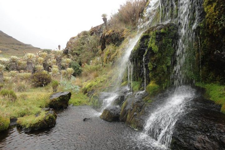
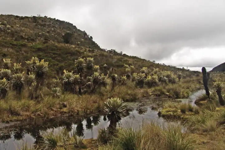
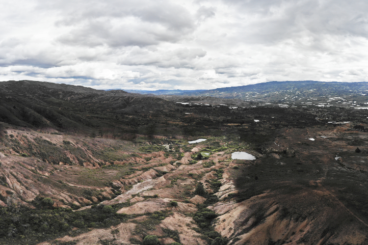
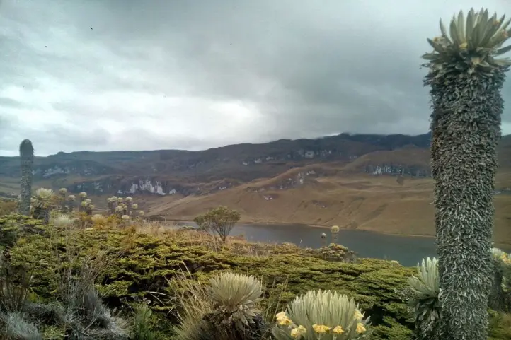
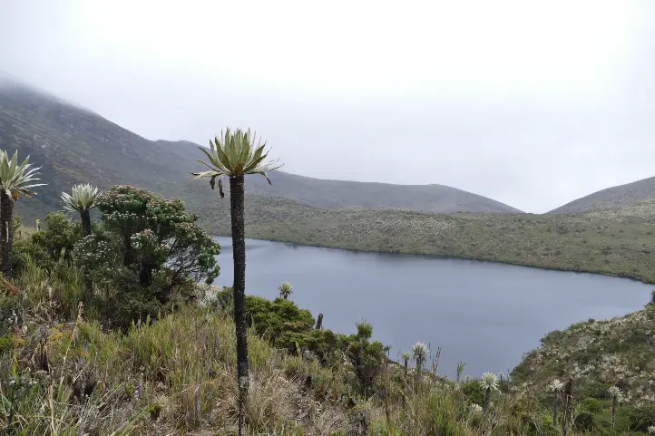
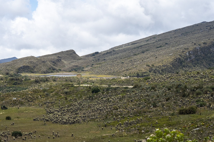
Ocetá Paramo
Ocetáparamo is considered one of the most beautiful in the world, this is because its valleys contain the largest number of species of paramo flora in Colombia.
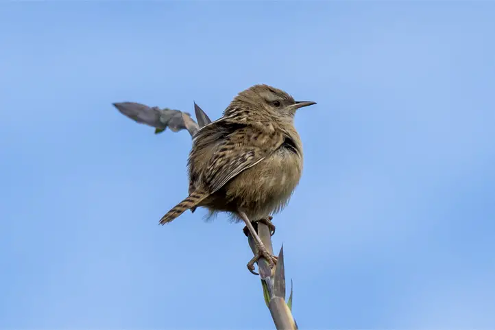
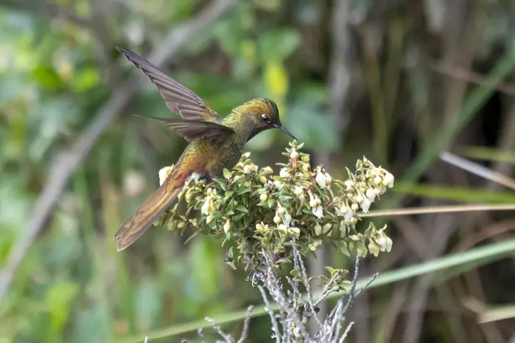
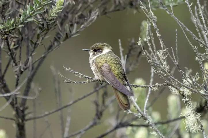
Among the most characteristic fauna that you will be able to appreciate are the lupines, senecios, white-tailed deer and the beautiful hummingbird chivito de páramo; without forgetting to enjoy the magical viewpoints that will take your breath away.
Páramo de Ocetá
Mongui is the closest town to the paramo, so you can dedicate a day of your visit to the town to visit this beautiful valley of Frailejones, where you can visit the Black Lagoon, the Boat, the City of stone and it is also possible to see fields of senecios. If you are lucky and the sky is clear, it is possible to see the Sierra Nevada del Cocuy.
To get to the paramo you can choose the option of walking for 3 hours or take the service of a 4X4 car, but it is essential that you take the guide service to safely enjoy the paramo while you learn about this beautiful place.
Rock climbing
On the outskirts of Mongui you can test your endurance to climb a rock, with a duration of 4 to 8 hours depending on the intensity you want to practice.
In the center of town you will find guides who can offer you this service.
Mountain biking
2 available routes start downtown and extend over 20 km and 40 km, where you will have an ascent up to 3650 meters above sea level at the highest point; on the way you will be able to appreciate the beautiful landscapes. The average time is 5 to 8 hours and it is advisable to start the tour in the morning.
Know the Cultural Patrimony of Mongui
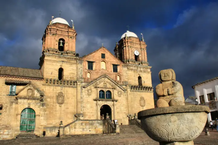
San Francisco Church, CC license
History of Balloons in Mongui
When Froilán Ladino was recruited in 1932 to render military service for Colombia in the war against Peru; when he was in Manaus he met Brazilian saddlers who were experts in the manufacture of leather balls; and two years later, when the war ended and he returned to Monguí, he joined his brother Manuel, to create his own tannery and to elaborate leather balls.
Froilán taught the craft of ball manufacturing to a group of twelve peasants who later became known as the “twelve apostles”. This activity was a new way to generate resources with an activity that could be combined with agriculture and cattle raising.
The Ladino company had its best period in the 1970s, when they were in charge of supplying demand throughout the country.
However, the boom in the entry of Chinese products in the 2000s caused a decline in the demand affecting domestic manufacturers like Ladino.
If you want to get more information and learn more historical data in the Ball Museum located in the village you will be able to learn.
Calicanto Colonial Bridge
The bridge was built by the Sanoha tribe in the XVII century over the Morro River, its name comes from the material with which it is made: calicanto, a glue made of a mixture of lime, sand, beef blood and molasses.
It represents a typical work of the Colonial era, after its construction was where the stones that were used to build the Basilica of Our Lady of Monguí were transported.
Basilica and cloister of Nuestra Señora de Monguí
This beautiful stone-built Basilica was finished during the seventeenth century and is considered cultural heritage of Colombia, besides being an architectural treasure of the department.
Its origin was a small chapel where the Franciscan missionaries met to evangelize the indigenous people who were in this region.
When you are in front of the front door you will be able to appreciate the coats of arms of the kingdoms of Aragon and Castile, as a symbol to remember the supremacy of Spain during the time in the region.
Franciscan Convent and Church
The Franciscan convent and church is located next to the Basilica, it has 2 floors and what you will appreciate most are the ceilings supported by Roman arches, at the entrance you will be able to appreciate a gigantic stone column in the form of a spiral of about 2.5 meters high.
Its construction took 100 years, since those responsible for its manufacture decided to devote the relevant time to each of the details; when you are walking inside the convent you will be able to see some paintings depicting scenes of Christianity, and some furniture used by the friars of the time.
Peasant for a day
Through sustainable tourism and the association of several farmers you can experience a day of a family in the sector; you can learn about morning activities, animal management techniques and the preparation of typical foods. This activity begins in the early morning and ends after lunch.
References
Network of Colombian Heritage Villages
Colombia Travel
About the author
Luisa Martin
Engineer, world traveler, amateur photographer, traveling blogger, and foody.
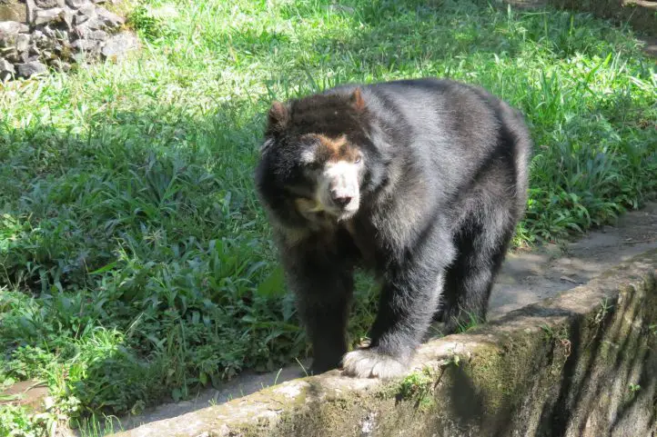
One of the smallest bear species, the Spectacled Bear or Andean Bear is recognized as the guardian of the Andes and gardener par excellence. We invite you to discover this species that inhabits the Colombian territory and other South American countries.
Spectacled bear Facts
South America: The spectacled bear or Andean bear (Tremarctos ornatus) is native to South America;
Endemic: It is the only species of bear that inhabits South America, and it is endemic to the tropical Andes.
Ancient: It has inhabited South America for more than five million years.
Last of its kind: It is the only living representative of the short-nosed bears, a group that inhabited only the American continent.
Big Territories: This bear needs large areas to be able to feed and look for mates.
Forest Engineer: The Andean bear has an efficient role as a seed disperser, making it fundamental for paramo and the Andean Forest.
Wide distribution: The spectacled bear is present in the forests of Venezuela, Ecuador, Peru, Bolivia, Argentina (in the northern forests) and Colombia (with presence in the 3 mountain ranges, in protected areas).
Highlander: They are able to live at altitudes of up to 4,750 meters above sea level and it is not normal for them to frequent altitudes below 2000 meters.
Bioindicator: the presence of Spectacled bears indicates the availability of water and that nearby forests are in perfect condition.
Characteristics of the Spectacled Bear
Spectacled Bear rescued at La Planada Nature Reserve. Its name is Arcoiris (Rainbow)
One of the most important characteristics is the presence of white fur around the eyes in a circular shape, making its shape like that of a pair of glasses. There are many specimens where this white fur extends to the chest.
The size, coloration and shape of these white spots are usually different in each individual and are characteristics that are often used for identification at this level. The rest of their body fur is dark brown or black.
They are a very small species of bear; adult males reach a size of 100 to 200 kilograms while adult female spectacled bears weigh only 30 to 85 kilograms.
It is a species that normally remains alone, only when the female is in mating season can be observed accompanied. Spectacled bears only remain with their mother until they are one and a half years old, after which they separate from the litter.
Spectacled bears reach sexual maturity between 4 and 7 years of age. It is known that they can mate at any time of the year, although the highest reproductive activity is registered in April and June. Usually a female gives birth to a litter of 2 cubs, but sometimes 3 cubs are born after a gestation period of 5.5-8.5 months.
It is not aggressive, you may be surprised to find a bear that by instinct will stand on two legs when it feels invaded in its space or confused by the intruder in its habitat, but it will not try to attack if it sees a distant and clueless individual.
Where to Find the Spectacled bear in Colombia
There are many places in Colombia where the Andean bear is distributed, but seeing it is a fortuitous event. The places where you can have more luck to see the Spectacled bear in Colombia are:
Natural National Park Chingaza
During hiking activities in the páramo it is possible to see Andean bears directly or indirectly. Also on the trails you may be able to see tracks on the ground, scratches on the trees, territory marking, bedding and feeding troughs.
Surroundings of the Natural National Park Las Orquideas
Since 2016 there is registration in this protected area of the bear, so that in the stipulated trails there is evidence of the presence of bears; on very few occasions visitors have been able to make a direct sighting; the park caretakers if they have had the opportunity to see families of bears.
El Verjón, Near Bogota
This is the first time that the spectacled bear has been seen so close to an urban area; last July. 2021, a surprising spectacled bear was seen walking in the Cerros Orientales of the city of Bogotá. The sighting of the animal was recorded in a security camera video.
Municipality of Íquira
In the buffer zone of the Cerro Banderas Ojo Blanco Regional Integrated Management District (DRMI) and Nevado del Huila National Natural Park, a male bear was spotted by camera traps. In the department of Huila there are other municipalities where records of this endangered species have been documented in Santa María, Garzón, Guadalupe, Neiva, Algeciras, Colombia, Palermo, Teruel, Pitalito and San Agustín.
Threats to the Spectacled Bear
Currently, human encroachment on the spectacled bear’s habitat has caused a high percentage of deforestation, due to the increase of the agricultural frontier, which has caused the bears to move to higher and higher areas in the mountain range.
The International Union for Conservation of Nature (IUCN) and the Ministry of Environment and Sustainable Development have catalogued the spectacled bear as a species vulnerable to extinction.
Biological Corridor in Colombia for the Spectacled Bear
When we talk about a biological corridor is habitat for different species of wildlife, this time we will tell you the one that has the spectacled bear, tremarctos ornatus by the southwest and west of the department of Antioquia. This corridor can be identified in the following municipalities:
Jardín – Tamesis ( 28061 ha).
Andes – Betania – Ciudad Bolivar ( Farallones del Citará 30875 ha)
Salgar – Betulia (Cuchilla cerro plateado alto San José 8900 ha)
Urrao (29870 ha)
Anzá- Caicedo – Santa Fe de Antioquia (10087 ha)
Las Orquideas NPP (32000 ha )
Frontino ( 30139 ha)
Abraqui – Cañas Gordas – Giraldo ( 6900)
Currently the department of Antioquia is promoting a project for the conservation of the spectacled bear corridor, promoting:
The restoration of the forests
The protection and monitoring of the species present.
Establishing limits of the biological corridor and monitoring compliance.
Controlling the expansion of the agricultural frontier.
Constant education of the community in the conservation and protection of the biological corridor.
Development of projects for sustainable agricultural practices.
Ecological importance and importance in cultural and nature tourism
In addition to its ecological importance, the Andean bear has also been an emblematic animal, involved in the development of many of the indigenous and peasant cultures in the Andean countries. For many it is sacred, for others the big brother of the human being. In the oral traditions of the peoples, the bear is found in legends, tales, songs and myths.
The Andean bear is reflected in the common names of some plants, such as “la mano de oso” (Oreopanax bogotensis) and “la hierba del oso” (Xerophyllum tenax).
It is also very common to find sites or places that receive their names honoring the Andean bear: Alto del Oso (Colombia), Cueva del Oso (Ecuador), Quebrada El Oso (Colombia, Peru, Venezuela), Vereda del Oso (Colombia), among others. Thus, the Andean bear is part of the cultural heritage and worldview of the countries of the Andean region.
Sandoval-Guillén, Pablo, & Yánez-Moretta, Patrício. (2019). Aspectos biológicos y ecológicos del oso de anteojos (Tremarctos Ornatus, Ursidae) en la zona andina de Ecuador y perspectivas para su conservación bajo el enfoque de especies paisaje. LA GRANJA. Revista de Ciencias de la Vida , 30(2), 19-27. https://doi.org/10.17163/lgr.n30.2019.02
About the author
Luisa Martin
Engineer, world traveler, amateur photographer, traveling blogger, and foody.
Sara Colmenares
The current director of Sula. Doctor in Biological Sciences. Her main interests are to explore and understand the organism-environment interactions, taking advantage of emerging knowledge for the management and conservation of species and ecosystem services. She is currently working as a consultant in functional ecology, ecosystem services, and conservation projects in Colombia related to ecotourism and birdwatching.
The lagoon where mankind supposedly originated, the ancient Muisca trails and a variety of ecosystems are some of the magical attractions to be discovered at Iguaque Flora and Fauna Sanctuary, a sacred place for the Muisca culture. The information below will be very useful for your visit to Iguaque in the Colombian Andes.
This sanctuary is located on the eastern mountain range between the departments of Boyacá and Santander, in the jurisdiction of the municipalities of Sáchica, Chíquiza, Villa de Leyva and Arcabuco, covering an area of 67.5 km².
Community Interaction with Iguaque
The communities on the periphery of the Sanctuary are mostly made up of farming families dedicated to cattle ranching and agriculture.
In the rural population, especially in Chíquiza, there is a deep rootedness for the Muisca Culture, indigenous people that inhabited the Cundi-boyacense highlands. The same is their rootedness for the natural environment that the Sanctuary offers, and they continue to venerate the Iguaque Lagoon, as a sacred natural element of their Muisca Culture.
Ecosystems You Can Know in Iguaque
The sanctuary has four different ecosystems: Páramo and subpáramo, Paramo wetlands, High Andean forest and Andean forest.
The lower limit of the páramo ecosystem is 3200 meters above sea level until it reaches 3800 masl. It is important to note that the structure of the páramo and subpáramo is very similar, mainly composed by grasslands, and the presence of Frailejones (Espeletia sp.).
Paramo wetlands
In the sanctuary you will see the following types of wetlands: lagoons, wet drains, and wet plains. These bodies provide water to the communities near the sanctuary.
High Andean forest
The Sanctuary has an anomaly that means that the differences between paramo and high Andean forest can only be clarified thanks to the plant species of each ecosystem, since there are points in the Sanctuary where they can have the same altitude.
Andean forest
In the northern sector of the Sanctuary, it is possible to appreciate this ecosystem, located at the lowest point of the Sanctuary, the average altitude ranges from 2,400 to 3,000 meters above sea level.
The Muisca Legend
As per Muisca tradition humanity originated in Iguaque lake. Here Bachué (Goddess) emerged from the lake with a child in her arms. The child grew up and became her husband and together they populated the Earth. At the end of their mission they decided to become snakes and returned to the sacred lake.
How to get to Iguaque Flora and Fauna Sanctuary
Bogotá – Villa de Leyva
To get to the sanctuary you must take a 3.5 -hour road trip from the city of Bogotá to the town of Villa de Leyva, total distance of 190 km.
When you are in Villa de Leyva you must take a 30-minute road trip of 10 km to the Casa de Piedra sector to make a 3 km ascent on foot to access the sanctuary.
What to do in Iguaque Flora and Fauna Sanctuary
Hiking
Bachué Trail to the Sacred Lagoon of Iguaque
The Sanctuary has the trail to the Iguaque Lagoon, the average time is estimated to be 6 to 7 hours of walking, the approximate distance is 8.2 km (round trip). The initial altitude is 2.800 meters above sea level and when arriving to Iguaque Lagoon the final altitude is 3.650 meters above sea level. Note that this is a medium-high intensity trail.
The time to start the hike is from 8am – 10am at the Carrizal Administrative Center; it continues through the Furachiogua Visitor Center, 700 meters above.
Birdwatching and Wildlife
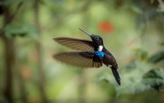
Black Inca. Arango, C. 2016. Wiki Aves de Colombia. (C. Arango, Editor). Universidad Icesi. Cali, Colombia. https://www.icesi.edu.co/wiki_aves_colombia/tiki-index.php?page_ref_id=1872
There are 173 species of birds and 19 species of hummingbirds. The largest bird in the Andean forests is the Andean guan (Penelope montagnii) and you can see it in the sanctuary’s facilities. Theres is another bird, the Black Inca (Coeligena prunellei) a hummingbird which is endemic species of the humid montane forests in the departments of Santander, Cundinamarca and Boyacá.
Other representative birds include Moustached brushfinch (Atlapetes albofrenatus) and the Acorn woodpecker (Melanerpes formicivorus flavigula), both endemic to the eastern cordillera of the Andes. Additionally, the Rufous wren (Cinnycerthia unirufa), Golden-fronted whitestart (Myioborus ornatus), Tawny-breasted tinamou (Nothocercus julius) and Lined quail-dove (Zentrygon linearis), which are near endemics species.
The largest and most charismatic mammals are the Andean white-tailed deer or Paramo deer (Odocoileus goudotii) and the Little red brocket or Soche deer (Mazama rufina). Recently, Tigrillo or Oncilla (Leopardus tigrinus) and the Tayra (Eira barbara) have been recorded in camera traps.
In addition to them, Iguaque has 3 species of snakes that are in conservation programs: Atractus crassicaudatus, Chironius montícola and Mastigodryas boddaerti.
Scientific Tourism and Environmental Education
The exuberant nature of the protected area and its conservation status make it a suitable place for scientific research. In addition, environmental education activities can be carried out. In order to carry out scientific research activities, a permit is required.
Where to Stay in Iguaque Flora and Fauna Sanctuary
The sanctuary does not offer lodging services for visitors; there is only a camping area. Our recommendation for you is to stay in Villa de Leyva, 15 kilometers from the entrance to the sanctuary.
The hotels we recommend are: Selina Villa de Leyva, Santa Maria de Leiva Hotel boutique and La Casona de la Villa.
Best time to visit Iguaque Flora and Fauna Sanctuary
The sanctuary can be visited all year round. The dry season occurs twice a year at the beginning of September until the end of March, and the average temperature is of 13º C (55º F).
Iguaque Flora and Fauna Sanctuary Entrance fees
The entrance fee varies depending on the nationality and age of the visitors. These are the entrance fees for 2021:
Colombians, foreigners holding valid residence permit and tourists from Bolivia, Ecuador and Peru (ages 5 to 25): COP 13,000
Colombians, foreigners holding valid residence permit and tourists from Bolivia, Ecuador and Peru (over 25 years old): COP 19,500
Non-resident foreigners (over 5 years old): COP 55,000
Children under 5 years old and Colombians over 65 years old have free entrance presenting their IDs.
Currently the Iguaque Flora and Fauna Sanctuary is CLOSED to the public due to infrastructure adjustments to their ecotourism services.
Before visiting Iguaque Flora and Fauna Sanctuary Consider:
In order for you to enter Iguaque Flora and Fauna Sanctuary you must buy an accident and rescue insurance policy, with either of the following companies: COLASISTENCIA, AVIA SEGUROS and SEGUROS MÉDICOS INTERNACIONALES.
The hours for visitors to walk the trail to the Iguaque Lagoon are from 8:00 a.m. to 10:00 a.m. After that time, entry is not allowed.
Departure time from the protected area is at 5:00 pm.
You can make a reservation to enter the sanctuary by sending an email to iguaque@parquesnacionales.gov.co 24 hours before the visit indicating the number of people and the date you wish to enter.
The maximum number of people allowed to enter the sanctuary is 50.
You should wear warm, waterproof clothing to protect you from the cold and rain, use sunscreen, a hat or balaclava, gloves, hiking boots or marsh boots.
The entry of pets or domestic animals is prohibited.
The use of flash when taking photographs is prohibited.
Use of binoculars to watch animals’ behavior is recommended.
Bring along valid identification documents and health insurance.
It is recommended to be vaccinated against yellow fever and tetanus.
If you take specific medications, take them with you a personal first aid kit.
Some prohibitions
Feeding, bothering or hunting animals, alcoholic drinks and drugs, throwing cigarette butts, burning garbage, felling, and capturing wildlife.
References
Colparques
Parques Nacionales
About the authors
Luisa Martin
Engineer, world traveler, amateur photographer, traveling blogger, and foody.
The name “Puracé” comes from the ancient local dialect “Quechua”, and stands for “mountain of fire”. This name was assigned to the Puracé National Natural Park. This park is located in the Andean Region of Colombia, southeast of the city of Popayán. Its main attraction is the Puracé volcano, one of Colombia’s most active volcanoes.
Discovering Puracé National Natural Park
Puracé National Natural Park is located in the central mountain range of the Colombian Andes. In the southwest of the department of Huila and nearby the archaeological park of San Agustin.
Its area of 830 km2 is shared between the departments of Cauca and Huila. Inside the park is the Puracé Volcano, which is one of the most active volcanoes in Colombia.
Moreover, the volcanic chain of the Coconucos, known as Serranía de Los Coconucos, also originates in Puracé and it’s comprised of 12 volcanoes; the most notable being the so-called Sugar Loaf (5,000 m), the Purace (4,780 m) that is the only active one, and the Coconuco (4,600 m).
Thus, the place is full of more than 50 lagoons and because of its volcanic nature, hundreds of “Sulphur” springs, which can be visited along the natural reserve.
Purace is also well known because 4 of the most important rivers in Colombia are born there: Magdalena, Cauca, Patia, and Caquetá.
The park has a great abundance of ecosystems, including paramo, super-paramo, snow, and rainforest. Endangered plant species such as the Colombian pine, oak, and wax palm are part of the protected area.
How to get to The Puracé National Natural Park
Bogotá – Popayan Route
Take a 1.5-hour flight from Bogotá to Guillermo León Valencia Airport (PPN) at Popayan city. From Popayan, take an approximately 5,5-hour ride to Puracé. Once at Puracé you should take an extra 40-minute car ride to the administrative center of Pilimbalá.
At Pilimbalá, first register at the National Natural Park checkpoint to access Puracé National Natural Park. At Pilimbalá you can enjoy some food at local restaurants, thermal pools, and the beautiful fauna and flora.
Bogota – Cali Route
Take a 1-hour flight from Bogotá to Alfonso Bonilla Aragón International Airport (CLO) at Cali city. From Cali, take an approximately 1,5-hour ride to Puracé (233 km). Once at Puracé you should take an extra 40 minutes car ride to the administrative center of Pilimbalá.
The trip continues the same from this point, as in the previous alternative.
Andean Condor
What to do in the Puracé National Natural Park
This is a place impregnated by the indigenous tradition of the region. There, everything is intimately linked to the creator gods, mother nature, and life.
Hiking and Trekking
Hiking is the most exciting activity to do at Puracé National Natural Park. You can hike through 5 trails:
Puracé volcano crater trail
The day starts at 4:30 a.m. with hot drinks and energy bars. The hike is approximately 2 hours long. The crater is 4,673 meters above sea level, and the trail is considered of medium difficulty. During the hike, you will be able to appreciate small glacier lagoons and snow-covered volcanic ash deposits.
Coconucos crater trail
Covering a distance of approximately 6 km over the volcanic chain, this trail allows visiting 6 extinct craters of ancient volcanoes and dry lagoons with volcanic ash. The hike is 6 hours long.
The Buey (Ox) Lagoon
After hiking for 20 minutes you will have the opportunity to see a spectacular lagoon with dimensions the size of an old volcanic crater. There you can have contact with orchids, birds; this area is full of native species such as bears, deers, and rabbits.
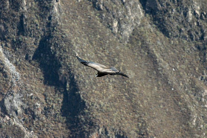
Whitestone trail
Take a 20-minute walk to Pilimbalá, a beautiful viewpoint to check the marvelous Andean Condor (the world´s largest flying bird). You may have to wait a few minutes to be able to observe the flight of this beautiful bird.
Birdwatching and Wildlife Observation
Observing a great variety of wildlife is possible on each of these trails. If lucky, you could come across mammals such as bears, otters, deers, pumas, and the paramo tapir. Regarding flora, the Colombian pine (Podocarpus oleifolius), oak, (Quercus humboldtii), wax palm (Ceroxylon spp) and tree fern (Cyathea spp) are abundant.
Note that this area is home to more than 200 species of orchids, a natural wonder not be found in any other part of the world.
Hot Springs – Lakes and Volcanoes in Puracé-Coconuco
Visit the Puracé Volcano and the Laguna Andulvio (San Rafael)
The imposing volcano is linked to the Andulvio lagoon. This couple (volcano and lagoon) are children of the Puraceños. The lagoon means the place where the nymph of the waters lives, goddess of the locals.
San Antonio Waterfall
Near the town of Puracé the dark Vinagre River rushes, after having traveled from the slopes of the Puracé Volcano, through rocky and canyoned areas forming a beautiful waterfall. It is so-called because, according to indigenous legend, Saint Anthony appears there during Holy Week. It is also believed that when visiting the waterfall, singles can make a wish to find the partner of their dreams and the wish will be granted.
The condor of the Andes
Known as the “lord and master of the heights or messenger of the sun”, a symbol of freedom and purity. In the indigenous reserve of Puracé, for more than twelve (12) years the repopulation of the species has been advancing. You can make sightings along the majestic canyon of the San Francisco River, commonly known as the refuge of the condor of the Andes.
The Ox Lagoon
Located in the southeast of the municipality of Puracé, ancestral territory of the Kokonuko Yanacona people. It is immense, in the summer season it is seen in the blue sky, surrounded by places and abundant native vegetation; it is called the Ox because the older ancestors say they have seen an ox in the lagoon.
For the indigenous people, the lagoon is the woman of the Pan de Azular volcano, mother of the Kokonukos Yanaconas tribes, who today live in the Paletara Valley. There, the majestic and virtuous Cauca River also begins to make its way, which runs its first kilometers through a peaceful landscape of paramo.
The Green Lagoon (Laguna Verde)
Located to the north in the indigenous reservation of Paletara. A charming place colored by the presence and influence of green algae, the greenish-yellow of the mosses and lichens with the shade of blue water, and accompanied by streams of sulfur water, offering a polychrome landscape of rapture.
Thermal baths of Casa Quinta
Thermal water loosening, located in the indigenous reservation of Paletara. With 22 degrees Celsius, this place is an ideal scenario for recreation, rest, but above all to meet with the spirit of life and appreciate the goodness that nature offers us.
Lagunillas
Consisting of three beautiful lagoons, located north of the Andulvio Lagoon. There you can see the Torrent Duck.
Candelaria waterfall
Located in the village of Santa Leticia, Bella Vista, the waterfall is formed by the precipitation of the Candelaria River, giving rise to a fantastic fall of more than 100 meters high. In this place, the Pijaos and Augustinians worshipped the Sun God and the Moon God.
Where to stay in The Puracé National Natural Park
In the Puracé sector, it is possible to find different hotels for individual accommodation. Suggested choices are:
Cabaña Coconuco is located 4,3 kilometers away from the park entrance.
Hacienda Pisoje is located 7 kilometers away from the park entrance.
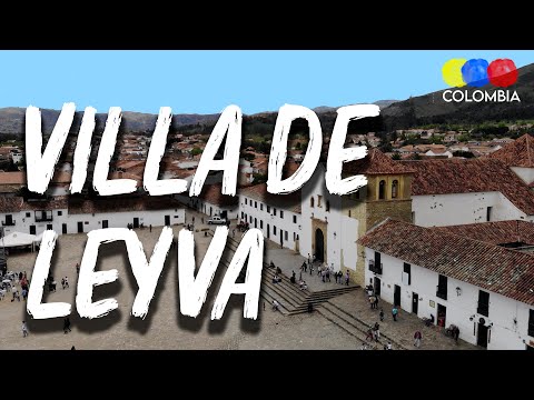
Villa de Leyva is a beautiful colonial town. It is part of the “Network of Colombian Heritage Villages”, located in the province of Ricaurte in the department of Boyacá.
Moreover, the town was founded in 1572 under the name of Villa de Santa María de Leyva and later recognized as a national monument in 1954 because of the beauty of its colonial architecture.
It is located 40 km west of Tunja, capital of the department, and 165 km from Bogota, capital of the country.
This town is very famous for its historical importance and its magnificent square. In fact, the Plaza Mayor of Villa de Leyva is the largest in Colombia and one of the most imposing in South America with its 14 thousand square meters.
The Diversity of Nature in Villa de Leyva
In addition to its colonial architecture, Villa de Leyva is characterized by its varied rural landscapes, and ecosystem ranging from paramo to desert. Also, the town is framed by two branches of the eastern mountain range of the Andes.
Due to its great offer, Villa de Leyva is ideal to encounter history, science, art, culture, and nature. It also has an important value in terms of paleontology, anthropology and archeology.
This park belongs to the National Natural Park System, created by Agreement No. 33 of 1977. It is located between the municipalities of Villa de Leyva, Arcabuco, and Chíquiza.
The park has an area of 6,750 hectares, and it is associated with the Pómeca River basin to the north and the Hoya del Río Chíquiza to the south. Additionally, the sanctuary has eight lagoons formed in the cloudy páramo. There you can see deer, weasels, and three species of woodpeckers, among other animals.
The entrance to Iguaque Park is through the road that leads from Villa de Leyva to Arcabuco. The Sanctuary is open to the public for ecotourism and it offers three cabins located in the sectors “Carrizal”, “Chaina” and San Pedro de Iguaque.
Important recommendations
To visit the Iguaque Sanctuary, it is necessary to bring adequate clothing for cold weather and moorland.
Also to bring garbage bags, a backpack instead of a suitcase, food that provides enough calories and beverages.
If you are going to camp, bring complete camping equipment, sleeping bag and sleeping bag.
People who suffer from hypertension, hypotension or mountain sickness should be cautious because the hike requires great physical effort.
The Mythic Iguaque Lagoon
Also called San Pedro Lagoon. It belongs to the Sanctuary of Fauna and Flora, has an area of 850 square meters, and is located at an altitude of 3,800 meters above sea level.
According to Muisca mythology, the Iguaque Lagoon is the cradle of humanity because the mother of that civilization emerged from its waters. From this lagoon emerged Bachué, mother of the Muiscas.
This is why this place is considered a sanctuary and a mythical place full of legends.
The Hidden Valley (Valle Escondido)
It is located at 2050 meters above sea level in the Salto and La Lavandera trail in the Las Vegas sector. The access to Valle Escondido is by an unpaved road that is in good condition, half an hour from the town center.
This beautiful valley is found by turning right by the Hacienda El Cárcamo. Among the attractions offered in addition to the lush landscape is the old Primavera Mill.
Pozo de la Vieja (Well of La Vieja)
It is located in Vereda El Roble, 6 km from the town of Villa de Leyva via Gachantivá through Alto de los Migueles. Its waters come from the Caño River.
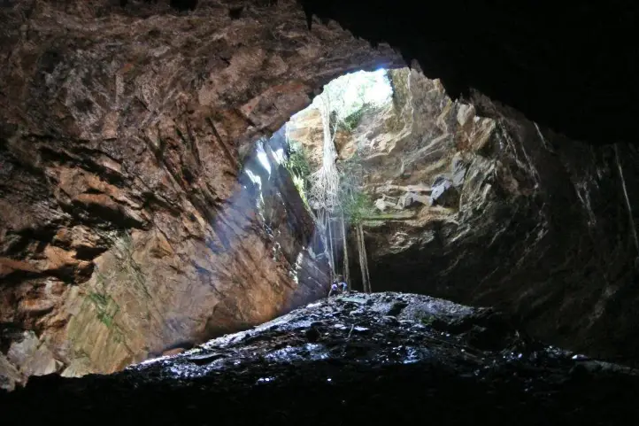
This site is located on the road that goes to the municipality of Santa Sofia, approximately 20 kilometers from Villa de Leyva. It is a natural cave formed by a subway river.
It is a place you can visit to practice speleology. This cave is not very humid, so there are few stalactites and bats are their permanent companions.
El Hayal Waterfall
This waterfall is located on the road that goes from the municipality of Santa Sofia to the municipality of Moniquirá, approximately 6 kilometers away from Villa de Leyva.
It is a natural rock formation with a gigantic grotto of approximately 150 meters high. There you will find waterfalls of 25 meters.
The “Hoyo de La Romera” is located on the road that goes from the municipality of Santa Sofía to Moniquirá.
The hole is of great magnitude, with a drop of approximately 40 meters. There is speculation that this hole may have been used by the indigenous people to go to other towns.
People say that after 12 meters of ascent, there is a small cave. This cave is presumed to be the beginning of a road that leads to the municipality of Monguí (Boyacá), located almost 150 kilometers away.
It is also known as “El Hoyo de Los Infieles”. Legend has it that it was a place of punishment for women who were unfaithful to their husbands. They were thrown from the edge of the hole. It can be said that its original name was “El Hoyo de las Rameras” (The Hookers’ Hole).
The Blue Wells (Pozos Azules)
It is located 3 km from Villa de Leyva to Santa Sofia. You can go by car, horseback, bicycle or walking (30 minutes).
Pozos Azules are artificial wells that have taken this color by the action of salts and minerals in the soil.
Viewpoints
You will find beautiful viewpoints from which you can observe the breathtaking scenery of this territory, some of these are:
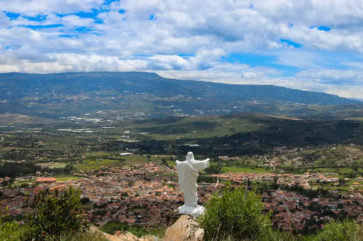
Colina el Santo Viewpoint
Located at 2,400 meters above sea level, to the northeast of the urban center, a 45-minute walk along a road with little demarcation.
From there, you can see the urban center of Villa de Leyva and the imposing mountains of its surroundings.
Colina del Santo Viewpoint, Villa de Leyva, Colombia
Alto de las Cometas
From this viewpoint, you can see the entire urban center immersed in the contrasting landscape of the lowlands and the mountainous area. It is located in the desert area, one kilometer from the village on the road to “Fósil”.
Alto de los Migueles
It is located approximately 5 km from the urban center, taking the road that leaves the cemetery of Villa de Leyva. From this viewpoint, you can see to the east where the landscape changes abruptly.
Cerro de Leyva
On this hill, there is a high Andean forest remnant where you can find foxes, rabbits, beacons, birds, and deer.
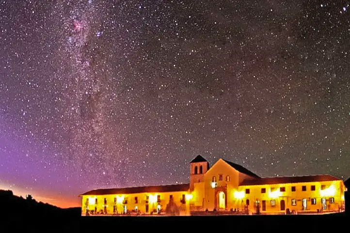
Stargazing
Astronomical Observatory
The observatory is an ideal place to observe the sky, the depths of the universe, to enjoy spectacular nights, to recognize constellations, to observe planets, nebulae, galaxies, shooting stars, to follow diverse phenomena and to marvel at mythical stories about the cosmos!
Night at Villa de Leyva – Facetas Boyacá
It has several telescopes and devices for the observation of the celestial vault. You will be able to explore the deep sky and also to observe sunspots and solar flares.
Besides this, there is also a space museum called Kosmos, ideal for visiting with your kids and family. The museum specializes in archeoastronomy, exobiology, history of flight, and space travel.
Finally, the museum also has a collection of meteorites unique in Colombia, and a planetarium ideal for projections.
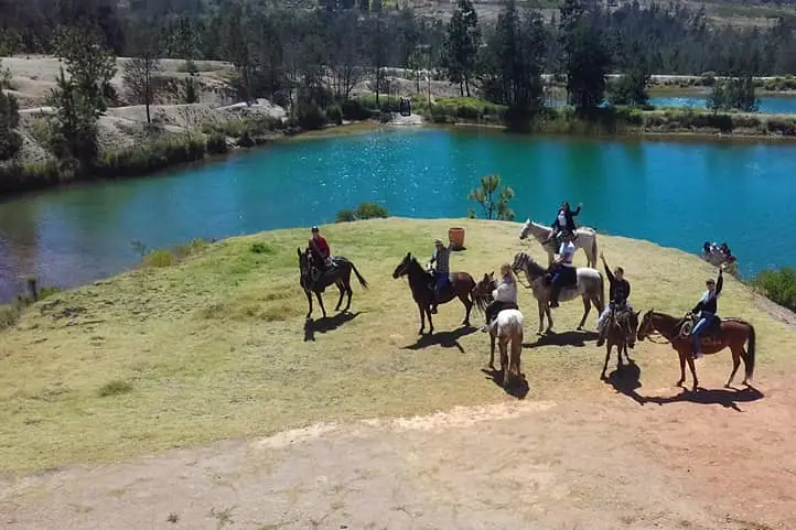
Without a doubt, getting to know Villa de Leyva is an adventure that you can make the most of through these horseback tours.
The ride consists of crossing the desert of La Candelaria towards the valley of Villa de Leyva. You will leave from La Candelaria Monastery, in the middle of the desert.
Finally, once you arrive in the town, you will be able to make a walk city tour and visit its main colonial attractions:
The Main Square of the town, considered the largest in Colombia.
The Casa del Cabildo, a historical relic near the main square.
The Casa de Nariño, a museum dedicated to preserving historical material from the colonial era.
The Cloister of San Agustin, the first church of the town.
I hope you liked this brief guide of natural destinations in Villa de Leyva. If you want to know more, or schedule your trip, do not hesitate to contact us.
Current director of Sula. Doctor in Biological Sciences. Her main interests are to explore and understand the organism – environment interactions, taking advantage of emerging knowledge for the management and conservation of species and ecosystem services. She is currently working as a consultant in functional ecology, ecosystem services and conservation projects in Colombia related to ecotourism and birdwatching.
The lakes of Colombia are not lakes proper. Due to its extension, the water deposits of the Andean mountains are only lagoons. The largest are: Lake Tota, located at 3,115 meters above sea level in Boyacá, and Lake La Cocha, at 2,660 meters above sea level in Nariño. In Cundinamarca there is the Lake Fúquene and others of great importance Like the Suesca and Guatavita lagoons.
But don’t get confused! In Spanish lago (lake) and laguna(lagoon) definitions are not the same as in English.
In Spanish, a lake refers to a body of water that has an entrance and an outlet of rainwater, groundwater, and/or rivers, for example, the Lake Michigan or the Lake Superior in the USA, or the Lake Tota in Colombia. A lagoon, on the other hand, is a body of standing water that has an inlet from rivers or streams, but no outlet, for example the Great Salt Lake in the USA, the Caspian Sea in Asia, the Lake Corangamite in Australia, the Laacher See in Germany, and Lake Titicaca in Bolivia.
Now, in English, the difference between a lake and a lagoon, as well as its definition, is quite different. Lagoon is defined as a type of saltwater lake that is formed by the waves of the ocean. Also, lagoon is close to the ocean, whereas lakes are far away from oceans.Lagoon is saltwater body, whereas lakes are mostly freshwater bodies. Lagoons are generally shallow compared to lakes. And so on…
For an equal understanding, this is what you may call an exorheic and an endorheic basins, i.e. open and closed lakes respectively. And, translating to Spanish, lakes are exorheic and lagoons are endorheic basins. If you arrived here because of a homework about lakes visit National Geographic Encyclopedia about lakes. So… what is this post about?
Lagoon. In Spanish, a lagoon is a body of standing water that has an inlet from rivers or streams, but no outlet.
Lake. In Spanish it means a body of water that has an entrance and an outlet of rainwater, groundwater, and/or rivers.
Ok. This post is about the lakes of Colombia you can visit for fun and enjoy nature. Lakes of Colombia are also known, and called, as “lagunas” (lagoons), but they are not like the lagoons you are used to know. So, don’t get confused, when you visit a “lagoon” in Colombia, it will be, for sure, very far from the coastal zone, and it will be a freshwater lagoon, as you may have already noticed. And it can be lake… or not… geez!
In parentheses you will find the real type of water body that each lake or lagoon belongs to, according to the definition in Spanish.
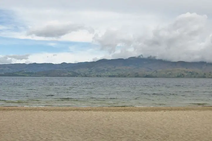
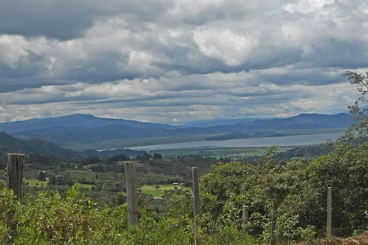
Exorheic Basin. With an area of nearly 55 km², it is the largest lake in Colombia and, after Titicaca, the second highest navigable lake in South America at 3,015 meters above sea level (9891.7 Ft.).
In the southwestern part of the lake, there is a natural bay called Bahía Blanca. It is frequented by bathers and water sports enthusiasts despite the low temperature that usually does not exceed 12 °C.
What to do
Despite the stories about the Tota Lagoon monster(Diabloballena), as terrifying as the Loch Ness monster (Nessie) in Scotland, today you can practice water sports, sportfishing, navigate the lake, walk through the forest, camp and enjoy Playa Blanca, the only cold-weather beach in Colombia.
When sailing you can visit the islands of the lagoon: El Sagrario de los Milagros, San Pedro, Cerro Chino, Santo Domingo, Isla del Amor and La Ballena.
Laguna de La Cocha
(La Cocha Lagoon, exorheic)
Location
Characteristics
Lake La Cocha, also called Lake Guamués, is a natural lagoon of glacial origin, located in El Encano, a village in the municipality of Pasto, in the department of Nariño. With an area of nearly 40,5 km², it is the second largest natural body of water in Colombia, after the Laguna de Tota. It is located at 2680 meters above sea level (8792.6 ft.)
In 2000, Colombia registered the La Cocha lagoon, or Guamués lake, as a wetland of national and international importance within the Ramsar Convention, being the first with this qualification in the Colombian Andean region.
What to do
In this place it is possible to take boat trips, do sport fishing and bird watching.
Inside the lagoon there is the smallest flora sanctuary of Colombia, the Isla de la Corota Flora Sanctuary, with 15.2 hectares. It is located in the north of the Laguna de la Cocha. It is considered as a source of sacred energy for the indigenous and traditional doctors of the region. Likewise, it has a chapel that is an important pilgrimage site for Catholics, especially during the Virgen de Lourdes Festival. There you can walk trails designed to observe the forest.
Laguna de Guatavita
(Guatavita Lagoon, endorheic)
Location
Characteristics
This is the most famous sacred lake among our pre-Hispanic ancestors. The legend of El Dorado derives from it, a story that brought many people crazy about its relentless thirst for gold and wealth. The lake has suffered failed drainage attempts, made by these crazy treasure hunters.
It is located in the eastern mountain range of Colombia, at an altitude of 3,100 meters above sea level (10170.6 ft.) and has a temperature of 5 to 11℃. the lagoon has a maximum width of 0.7 km, a surface area of 19.8 hectares and an average depth of 125 m. It is supplied mainly by groundwater. It was formed in a perfectly circular mountain depression, surrounded by native forests. There are several hypotheses about its formation: by a meteorite, by a collapse caused by the dissolution of saline strata, or by glacial action and erosion. Today it has reached a stage of sedimentation.
What to do
Its environmental recovery has allowed that, after many years, activities can be carried out such as hiking, and landscaping.
Laguna de Fúquene
(Lake Fúquene, exorheic)
Laguna de Fúquene. Picture by Francy Ramírez
Location
Characteristics
With an area of 30 km² and located at an altitude of 2540 meters above sea level (8333.3 ft.), the Fúquene lake has numerous islands, one of which was a sanctuary for the Muiscas. According to the legend, hidden under the waters and ready to defend his domains in the valley of Ubaté and Chiquinquirá, remains Fu, a god-demon with the head and tail of a fox and human body. His name in Chibcha is decomposed from “Fu” which means fox, and “quene” which means bed, which would be translated as the bed of the fox.
The local community depends directly on the lagoon, since it is a source of water for domestic, agricultural and industrial activities. It is also the habitat of several migratory and endemic species.
What to do
Its environmental recovery has allowed that, after 40 years, nautical activities can be carried out with small boats such as sailboats, kayaks and rowing surf.
The Otún lagoon is one of the highlights of the Los Nevados National Natural Park. This lake measures about 1.5square kilometers and is located at 3,950 meters above sea level (12959.32 ft.) in páramo ecosystem, being perhaps one of the highest that you can visit. Formed by volcanic and glacial action, it is fed mainly by the snowmelt of the Nevado de Santa Isabel. It is one of the most beautiful ecological hiking destinations in Colombia. It is located in the department of Risaralda, Colombia. Its waters seep under caverns formed by volcanic flows and give rise, together with Laguna La Leona, to the Otún River, which is the source for the aqueduct of the city of Pereira.
What to do
This lake is a great tourist attraction in Risaralda for its great beauty and for trout fishing. The trout is a species introduced to the lake. In the lake you can see the Ruddy Duck (Oxyura jamaicensis), owls and hummingbirds, while the landscape is dominated by frailejones (Espeletia sp.) and typical páramo grasslands. Besides fishing, you can also camp there.
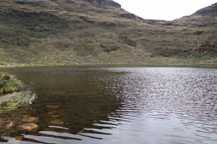
The Iguaque lagoon is located near the municipality of Villa de Leyva in the department of Boyacá, Colombia. It has an area of 6.75 km² and an average depth of 105 m. It is located at 3,800 meters above sea level (12467.19 ft.) in the páramo ecosystem, with a temperature from 4 to 12ºC on average.
According to the Muisca legend, the goddess Bachué came out of the lagoon with a child, giving rise to the entire human race. Bachue is the “Good Woman” mother goddess of the Muiscas.
What to do
Visiting this sacred lagoon is believed to cleanse the soul and purify the spirit. The lagoon is protected as part of the Iguaque Fauna and Flora Sanctuary. There you can go hiking, go on scientific and research tours, observe fauna and flora, observe the cultural heritage, and enjoy the landscape.
The Laguna de Sonso or del Chircal, was decreed as a Natural Reserve since 1978 and regulated for the use of land, water and airspace in 1979.
It is located on the right bank of the Cauca River, between the municipalities of Buga, Yotoco and Guacarí, in the department of Valle dal Cauca. It has an area of 2,045 hectares, (covering 14 square kilometers of these municipalities), of which 745 correspond to the lagoon zone and 1,300 to the buffer zone. It is located 936 meters above sea level, with an average temperature of 23ºC, and a relative humidity of 75%, being an attractive space for various species.
What to do
The Lake Sonso is part of the RAMSAR international agreement signed on February 2, 2017. It has a perfect combination of aquatic birds and dry forest. In addition, it is a refuge for migratory and endemic bird species, totaling more than 300 species. For this reason the main tourist activity in the Sonso lagoon is bird watching and bird photography.
Lagoons at Natural National Park Chingaza
(Lakes of Chingaza, exorheic)
Lakes of Chingaza National Natural Park
Location
Characteristics
The beautiful Chingaza National Natural Park is located in the eastern Andean mountain range of Colombia, between 3,050 and 3,950 meter above sea level (9858.924 – 12959.32 ft.). It has a great water richness constituted by the upper basin of several rivers, as well as by a lagoon system which has been declared a Ramsar site.
The Lacustrine system of Chingaza is formed by 20 lagoons and wetlands that supply water to the capital city, Bogotá. It is also of great importance for migratory birds.
Among all the lagoons, the largest is the Chingaza lagoon, with an area of 88 hectares, which contributes a high percentage to feeding the aqueduct that provides water to the city of Bogotá.
What to do
Four of the 6 trails enabled for ecotourism in the Chingaza park are to visit different lagoons:
You can do guided mountaineering in the modality of “hiking without camping” towards the lagoons. You can also contemplate the landscapes of lagoons, wetlands and streams, as well as observe the flora and fauna of the páramo.
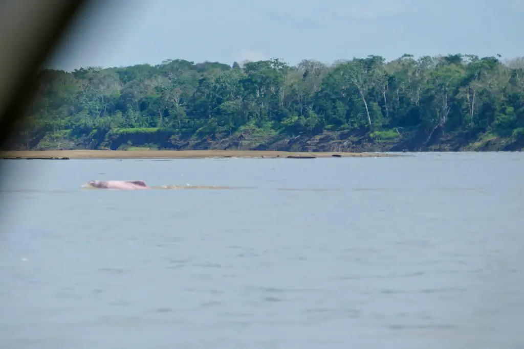
Lakes of Tarapoto
(Lakes of Tarapoto, exorheic)
Amazon river dolphin (Inia geoffrensis), at Puerto Nariño, Amazonas department, Colombia.
Location
Characteristics
It is located in the municipalities of Puerto Nariño and Leticia, department of Amazonas. The lakes of Tarapoto are a strategic ecosystem made up of more than 30 interconnected lakes, which reach an approximate area of 11,424 m2 in periods of low water. According to Ramsar.org, this ecosystem:
“provides important functions such as flood and erosion control, waterways for transportation, recreation and tourism.”
Besides being one of the greatest ecotourism attractions in the region, this biome is the means of subsistence and food for 22 indigenous communities, Cocama, Ticuna and Yagua, which are part of the Ticoya reservation in the Amazon.
It has been declared a Ramsar area in 2018, thanks to the joint work between the inhabitants of Puerto Nariño, the indigenous people of the Ticoya reservation, the Omacha Foundation, the Colombian government, Corpoamazonía, the Sinchi Institute and the World Wide Fund for Nature (WWF).
What to do
There you can arrive by boat and wait in silence for the appearance of pink dolphins, while contemplating the majesty of the Amazon jungle.
Lagoons at Natural National Park Sumapaz
(Lakes of Sumapaz, exorheic)
Páramo of Sumapaz
Location
Characteristics
Bogotá has the largest and most beautiful páramo in the world, the Páramo of Sumapaz. This ancestral place was considered by the Muiscas as the habitat of the gods.
Here you can enjoy unique landscapes, unique animals and the particular vegetation of an ecosystem that is dedicated to safeguarding water: the páramo.
What to do
In the Sumapaz páramo you can visit the following lagoons:
Alar Pasquilla Lagoon
According to the District Tourism Institute of Bogotá, the Alar Pasquilla lagoon is one of the seven wonders of the city. This sanctuary full of frailejones, imposing cliffs and a 3,200-meter-high viewpoint is a unique plan.
Negra lagoon
This body of water has been the object of legends, which is why it can be considered the most mysterious lagoon in the páramo of Sumapaz. In pre-Columbian times, when the Zaque de Hunza (Tunja) and the Zipa de Bacatá (Bogotá) were at war, it was known as the Saguanmachica lagoon, because a zipa with that name was crowned there.
Los Colorados Lagoon
Also known as the enchanted lagoon, this paradise is a place that few know because of its difficult access.
Los Tunjos
They are the best known bodies of water in Sumapaz because it is easy to get to them. This area has a forbidden route, where you can see lagoons and cliffs as high as the Colpatria building.
Larga Lagoon
In this lagoon of the Sumapaz National Natural Park it is common to see fish, wild ducks and other types of birds. Access is very easy, because it is close to the Los Tunjos complex.
Laguna Cajitas lagoon
This body of water at 3,850 meters high is famous because the Black-chested Buzzard-eagel can be seen frequently. The best panoramic view of the lagoon is on Cerro La Carolina, a difficult place to access because you have to climb for about an hour.
Laguna de Cumbal
(Lake Cumbal, exorheic)
Location
Characteristics
The Cumbal lagoon, also called La Bolsa lagoon, is located at the foot of the Cumbal volcano, at 3440 meters above sea level (11286.09 ft), in the department of Nariño, south of Colombia.
This lagoon is characterized by the gray color of its waters, the very low temperature and the absence of waves. The Cumbal lagoon basin is small in size (9.8 km²) and is located in a very sensitive aquifer recharge zone.
It is a sacred place for the indigenous people of the region, who belong to the grasslands ethnic group, and according to them, humanity originated there. For this you infer this place is of feminine energy, and it recalls the uterus of a woman, that is why it is called the bag.
What to do
You will be able to enjoy a majestic landscape of mountains, valleys, nearby volcanoes and see the snow-capped mountains of the Republic of Ecuador.
You can also do sport fishing activities, since the rainbow trout abounds in its waters. You can also meet the indigenous inhabitants of the area, their culture, traditions and gastronomy.
Recommendations
To enjoy it to the fullest, we recommend you take comfortable, warm and waterproof clothing. You should also wear mountaineering boots that are waterproof. In some places you may be short of breath due to the altitude, in that case, breathe deeply and slowly, and walk at your own pace. There will always be people watching over you and taking care of you so that you get the best experience.
If you want to know more about Colombian nature tours, or want to visit any Lake of Colombia, follow us, write us comments, or just contact us.
Rutas de los Andes Blog https://rutasdelosandes.com/
Wikipedia
WikiAves de Colombia
Colombia Travel
Colparques Website
National Natural Parks of Colombia Website
Ramsar.org
Semana Journal
About the author
Sara Colmenares
Current director of Sula. Doctor in Biological Sciences. Her main interests are to explore and understand the organism – environment interactions, taking advantage of emerging knowledge for the management and conservation of species and ecosystem services. She is currently working as a consultant in functional ecology, ecosystem services and conservation projects in Colombia related to ecotourism and birdwatching.
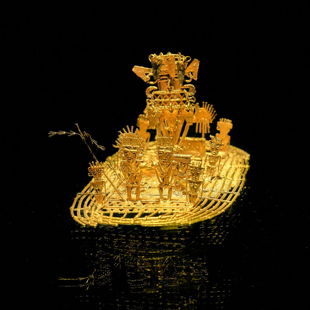
The Guatavita lagoon was one of the most sacred of the Muiscas, since the ritual of investiture of the new Zipa (Cacique- chief) was carried out there. This is one of the origins of the El Dorado Legend. The famous Muisca Raft that is exhibited in the Gold Museum of the Bank of the Republic of Colombia is evidence that this type of ritual was celebrated in the lakes of the region. Find out more about the museums of Colombia in The 117 Museums Guide of Colombia for Culture Travelers travel guide.
Guatavita comes from the Chibcha language GUA-TA-VITA, which translated into Spanish means “tillage of the tip” or “end of the mountain range”, as stated by the linguist Joaquín Acosta Ortegón in his Chibcha dictionary. The Chronicler Fray Pedro Simón, in his “Historical News”, said that Guatavita was called Guatafita, which means “thing set on high”, stating that it was the Spaniards who made the change from F to V to give it more phonetic sweetness to that name.
Origins of El Dorado Legend
According to the Muisca tradition, in Guatavita the cacique Sua was married to a beautiful princess from another tribe. Sua was very fond of chicha and bacchanals, and his wife, with whom he had a daughter, fell in love with a warrior who was courting her.
The lovers were caught by Sua, and he subjected the warrior to horrendous tortures, to the point of taking his heart out and serving it to his wife. The woman fled in despair, took her daughter in her arms and dove with her into the lagoon.
The cacique ordered the priests to recover his family. They informed him that the woman was now living under water, where a large snake had betrothed her. The cacique demanded that his daughter be brought to him, and they brought him a child without eyes. Sua, disheartened, returned her to the waters and ordered that from that day on, the best emeralds and gold filigrees be thrown into the lagoon (if you want to know about filigrees watch our video Santa Fe de Antioquia). The purpose of the ceremony was to beg the queen to ask the gods for prosperity and bonanza for her people.
Every full moon, Guatavita’s snake emerged from the waters to remind the people about the offerings, the priests watched his appearance as a sign of prosperity.
The Golden Indigenous
El Dorado Legend, gold statue at the Gold Museum, Bogotá, Colombia, picture by Pedro Szekely, from flickr, CC BY-SA 2.0. Wikimedia.
With the Spanish invasion, the ritual acquired a new meaning. They were told that a ritual was carried out when a new cacique, usually the nephew, son of a sister of the previous cacique, was in power.
The heir prepared himself within a six years period before the ceremony. He had to purified himself through fasting, and confined himself in a cave where he could not see the sun or eat food with salt or chili.
Some chroniclers have narrated it this way:
“…In that Guatavita lagoon, a great raft of reeds was made, decorated as brightly as possible… They undressed the successor, smeared him with a sticky soil and sprinkled him with gold powder and ground, so that in the raft everything was covered with this metal…
The golden indigenous man made his offering by pouring all the gold and emeralds he carried into the middle of the lagoon, and the four chiefs who went with him did the same. During the way back to land in the raft, they started a party, with bagpipes and “fotutos”, with dances in their own way, with which ceremony they received the new cacique who was recognized as lord and prince …”
From this ceremony was taken that so celebrated name of El Dorado.
The Search for the Treasure
The history of the “golden indigenous” gave rise to the “El Dorado”, a mythical place that the conquistadors sought from the Andes to the Amazon, with such eagerness that within a week, in 1539, three expeditions led by Sebastián de Belalcázar, Nicolás de Federmán and Gonzalo Jiménez de Quesada, from Peru, Venezuela and Santa Marta, respectively, coincided in Guatavita.
There were several attempts to drain the lagoon to find its hidden treasures, among which the most important were that of Captain Lázaro Fonte, who was able to extract several pieces of fine gold, and that of Antonio de Sepúlveda in the 16th century, who also managed to remove emeralds and ceramic pieces.
In 1580, a merchant named Juan Sepulveda employed 5,000 indigenous men and dug a canal to drain it. The water level dropped as much as 20 meters, but then the canal collapsed and the King of Spain refused to continue financing the enterprise. Sepulveda had to abandon, despite having rescued several pieces of filigree and an emerald the size of a fist.
Unsuccessful attempts continued throughout the colony, but the legendary gold continues to fuel treasure hunters’ dreams to this day. In an old German book published in 1911, for example, there is even a photograph, supposedly real, of the totally drained lagoon.
In the book is narrated that some W. Cooper, representative of the English company Contractors Limited, had shown two German tourists photographs of objects taken from the lagoon as rings, snakes, frogs and men’s heads, made of gold. This Cooper told them that the value of the gold found since 1909 amounted to at least 500 pounds, which paid several times the investment of the expedition.
Recovery of Guatavita Lagoon
What is certain is that the Guatavita lagoon, when you visit it for the first time, is smaller than you could imagine… given the size of the legend!. But the sad thing is that this happened after it was emptied of more than half its contents by gold diggers, English and Germans, among others, until the end of the 19th century. These treasure hunters opened a hole in the mountain to drain the water to take out the gold pieces that rested at the bottom of the lagoon.
Fortunately, the failure of all these expeditions appeased the greed of the gold diggers. Initially, the place was reduced to abandonment, and at the beginning of the 21st century the park was closed to the public to try to recover it.
Today, a good part of its splendor has been reborn, with the frailejones, bromeliads, lichens, arnicas and multicolored mosses. The true treasure is the lagoon and the páramos of Colombia, because from there the water flows to all the surrounding regions.
Currently, the lagoon is located in an environmentally protected area where you can access a trail that crosses an impressive mountainous area, full of vegetation and typical species of the Colombian páramo.
We recommend you to visit the Guatavita Lagoon after visiting the Golden Museum in Bogotá.
How to Get to Guatavita Lagoon
Guatavita town is located 75 kilometers northeast of Bogotá, bordering the municipalities of Sesquilé and Machetá to the north; Gachetá and Junín to the east; Guasca and Sopó to the south; and Tocancipá and Gachancipá to the west.
However, Guatavita Lagoon is 8 km from the road that borders the Tominé reservoir, besides the town.
The Guatavita lagoon today is a Regional Natural Reserve of the System of Protected areas of Colombia. Entrance fee for foreigners is around of 13,000 COP (3.5 USD). After paying, you will be led by a local specialized guide, in small groups, through a natural path along the paramo.
Local guides are from the Muisca community which still inhabits the region.
Accomodation near Guatavita Lagoon
You can find accommodation in the town of Guatavita or in the nearby parks associated with the reservoir circuit that exist throughout the region. This accommodation, offered by the parks, is of the shared cabin type, with a minimum cost of 215,000 COP (60 USD), depending on the number of people.
Recommendations
To enjoy it to the fullest, we recommend you take comfortable, warm and waterproof clothing, as the average temperature of the place is 13ºC and rainfall is frequent. However, none of this will prevent you from having a deep connection with nature and with the ancestral past that this lagoon hides, and that makes it an authentic cultural heritage of the country.
If you want to know more about Colombian nature tours, or want to visit Guatavita Lagoon, follow us, write us comments, or just contact us.
Current director of Sula. Doctor in Biological Sciences. Her main interests are to explore and understand the organism – environment interactions, taking advantage of emerging knowledge for the management and conservation of species and ecosystem services. She is currently working as a consultant in functional ecology, ecosystem services and conservation projects in Colombia related to ecotourism and birdwatching.
All travelers staying in Bogota should devote a day or two to visit “the great source of water” – Chingaza National Park. This huge park offers the most stunning views just a couple of hours from the capital of Colombia. The area is of great ecosystemic and cultural importance in the region and offers a great nature experience.
In this post, you will find all the information you need to know to visit the Chingaza National Natural Park in Colombia, such as how to get there, what you can do in the park, where to stay, how much it costs and some recommendations for your trip.
Discovering Chingaza National Park
In the Eastern Cordillera, east of Bogota, an incredibly important ecosystem functions in a territory formerly worshipped by the Muisca indigenous. It is Chingaza, a NationalNatural Parkof 76,600 hectares that provides 80% of the drinking water of Bogota – the capital and largest city in Colombia. Amazing, right? This region is a water factory thanks to its paramos, Andean forests, lagoons, creeks and rivers, and is nicely embellished with unique Frailejones.
The paramo ecosystem is native to the Andean mountains in Colombia, Ecuador, Venezuela, and Peru and extends from 3200 to 5000 MASL. “The paramos play a fundamental role in sustaining the lives of millions of people, providing essential ecosystem services such as water production for urban use, irrigation and hydropower generation. Paramo‘s soils and vegetation provide efficient forms of carbon storage and sequestration” (IUCN, 2010). What makes Colombia so special is that it is home to most paramos in the world, including the largest paramo on earth Sumapaz! After this parenthesis, you should know that climate change and human activity are endangering the paramos. Livestock and agriculture – especially potato crops in nearby areas, are the main threats to the Chingaza páramo.
In Chingaza, you will find over 60 lagoons of glacial origin that impress with their crystal-clear waters. You will feel lucky to drink such pure water! The largest and most important lagoon culturally is Chingaza lagoon, at 3250 m (10600 ft) ASL. The three Siecha lagoons are quite tourist-attractive too. Lagoons, mountains, and water were sacred worship sited for the Muiscas, where they made offerings. In their language, Chingaza means Serranía del Dios de la Noche (God of the Night Mountain Range).
Chingaza is also a haven for native flora and fauna. The park covers areas up to 4000 m (13120 ft) ASL, so the animals and plants that inhabit these zones are capable of withstanding extreme conditions such as temperatures as low as 4°C (39°F) and constant rainfall. This means that the flora and fauna that you see here are endemic to this ecosystem. There are over 2000 plant species and around 390 bird species reported in Chingaza National Park. A number of mammals and frogs are found here too.
How to get to Chingaza
Chingaza is located a couple of hours from Bogota by car. There are 3 access points to Chingaza NNP:
Guasca access: the Siecha control post is located 15 kilometers from the town of Guasca.You can only reach Lagunas de Siechafrom this entrance.
Private vehicle access: RouteGuasca – La Trinidad rural settlement-San Francisco sector. After passing the Paso Hondo site, take the detour where you will find a signal indicating vehicle parking. From there, continue on foot for 1 kilometer until you reach the park cabin. No parking is available at the cabin. Vehicles are to remain on the road as indicated. This trip is recommended on a 4×4 vehicle. The distance between Guasca and the parking location is 14 kilometers.
Public transportation access: Take a bus or taxi inGuasca to Paso Hondo, at La Trinidad rural settlement. The bus will drop you at Paso Hondo, from where you must continue on foot for 6 kilometers (1.5 hours) to the Siecha control post. Hikers are advised to be extra careful due to the transit of food-loaded trucks.
La Caleraaccess: La Calera urban center –Cemento Samper ruins – Buenos Aires rural settlement – Piedras Gordas control post (22 km from La Calera). Continue for 28 kilometers to the Monterredondo administrative center. Access through this sector is only possible by private vehicle. No public transportation access exists.
Privatevehicleaccess: Route La Calera – Guasca. After 1 kilometer, take the detour on the right (passing the old Cemento Samper facilities-La Siberia), and then follow the road directions to the Chingaza Natural National Park. Although the road is not paved, it is in good condition, so cars, jeeps, and buses can drive here.
Fomeque access: starting from the Fomeque urban center, continue for 26 kilometers, passing through the La Paila-Laguna de Chingaza control post, continue for 28 kilometers to the Monterredondo administrative center.
Private vehicle access: Fomeque– La Paila control post. 26 km on the road to San Juanito, Meta. You should take this land access in a private 4x4 vehicle or hire one at Fomeque.
Public transportation access: There is a route from Fomeque to San Juanito, Meta which passes by the La Paila control post on Mondays, Wednesdays, Thursdays and Saturdays. However, this route does not return the same day and there is no camping or accommodation available.
What to do in Chingaza
Hiking: 5 hiking trails currently exist: Lagunas de Siecha trail, Lagunas de Buitrago trail, Laguna Seca trail,Suasie trail, and Las Plantas del Camino – Laguna de Chingaza trail. The hikes along these trails let tourists admire the stunning cloudy landscapes with crystalline lagoons and a bunch of Frailejones while learning about the ecosystem, its importance and the cosmology of past inhabitants of the region including the Muiscas, Guayupes and farmers. There are also 3 viewpoints: La Arboleda, La Ye (from where you can see the Chingaza lagoon) and Mirador de los Condores.
Wildlife observation: In Chingaza, you can spot animals such as the white-tail deer (Odocoileusvirginianus) – the largest species of deer in Colombia, which you will mostly find in pairs sneaking through the vegetation. Also, you can find the little red brocket,mountain paca, the endemic Pristimantis dorado frog and the puma. The main attraction of the park is the Andean bear, though. Also known as the Spectacled bear, the vulnerable species Tremarctosornatosis actually difficult to spot because it is solitary and elusive. However, you can always trace it by tracks on the ground, scratches on trees, beds made of leaves and other signs.
Flora observation:Among the 2000 species of plants in Chingaza, 5 are Frailejones. There is even an endemic species called Espeletiauribei, one of the tallest in the world since it reaches up to 18 meters. The Chingaza orchid (Telipogonfalcatus) is a small, beautiful epiphyte orchid, which means that it grows on the surface of a plant.
Birdwatching: As mentioned above, around 390 species of birds have been recorded in Chingaza. Occasionally, on clear days, majestic Andean condors(Vulturgryphus) can be spotted soaring over the paramo from Mirador de los Cóndores. Other representative birds are the masked trogon (Trogon personatus) and the endemic Flame-winged parakeet (Pyrrhuracalliptera).
Where to stay in Chingaza
You can make day trips to Chingaza, but there are two options for accommodation in case you want to spend an entire weekend away from the city.
Camping: There is a camping zone in the Monterredondo sector equipped with parking, electric power, and bathrooms with drinking and hot water.
Dorm in a cabin: Also, in the Monterredondo sector you will find a cabin managed by Corpochingaza, a community tourism organization in charge of the ecotourism services in the park.
Entrance fees to Chingaza
The entrance fee to Chingaza National Natural Park varies depending on the nationality and age of the visitors. These are the entrance fees for 2020:
Colombians, resident foreigners and tourists from Bolivia, Ecuador and Peru (ages 5 to 25): COP 16,500
Colombians, resident foreigners and tourists from Bolivia, Ecuador and Peru (over 25 years old): COP 20,000
Non-resident foreigners (over 5 years old): COP 53,500
Children under 5 years old and Colombians over 65 years old have free entrance.
Additionally, depending on the vehicle you enter to the park in, you have a different fee:
Car: COP 14,500
Van (Colectivo): COP 37,000
Bus: COP 78,000
Motorcycle: COP 10,000
What you should consider when you visit
Visitors must purchase an all-risk policyfor entering and staying in the protected area.
You must file an entrance request at least 15 beforeyour visit.
The trip to Chingaza is only possible with a private car. If you don’t have one, contact a local tourism agency that organizes transportation for you. Having said that, the access roads are unpaved and care must be taken while driving.
Plan a 2-day or 3-day trip to Chingaza if you want to hike several trails to explore more of the park. Distances are long and the weather is variable.
Entrance hours are from 8:00 am to 12:30 pm. You must leave the park by 4:00 pm if you are not sleeping there.
Only 40 people are allowed per trail, except for the short Suasie trail – which allows 80 people, and Lagunas de Siecha trail – with capacity for 60 people.
If you are camping in the park, make sure the equipment is suitable for high mountain environments.
Wear cold weather, waterproof clothes in layers (so you can peel off when necessary). This includes hiking boots or rubber boots since the trails can be very muddy.
Use sunscreen! Even if you think you don’t need it because it is cloudy. Also, a pair of sunglasses doesn’t hurt.
Don’t feed the deer and any other animal in the park! This is for their sake.
Don’t throw any garbage or take your garbage with you.
References
Album Jet Vive la Aventura Colombia – ParquesNacionales Naturales de Colombia, National Geographic, Compañía Nacional de Chocolates
International Union for Conservation of Nature IUCN
About the authors.
Ana María Parra
Current content writer for Sula. Modern Languages professional with emphasis on business translation. Interested in cultural adaptation of written and audiovisual content. Passionate about knowing new cultures and languages, tourism and sustainable living.[/vc_column_text][/vc_column][/vc_row]
The Páramo de Sumapaz National Natural Park is an important reservoir of biological, ecological and genetic diversity in Colombia, and the world, with high presence of endemic plants and animals. It is also one of the largest water reserves in the country.
Under the post-conflict scenario, the Páramo of Sumapaz ceased to be a military corridor, as it happened for almost 54 years during the war conflict. Unfortunately, this conflict left a sad mark in some areas of the park: antipersonnel mines.
Currently, the government and some international NGOs are making progress in a process for humanitarian demining in the context of the PEACE process.
These areas are closed to visitors, but it is recommended to have authorized touristic service providers to visit the place.
Despite all of this, nowadays the park it becomes one of Colombia’s natural treasures, important to be better explored and conserved. It is a great compromise to protect this place from extensive agriculture and livestock, from mining, construction and real estate projects, and from irresponsible tourism.
Undoubtedly, Colombia has the largest and most beautiful Páramo in Colombia, and perhaps the planet. To be there is to contemplate the mastery of nature and feel gratitude for such a fabulous gift.
Paramo de Sumapaz
7 Facts about the Páramo de Sumapaz
The Sumapaz Páramo is one of the largest and the biggest protected paramo in the world.
It is part of the 36 páramos complexes present in Colombia.
It has a unique ecosystem, fauna and flora to the planet.
There have been reported about 260 species of mammals.
It is the origin of crystalline rivers that cover the Andean geography and the center of the country.
It is located in five municipalities of the department of Cundinamarca (Pasca, Arbeláez, San Bernardo, Cabrera and Gutiérrez); six municipalities of the department of Meta (Acacias, Guamal, Cubarral, El Castillo, Lejanías and Uribe), one municipality in the department of Huila (Colombia) and two districts in Bogotá (Usme and Sumapaz).
It is monitored by several environmental authorities, such as Ministry of Environment and Sustainable Development, the National Unit of Natural Parks, the Regional Autonomous Corporation of Cundinamarca (CAR), the Autonomous Corporation of Huila (CAM) and the Autonomous Corporation of Macarena (CORMACARENA).
Birding at Páramo de Sumapaz
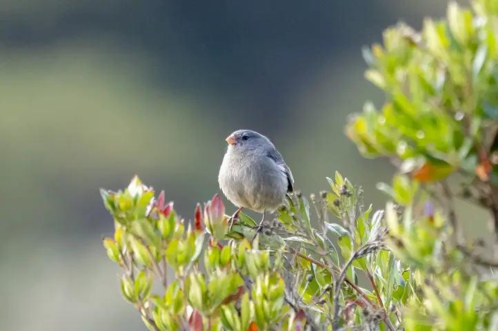
This beautiful, huge national Park of Colombia encompasses large protected Paramo and is a large watershed for the city of Bogotá. Reached by a smooth, roughly 1 1/2-hour ride from the city center (get there early to avoid the traffic jam in the city) it makes it, together with Chingaza National Park, a prime destination for high altitude species.
Birding is easy and done mainly from a very dusty road, as access to the National Park is restricted. The road is currently being paved, which will make birding much more comfortable in near future!
Once you leave the suburban sprawl of Bogota in Usme, the shear uncontrolled growth of this Megapolis is visible below you and on the close mountain slopes.
Finally, higher up, concrete gets replaced by potato fields, cars by horses and noise by birdsongs! Once you reach the tree-line (Elfin forest) good birding starts.
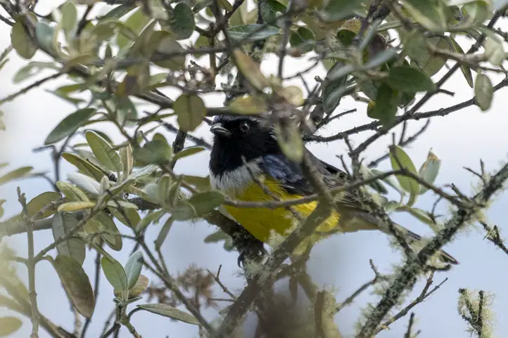
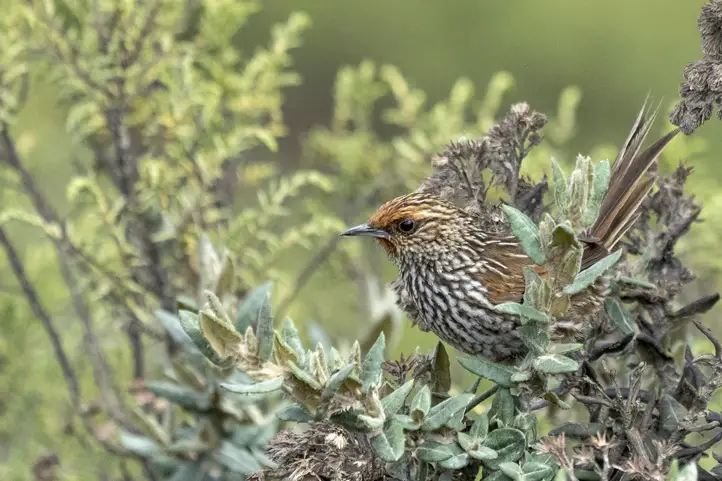
The range-restricted Bronze-tailed Thornbill & endemic Green-bearded Helmetcrest! The Thornbill is a territorial species. Look for it in vegetation close to the road.
The Helmetcrest is fond of Espeletia (local name “Frailejones”, a plant from the Asteraceae Family) which is in full bloom from late June – August. This might be the best time to see the Helmetcrest. And that’s when this spectacular, unique landscape looks even better.
Both species can be seen fairly reliably at most other times, too. If lucky, both species can be observed feeding, clinging to flowers, as many highland Hummingbird species do!
A particular good spot for the Helmetcrest is immediately adjacent to the large lagoon at the park entrance (There’s a sign of the Helmetcrest and a parking area to the right if coming from Bogotá). The lagoon to your left has typical cushion plants bordering it. That makes it perfect habitat for the critically endangered and endemic Bogota Rail and the more common Noble Snipe.
Many-striped Canastero – Asthenes flammulata
Many-striped Canastero and White-chinned Thistletail are to be looked for too, but it’s certainly the endemic Apolinar’s Wren which most people expect to see here. It occurs in fact in good numbers here, especially where there is Dwarf Bamboo – a plant required – for nesting.
The Wren is represented by the subspecies hernandezi, different from apolinari, the race occurring in the Sabana de Bogotá. Locate Apolinar’s Wren by its regularly performed song duets. The similar Sedge Wren occurs side by side with Apolinar’s Wren. Look and listen carefully…Exploring further along the Road can be good for Paramo Seedeater and more of the mentioned above.
Plain-colored Seedeater – Catamenia inornata
If you visit first time, remember that Sumapaz is a high-altitude site. Protect yourself from sun, hydrate properly and take things slow. The air is thin up there. Also protect your equipment from heavy dust (know how to do it here).
About the authors
Jérôme Fischer
Professional bird guide, swiss native, with more than 32 years of experience guiding hardcore birders and birdwatching tours. He has been focused in bird identification. He also travelled many countries, starting in Switzerland and then exploring south America, the most biodiverse continent in the world, becoming specialized in Neotropical birds.
Sara Colmenares
Current director of Sula. Doctor in Biological Sciences. Her main interests are to explore and understand the organism – environment interactions, taking advantage of emerging knowledge for the management and conservation of species and ecosystem services. She is currently working as a consultant in functional ecology, ecosystem services and conservation projects in Colombia related to ecotourism and birdwatching.