Naturally Mummified Bodies of the Museum of Mummies in Colombia

When you think of mummies, you surely think about Egypt, and its famous mummified pharaohs buried in their imposing pyramids. Yes, Egypt is known for its magical history and its gigantic cultural contribution, with their special techniques to mummify their bodies. But did you know that you can find naturally mummified bodies in the museum of mummies of Colombia?

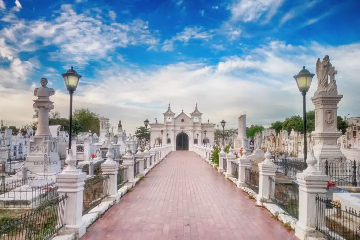
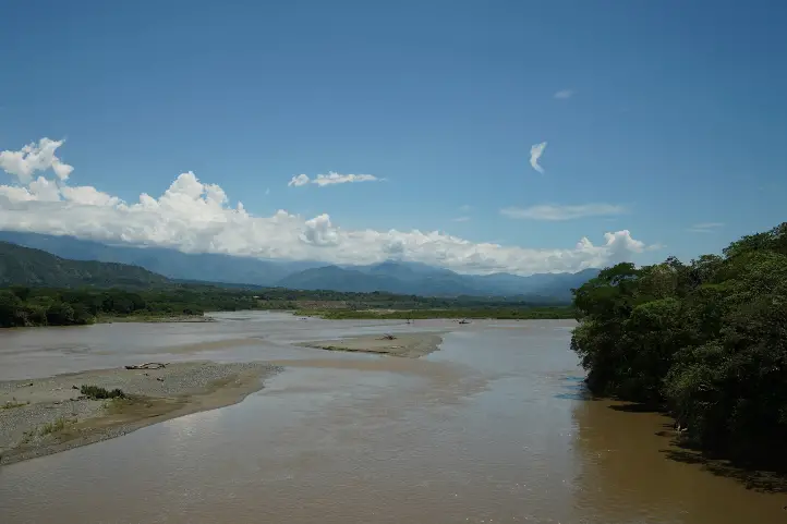
In a hidden village, approximately 99 km from Bogota, there is San Bernardo, a cozy village with very friendly locals. In the cemetery of San Bernardo, many of the dead become mummies for unknown reasons. It happens so often that the Church decided to build a mausoleum to keep them in glass urns, when the families allow it.

It is known for being the only town in Colombia where the dead buried there have a layer of skin between white and brown tones that gives them a very peculiar appearance.

In San Bernardo, death acquires a fantastic and mystical touch, since there is no scientific explanation for this process.

The following is the information you need to make the most of your visit to San Bernardo, the town of mummies in Colombia.

Exploring San Bernardo

The municipality of San Bernardo is the agricultural pantry of Sumapaz region, charming, magical and quiet land. Its gastronomy is recognized regionally and its agro-ecological fairs are the best in Sumapaz.

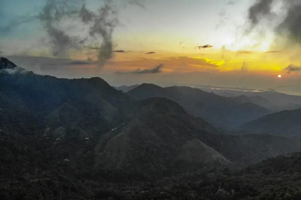
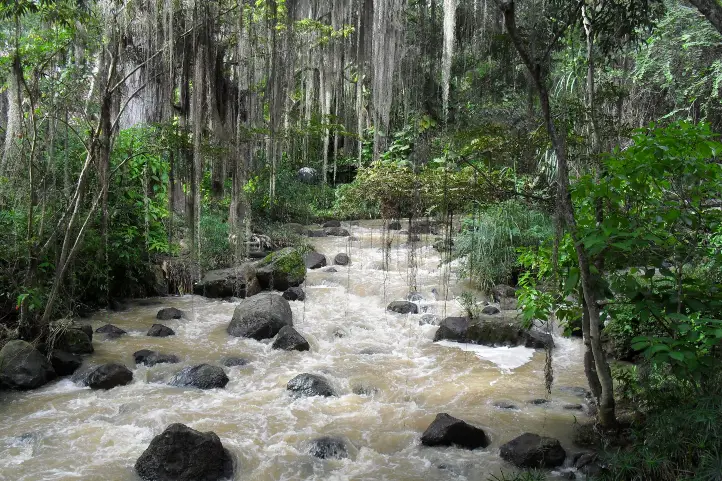
Its landscapes offer a great variety of climates and agricultural products; a natural paradise rich in natural niches such as the Sumapaz National Natural Park, its people are friendly and welcoming and always welcome you with open arms.

San Bernardo is the only place in Colombia where there is a natural mummification process that has not been explained.

Why are they mummified?

It all started in the 1950’s, when the new cemetery was inaugurated. The old one was on the banks of a river in the lower part of the municipality, but the current swept away some of the dead when the waters rose.

When they began to remove bodies for exhumations, mummified bodies began to appear.

Environmental Context for Mummification

The context in each case may be different, but in principle an extreme environment is needed: very hot, very dry or very cold.

After death, our cells begin to break down and release all sorts of substances – including enzymes – that create an ideal environment for bacteria and fungi, which enter this mixture and begin to break down the body.

In most cases, enzymes need an aqueous environment to work. But if the temperature is too high, the body dehydrates before the enzymes can take action, and this results in mummification.

When the temperature is too low this can also happen because the cold inhibits bacterial activity. Especially if the body remains covered with ice or snow.

Swamps (wet by nature) are another natural environment that favors mummification. This is because they are generally cold, acidic and anaerobic environments.

Another influencing factor is the composition of the soil, e.g. the presence of heavy metals in the soil can retard the action of enzymes. The material of the coffin, as well as the textiles that cover the body and absorb the liquids, can also have an impact on the process.

Finally, it also depends on the body characteristics of each individual.

What can be happening in San Bernardo?

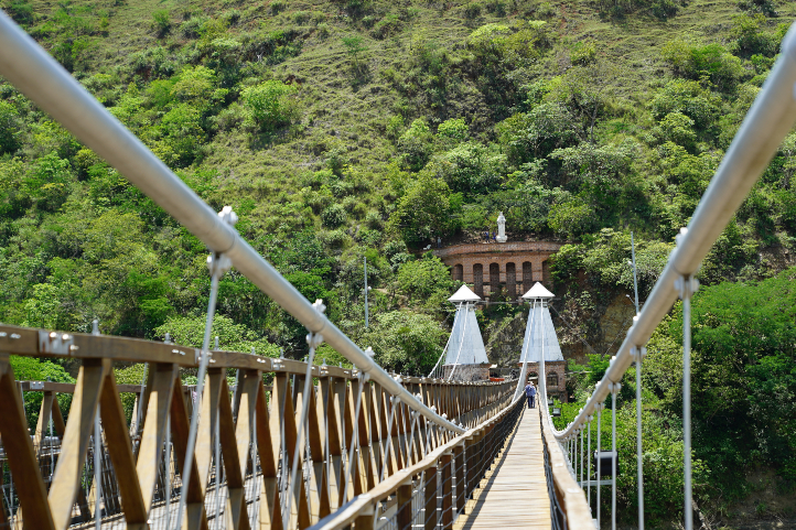
San Bernardo lies on the hills of Sumapaz, in the south of Cundinamarca, and the cemetery was built on the side of a mountain where it smells of pine trees and flowers. This cemetery is placed in the highest part of the village, near to the Paramo.

The gravedigger tells that the dead are exhumed every five years, and it always happens that they are intact… when they are cut they still have blood, they have flesh and they have everything. Even the eyes!

But there is a particular detail, according to the gravedigger, when the bodies come out “exact”, there is a thin layer of ice that covers the whole body. His testimony may suggest the very cold environment cause for mummification.

However, there are no studies to support the hypothesis of freezing, in spite of the testimonies.

Funerary and Cultural Heritage

Recently, the mummies of San Bernardo, and all the natural process is proposed to be declared as Funerary and Cultural Heritage.

The aim is to promote the Mummies of San Bernardo as Funerary and Cultural Heritage given the characteristics of the phenomenon that occurs naturally and the manifestations and identities that derive from it.

It is Funerary Heritage because it generates alternative visions of the meaning of death and the transcendence of the body after death. It is Cultural Heritage because through popular and daily orality emerge all kinds of myths connected with others transmitted by generations about the reason for the phenomenon. The mummies are the living memory and identity of a region that resists oblivion.

How to get to San Bernardo

The town is located in the south-east of the Department of Cundinamarca in the Sumapaz Province. San Bernardo has an average temperature of 21°C (69º F), making it a pleasant climate for tourists.

To get to San Bernardo you must take a 3-hour road trip from the south of the city of Bogotá for 99 km. On your way you will pass through towns like Fusagasuga and Arbelaez. When you passing Arbelaez  you must take an unpaved road that will take you to the center of town.

Where to stay in San Bernardo

Being a very small town we tell you to dedicate a whole day to walk the streets and points of interest.  In the afternoon you can stay in the town of Fusagasuga which is to 36 km away. In Fusagasuga we recommend you to stay in the following hotels:

Attractions and activities in San Bernardo

San Bernardo has two attractions that you will have the opportunity to visit. So we recommend some other nearby activities and attractions that you will love.

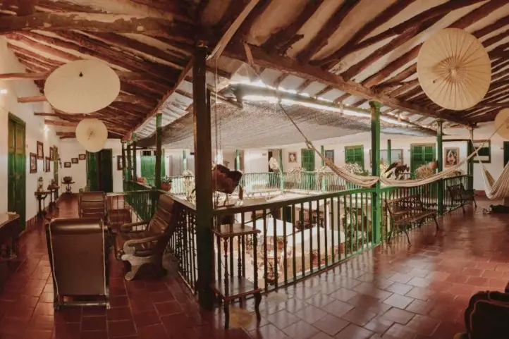
Mausoleum José Arquímedes Castro, or the Museum of Mummies

Mummies of the Mausoleum of Mummies © Mausoleum of Mummies

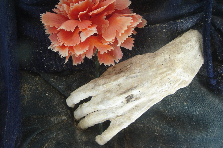
This is a museum that exhibits the mummies. Their bodies did not decompose but were calcified, keeping the skin and some parts of the body intact.

Currently, there are 14 mummies exhibited, since their number was reduced for health reasons, but at some point there were about 180.

The inhabitants of the village believe that the origin of the mummification is based on the diet of the Sanbernardinos, based on the consumption of Guatila and Balú. Both foods are part of the food tradition and grow wild and naturally, without chemicals that alter them.

However, all the surrounding municipalities consume the same food, and do not present mummified dead, thus refuting this local hypothesis.

The Mausoleum is open every day except Tuesdays from 8:00 a.m. to 1:00 p.m. and from 2:00 p.m. to 5:00 p.m. The entrance fee is 5000 pesos for adults and 4000 pesos for children. It is recommended to visit early in the morning so that you can make your visit at your leisure.

Before visiting the museum of mummies remember:

  • The mummies are deceased people so it is very important to maintain the due respect.
  • Avoid taking pictures of the mummies out of respect for the deceased and their families.
  • Do not throw garbage on the floor during your trip.
  • Your early visit allows you to go to places in and around San Bernardo with beautiful scenery.
  • Keep your hands clean and wear your mask correctly.

Macaracuay Ecological Farm

At the farm you can learn about the flora and fauna present in the village, have a sample of each of the products that are harvested. You will learn about the traditional farming techniques used in the village. It is possible to have contact with the animals of the farm and eat typical food of the area.

Water activities

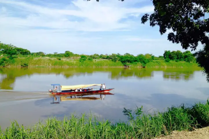
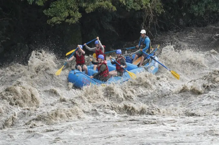
In the Negro River, near the village, you can do activities such as rappel, rappel and hike through caves near the river. You should keep in mind that these activities can only be done with certified guides that you can find in the different agencies located in the center of town.

Horseback riding

If you are a horse lover you can take the horseback riding service available in town, the marked trails will take you through traditional paths used by the villagers to get around. In addition, you can also ride to the Rio Negro River or the Macacuay Ecological Farm. Please note that most horseback riding hours are between 8:00 a.m. and 4:00 p.m.

La Chapa Viewpoint

In the neighboring town of Pandi, you will find an imposing viewpoint, from which you will have a view of the Sumapaz River canyon, the municipalities of Pandi, Icononzo, Venecia, Alto de Boquerón, Chinauta and the Natural Park of the Nevados del Tolima, Ruiz and Santa Isabel. It is located 8.3 km (26 minutes) from the center of San Bernardo, so it is necessary to take a car service to reach this point.

Green and Aquatic Park

This beautiful park is located 3 km from the town of Fusagasuga and 40 km from San Bernardo (1.5 – Hours); during your stay in the park you can enjoy beautiful and unimaginable landscapes, abundant in water, and a majestic diversity of green in the mountains.

You will be able to do activities such as hiking where you will be able to do bird watching and recognize the species thanks to the information offered by the park guides. You can have the opportunity to stay in individual cabins or there is also a camping area.

Quinini Hill

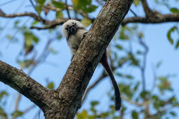
In the municipality of Tibacuy is this beautiful nature reserve with a beautiful viewpoint, located 60 km from San Bernardo (2 – hours). Quininí refers to the “Sacred Mountain of the Moon or Moon Goddess”, which is what it means in the language of the indigenous communities that lived there. Quinini is also a recommender destination for birdwatching near Bogotá.

References
About the authors

Sara Colmenares.

Current director of Sula. Doctor in Biological Sciences and Specialist in Tourism Management and Nature Tourism. Her main interests are to explore and understand the organism – environment interactions, taking advantage of emerging knowledge for the management and conservation of species and ecosystem services. She is currently working as a consultant in functional ecology, ecosystem services and conservation projects in Colombia related to ecotourism and birdwatching.

Luisa Martin

Engineer, world traveler, amateur photographer, traveling blogger, and foody

Stop Romanticizing Poverty, the case of Santa Cruz del Islote, Colombia

In the heart of the Gulf of Morrosquillo, in the middle of the Caribbean Sea, is Santa Cruz del Islote, an artificial island under the jurisdiction of the Corales del Rosario and San Bernardo National Natural Park, where 779 people live on one hectare. It is the most overcrowded island in the world.

Santa Cruz del Islote, with its shingled houses, stands out from the crystalline waters of the Caribbean Sea, in the heart of the Gulf of Morrosquillo. It is covered by a collage of more than 100 houses, everyone there is family related, and the offspring continue to grow.

The formation of new families has caused construction to grow vertically, increasing household overcrowding. The island has no public utilities and 40 percent of households still dump feces into the sea; the rest of the community uses septic pits.

The island’s vocation has always been fishing, but in recent years it has been seduced by tourism….

Slum Tourism in Colombia

The hyper-crowded Island

Santa Cruz del Islote has gained much popularity due to its overpopulation. Newspapers, such as The Guardian, have associated it with García Márquez’s magical realism, relating how people live at their own pace and highlighting the absence of violence and the mutual support among the inhabitants who are like one big family.

Documentaries have also been made, such as Aislados (Isolated), an award-winning 2016 documentary. The documentary shows the most densely populated artificial island in the Colombian Caribbean where there are no police, no priests, no armed conflict, and where the arrival of modernity and the possibility of an eviction, makes its inhabitants begin to awaken from the magic spell.

Today many children on the island dream of moving to the mainland, studying, working, and thus “sending money to fix the island”.

Santa Cruz del Islote currently occupies 10.000 km2, i.e. 1 hectare. With an average of 1.25 inhabitants per 10 m², 65% of the population is under age, and there are only 6 surnames and 97 houses. Scarce resources, and people’s curiosity, created a niche for a kind of slum tourism, promoted by the same inhabitants. Besides, the Official Tourism Site of the Republic of Colombia, promotes it as a destination to see, for being the most densely populated island in the world.

So far, this slum tourism has made little change or contribution to improving conditions on the island or for its inhabitants; and it does contribute to romanticize poverty, by focusing on the magical realism of the colors of their houses, the marvelous blue of the Caribbean Sea and the children playing on a small soccer field. About their precarious and difficult reality? no idea.

Artisanal aquariums to swim with Sharks

Apart from the social-cultural attraction, another of the island main attractions are some artisanal aquariums, where locals kept sharks and fish, semi-confined, to swim with tourists. The propaganda followed the idea that going to Santa Cruz del Islote means having the opportunity to swim with sharks, rays and fish in the small improvised pool and make short tours through the streets of the island. Sounds Great! right? But reality is different.

In high season, the influx of tourists can reach 1,200 people, eager to participate in the great attraction offered by this community. Thus, for 5 thousand pesos, people have the right to swim with sharks.

There, in precarious conditions of confinement, without scientific surveillance or any kind of professional marine scientists, they keep the fish, which endure the harassment of dozens of tourists who jump into the water to touch them and take pictures.

This is a type of invasive and illegal tourism, even if the intention is not to mistreat the animals, but to have an alternative economic activity, it is not the right way.

On the other hand, as there are no sewage services on Colombia’s most populated island, the unwary travelers do not know that they are swimming in a sea of feces, in the aquarium-pools. There are also all kinds of pollutants, such as motor oil for the boats and large amounts of garbage.

Towards a sustainable tourism

In January 2020 a tourist denounced in her twitter account: This happens in Santa Cruz del islote, they have these animals in captivity so that people enter and touch them and disturb them. The animals were trying to avoid people. They are little animals that have no teeth, they can’t defend themselves #NoAlMaltratoAnimal @PoliciaColombia @Citytv pic.twitter.com/DvvcmZmqxz
– Daniela Correa (@dacf2891) January 27, 2020.

Although the sharks are going to be released, the inhabitants are asking for other work alternatives. Today the local government is working with these communities to implement sustainable tourism to protect the beaches and to eradicate illegal practices such as the captivity and mistreatment of these sharks.

The goal is to provide these communities with new work opportunities, such as implementing pools for lobster farming, training them in sustainable tourism practices, legalizing their boats, among others.

Discovering Santa Cruz del Islote

Santa Cruz del Islote. ©El Universal

Santa Cruz del Islote contrasts in a fascinating way with the Archipelago of San Bernardo, of which it is part, where wild mangroves, white beaches and few inhabitants is the common landscape.

However, it has an artificial origin, Santa Cruz del Islote was built by man.  The islet was built by fishermen who arrived and built it in the middle of the coral, with stone, rubble and garbage. The little town has four main streets but no presence of cars or motorcycles. You can see that there are boats everywhere, floating on the shores of the sea or on the cement patios of the houses.

On your visit to Santa Cruz del Islote you will see some stores, a health post, a three-story school, a restaurant and 97 houses that are no larger than 40 square meters. About ten people live in each house. The islet has an average temperature of 28°C (83º F).

How to get to Santa Cruz

Santa Cruz del Islote is located between the islands of Tintan and Múcura. The closest ports are Rincón del Mar, Berrugas and Tolú in Sucre, and boat transportation costs 30,000 pesos per person. To Cartagena, in Bolivar, the boat fare is 60,000 pesos.

  • Take a 1-hour flight from El Dorado (BOG) in Bogotá to Rafael Nuñez International Airport (CTG) at Cartagena city.
  • Take a 1-hour flight from El Dorado (BOG) in Bogotá to Las Brujas Airport (CZU) at Sincelejo city. Once at the airport, take an approximately 1-hour ride to Tolú.

Once there you must pay a fee of 5,000 COP for the entrance to the islet in exchange you will be offered a guided tour of the islet.

Where to stay in Santa Cruz del Islote

Santa Cruz del Islote belongs to the islands of San Bernardo, in the Colombian Caribbean. You can stay overnight on the island, but if you want a more comfortable accommodation you can stay in one of the adjacent islands: Múcura or Tintipán; or even in the houseboats in the surroundings, as is the case of “Casa en el Agua” (House on the Water), with very basic services and very low comfort.

Activities and attractions in Santa Cruz del Islote 

As mentioned before, at Santa Cruz del Islote you will know one of the most populated places in the world. You can stroll through its alleys and admire its colorful houses, you will talk to the people who always seems to be happy; you can also enjoy the peaceful atmosphere of the island (no violence, theft, altercations or fights). If you are a soccer lover you will be able to play a game with the locals.

You can also visit near places in Tolú and Múcura Island.

Tolú

  • La Ciénaga de la Leche. It is a natural reserve located 20 minutes from the center of Tolú. It consists of beautiful mangrove trails and a surprising biodiversity. During the tour you will find several species of birds and abundant vegetation that will allow you to connect with nature.
  • Roca Madre Adventure Field Park. Considered one of the best attractions in the department of Sucre, this park is ideal for adventure lovers. You will be able to walk through the tropical dry forests and discover the most amazing natural attractions.

You will also have the possibility of doing several extreme activities for the more adventurous such as climbing, rappel and canopy, as well as getting to know the flora and fauna of the area.

  • The Toluviejo Caves.These caves are formed by millenary formations of stalactites, stalagmites and dolomites in its depths, dating from the Miocene and Pliocene periods. Ideal for spelunking activities, the caves are:Las Claras, Del Caimán, De la Iglesia or Catedral, De las Mercedes, Del Cáñamo, De la Mansión; each of these names has been given by the community in relation to their similarities, and others are honorific.

Múcura Island

  • Snorkeling: It is done every day from 9:30 am to 12 noon. In this tour people are taken to a beautiful reef.
  • Kayaking: You can do it with the tranquility of this turquoise sea, spend a moment of tranquility while contemplating the beauty that the island offers.
  • Ecological Hike: You can tour the island with a guide or you can do it alone, you can walk along the island and marvel at the nature that this little piece of land offers you.

Tintipan Island

You can also spend an afternoon on Tintipan Island, where you can snorkel and do some sport fishing.

———

If you want to come to Colombia contact us and plan your trip with us.

 References

About the authors

Sara Colmenares

The current director of Sula. Doctor in Biological Sciences. Her main interests are to explore and understand the organism-environment interactions, taking advantage of emerging knowledge for the management and conservation of species and ecosystem services. She is currently working as a consultant in functional ecology, ecosystem services, and conservation projects in Colombia related to ecotourism and birdwatching.

Where to Spot the Spectacled Bear in Colombia?

One of the smallest bear species, the Spectacled Bear or Andean Bear is recognized as the guardian of the Andes and gardener par excellence. We invite you to discover this species that inhabits the Colombian territory and other South American countries.

Spectacled bear Facts

  1. South America: The spectacled bear or Andean bear (Tremarctos ornatus) is native to South America;
  2. Endemic: It is the only species of bear that inhabits South America, and it is endemic to the tropical Andes.
  3. Ancient: It has inhabited South America for more than five million years.
  4. Last of its kind: It is the only living representative of the short-nosed bears, a group that inhabited only the American continent.
  5. Big Territories: This bear needs large areas to be able to feed and look for mates.
  6. Forest Engineer: The Andean bear has an efficient role as a seed disperser, making it fundamental for paramo and the Andean Forest.
  7. Wide distribution: The spectacled bear is present in the forests of Venezuela, Ecuador, Peru, Bolivia, Argentina (in the northern forests) and Colombia (with presence in the 3 mountain ranges, in protected areas).
  8. Highlander: They are able to live at altitudes of up to 4,750 meters above sea level and it is not normal for them to frequent altitudes below 2000 meters.
  9. Bioindicator: the presence of Spectacled bears indicates the availability of water and that nearby forests are in perfect condition.

Characteristics of the Spectacled Bear

Spectacled Bear rescued at La Planada Nature Reserve. Its name is Arcoiris (Rainbow)

One of the most important characteristics is the presence of white fur around the eyes in a circular shape, making its shape like that of a pair of glasses. There are many specimens where this white fur extends to the chest.

The size, coloration and shape of these white spots are usually different in each individual and are characteristics that are often used for identification at this level. The rest of their body fur is dark brown or black.

They are a very small species of bear; adult males reach a size of 100 to 200 kilograms while adult female spectacled bears weigh only 30 to 85 kilograms.

It is a species that normally remains alone, only when the female is in mating season can be observed accompanied. Spectacled bears only remain with their mother until they are one and a half years old, after which they separate from the litter.

Spectacled bears reach sexual maturity between 4 and 7 years of age. It is known that they can mate at any time of the year, although the highest reproductive activity is registered in April and June. Usually a female gives birth to a litter of 2 cubs, but sometimes 3 cubs are born after a gestation period of 5.5-8.5 months.

It is not aggressive, you may be surprised to find a bear that by instinct will stand on two legs when it feels invaded in its space or confused by the intruder in its habitat, but it will not try to attack if it sees a distant and clueless individual.

Where to Find the Spectacled bear in Colombia

There are many places in Colombia where the Andean bear is distributed, but seeing it is a fortuitous event. The places where you can have more luck to see the Spectacled bear in Colombia are:

Natural National Park Chingaza

During hiking activities in the páramo it is possible to see Andean bears directly or indirectly. Also on the trails you may be able to see tracks on the ground, scratches on the trees, territory marking, bedding and feeding troughs.

Surroundings of the Natural National Park Las Orquideas

Since 2016 there is registration in this protected area of the bear, so that in the stipulated trails there is evidence of the presence of bears; on very few occasions visitors have been able to make a direct sighting; the park caretakers if they have had the opportunity to see families of bears.

El Verjón, Near Bogota

This is the first time that the spectacled bear has been seen so close to an urban area; last July. 2021, a surprising spectacled bear was seen walking in the Cerros Orientales of the city of Bogotá. The sighting of the animal was recorded in a security camera video.

Municipality of Íquira

In the buffer zone of the Cerro Banderas Ojo Blanco Regional Integrated Management District (DRMI) and Nevado del Huila National Natural Park, a male bear was spotted by camera traps. In the department of Huila there are other municipalities where records of this endangered species have been documented in Santa María, Garzón, Guadalupe, Neiva, Algeciras, Colombia, Palermo, Teruel, Pitalito and San Agustín.

Threats to the Spectacled Bear

Currently, human encroachment on the spectacled bear’s habitat has caused a high percentage of deforestation, due to the increase of the agricultural frontier, which has caused the bears to move to higher and higher areas in the mountain range.

The International Union for Conservation of Nature (IUCN) and the Ministry of Environment and Sustainable Development have catalogued the spectacled bear as a species vulnerable to extinction.

Biological Corridor in Colombia for the Spectacled Bear

When we talk about a biological corridor is habitat for different species of wildlife, this time we will tell you the one that has the spectacled bear, tremarctos ornatus by the southwest and west of the department of Antioquia. This corridor can be identified in the following municipalities:

  • Jardín – Tamesis ( 28061 ha).
  • Andes – Betania – Ciudad Bolivar ( Farallones del Citará 30875 ha)
  • Salgar – Betulia (Cuchilla cerro plateado alto San José 8900 ha)
  • Urrao (29870 ha)
  • Anzá- Caicedo – Santa Fe de Antioquia (10087 ha)
  • Las Orquideas NPP (32000 ha )
  • Frontino ( 30139 ha)
  • Abraqui – Cañas Gordas – Giraldo ( 6900)

Currently the department of Antioquia is promoting a project for the conservation of the spectacled bear corridor, promoting:

  • The restoration of the forests
  • The protection and monitoring of the species present.
  • Establishing limits of the biological corridor and monitoring compliance.
  • Controlling the expansion of the agricultural frontier.
  • Constant education of the community in the conservation and protection of the biological corridor.
  • Development of projects for sustainable agricultural practices.

Ecological importance and importance in cultural and nature tourism

In addition to its ecological importance, the Andean bear has also been an emblematic animal, involved in the development of many of the indigenous and peasant cultures in the Andean countries. For many it is sacred, for others the big brother of the human being. In the oral traditions of the peoples, the bear is found in legends, tales, songs and myths.

The Andean bear is reflected in the common names of some plants, such as “la mano de oso” (Oreopanax bogotensis) and “la hierba del oso” (Xerophyllum tenax).

It is also very common to find sites or places that receive their names honoring the Andean bear: Alto del Oso (Colombia), Cueva del Oso (Ecuador), Quebrada El Oso (Colombia, Peru, Venezuela), Vereda del Oso (Colombia), among others. Thus, the Andean bear is part of the cultural heritage and worldview of the countries of the Andean region.

References
About the author

Luisa Martin

Engineer, world traveler, amateur photographer, traveling blogger, and foody.

Sara Colmenares

The current director of Sula. Doctor in Biological Sciences. Her main interests are to explore and understand the organism-environment interactions, taking advantage of emerging knowledge for the management and conservation of species and ecosystem services. She is currently working as a consultant in functional ecology, ecosystem services, and conservation projects in Colombia related to ecotourism and birdwatching.

14 Unique Monkeys you Cannot Miss in Colombia

Colombia is one of the countries with the largest diversity of monkeys. It is ranked as the sixth country in the world, and the third in the region after Brazil and Peru. Such diversity is associated to Colombia’s geographic location and topography.

Colombian primate species, aka Colombian monkeys,  are a good example of Neotropical monkeys, since we have representatives of the three families recognized for the American continent: Cebidae, Pithecidae and Atelidae. The department with the largest number of species is Cauca, since it includes Andean, Chocó and Amazonian Piedemont areas, each of these regions usually has some particular species.

Below you will know and discover some of the most unique monkeys that you can find in Colombia.

Discovering the endemic monkeys of Colombia

Brumback’s night monkey – Aotus brumbacki

Brumback’s Night Monkey – Aotus brumbacki

Where to find it: Arauca, Boyacá, Casanare, Cundinamarca, Meta, Vichada

Conservation status: Vulnerable

Habitat: inhabits at low altitudes in Colombian Eastern Plains, usually in dense forest, fragmented forest, gallery forest and riparian forest.

It is also found in a small part of Apure State, Venezuela. Its western range extends from the foothills of the Eastern Cordillera between the Arauca River to the north and the Guaviare River to the south.

They are nocturnal animals, being mainly active on full moon nights. During the day they take refuge mainly in tree hollows to rest. They are monogamous and congregate in groups of 3 to 5 individuals.

Hernández-Camacho’s night monkey – Aotus jorgehernandezi

Where to find it:  Habitat: Quindio and Risaralda, it is possible that it occurs in Tatamá Natural National Park.

Conservation status: Data deficient.

Habitat: dense forest, fragmented forest, gallery and riparian forest and secondary or transitional vegetation.

It is a nocturnal species, first described in 2007 by Thomas Defler and Marta Bueno, two of the most important primatologists of Colombia.

This monkey has a gray neck and a white spot over each eye, separated by a black band. The skin on the chest, belly, lower arms and lower wrists is thick and black.

Gray-handed night monkey – Aotus griseimembra

Where to find it:  Sinú River, including the Sierra Nevada de Santa Marta and the Magdalena River, Cauca River and Sao Jorge River valleys. It can be found in the border with Venezuela near to Maracaibo.

Conservation status: Vulnerable.

Habitat: tropical dry forest. It is arboreal and nocturnal.

This little monkey eats fruits, flowers, leaves, nectar, and insects. A curious fact of this monkey is that it is monogamous, and communicates visually. Also, male and female are identical. The Gray-handed night monkey is an important dispersor of seeds and are also potential pollinators for trees, and it is used by scientists as a model because it is resistant to VIH-1.

The hair on the back of the hands and feet is the color of light coffee with darker hair tips, a key distinguishing feature from other A. lemurinus subspecies.

Varied white-fronted capuchin – Cebus versicolor

Where to find it:  Middle and high Magdalena Valley.

Habitat: Lowland moist forest and palm swamps in the Río Magdalena Valley of northern Colombia

Conservation status: Endangered.

It was classified as a subspecies of the white-fronted capuchin (C. albifrons) but genetic analysis revealed it to be a separate species.

Santa Marta white-fronted capuchin – Cebus malitiousus

Where to find it:  Magdalena

Conservation status: Endangered

Habitat: The habitat where this species can be seen is in Mosaic of crops with natural spaces Gallery and riparian forest.

This primate is a medium-sized monkey, is characterized by a color that is rather dark brown over almost the entire body with yellowish shoulders.

It is omnivorous, feeding mainly on fruits, invertebrates, other plant parts and sometimes small vertebrates.

Colombian black-handed titi – Cheracebus medemi

Where to find it:  Putumayo and Caquetá.

Conservation status: Vulnerable.

Habitat: Inhabits tropical rainforest in southern Colombia, and this is one of the species most affected by climate change. They live in family groups and are monogamous.

The Colombian black-handed titi is territorial, and vocalizes loudly when couples from other groups enter their own territory.

Their diet consists mainly of fruits. To a lesser degree they also eat other parts of plants and insects.

Ornate titi – Plecturocebus ornatus

Where to find it:  Caquetá.

Conservation status: Critically endangered.

Habitat: This species can be seen in the following habitats: Dense forest, fragmented forest Secondary or transitional vegetation Mosaic of crops, pastures and natural spaces Gallery and riparian forest.

It is a miniature monkey with a graceful red beard, discovered in the Colombian jungle. Its fur is grayish-brown, it does not have a white band on its forehead and is the size of an average domestic cat.

They have one offspring per year and, when the offspring arrive, the parents usually force the eldest of the offspring to leave the group, to concentrate their attention on the newborn. Family groups of this species stay together in groups of up to four individuals.

Caqueta Tití – Plecturocebus caquetensis

The Caquetá Titi Monkey (Plecturocebus caquetensis) (Illustration: Stephen D. Nash)

Where to find it:  Caquetá.

Conservation status: Critically endangered.

Habitat: It usually inhabits the humid forests between the Caquetá and Orteguaza rivers, in the northwestern Amazon, southern Colombia.

Its body measures between 35 cm in length and its tail 61 cm, weighs between 800 and 1400 g. Their body fur is abundant and reddish on the neck; the end of the tail is black with white tips.

They are monogamous and form small groups of 3 to 6 and preferably 4 individuals.

White-footed tamarin – Saguinus leucopus 

Where to find it:  Confined to restricted forest patches in the Magdalena River valley towards the center and north of Colombia, particularly in the departments of Antioquia, Bolívar and Tolima; between 0 to 1600 m.a.s.l.

Conservation status: Vulnerable

Habitat: This primate is found in dry tropical, humid tropical, very humid tropical and very humid premontane forest (under the Holdridge scheme). This species uses different types of habitat: primary forest and secondary forest with several years of regeneration, preferably using primary forest.

The White-footed tamarin is very similar in appearance to the cotton-top tamarin, from which it is separated by the Atrato. Its average weight is 440 grams. These primates are diurnal and arboreal, active and agile. They move constantly and quickly between trees, and can jump up to four meters between them.

The back is pale silvery brown, or yellowish white variegated with brown. The face is almost naked with some thin white hairs. The forehead is whitish, as well as the area from the crown of the head to the ears.

Groups range in size from 2 to 15 individuals.

Cotton-top tamarin – Saguinus oedipus

Cotton-top tamarin – Saguinus oedipus

Where to find it: Atlántico, Bolivar, Sucre, Córdoba, Antioquia.

Conservation status: Critically endangered.

Habitat: Found only in the northern region of Colombia in tropical dry forests.

Squirrel-sized, they also have white chests and bellies, while their backs and tails are covered with long black and brown fur. They have claw-like nails, which are essential for jumping from one tree to another.

They feed through the middle layer of the canopy in search of the fruits and insects that make up much of their diet. The Cotton-top tamarin form social family groups that include breeding parents, their adult offspring and even unrelated adults that have migrated into the group.

Interesting Endemic subspecies

Colombian woolly monkey – Lagothrix lagothricha lugens

Where to find it:  Amazonia and Orinoquia Regions.

Conservation status: Critically endangered

Habitat: it can be found in dense forest, fragmented forest and open forest.

It is a large species among the New World monkeys. The body length ranges between 45 and 55 cm, the tail is longer than the body and measures between 60 and 65 cm; the average weight is between 7 to 10 kg, larger males can have a muscular body, with well-developed arms and tails. They are obligate frugivores, completing their diet with immature leaves, their main function in the forest is the dispersion of seeds.

They usually live in groups of 20 to 24 individuals, for their rest periods they look for tall trees to sleep 25 to 30 meters high.

Hernández-Camacho’s Black-mantled Tamarin – Leontocebus nigricollis hernandezi

Where to find it: Amazonas, Caquetá, Cauca, Cauca, Huila, Meta, Nariño, Putumayo

Conservation status: Least concern

Habitat: Found in a wide variety of habitats: secondary vegetation, isolated patches of forest, seasonally flooded forest and inland non-flooded forest up to an altitude of approximately 500 meters above sea level.

Head-body length ranges from 175 to 270 mm, while its tail reaches 250 to 383 mm; it weighs between 338 and 436 g. Females are slightly heavier than females. Females are slightly heavier than males. Their diet is based on insects and fruits.

Colombian squirrel monkey – Saimiri cassiquiarensis albigena

Where to find it:  Amazonia and Upper Orinoco

Conservation status: Least concern

Habitat: It is one of the best known monkeys in Colombia due to its wide distribution, its adaptability to highly disturbed or urban environments.

The body with the head reaches 25 to 37 cm in length in the male and up to 34 cm in the female; the tail is 38 to 45 cm long in the male and up to 43 cm in the female; it weighs between 550 and 1,200 gr.

Their diet is based on insects and ripe fruits, so they spend most of the day moving among the branches in search of food, they are social and arboreal animals, and rarely travel on the ground. Females give birth to 1 or 2 young after a gestation period, which lasts between 150 to 170 days.

Varied Capuchin – Cebus versicolor cesarea

Where to find it:  Cesar, Magdalena, Bolivar, Santander, Boyacá, Caldas, and Cundinamarca.

Conservation status: Critically endangered.

Habitat: it inhabits mosaics of crops with natural spaces, gallery and riparian forest, and dense forest. It is an arboreal and diurnal animal, however, they come down to the ground more often than most New World monkeys.

They feed on many types of food including fruits, plant material, invertebrates and in some cases small vertebrates. They are medium-sized animals weighing between 1.5Kg and 4Kg, with an average adult length between 33.5cm and 45.3cm (excluding the tail), with the male being about 27% larger than the female.

What Can be Done to Conserve Primates in Colombia?

Half of Colombia’s primates are at some level of threat to their survival and little effort is being invested to protect them. This situation is serious, considering the decisions that need to be made for the future of primates, which are an extremely important part of Colombia’s forest ecosystems.

The Atlas of primate biodiversity published by the Humboldt Institute tells us that the loss of the distribution area of endemic primates is a recurrent pattern in the country, some of them have lost between 8 and 68% of their potential and natural distribution.

Avoiding the destruction of forests and minimizing hunting are the main actions that can help their conservation. It is also important to monitor populations and carry out forest restoration projects, generate biological corridors and protect habitat in the most important areas for their populations.

Recently, researchers from the University of Caldas confirmed the presence of a nocturnal monkey in the department of Nariño, which could be a new species. Also in the south of Meta there is a species of marmoset that has a similar appearance to Plecterocebus caquetensis… This means that perhaps in Colombia there are still monkey species to be discovered!.

Nature tourism is also a help since it serves as a tool for the education of human populations around the habitats of these species, which they begin to learn about and care for. Learn about Conocer para Conservar initiative in the Primatology Association of Colombia website.

If you want to see monkeys in Colombia, contact us and we will help you plan the best trip!

References
  • http://www.humboldt.org.co/
  • https://www.asoprimatologicacolombiana.org/
  • https://www.itis.gov/
About the authors

Sara Colmenares

The current director of Sula. Doctor in Biological Sciences. Her main interests are to explore and understand the organism-environment interactions, taking advantage of emerging knowledge for the management and conservation of species and ecosystem services. She is currently working as a consultant in functional ecology, ecosystem services, and conservation projects in Colombia related to ecotourism and birdwatching.

Luisa Martin

Engineer, world traveler, amateur photographer, traveling blogger, and foody.

Jaguar Sighting Routes in Colombia and Latin America

The jaguar, yaguar o yaguareté (Panthera onca)  is recognized as the largest feline in America and the third-largest feline after the tiger and the lion. Besides, Colombia is the third country in Latin America with the largest population of jaguars, after Brazil and Peru. So there is a good chance to see them here!

In this publication, you will get the necessary information about jaguars, and where to discover this wonderful species in Colombia.

Facts About Jaguars

  1. Their skin is yellow with rosettes and black spots. However, this species sometimes presents melanic variations: black or dark brown individuals, which are called the black panthers.
  2. The jaguar measures between 1.5 and 2.4 meters, weighs between 45 and 120 kg. and lives between 10 and 12 years. Its body is robust and muscular, with a broad head and small, rounded ears.
  3. Adult jaguars are solitary, only joining temporarily for a couple of weeks for courtship and copulation. The rutting season lasts 12 days in a 47-day cycle. Ovulation in the female is induced by previous copulation, which stimulates and activates the female’s reproductive system.
  4. It is theorized that female jaguars may give birth at any time of the year, but the few reports of cubs generally occur between December and March. Sexual maturity is attained at 24-30 months of age.
  5. Gestation lasts approximately 100 days, and the female gives birth to two or three cubs weighing 800 grams. The cubs are weaned at 4-5 months to begin their carnivorous diet and become independent from their mother between 16 and 24 months of age.
  6. The jaguar has the most powerful bite of all felines, the intensity of the bite in the attack depends on the prey.
  7. Unlike other felines, they do not reject water. In fact, they are very good swimmers.
  8. They are capable of dragging their prey for dozens of meters, even passing it over fallen logs or over wire fences, demonstrating extraordinary strength with their jaws.
  9. The jaguar also plays a fundamental role in the ecosystem balance, it is capable of guaranteeing the survival of smaller species, and it is an excellent protector of water and forests.

Where do the Jaguar live?

Jaguars can be found in diverse habitats such as forests, wetlands, savannas, and grasslands, from sea level to 3,000m altitude. Current jaguar populations are distributed from Mexico to northern Argentina over an area of 8.75 million km2.

In South America, the number of jaguars exceeds 163 thousand, and Brazil and Peru are the countries with the largest populations of this feline.

Despite this broad range, jaguars have been eradicated from 40 percent of their historic range and are extinct in Uruguay and El Salvador. While the rare individual has been spotted in the US, there has not been evidence of a breeding population in the US in more than 50 years.

The Jaguar is an Endangered Species

There are three causes that endanger the jaguar in the different areas through which it moves:

  • The loss of its habitat is due to the use of wildlands for agriculture and other developments. This causes jaguars to run the risk of being isolated in small areas, increasing their risk of extinction.
  • Direct hunting by people living in the countryside, who see the jaguar as a threat to their lives and livelihoods.
  • The scarcity of natural prey, which is also hunted by humans, has led jaguars to reach areas where they encounter domestic animals for food.

According to the IUCN Red List of Threatened Species, of the 34 jaguar subpopulations that exist throughout the continent, 33 are Endangered or Critically Endangered. The Amazonian population is the only one in a state of Least Concern.

Recent studies by Panthera Foundation show that there are about 173,000 jaguars remaining in the Americas, less than half of the species that historically existed throughout its range.

The Jaguar Corridor

The jaguar is listed as “Near Threatened” on the International Union for the Conservation of Nature (IUCN) Red List of Threatened Species, though its status is in review and may be elevated to “Vulnerable” in the next year.

The species is threatened by habitat loss and fragmentation, conflict with local people due to the real or perceived threat posed to livestock, and overhunting of the jaguar’s prey by local people.

The jaguar corridor is a project showing how big predators can indeed live with humans. Dr. Alan Rabinowitz devoted his life to conserving this magnificent cat and co-founded the Panthera organization, “the only organization in the world that is devoted exclusively to the conservation of the world’s 40 wild cat species and their ecosystems”.

Rabinowitz established the world’s first jaguar sanctuary – the Cockscomb Basin Wildlife Sanctuary – in Belize in 1986. He also developed the conceptualization and implementation of the Jaguar Corridor across their entire range from Mexico to Argentina.

Jaguar Corridor and Conservation Areas

The countries that make up the Jaguar Corridor are: Mexico, Belize, Guatemala, Honduras, Honduras, Nicaragua, Costa Rica, Panama, Colombia, Ecuador, Brazil, Argentina, Paraguay, and Bolivia. Besides, the initiative is supported by numerous governments, landowners, corporations, local communities, and scientists.

Currently, the governments of Brazil and Argentina have identified an increase in the jaguar population, which has caused an increase in surveillance and monitoring of border areas in both countries and joint parks to prevent illegal hunters, especially in Iguazu.

Today there is a conservation strategy called Jaguar 2030 Conservation Roadmap for the Americas, a multi-government plan to conserve jaguars across their range supported by UNDP, Panthera, WCS, and WWF. Find out more in the document Jaguar Strategy 2020-2030.

Best Spots to See Jaguars in South America

Jaguars are difficult to spot, as good hunters of prey, they are stealthy animals and camouflage themselves very well. Luck must be on your side!

The most famous destinations for jaguar sightings are:

Brazilian Pantanal.

Jaguars are common to find in the Pantanal ecosystem. 80% of Pantanal is in Brazil, and the remaining 20% is located between Bolivia and Paraguay.

The best spots to see jaguars in Pantanal are in Brazil. In the north, the Cuiabá River is the most known place to watch this animal. Jaguars get exposed during the dry season, from June to October, when they visit the riverbanks to hunt capybara and caiman.

Towards the southern Pantanal, there is the Caiman Lodge, the Onçafari Project fosters ecotourism, monitors wild jaguars, and releases rescued cats into the wild.

The Amazon Jungle in Peru

Manú National Park is a biosphere reserve, a hot spot of biodiversity, where you can see jaguars. Besides, this reserve is a great destination for birdwatching.

The tropical forest of the Guiana Shield in Guyana

The place is famous since the BBC filmed its series Lost Land Of The Jaguar in 2008.

The tropical cloud forest of Belize

In Belize, you will find the first nature reserve created to protect jaguars, it is called Cockscomb, a sanctuary located in central Belize.

Eastern Plains in Colombia

In Casanare, in Hato La Aurora, in Hato Corozal, in the Ariporo and Orinoco River Basin, are the places where jaguars can be free and protected thanks to the support of the community.

In this area there is natural prey such as armadillos, deer, and others that are not found in any habitat, that is to say, that where the Jaguar is, it acts as a protector of these species and those that are not seen such as insects, invertebrates and plants that are within an ecosystem.

Colombia is a favorite place for jaguar conservation

Jaguar populations inhabit forests below 2,000 m.a.s.l., in tropical forests, riparian and gallery forests associated with rivers, marshes and beaches, tropical savannahs; they are also found in montane forests.

In Colombia, there are four blocks of large populations, in decreasing size: Amazon, Orinoco, biogeographic Choco, and the Caribbean. Jaguars’ distribution in the national territory follows like this:

  • 4.2 jaguars per 100 km2 in Amacayacu National Natural Park.
  • 2.8 jaguars per 100 km2 in unprotected Amazonian rainforests.
  • Populations of 3.2 adults/100 km2 for an oil palm landscape in the Magdalena Medio region.
  • 1.9 adults/100 km2 for the Colombian Llanos.

The biological corridor in Colombia covers 228.000 hectares and protects the lives of 34 species of medium and large mammals; it is the most important and largest in the countries where the jaguar is present.

Besides, there are videographic records in different areas of the country where you can see the presence of the jaguar in its natural habitat, which has led to studies for conservation.

Today, Colombia launched its first Jaguar Sighting Route, a conservation – tourism project which aim is to strengthen Colombia as a jaguar sighting destination. The project includes the creation of a guide to good practices for cat watching, training of local guides, and the creation of trails and a portfolio of services associated with nature tourism. Find out more in our entry The Top Post-Covid-19 Destinations for Conservation Lovers in Colombia.

References
  • http://reporte.humboldt.org.co/biodiversidad/2015/cap3/306/#seccion7
  • http://www.wildllanos.com/la-aurora-tour.html
  • https://fundacion-jaguar.org/en/informacion-del-jaguar.php
  • https://www.panthera.org/cms/sites/default/files/Panthera_Fact-Sheet_Jaguar.pdf


About the author

Luisa Martin

Engineer, world traveler, amateur photographer, traveling blogger, and foody.

Travel Guide to the “Ciudad Vanidosa”: Ciénaga, Magdalena, Colombia

Ciénaga is considered one of the most beautiful towns in Colombia, it was the setting for the inspiration of the book One Hundred Years of Solitude by Gabriel Garcia Marquez.

Walking through the streets, squares, and houses of Cienaga you can bring to life the characters and events that are narrated in the book.

Founded in 1751, its historic center, consisting of 76 blocks, was declared National Heritage in 1994. Ciénega was also declared a Heritage Town in 2012 for its history, culture, and architectural richness, which further boosted tourism.

Within its architectural heritage, you can find the Templete, the Chapel of the Santa Teresa School, the Old Railroad Station, the Church of San Juan Bautista, the Masonic Lodge, and the Casa del Diablo (House of the Devil).

At the cultural level, its main events are the Cienaguero Cayman Festival held every January 20th and the National Guitar Music Festival that pays tribute to Guillermo Buitrago every June.

Besides, Cienaga has the magic to make you travel back in time for its historical, architectural, urban, environmental, and social values. In this guide, you will receive the necessary information to make the most of your visit to this special heritage town.

Exploring Ciénaga

This town and its surroundings have gone through difficult situations of violence and armed conflict in the past. Today, ecotourism, cultural tourism, and community-based tourism are economic bets for the people of the region.

Ciénaga Magdalena is known as the “Ciudad Vanidosa” because it has an endless number of water mirrors around it that reflect its beauty from any point you look at it.

It is located in the department of Magdalena, 33 km from Santa Marta, on the shores of the Caribbean Sea, and next to the Sierra Nevada de Santa Marta, at the northeastern end of the Ciénaga Grande de Santa Marta, a Ramsar area of Colombia and one of the biosphere reserves present in Colombia.

Ciénaga is wealth in water, with reserves coming from the Caribbean Sea, the Ciénaga Grande de Santa Marta, the Toribío and Córdoba rivers. It also has the hot springs Volcano, located in the village of Cordobita, just ten minutes from Ciénaga, which is the only hot spring in the Caribbean region.

The average temperature in Cienaga is between 23 ºC (73ºF) to 35 ºC (95 ºF) and the best time of the year to visit Lórica for hot activities is from mid-December to the end of February.

How to get to Cienaga Magdalena

  • Bogotá – Santa Marta– Cienaga

Take a 1,5-hours flight from El Dorado (BOG) in Bogotá to Simón Bolivar International Airport (SMR) at Santa Marta city. Once at in Santa Marta you take an approximately 40 – minutes ride (33 Km) to Cienaga Magdalena.

  • Bogotá – Barranquilla – Cienaga

Take a 1.5 hour flight from El Dorado (BOG) in Bogotá to Ernesto Cortissoz International  Airport (BAQ) in the city of Barranquilla. Once in Barranquilla, it takes approximately 1,5 – hours (72 km) to Cienaga Magdalena.

Where to stay in Cienaga Magdalena

Ciénaga has a low hotel demand but we recommend the hotel: Casa D’remedios La Bella Hotel Boutique.

Thanks to its proximity to the city of Santa Marta we recommend these hotels in the city:

  • Hotel Nueva Granada,
  • Oasis Fresh Hotel,
  • Placita Vieja Hotel Boutique,
  • Hotel Boutique Don Pepe and
  • Hotel Santorini Casablanca Santa Marta.

Attractions and Activities in Ciénaga, Magdalena

This beautiful town is a place where you can still breathe colonial air and where you can see the most beautiful landscapes due to its location at the foot of the Sierra Nevada de Santa Marta.

Visit the Cienaga Grande, Biosphere Reserve of Humanity 

Ciénaga del Magdalena view from Sierra Nevada de Santa Marta

It is possible to enjoy this beauty, thanks to a tour called The Tour of Nature, which allows you to visit all the rivers that are tributaries of the swamp complex which concentrates a large number of important species of flora and fauna.

Visit the Palafito Villages of the Ciénaga Grande

Here you will experience a cultural exchange with fishing communities on a trip that includes land and boat transportation. The palafito villages of the Ciénaga Grande de Santa Marta have colorful wooden houses, and canoes are a vital part of the landscape.

Nueva Venecia, Buenavista and Trojas de Cataca are the only palafit towns in Colombia. Their streets are made of water and can only be moved by canoe, the only bridge that exists connects the school and the church.

Nueva Venecia

It is a magical town on the water, where you can discover a different reality in the country, with a surprising lifestyle. To get there you must do it by the river, it takes approximately 2 hours from the point of Tasajera.

Walking through its streets in canoes you will be able to explore and get to know a new reality. This place has an infinity of species in flora and fauna; it has its own Flora and Fauna Sanctuary, a magical place to connect with nature.

Nueva Venecia is completely fluvial, amphibious, and palafitic. To cross the town, visit neighbors, go to the store or to the police station, you must necessarily go by canoe.

Cultural and Architecture Places

Ciénaga, Magdalena, Colombia. Photo by Edgardo Perez Diaz, CC BY-SA 4.0

Historic Center of Ciénaga

Touring the historic center is to marvel at the magical realism that inspired the Nobel Prize winner in literature to recreate Macondo, the splendor of its buildings, there are also corners and moments taken as if from a book. You can enjoy sunsets with shades of yellow, red, and orange painted in the sky.

The Santa Cruz de Papar Farm

This is one of the places you can’t miss, it will transport you to colonial times thanks to its architecture. It was a hacienda where sugar was planted and alcohol was produced for export.

Centenario Square

This square has an ecclesiastical style, giving it the shape of an eight-pointed star, designed by the French architect Eduardo Carpentie. You will also be able to appreciate four water fountains, donated by the Italian colony, bordering this square.

San Juan Bautista Church

It was built in 1612 at the request of the indigenous people of Ciénaga to the representatives of the Spanish crown. The walls of this church have stucco murals. According to historians, its construction lasted several decades, due to the multiple battles that plagued the town.

Municipal Palace

It has a republican style, it was built in four stages. Its plans were designed by the firm Parrish of Barranquilla. What stands out the most is its tones have varied between a strong yellow and white, color that is already established for the buildings that are the heritage of the country. What will impress you the most are its arches, wooden doors, and floor.

Ruins “Casa del Diablo”

It is a corner mansion with two floors and republican style, white facade with 14 Roman columns and crowned by a pediment with zither shapes, built by Manuel Varela.

Its name is due to the fact that the inhabitants of Cienaga say that every year Manuel Varela sacrificed a worker from his banana plantation to Satan as payment for the prosperity granted to him.

Despite being a possible myth, other versions speak of some 300 dead, and some estimate that there were thousands, a tragedy that remained in the history of Colombia as “The Massacre of the Banana Plantations”.

Gabriel García Márquez was also tempted by this myth and therefore also referred to this event, unreal or not, in his book One Hundred Years of Solitude.

References
About the Authors

Sara Colmenares

The current director of Sula. Doctor in Biological Sciences. Her main interests are to explore and understand the organism-environment interactions, taking advantage of emerging knowledge for the management and conservation of species and ecosystem services. She is currently working as a consultant in functional ecology, ecosystem services, and conservation projects in Colombia related to ecotourism and birdwatching.

Luisa Martin

Engineer, world traveler, amateur photographer, traveling blogger, and foody.

Travel Guide to Santa Cruz de Mompox, Mompós or the Land of God

Mompox is one of the most beautiful heritage towns in Colombia and has one of the best-preserved historic centers in Latin America. Santa Cruz de Mompox or Mompós has the typical architecture of the Spanish Colony, with white facades and beautiful windows covered with wrought iron railings.

This architectural beauty, as well as its excel of conservation, led Mompox to be declared a National Monument in 1959 and a World Heritage Site by UNESCO in 1995.

When this town was built in 1540 it was an important port. With time it became isolated, and that allowed it to preserve its architectural heritage. It is the magical place that so often inspired our Colombian Nobel Prize winner Gabriel García Márquez.

It is also known as the first town of the Viceroyalty of the New Kingdom of Granada to give the cry of absolute Independence from Spain.

Santa Cruz de Mompox, the largest river island in Latin America, also holds in its streets a unique cultural treasure in Colombia. The Mompox Jazz Festival launched in 2012, enhanced the tourist vocation of the town, attracting travelers from around the world.

Below you will receive the necessary information you need to make the most of your visit to Santa Cruz de Mompox.

Exploring Santa Cruz de Mompox

Momopox is located in the department of Bolivar, 320 km from Cartagena by land. It is on the list of “Network of Colombian Heritage Towns” a place full of history and culture. Its name comes from the indigenous Malibu language, “Mompoj”, and since the XVIII century it is called Mompox or Mompós in the official documents of the country; it is also known as “La Tierra de Dios” i.e. The Land of God.

It is located in the Department of Bolivar, 248 kilometers from Cartagena, and is bordered by the municipalities of Magangué (Bolivar), Pinillos and San Fernando (Bolivar), Santa Ana, San Zeno, and San Sebastian de Buenavista (Magdalena), with the Magdalena River in between, and with the municipality of Talaigua Nuevo (Bolívar).

The average temperature in Santa Cruz de Mompox is between 23 ºC (73ºF) to 38 ºC (100 ºF) and the best time of the year to visit Mompós is from mid-December to the end of February.

How to get to Santa Cruz de Mompox

You can take a direct flight from El Dorado (BOG) in Bogotá to San Bernardo Airport (MMP) at Santa Cruz de Mompox with a duration of 1,5 – hours.

Other alternatives to get to Mompox are:

  • Bogotá – Cartagena – Mompox

Take a 1,5-hours flight from El Dorado (BOG) in Bogotá to Rafael Nuñez International Airport (CTG) at Cartagena city. Once at in Cartagena you take an approximately 5,5-hours ride (273 Km) to Santa Cruz de Mompox

  • Bogotá – Sincelejo – Mompox

Take a 1,5-hours flight from El Dorado (BOG) in Bogotá to Las Brujas Airport (CZU) at Sincelejo city. Once in Sincelejo, you take an approximately 3-hours ride (148 Km) to Santa Cruz de Mompox.

Where to stay in Santa Cruz de Mompox

Bioma Hotel Boutique, Mompox, Bolívar, Colombia CC Bioma

In Mompox you can find several lodging options, among those are hotels that preserve the local architecture, we recommend:

Santa Cruz de Mompox Attractions and Activities

Historical and Cultural Activities in Mompox

In “La Tierra de Dios”, you will be able to appreciate the Andalusian architecture of the XVI century, considered one of the most precious cultural and historical jewels of the Caribbean.

The Culture House

It has civil architecture. It has been in operation since 1962, and keeps, as its director shows us, elements of the historical archive, antiques, works of Candelario Obeso, the black poet, and one of the maximum referents of the momposina culture, homemade swords, elements of tailoring of the time and indigenous crafts, among others.

Te Deum House

Its name comes from the Latin inscription that its owner Don Pedro Martinez de Pinillos placed on its façade: “Té Deum Lauda mus Te Dominum”. Renowned for its gardens and the huge sun tree in the middle of the courtyard, refuge of the howler monkeys, a species that moves around the city and emits a particular sound.

House of the Portals o the Marquesa de Torrehoyos

It is a group of houses (four) that is undoubtedly a permanent attraction in the city, is clearly distinguished by the portals or external gallery that runs along its facade and that prints an architectural character of its own and very different from the homogeneous silhouette of the city.

Rosario Cemetery Mompox, Bolivar, Colombia . Alcaldia Mompox, CC BY-SA 4.0

Mompox Rosario Cemetery

Usually, cemeteries are not tourist places but the cemetery of Mompox, along with that of Barichara, are among the most beautiful in Colombia.

A space full of cultural and historical heritage, besides having beautiful burial constructions and is inhabited by many cats. During the Holy Week season, it becomes the scene of the traditional serenade to the deceased.

San Anselmo Fort

Possibly it was built as a simple warehouse or deposit of merchandise. It is owned by an Austrian who, after sailing around the world in his sailboat, arrived and stayed in Mompox. At the next table, there are four old men, who with a slow coastal accent greet us, while they evoke, in a pleasant gathering, an epic Santa Cruz de Mompox.

Church of Santa Bárbara

It has a balcony that is undoubtedly the most impressive element. It is located in the square of Mompox, and it is also the place of legends among the locals.

Immaculate Conception Church

Built-in 1541 and despite having been rebuilt several times. In the interior you can notice several aspects, among others, the way the central nave was covered, using for it the armor of pair and knuckle.

Santo Domingo Church

It was built as a straw temple by the friars of the Dominican order, the first to preach the gospel in America. Years later its roofs were covered with bricks that remained useful until August 19, 1846, when it collapsed. Ten years later in 1856, the temple was restored.

San Francisco Church and Convent

This beautiful church is a clear example of momposina elegance, its walls are covered in red ochre in contrast with its white lines. A cultural jewel, worthy of knowing and appreciating.

San Juan de Dios Church

Built-in the XVII century. The church officiates on Holy Thursday, the mass for the sick and disabled to participate in the Momposina Holy Week.

Natural Attractions in Mompox

Mompos, Bolivar, Colombia. A town surrounded by swamps and rivers.

Pijiño Swamp

It is a backwater where different species of birds coexist, approximately 20, it is possible to find the white heron, the brown heron, the little brown heron, and also the kingfisher; in addition to the presence of reptiles.

This marsh has an area of approximately 1,350 hectares. Bird watching excursions are part of a program to show the world the richness of Colombia’s biodiversity and are promoted by the National Tourism Fund (Fontur) and the Ministry of Commerce, Industry and Tourism.

Margarita Island

This island is located in the geographical situation called the Momposina depression, bathed by the waters of the Magdalena River, with the arms of Loba, Mompox, and Chicagua; and has an area of 2600 square kilometers.

The island is home to fish species such as barbudo, bocachico, mojarra amarilla and mojarra lora, and amphibians such as babillas, galapagos, turtles and otters. The flora is composed of cantagallo, mangrove, bell pepper, coquillo or cocuelo and campano.

If you want to come to Colombia contact us and plan your trip with us.

References
About the Authors

Luisa Martin

Engineer, world traveler, amateur photographer, traveling blogger, and foody.

Colombia’s Kibbe-flavored Caribbean town: Santa Cruz de Lorica

Lorica or Santa Cruz de Lorica, is a heritage town of Colombia located on the banks of the Sinú River, bathed by the Ciénaga Grande del bajo Sinú, in the department of Córdoba. It has an enormous cultural value, both for the influence of the Sinu River and the different groups that have inhabited the region.

This town of Lorica receives several names such as the Ciudad Antigua y Señorial (i.e., Ancient and Lordly City), the Capital of Bajo Sinú, the Capital of Bocachico and even as Saudi Lorica, as a result of the arrival of Lebanese immigrants in the late nineteenth century.

Santa Cruz de Lorica is known by both its architectural majesty and by its gastronomy. Regarding gastronomy, the Bocachico fish is an elemental ingredient of typical dishes such as Bocachico Sinuano and Sancocho de Bocachico.

Besides, since the end of the XIX century and the beginning of the XX century, Lorica stood out as one of the great fluvial ports of the country. If you visit this town, we recommend you to visit the banks of the Sinu River, for a magical walk.

Below you will receive the necessary information you need to make the most of your wonderful visit to Santa Cruz de Lorica.

Heritage town of Colombia since 2010

The Land of Mixed Waters

Lorica was founded in 1740, and its historic center presents a mixture of Republican and Arabian styles, offering a beautiful spectacle to those who visit it. For its architectural beauty it was declared a National Monument in 1996.

In Lorica you can find beautiful places that transport the tourist to the Middle East, such as the Municipal Palace, the Cathedral and the Afife Matuk Building.

An emblematic place of Lorica, on the banks of the Sinu River, is its market square, also called the Ranchon, which not only offers the best of local cuisine, very varied indeed.

Lorica’s Jewels of architecture

Its architecture combines a style that merges the Republican with the vernacular and Mudejar, a mixture of Andalusian and Arabic constructions.  This place is a faithful exponent of a cultural legacy that shows the dynamics of the mid-twentieth century, product of the heyday of activities such as navigation and trade.

Its great architectural constructions are the legacy of some foreign settlers who imposed a unique stamp that has been maintained over the years. In fact, Syrian-Lebanese immigrants who, with the desire to build their own properties, gave shape to their culture and marked the identity of this region.

Sustainable Destination

In 2020, with support from FONTUR, the Historic Center of the municipality of Santa Cruz de Lorica was certified as a Sustainable Tourism Destination, after meeting the requirements of the Sustainable Tourism Sector Technical Standard NTS TS-001-1.

This represents a tool for the promotion and strengthening of the tourism sector in the destination, which allows to offer all visitors a quality tourism, generating confidence and satisfaction when walking the streets of this magical municipality.

Exploring Santa Cruz de Lórica

Santa Cruz de Lorica is on the list of “Network of Colombian Heritage Villages” a place full of history and culture. Lorica has a unique architecture between Republican and Lebanese, so it is charming to walk through its streets.

This town is located in the department of Córdoba, 60 km from Montería. It is recognized as the treasure of the Caribbean, for its important fluvial artery which is the Sinu River.

Bear in mind, the average temperature in Santa Cruz de Lórica is between 23 ºC (73ºF) to 35 ºC (95 ºF) and the best time of the year to visit Lórica is from mid-December to the end of March.

How to get to Santa Cruz de Lórica

Lorica that is located in the department of Córdoba, 63 kilometers from Montería and 55 from Sincelejo. There are two airports near to city you can arrive traveling from Bogota.

Bogotá – Monteria – Santa Cruz de Lórica

Take a 1,5-hours flight from El Dorado (BOG) in Bogotá to Los Garzones International Airport (MTR) at Monteria city. Once at in Monteria you take an approximately 1,5-hours ride (61 Km) to Santa Cruz de Lórica.

Bogotá – Tolú – Santa Cruz de Lórica

Take a 1.5 hour flight from El Dorado (BOG) in Bogotá to Golfo de Morrosquillo Airport (TLU) in the city of Tolú, with ADA Airlines. Once in Tolú, it takes approximately 35-minutes (30 km) to Santa Cruz de Lórica.

Where to stay in Santa Cruz de Lórica

In Santa Cruz de Lórica you can find hostels and hotels that preserve the local architecture, we recommend Hotel Boutique Beteska and Onoma Hotel.

Santa Cruz de Lórica Attractions and Activities

Historical Center

The most striking attraction with eclectic buildings of Arabic influence and similar to those found in the city of Cartagena. Their fine elements and details make them imposing.

Public Market

Built in 1929, this building of republican architecture with certain Arabian touches, covers an entire block of the historic center, located on the banks of the Sinu River. Due to its importance and uniqueness, the Government, in 1996, named it a national monument.

Parish of Santa Cruz de Lorica

Built before 1800, and had to be remodeled in 1896. An important fact for when you visit this parish is that its bells were brought from Portugal, the bronze images of the facade are of French origin, and the clock, brought from Italy, was donated by the Syrian-Lebanese colony around 1929.

Gonzalez Building

It was owned by one of the wealthiest families in the region. It has an area of 540 square meters and it displays a republican style which highlights the facade and its internal spaces. You can take beautiful pictures in this imposing building.

Lorica Club

It is located in a corner of the Plaza de la Cruz, formerly where the Syrian-Lebanese immigrants organized their social gatherings. Nowadays it is open to the population where nightly events are held.

Afife Matuk Building

Placed on the banks of the Sinu River and adjacent to the public market. This building was finished in 1929, and it remains intact to date. Inside, you will notice how the light blue and white colors stand out in small walls that separate each space, with arabesque figures. It also has a room with a large window where you can see the waters of the Sinu River.

The Malecon of Lorica

It is the complement of the patrimonial buildings of the Historical Center and the Public Market, it has an extension of 5 km around the banks of the Sinu River. It was declared of Cultural Interest in 1998; during your walk you will be able to appreciate the beauty of the river and the beautiful buildings.

Gastronomic delights in Lorica

Immigrants played an important role in Lorica’s gastronomy, so it is possible to enjoy very typical dishes of the region such as bocachico stew, the popular sarapa, mote de queso (whose main ingredient is Creole yam and coastal cheese) and food such as kibbes (prepared with ground beef, wheat, onion, mint, salt and pepper) that characterizes the immigrant culture.

Craft traditions in Lorica

In Lorica, primitivist painting is its maximum artistic expression. It reflects the popular imagination, dishes, objects and colors of the peasant culture. Its main exponent was Marcial Alegría Garcés, a man who dedicate himself to painting. Marcial’s paintings are present in more than 18 countries, becoming one of the emblems of Lorica’s art and tradition. You will appreciate his history and works in the village of San Sebastian. Marcial also applies his art to ornate pottery pieces that are made and sold there, as well as canvas paintings and wooden frames.

Nature Destinations Near Lorica

Lorica is surrounded by a complex landscape of swamps and marshes mixed with pastures with extensive cattle ranching and patches of flooded forests. The area is very susceptible to water level variations in the marshes and the Sinú River as a result of seasonal changes in rainfall. The main habitats in the region are swamps and marshes.

Visit the Nearby Marshes and Natural Reserves

34 km from the town you can visit the swamp of La Caimanera, with 2000 hectares of mangroves, herons and reptiles. it is possible to kayak and canoe along the river.

There is also La Leche swamp, ideal to see monkeys, snakes, tigers and deer.  Finally, the Sanguaré Natural Reserve, with 110 hectares of tropical dry forest surrounded by mangroves, coastal freshwater lagoons, sea grasses and reefs.

Ciénaga Grande de Lorica is another big swamp, which is home to numerous species of birds, mammals, fish and reptiles. It is shared by five municipalities and fed by lagoons and streams and the Sinu River. It has an extension of more than thirty thousand kilometers, and it is home to the Blue-winged Teal (Anas discors) when they arrive from Alaska.

Swamp complex of the western margin of the Sinú River

This region was declared Important Bird and Biodiversity Area (IBA). Despite conservation efforts, the land is mainly used for extensive cattle ranching and fishing, subsistence agriculture and timber extraction. From 1997 to 2002 a project on sustainable use of wildlife was developed in the Bañó swamp, where a community-based tourism program was key. However, the place has no the expected recognition as an ecotourism destination.

Birdwatching

Bañó marsh alone registers a total of 142 species of birds. However, the number of species may be higher, as many marshes remain uninventoried.

There are large flocks of Fulvous whistling duck (Dendrocygna bicolor), Black-bellied whistling duck (D. autumnalis), White-faced whistling duck (D. viduata) and a large number of waterfowl in general. The area is potentially important for reproduction and long-term maintenance of the Northern screamer (Chauna chavaria) population, as well as five other species of ducks. More than 20,000 waterbirds congregate there.

Other fauna

Besides birds, it is possible to find some threatened fauna species such as Neotropical otter (Lontra longicaudis) (DD), Gray-bellied night monkey (Aotus lemurinus griseimembra) (VU), Dahl’s toad-headed turtle (Phrynops dahli) (CR), Magdalena River turtle (Podocnemis lewyana) (EN), Hicotea (Trachemys scripta callirostris) (LR/nt). Two characteristic species of flora are: Pithecellobium lanceolatum and Thalia angustifolia.

Diving

There are more than 17 dive sites where you can admire the largest variety of virgin corals in the Caribbean, nurse and whitetip sharks, turtles, fire and brain corals. It stands out Bajo Bushnell, a reef where barracudas, giant gorgonians and horn coral colonies abound. Other interesting diving places are: Burbujas, Los Pargos, Grieta del Socorro, Fondo Loco, Bajo Mariajo, Los Venados, Los Bayones. Moreover, for advanced divers, Bartolo reef and El Orion.

Beatiful Beaches of Coveñas and Tolu

Thanks to its proximity you can visit Coveñas and Tolú. To get to Coveñas you must take a 45-minute (30 km) road trip. There you will be able to develop the following activities:

Relaxing at the beaches of Coveñas

The beaches you can visit in Coveñas are La Coquerita and Punta de Piedra. You can practice activities and sports such as jet skiing, scuba diving, donut riding, jet skiing, among others.

Marine Infantry Museum Park

It is a museum that has a very attractive architecture, where the work of the armed forces is exhibited as well as part of the history of the country. You can enjoy 22 exhibition rooms and other spaces where the history of the Colombian infantry is shown from independence to the present.

San Bernardo Archipelago

You can also visit this paradise, a group of islands in the Gulf of Morrosquillo where you can enjoy everything from gastronomy to water sports. For more information visit our blog Travel Guide to El Rosario and San Bernardo Corals National Natural Park.

Las Cuevas Toluviejo

There are 7 caverns where you can go spelunking and explore the mysteries hidden inside, also formed by millenary formations of stalactites, stalagmites and dolomites in its depths, dating from the Miocene and Pliocene periods.

If you want to plan your trip to Colombia do not hesitate to contact us, visit our Plan your trip page!

References
About the Authors

Sara Colmenares

The current director of Sula. Doctor in Biological Sciences. Her main interests are to explore and understand the organism-environment interactions, taking advantage of emerging knowledge for the management and conservation of species and ecosystem services. She is currently working as a consultant in functional ecology, ecosystem services, and conservation projects in Colombia related to ecotourism and birdwatching.

Luisa Martin

Engineer, world traveler, amateur photographer, traveling blogger, and foody.

The Adventure’s and Extreme Sports’ Capital of Colombia: San Gil


San Gil is known as the “Tourist Capital of Santander”, as you will find adventure experiences and the possibility of extreme sports.

During your stay in San Gil you will learn about the history of the brave Guane tribe, which in the past inhabited these lands giving origin to the mestizaje (i.e. Miscegenation).

The town was founded in 1689 under the name of “Muy Noble y Leal Villa de Santa Cruz y San Gil de la Nueva Baeza” in the department of Santander, 103 kms from Bucaramanga capital of the department, and 300 kms from Bogota, capital of Colombia.

Below you will find the necessary information you need to make the most of your visit to San Gil.

Exploring San Gil, Santander, Colombia

Among the wonders you can find in San Gil are the Fonce, Suarez and Mogoticos rivers, as well as caves, waterfalls, trails, natural spas and parks, where you will explore and enjoy yourself to the fullest.

In fact, San Gil has cobblestone streets and gardens that decorate the landscape around the ceiba tree in the center of the town park. The historic center of San Gil, dates from the seventeenth century, and is declared a National Monument of Colombia.

It also has an average temperature of 21°C (69º F), making it a pleasant climate for tourists.

San Gil is only 32 km far from Barichara. So you can visit Barichara for a day trip and then return to San Gil in the evening. Know more about Barichara in our entry 9 Plans You Cannot Miss in Barichara.

Extreme and adventure sports in Colombia

Rafting in San Gil, Santander, Colombia

San Gil is the pioneer city of extreme and adventure sports in Colombia. In 1996 it began the commercial operation of rafting being the only destination in the country at that time.

There you can practice various extreme and adventure sports such as rafting, canoeing-rafting, torrentism, paragliding, caving, rappelling, canyoning, bungee jumping, mountain biking and motocross, among others.

It has the endowments of nature in areas such as waterfalls, rivers, natural caves, mountains and the great Chicamocha Canyon located just an hour from San Gil.

How to Get to San Gil

To get to San Gil by air from the main cities of Colombia (Bogota, Barranquilla, Medellin or Cali) you must take a commercial flight to the city of Bucaramanga.

Once in Bucaramanga, take an approximately 2,5-hours ride to San Gil.

If you want to travel by land to San Gil, be ready for a 309 km and approximately 7 hours road trip from Bogotá.

Natural Attractions and Activities in San Gil

Paragliding, San Gil, Santander, Colombia CC BY 2.0

1. El Gallineral Nature Park

El Gallineral is the only Natural Park within an urban perimeter in Colombia. It is a beautiful island formed by two branches of the Curití stream at the junction with the Fonce River.

The vegetation with heliconias and other wild flowers, its beautiful trees with hanging mosses create a paradise full of exotic landscapes. There are also cobblestone paths and colonial bridges which invite the visitor to walk and enjoy its fresh and romantic atmosphere.

At the Playita de la Piedra del Pato you can also enjoy the viewpoint where you can see the sailors passing by in the boats living the adventure of rafting.

It has a territorial extension of 4 hectares, where you will have the opportunity to go rafting on the Fonce River, hike through the caves La Antigua and El Alumbre, and visit the beautiful Pozo Azul.

The great variety of fauna and flora, is summarized in some species such as: Kapok tree (Ceiba pentandra), fig tree, heliconias, bromeliads and anthuriums.

Not to mention that the park is an ideal place for birdwatchers, with birds such as the Niceforo’s Wren (Thryophilus nicefori), Chestnut-bellied hummingbird (Amazilia castaneiventris), Amazonian motmot (Momotus momota), among many others.

The Gallineral Park is located next to the Fonce River boardwalk, following the right side of the road that leads from Bogota to Bucaramanga, less than 300 meters from the Rojas Pinilla Bridge. It is one of the most beautiful and attractive regional nature reserves in the country.

Inside the park you will find a restaurant, cafeteria, crafts and fun in the middle of nature.

2. Juan Curi Ecological Waterfall Park

The ecological park Cascadas de Juan Curí is located at kilometer 22 via San Gil – Charalá, in the department of Santander.

It is run by a family dedicated to adventure tourism, offering  lodging services, restaurant, ecological hikes, horseback riding, rafting and parking.

It stands out in the region for being a leader in the implementation of ecological activities, adventure and environmental awareness, without breaking with the environment, becoming known as one of the most sustainable places in the region.

There are waterfalls and a virgin jungle. Its main attraction is a large waterfall that exceeds 200 meters high. There you will be an interactive part of all its beauty and enjoy a refreshing swim in a natural well of more than 2 meters deep.

El Gallineral Park, San Gil, Santander, Colombia CC Licence

3. Guane Archaeological and Anthropological Museum of San Gil

Here you will have the opportunity to see a sample of the Guane ethnic group as well as walk through the corridors of the colonial house museum.

The museum is located in an old building. The cover is in stone, and it has two halls of a single plant. The building is made of brick, wood, cane and tile roof, and has large rooms. Its walls are white, painted with lime, and the floor is dark red tile.

Among the conservation samples are archaeological remains, sculptures, textiles and rock art made with colored earth. The most important objects are the young indigenous mummy, three unique jaguar cups, and fossils of fish, wood and giant ammonites.

4. Chicamocha National Park

The Chicamocha National Park is 60 km from San Gil, 1.5 hours by car. It is formed by several squares, where the spaces of the daily life of Santander are represented.

It is the second largest canyon in the world and has been nominated to be part of the 7 wonders of Colombia.

Know more about this park in our entry Discover the Chicamocha Canyon, the Largest Canyon in Colombia.

5. Paragliding at the Chicamocha Canyon

The flight takes place very close to the Chicamocha National Park. It is possible to reach heights of more than 2,000 m. If you are lucky with the right weather conditions you can enjoy beautiful landscapes such as the immensity of the canyon, mountains, the Chicamocha River that meets the Suarez River and Fonce River.

The average time for this activity is 20 to 30 minutes depending on weather conditions.

6. Trekking in San Gil

This is one of the most popular activities in San Gil, it is perfect to connect with nature on the road to Pinchote. In this trail you will find rappel, canyoning and mountaineering.

There is a 30-meter long suspension bridge 10 meters high, and an extreme staircase of 23 m. You will finish the trekking circuit with the second phase of the 225 m long cable flight until you reach a beautiful Kiosk.

7. Speleology at Vaca and Indio Caves

San Gil has 2 important caves that you can visit: Vaca and Indio.

The cueva Vaca is one of the jewels for caving in Colombia. In the cave you will cross cold water wells, watch bats and giant vaults. There you will be able to observe the formation of concave rocks such as stalactites and stalagmites, natural phenomena related with caves.

The Cueva del Indio is a magical subway place created over the years, where you can observe the beautiful rocky monuments known as stalactites and stalagmites. After crossing several obstacles along the way and connecting with the deepest part of the cave, the tour ends with a 3-meter jump into a well of icy water.

8. Rafting in the Suarez River

If you are a lover of adrenaline, nature and extreme experiences the Suarez river is ideal, as it can reach class v rapids, becoming one of the most visited places for rafting by travelers during their journey through South America.

This activity has an average of 2 hours of navigation on the Suarez river reaching iii, iv and v degrees.

9. San Gil Bicycle Tour

It is a tour of 15 km, with a duration of 5 hours and a medium-high degree of difficulty. Throughout the bike tour you will be surrounded by farms, coffee plantations, fruits and lots of nature.

10. Bungee Jumping in San Gil

Only 2 kilometers away via San Gil – Charalá, you will have the opportunity to go for bungee jumping on a metal structure 70 meters high over the waters of the Fonce river.

Find out more about extreme sports in Colombia in our vlog The Coolest Extreme Sports in Colombia – Colombian Travel Guide.

Where to Stay in San Gil

La Mansion Hostel, San Gil, Santander, Colombia

Most of the hotels can be found in the center of town. We recommend Campanario Hotel Boutique, La Mansion Hostel, Palmas del Zamorano, and Sunset Palm Lodge.

References
About the author

Luisa Martin
Engineer, world traveler, amateur photographer, traveling blogger, and foody.

What to do in Santa Fe de Antioquia? Cultural and Natural Heritage

Known as the “Mother City”, Santa Fe de Antioquia is adorned with beautiful colonial architecture, cobblestone streets, colorful wooden windows everywhere you look and the majestic Puente de Occidente.

Santa Fe de Antioquia is on the list of Network of Colombian Heritage Villages, a place full of history and culture; it is considered “the cradle of the paisa culture and the mother of the Antioquia department”.

In this guide you will have the necessary information to visit this adorable small town.

Discovering Santa Fe de Antioquia

Founded with the name of “Antioquia” on December 4, 1541 by Marshal Jorge Robledo in the same place where a mining town that was called Santa Fe was originally located; only until 1584 it began to be called Santa Fe de Antioquia, due to the merger of the city of Antioquia and the town of Santa Fe.

Bear in mind, the average temperature in Santa Fe de Antioquia is 23 ºC (73ºF) and the dry season is between December and March.

How to get to Santa Fe de Antioquia

The town is located in the western sub-region of Antioquia, bordered on the north by the municipalities of Giraldo and Buriticá, on the northeast by the municipalities of Buriticá, Liborina and Olaya, on the east by the municipalities of Olaya and Sopetrán, on the south by the municipalities of Ebéjico, Anzá and Caicedo, and on the west by the municipalities of Caicedo, Abriaquí and Giraldo. In addition it is located approximately 58 kilometers (36 mi) north of Medellín.

Take a 1,5-hours flight from El Dorado (BOG) in Bogotá to José María Córdova International Airport (MDE) at Rio Negro city. Once in Rio Negro you take an approximately 3,5-hours ride (56 Km) to Santa Fe de Antioquia.

Where to stay in Santa Fe de Antioquia

There you will find numerous accommodation offerings for all budgets and personal tastes; our recommendations for you are:

Santa Fe de Antioquia Attractions and Activities

Puente de Occidente, Santa Fe de Antioquia, Colombia

1. Walk through the historic center

We recommend that you start the tour in the central square, having as a starting point the Cathedral of the Immaculate Conception, which is a construction of the nineteenth century and you will fall in love with its unparalleled beauty.

As you walk through the streets you can appreciate different restaurants where to taste the traditional local dishes and delicious desserts. In addition you will find small fruit and handicraft markets.

2. Visit the municipal house of Juan Antonio Mon y Velarde

It is currently the town hall which has an imposing architecture. There you will be able to enjoy its garden and appreciate its beauty walking or taking a seat in the central part of the house.

3. Photographic session of the house of the Gómez Martínez family

It is one of the most recognized houses of Santa Fe de Antioquia and you will be able to recognize it by its majestic walls made of stone, brick and real mixture.

Being one of the largest houses, it is also the most used as a photographic scenery for tourists, so do not miss the opportunity to take a beautiful picture in its imposing wooden windows.

4. Visit the churches of Santa fe de Antioquia

Temple of Our Lady of Chiquinquirá

You must walk to the Plazuela de la Chinca 3 blocks from the main park, there you will find the Martinez Pardo Park where the church is located. The church of Our Lady of Chiquinquirá, built between 1863 and 1868 is well known for its neoclassical architecture with baroque details.

Santa Barbara Church

This beautiful church made of stone is located next to the religious museum, inside is the altar of the Virgin of Anguish with her son in her arms after being taken down from the cross. You will fall in love with its internal and external beauty.

5. Visiting the museums of Santa Fe de Antioquia

One of the museums that you cannot miss is the Juan del Corral Museum where you will be able to learn about the history of the city and appreciate pre-Columbian pieces of the region. Admission is free of charge.

Another museum you can visit is the Francisco Cristóbal Toro Museum of Religious Art, where you will see important works of the colony, pieces of gold and silver work. In addition to having 2 beautiful rooms, a room dedicated to Mother Laura and another to Holy Week in Colombia.

6. Visit the bridge Puente de Occidente

One of the most popular attractions in town. Just 5 km from downtown you will find this architectural jewel of the late nineteenth and early twentieth century, considered one of the most important ancient engineering works of the country. It is 291 meters long, allowing you to cross Cauca River.

Cauca River in Santa Fe de Antioquia

7. Outdoors and Nature Activities

Among other activities you can do in Santa Fe de Antioquia are the following:

Horseback riding

you can make a tour through the town on horseback, you can also cross the western bridge above or below the western bridge, where the horses will allow you to be in contact with the Cauca River.

Hiking

With the help of a guide you can hike in the nearby or rural areas of the town; you should bring comfortable clothes and hydration for the hikes.

Rafting

There are 2 important rivers near the town, Cauca and Tonusco, where you can do this aquatic activity; there you will have the opportunity to live a pleasant moment with all the protection and security of the case.

Visit to a vineyard

Visit the Sicilia Vineyard, which is located 45 km from the town. When you arrive at the vineyard you will have the opportunity to learn about the whole process of harvesting and production of high quality wines.

When you finish the tour you will be able to enjoy a glass of wine and if you wish you can stay in the beautiful facilities or take an afternoon of relaxation in a Wine spa.

Bicycle tours

Make a wonderful tour both in the cobblestone streets of the town and in the rural areas; each tour lasts approximately 4 to 5 hours accompanied by a guide.

Paragliding and hot-air balloon flights

Since there are high points in the mountains around the town it is possible to do these activities. With the support of specialized guides you will have a magical experience of paragliding or hot-air balloon flights over the valley of Tonusco.

Important events in Santa Fe de Antioquia

Holy Week

If you wish to visit Santa Fe de Antioquia during the holy week season you will be able to appreciate the beautiful cultural representations of this religious town happening during these dates. The processions are performed by faithful parishioners who respectfully interpret each role with the utmost respect and devotion that this date deserves.

Los Diablitos Festivity

At the end of each year, to be more exact the last 9 days of the year, the Fiesta de los Diablitos is celebrated; where different people dress up as striking devils with wide clothes and elaborate paper hair; they interact with the public that observes them in their daily parades through the center of town.

Santa Fe de Antioquia is a small town that will make you fall in love with its cultural offer and the quality of its inhabitants, you will also get to know the roots of the paisa people. Plan your trip with us!

References
About the author

Luisa Martin

Engineer, world traveler, amateur photographer, traveling blogger, and foody.