


Historic Royal Roads of Colombia: New trekking Destinations

Historic roads are routes that have great historical importance. Nowadays they are becoming interesting destinations for trekking in Colombia.
They exist from the prehistoric era and the first ones were supposedly traced by animals and then adapted by humans. They were usually for trade and communication throughout big empires.
Famous Historic Roads
Some of the most representative and largest historic roads are the following:
- Silk Road: trade routes that connected the East and West from the 2nd century BCE to the 18th century, specifically East, South and Southeast Asia with Persia, the Arabian Peninsula, East Africa and Southern Europe.
- Amber Road: amber trade route from the coastal areas of the North Sean and the Baltic Sea to the Mediterranean Sea.
- Royal Road: highway rebuilt by the Persian king Darius the Great in the 5th century BCE for facilitating rapid communication throughout the Persian Empire.
- Post Track: causeway in the valley of the River Brue in the Somerset Levels, England that dates back to 3.838 BCE.
- Red River Trails: network of ox cart routes between Canada and the US, from the 19th century.
- Inca road system: the most extensive and advanced transportation system in pre-Columbian South America. It was about 39,900 kilometers (24,800 mi) long and the most famous section is the Inca trail to Machu Picchu.
Nowadays, some historic roads have been the target of preservation efforts and, thus, adapted to tourism. One of the best examples is the Appalachian Trail.
Appalachian Trail

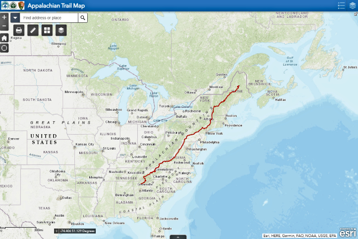
Proposed in 1921 and built in the following years, this trekking trail is 3,500 km (2,200 mi) long and goes from north to south in the Eastern United States.
Thousands of hikers attempt to travel the whole trail, but only 1/4 achieve it and are called ‘thru-hikers’.
The Appalachian Trail boasts a natural and cultural heritage, and for this reason, the Appalachian Trail Conservancy was created, to ensure this unique place is well-managed and preserved.
In 1991, an International Appalachian Trail was created, which continues northeast from the US state of Maine to Canada and then, sections in Greenland, Europe and Morocco were founded.
Royal Roads in Colombia
Historic roads were essential in the formation process of Colombia, since they allowed not only product exchange but culture and knowledge exchanges. In this way, the former isolated villages were becoming a network, a community, that offered tons of new opportunities.
Geography and population distribution throughout the country set a huge barrier for communication between the different settlements, so the ancient trails traced by native cultures have an incalculable value until today.

The Need to Connect the Country
Although the first routes were opened by indigenous communities amid dense forests and steep mountains for religious and cultural reasons, the Spanish conquerors were the ones who forced the integration of national territory.
Most urban centers were established far from the coasts as the largest indigenous groups lived in inland areas. Coastal towns had easier communication with Europe than with the capital and other inland territories, so the need for a transportation axis across the country was evident.
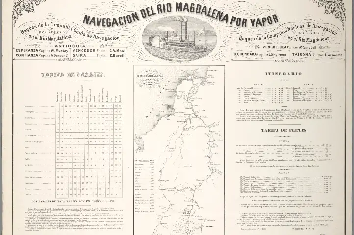
The Magdalena river was the axis to which several of the main hinterland roads converged, the royal roads.
Since the Spanish settlers sought to open new routes that helped the subjugation of the indigenous and the territorial integration, subsidies and benefits were offered to those who succeeded in opening crucial roads.
Later, from 1880 to 1930 the royal roads had their boom and transported volume of cargo and were traversed by travelers and mules as never before.
Since 1930, the bridle paths that allowed the inter-communication in Colombia experienced a crisis due to the introduction of wheel-friendly roads.
Royal Roads as Destinations for Trekking in Colombia
Nearly 80 years later, in 2008, Colombia’s Ministry of Culture launched the first project of cultural tourism in the country, which was about redesigning and reopening 3 routes of Royal Roads and was called ‘Recovery of Colombia’s Royal Roads‘.
The program aimed to analyze several variables of existing royal roads to determine its viability as cultural tourist attractions. The first royal road to be studied was the one located between Guaduas and Honda, which is 33 km long.
What motivated to undertake this project was the belief that “we must know, cherish and recover the Royal Roads, because they are essential parts of our memory and guiding threads to the future”, according to the then Ministry of Culture representative.
Now, these are the Colombian royal roads that are currently open for tourism. Check out some of our tours here!
Lengerke’s Royal Road
Some of the most beautiful colonial villages in Santander are connected by bridle paths built in the 19th century.
Geo von Lengerke, a German engineer, was the mastermind of these multiple roads that served to explore new territories and boost regional trade to and from the Caribbean coast along the Magdalena river.
Although the roads were planned by a foreigner, the construction was in charge of local labor. These represent a great architectural landmark, taking into account the complex topography of this region in northeastern Colombia. However, it has to be mentioned that the Guanes and Yariguies indigenous communities would have traced and traveled the roads before.
It is estimated that there are 800 to 1,300 km of roads with different conservation status, roads that demand a good physical condition since the trek is of intermediate to high difficulty.
The roads that helped the local economy thrive over 150 years ago, today keep their function, but in the tourism sector: they are favorite attractions among tourists visiting Santander.
One of the reasons is the big role that nature plays in beautifying the trek that passes by some of the best preserved villages of the region.
Itinerary of the trip along Lengerke’s roads
The Lengerke’s royal roads are full of amazing viewpoints and a background that helps tourists connect with Colombia’s history and development, while enjoying nature. This is the itinerary of the trip along Lengerke’s roads:
First Stop. The journey starts in Mesa de los Santos, a warm municipality that offers extreme sports facilities and a renowned organic coffee.
Second Stop. Jordan is the next stop, reached after descending by the breathtaking scenery of the Chicamocha Canyon, which takes about 3 hours. Jordan connected the southern municipalities with Bucaramanga, Santander’s capital, so it was of high importance. There it is safe to camp and rest before continuing toBarichara.
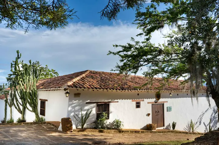
Third Stop. The colonial village of Barichara was declared a World Heritage Site in 1978, since it keeps its classic infrastructure of narrow streets, white walls and yellow ground, which gives its inhabitants the nickname of ‘patiamarillos’ or the yellow-legged. Barichara has various cultural attractions you can visit during your stop.
Fourth Stop. The journey goes on to Guane, a small village that was the most important chiefdom for Guane indigenous community during the pre-Columbian era. Its church, Santa Lucía, is a National Monument.
Five Stop. The last leg of the trip is from Guane to Zapatoca, the town where Lengerke lived his last years. There is a great ecotourism offer in this place, including vineyards, the Nitro’s cave, La Lajita waterfall and the Azul and Ahogado wells.
Honda – Santa Fe Royal Road
This is the most representative historic road of those built during the colonial era. Starting from Honda, a commercial port by the Magdalena river, and passing by the villages of Mariquita, Villa de Guaduas, Chinauta, Villeta and Facatativa, it ended Bogota (formerly called Santa Fe de Bogota).
In colonial times, the Magdalena river was navigable up to Honda. The Spaniards made the town a starting point to travel to the center of Colombia.
The royal road, built by slave labor in the 16th century, was very rustic, considering the difficult terrain: it went up and down, went along mountains, valleys, rivers, small villages and unexplored land.
Despite that, everyone who wanted to get to Bogota, had to go through this route, the main communication path in the kingdom of Nueva Granada.
It was about 112 km long and most of it was between mountains, the rest was located in the Bogota savanna. Travelers completed the route in 6 days or less in the summer; however, during the winter, they could take twice.

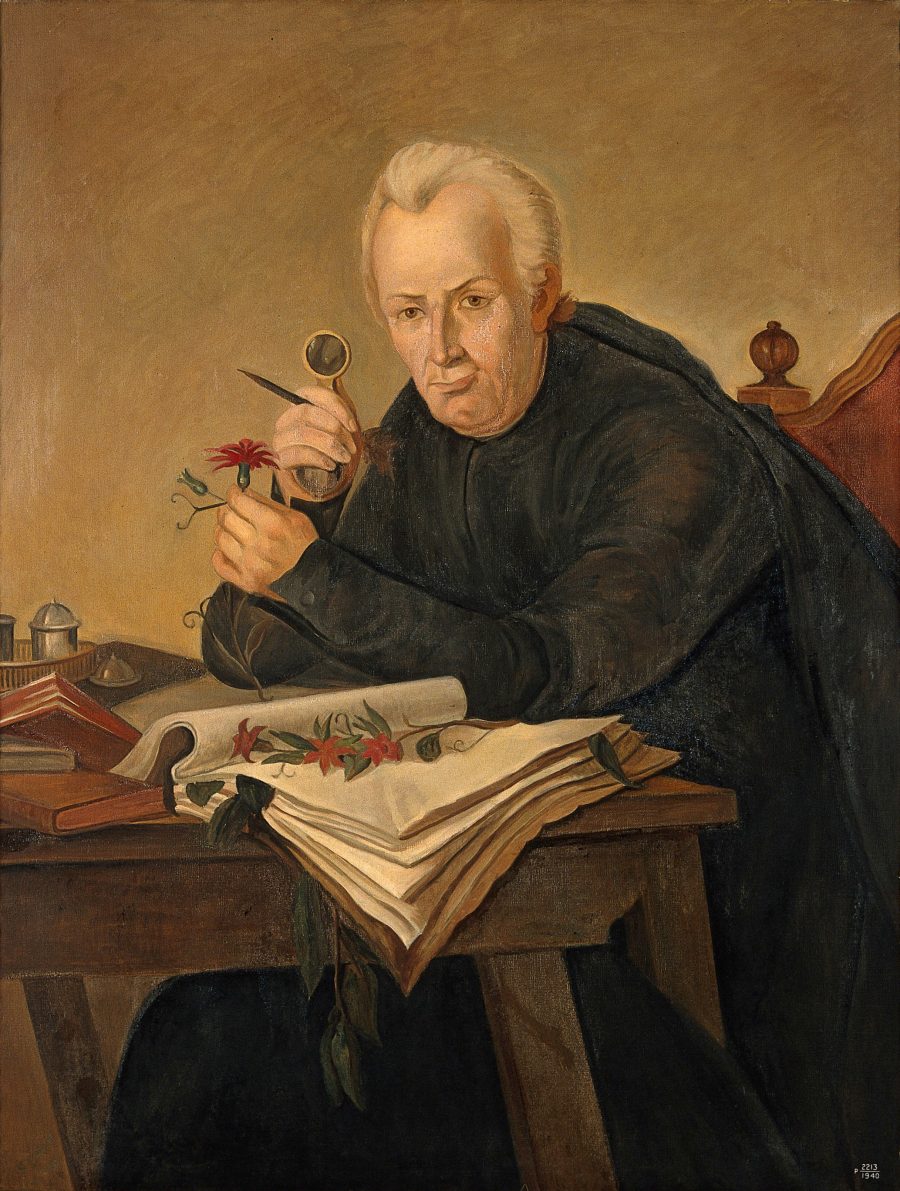
The ‘Mutis Route’
The first route for cultural tourism was created to celebrate the 200th anniversary of the death of Jose Celestino Mutis. It is called ‘Mutis Route‘ and includes the most important towns where this wise botanist passed by during his famous ‘Botanical expedition‘, i.e the ones that formed the Honda royal road.
Its goal is the appropriation and recovery of the artistic, cultural and historical wealth of the villages, while generating income for the improvement of their life quality.
It has nearly 300 km from Bogota to Ibague and its paths can take between 2 and 7 days of traveling.
Itinerary of the trip along the Mutis Route
Some of the villages that are privileged to have a section of the royal road are focusing on its preservation and offer guided tours down the road.
Mariquita
In Tolima, this town was a key transit point in the royal road, that witnessed not only valuable goods but news about new scientific discoveries and ideas.
It was the headquarters of the Royal Botanical Expedition from 1783 to 1791, when it moved to Bogota.
Honda

During the 18th century, its royal road had its boom, which lasted until the 20th century. Today, Honda is one of the Heritage towns of Colombia, thanks to its historical legacy.
Guaduas

This town is known to be the home town of Policarpa Salavarrieta, the heroine of Colombia’s independence, but before that, it was a key place in the route between Honda and Santa Fe de Bogota.
From the Capira Stone viewpoint, you can see the stunning Magdalena river valley and a section of the ancient Royal Road that leads to the capital of the country.
A civil society organization, along with young students, is in charge of maintaining the path for visitors to enjoy the travel along it.
La Mesa
La Mesa is a municipality in Cundinamarca situated on a plateau at 1,200 MASL and also played an important role in the road system of the hinterlands, serving as a mountain port.
It was a node of a network of several roads that came from nearby regions such as the Bogota savanna, the Magdalena valley and Tequendama.
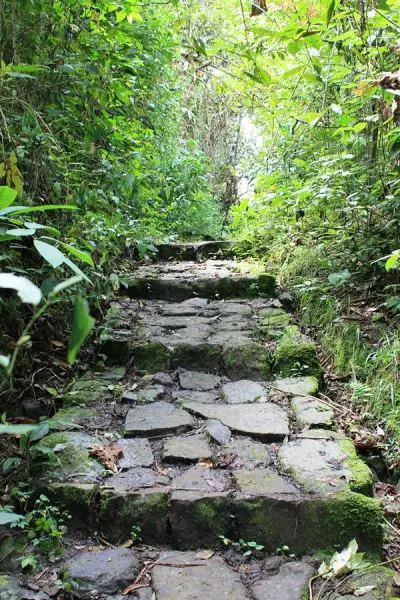
Some of these stone paths have been preserved to this day, for example, the royal road to San Javier or ‘Camino del Resbalón’. Although short, this road is a fantastic work that is only disrupted by some paved crossroads.
References
- Appalachian Trail
- Historic roads definition
- The Frontiers of War in the Conquest and Colonization of Colombia. Monique Lepage.
- Honda royal road Ref.1 Ref.2 Ref.3
- La Mesa royal road
- Lengerke roads Ref. 1 Ref. 2
- Mutis Route Ref. 1 Ref. 2
- Recovery of Colombia’s Royal Roads project
- Royal Roads of Colombia
About the author.
Ana María Parra
Modern Languages professional with emphasis on business translation. Interested in cultural adaptation of written and audiovisual content. Passionate about knowing new cultures and languages, tourism and sustainable living.

