Ultimate Travel Guide to the Utría National Natural Park

Discover the natural wonders of Utría National Natural Park in Colombia. It is possible to admire a series of mountainous spurs covered with exuberant tropical jungle, and bathed by the mysterious waters of the Pacific Sea. Its landscapes can be described with rainforest, mangroves, and gray beaches, and it is an ideal place for whale watching in Colombia.

Discovering Utría National Natural Park

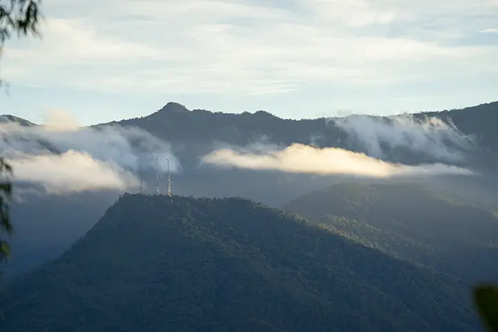
This park locates in the Biogeographic Choco Forest, belonging to the Baudo mountain range, in the north of the Colombian Pacific coast, in the department of Choco. This region is known worldwide to be the rainiest, and it is also an important biodiversity hotspot.

The park has a unique peaceful boat ride way inset to the sounds of the jungle. A beautiful lagoon of marine water surrounded by mangroves and gray beaches welcomes you.

At Utría, you can evidence a fracture of the earth generated millions of years ago. This fracture allows seawater to flow for 7km inland.

The Baudó mountain range gives rise to the Boroboro, Jurubidá, Baudó, Chori and Bojayá rivers, as well as the giant Caribbean and Pacific hydrographic areas. The hydrographic representation of this area is 2,242 MMC.

Biodiversity

This protected area has 7 of the 10 species of mangroves and hidden rocky cliffs reaching heights of 1,400 meters above sea level. Depending on the season, mangrove roots protrude like land animals at low tide. When the tide rises, roots hide underwater, serving as a shelter for water animals that visit to mate.

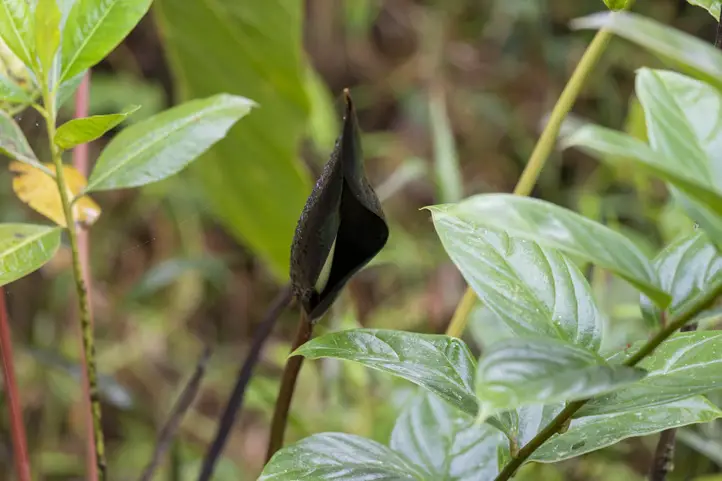
The diversity of the park makes it a magical place to appreciate diverse environments and ecosystems. The contrast of tropical rainforest and reefs makes the flora and fauna of this protected area quite unique and diverse.

Ethnography

Utría is a territory populated by two communities that are strategic allies for the conservation and protection of the park.

On one side, the “Embera” natives, which live within the jungles of the province of Chocó, keeping their cultural traditions intact. Their presence is also noticeable in the provinces of Antioquia, Risaralda, Quindio, Caldas, Valle, Cauca, Cordoba, Putumayo, Caquetá and Nariño.

On the other side, the black afro-Colombian communities of the Pacific coast that are known for developing economic activities related to the art of the sea and are the ones that have the most contact with visitors of this protected area.

How to get to Utría National Natural Park

Bogotá-Medellín-Bahía Solano

Take a flight to Rionegro José María Córdoba (JMC) airport in Medellín. Take a taxi ride to Medellin´s alternative Olaya Herrera airport (OH) at the city center, about 40 minutes away.

From Olaya Herrera, you can take a flight to Bahia Solano using Colombia’s national airline, Satena. Finally, from Bahía Solano take a boat to Utria National Natural Park.

Bogotá-Quibdo-Bahía Solano

Take a 1-hour flight from Bogotá to El Caraño Airport (UIB) at Quibdo city. Once at the airport, you have to take a flight to Bahia Solano with Satena Airline. Finally, from Bahía Solano take a boat to Utria National Natural Park.

Cali-Buenaventura-Bahía Solano

Take a 145-minute flight from Bogotá to Alfonso Bonilla Aragón International Airport (CLO) at Palmira city. Once at the airport, take an approximately 3-hour ride to Buenaventura.

In Buenaventura, take a 6 hours boat trip to Bahia Solano. Lastly, from Bahía Solano take a boat to Utria National Natural Park.

Although these three routes exist, we recommend the Medellin-Bahia Solano route because it is the safest.

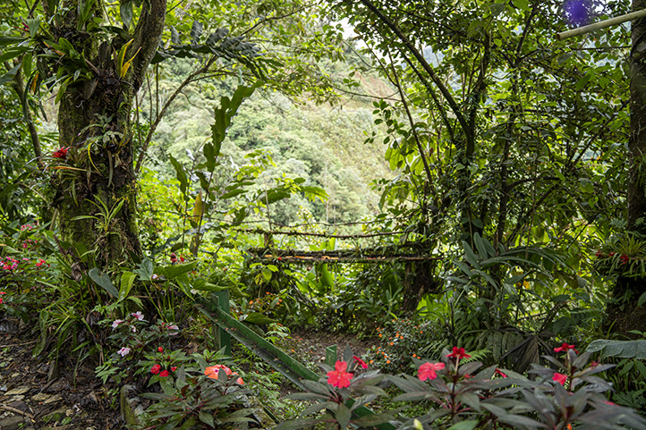
What to do in Utría National Natural Park

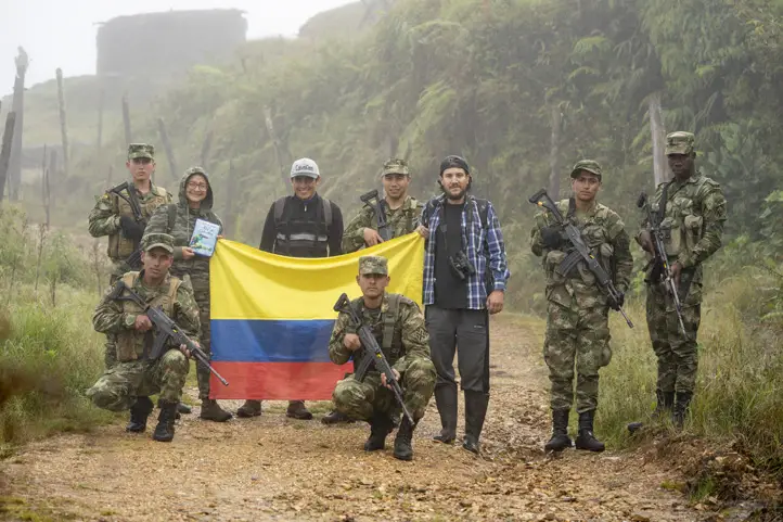
Utría National Natural Park is currently closed. Those who wish to visit Utría and carry out ecotourism activities may do so in the day trip mode, that is, enter the protected area in the morning and leave at the time arranged by the park.

The staff of Utría National Natural Park is the only one in charge of registering at the park’s entrance, giving induction talks, explaining the authorized sites, and providing recommendations for any activity within the protected area.

Utría National Natural Park, known as the ‘cradle of whales’, continues its whale season without any setbacks, as in previous years.

YouTube video player

Hiking and Trekking

Hiking along any of the 3 available trails is the most exciting activity in Utría National Natural Park:

  • Cocalito Trail, the round trip is about 1 km, 1 hour and it’s of moderate level of difficulty.
  • Estero Grande Trail, the round trip is about 611 m, 40 minutes, low level of difficulty.
  • Water trip, about 1.1 km long, with a low degree of difficulty; it can be done by canoeing at high tide.

Diving and Snorkeling

Diving at Punta Esperanza and Punta Diego, an ecosystem rich in coral formations and marine life is a must-do. At Playa Blanca, there is a marked snorkeling area. Diving programs, rental equipment, and facilities are available on site.

Wildlife Observation in Utría

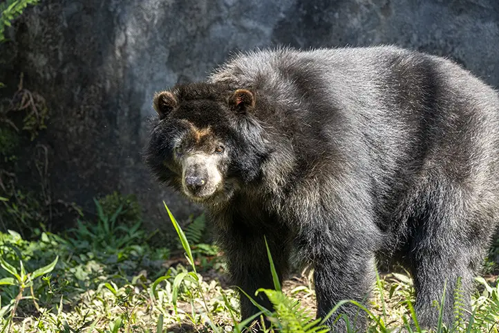
Utría hosts unique ecosystems on the planet and is ideal for observing a great amount of native fauna and flora. Regarding mammals, at the Utría Natural National Park it is possible to observe:

  • Giant anteater (Myrmecophaga tridactyla)
  • Jaguar (Panthera onca centralis),
  • Neotropical otter (Lontra longicaudis),
  • Gray-bellied night monkey (Aotus lemurinus zonalis),
  • Geoffroy’s spider monkey (Ateles geoffroyi),
  • Mantled howler (Alouatta palliata),
  • Baird’s tapir (Tapirus bairdii),
  • White-lipped peccary (Tayassu pecari),
  • Tamarins (Saguinus sp.),
  • Colombian white-faced capuchin (Cebus capuccinus),
  • Margay (Leopardus wiedii),
  • Agouti (Dasyprocta punctata),
  • Common opossum (Didelphys marsupialis),
  • South American coati (Nasua nasua),
  • Lowland paca (Cuniculus paca),
  • Red brocket (Mazama americana),
  • Tayra (Eira barbara) y
  • Hoffmann’s two-toed sloth (Chloepus hoffmanni)

With regards to marine life, it is worth noting that this point of the Pacific is ideal for animal mating and the birth of the amazing humpback whale (Megaptera novaeangliae), Orcas, or killer whales (Orcinus orca), and sperm whales or cachalot (Physeter macrocephalus).

Ocypode gaudichaudii, also known as the painted ghost crab or cart driver crab. Huina Beach, Bahía Solano, Chocó.

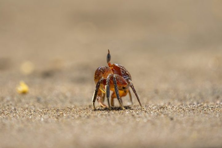
The area has 105 species of decapod crustaceans, where the painted ghost crab (Ocypode gaudichaudii) is a predominant species. There is also the presence of bivalves such as the Hacha (Pinna rugosa) and “piangua” (Anadara spp.), and mollusks such as the Eastern Pacific giant conch (Titanostrombus galeatus).

It is also possible to see endangered species of sea turtles on the beaches such as the olive ridley sea turtle (Lepidochelys olivacea), the hawksbill sea turtle (Eretmochelys imbricata), and the leatherback sea turtle (Dermochelys coriacea).
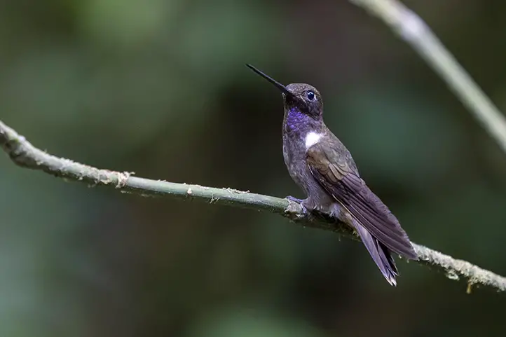
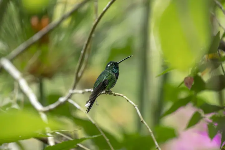
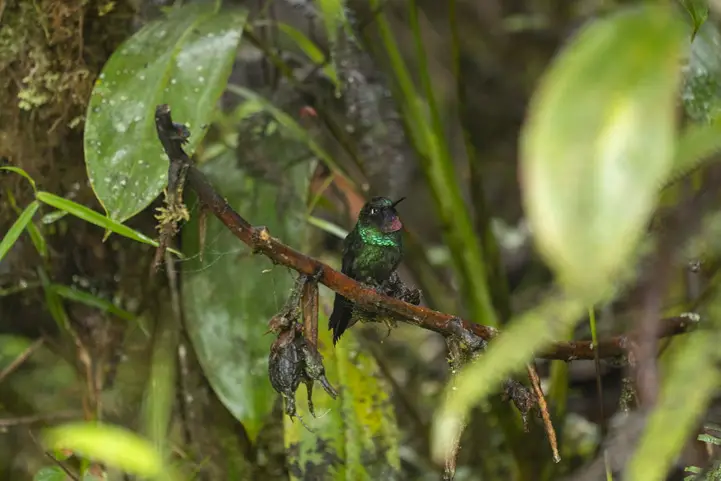
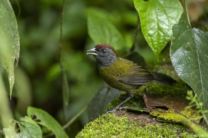
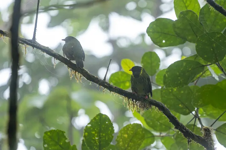
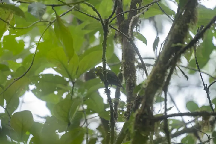
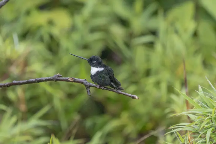
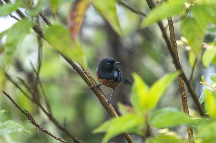
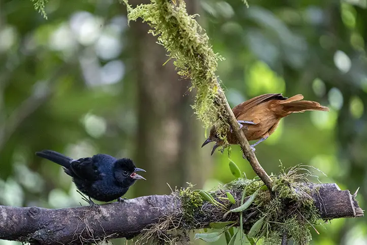
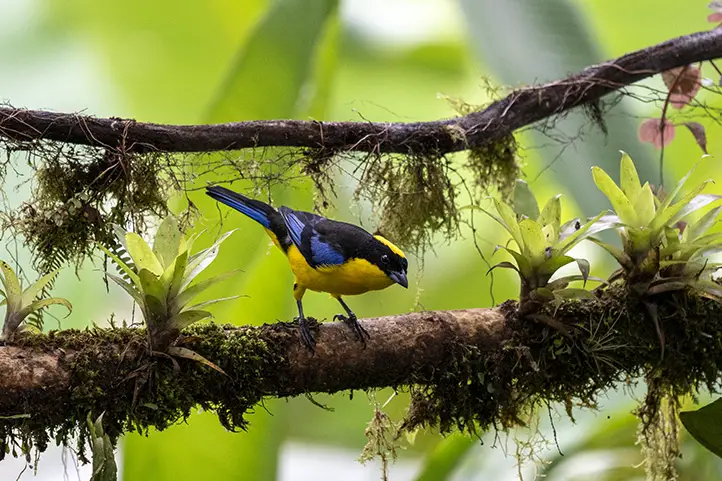
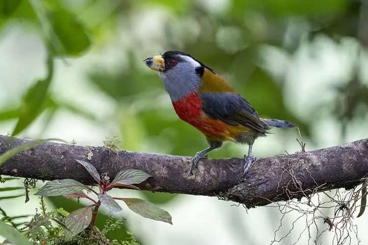
Bird Watching

Around 270 species of birds may be observed in Utria National Natural Park, being the most diverse watching spot in the area. The endemic birds in the Utria park are:

  • Choco tinamou or Chocó tinamou (Crypturellus kerriae)
  • The Harpy eagle (Harpia harpyja)
  • Great Green Macaw (Ara ambiguus)
  • The Great Curassow (Crax rubra)

Other bird species are Turkey vulture (Cathartes aura), Tricolored heron (Egretta tricolor), Yellow-crowned night heron (Nyctanassa violacea), Osprey (Pandion haliaetus), and many migratory shorebirds.

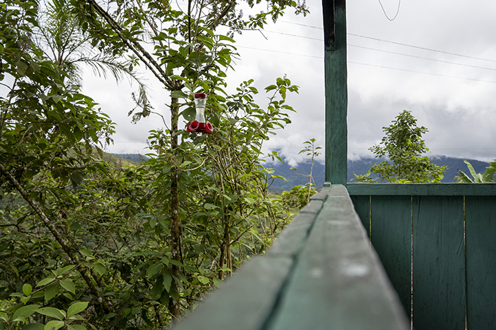
Where to stay in Utría National Natural Park

Utría National Natural Park offers shared accommodations within the Park. Additional accommodation alternatives are available close by. Our suggested choices are:

  • Ecolodge El Almejal is located in Bahia Solano, 24 km away from the protected area.
  • Hotel Costa Choco is in Bahia Solano, 30 km away from the protected area.
  • Coco Loco Lodge is in Bahia Solano, 23 km away from the protected area.

Best time to visit the Utría National Natural Park

Humpback whale watching season happens between July and November. Note that at Utría it rains for approximately 300 days a year, and October is considered the rainiest month.

Utría National Natural Park Entrance fees

The entrance fee varies depending on the nationality and age of the visitors. These are the entrance fees for 2021:

  • Colombians, resident foreigners, and tourists from Bolivia, Ecuador, and Peru (ages 5 to 25): COP 13,000
  • Colombians, resident foreigners, and tourists from Bolivia, Ecuador, and Peru (over 25 years old): COP 19,500
  • Non-resident foreigners (over 5 years old): COP 55,000
  • Children under 5 years old and Colombians over 65 years old have free entrance presenting their IDs.

What to consider before visiting Utría National Natural Park

  • To take any of the tours inside the park you must hire an authorized and certified guide.
  • Consider wearing personal protective items (sun blocker, sunglasses, towel, insect repellent, and hat).
  • The use of flash when taking photographs is prohibited.
  • Recommended the use of binoculars to admire animals’ behavior and beauty in their natural habitat.
  • Carry valid identity documents and health insurance. It is recommended to be vaccinated against yellow fever and tetanus.
  • If you take specific medications, take them with you. It’s never enough to carry a personal medicine kit.

Some prohibitions

Feeding, bothering, or hunting animals, alcoholic drinks and drugs, throwing cigarette butts, burning garbage, felling, and capturing wildlife.

References
About the authors

Luisa Martin

Engineer, world traveler, amateur photographer, traveling blogger, and foody.

The Southwestern Andes Birding Trail of Colombia

The Southwestern Andes Birding Trail of Colombia is probably the most diverse with nearly 1,400 bird species between the departments of Valle del Cauca, Cauca and Nariño.

In this region, you have contact with the Western Andes mountain range, the Choco Region, and the Pacific ocean.

The most relevant birding hotspots of this route are the Choco Forest and the Andean Cloud forests of the western cordillera.

The diversity of this route is explained because it covers many different habitats such as paramos, wetlands, Andean cloud forests, tropical rainforest, coastal areas, dry forest and very nice bird-lodges and farms dedicated to bird photography.

The Southwestern Andes Birding Trail

The National Audubon Society of the United States was involved in the design of this route along with the government of Colombia and Calidris NGO to help the country reach its goal of becoming the world’s top birding destination.

The training of stakeholders linked to the birding offer in the region was the main activity, including local guides, owners of lodges, farms and nature reserves, and community-based tourism associations.

Among the places to be visited are included national parks, civil society nature reserves, and private reserves.

Birding Spots of The Southwestern Andes Birding Trail

You should know that in the past, this region was not a safe place. Nowadays, birding tourism and related stakeholders are becoming:

active drivers in conservation, economic development, and peace-building”

For that reason, there are still some destinations with difficult access, and poor hotel infrastructure, especially towards the Pacific region in Valle del Cauca and Nariño.

Itinerary

The following itinerary is just an example of the route you can take. However, if you want to see more options, visit the itinerary designed by us.

Remember that you can customize your trip with us. Don’t miss the opportunity to add other activities such as whale watching; a city tour in Cali, the city of salsa music; an urban birding day also in Cali; a stop in the beautiful city of Popayan in the department of Cauca; or visit the paramos and volcanic lakes of Nariño, among many other activities, either alone or with your family.

Given the wide offer of destinations on this route, here are the main stops in each department. If you want to know more about each destination, I recommend you to visit the entries we prepared for you about them.

You can also visit our Youtube channel ColombiaFrank, where you will find first hand information about many of these destinations.

Valle del Cauca

Western Andes Cloud Forests

Wetlands – Sonso Lagoon

  • Laguna Sonso
  • Gota de Leche

Choco region – Anchicaya

  • El Descanso km 55
  • Upper Anchicaya
  • Aguasclaras
  • Lower Anchicaya
  • Buenaventura*

Following the path of the Anchicaya River as it descends through the western Andes to meet the Pacific Ocean, the old road from Buenaventura, mostly abandoned, offers incredible birding.

One of the most famous places in this point is the restaurant El descanso km 55, read our entry about this place Best Set to Photography Tropical Rainforest Birds at Upper Anchicayá.

Among the more than 500 species that have been recorded along the road are about 50 species endemic to the region.

The Pacific lowlands of the San Cipriano Reserve

  • San Cipriano Reserve
  • La Delfina
  • Buenaventura*

The Pacific rainforest of San Cipriano is incredibly humid, very lush and home to Chocó endemics, including the Five-colored Barbet, Chocó Toucan, Chocó Woodpecker, Rose-faced Parrot, Stub-tailed Antbird, Bicolored Antbird, and Black-tipped Cotinga.

*From here you can continue to Buenaventura for seabird watching on the Pacific coast. This point was not included in the official route, but if you have time, you can visit it in a day trip.

Cauca

Paramos in Puracé National Park and the Central Andes

From Valle, the route goes into the south of the department of Cauca to observe the Central Andes and the páramo where you can see the Andean condor.

At the end of the day you can enjoy a bath in the volcanic springs of Coconuco, where the thermal waters have been diverted to a series of pools, each at a different temperature.

Dry Forest in the Patía Valley

Descending from the páramo, the itinerary concludes in the dry forest of the Patía Valley, located only 600 meters above sea level. The dry forest is a very different habitat where you can find Blue Ground-Dove, Ruby-topaz Hummingbird, Apical Flycatcher (endemic), and the Scarlet-backed Woodpecker.

Nariño Extension (Optional)

Birders with extra time and a thirst for adventure should continue south to the department of Nariño, a former conflict zone that is newly accessible to visitors.

Nariño is rather more rustic than Valle or Cauca, but features fantastic birding, especially in the rainforests of the Pacific slope.

Among the highlights is La Planada Reserve, which offers some of the best birding in Colombia. You can also continue on to the Rio ñambi Reserve and the Bangsias Reserve.

Another place that has emerged as an interesting birding destination in Nariño is Tumaco. However, the law and order situation still keeps it on the back foot for tourism development. We do not recommend traveling to this place alone.

As time goes by, the list of Colombian birding trails has grown and you can be sure that you will find fantastic birds in any region of the country.

Recommendations

  • Take waterproof clothing, waterproof boots, and waterproof backpacks to protect your equipment in case of rain.
  • Remember that this whole region has a high relative humidity, so be prepared to keep your equipment safe from excess humidity. In our entry How to Prepare for a Birding Tour in the Neotropics? you will find useful information on this subject.
  • Be always accompanied by a local guide.

If you want to know more about Colombian nature tours contact us and plan your trip with us.

References
  • Birdwatching in Colombia – Procolombia
  • Audubon Society Website
  • The Southwestern Andes Birding Trail
About the author

Sara Colmenares

The current director of Sula. Doctor in Biological Sciences. Her main interests are to explore and understand the organism–environment interactions, taking advantage of emerging knowledge for the management and conservation of species and ecosystem services. She is currently working as a consultant in functional ecology, ecosystem services, and conservation projects in Colombia related to ecotourism and birdwatching.

La Planada Nature Reserve: All you Need to Know Before Visiting

La Planada Nature Reserve was created by the Foundation for Higher Education (FES) in 1982, with support from the World Wildlife Foundation (WWF). The objective of its creation was to avoid genetic loss and to preserve the life of hundreds of plants and animals, which are unique inhabitants of the last remnants of the tropical cloud forest in the western andean mountain range, in the so-called biogeographic Chocó in the Colombian Pacific, which has been so badly affected by intense forest clearing.


After more than 30 years, there is a historic moment for the Awa Indigenous people, with the help of the Critical Ecosystem Partnership Fund (CEPF). Since 9/27/2020 La Planada is connected to the interconnected network (internet).


Having an internet connection benefits the local community, the research and conservation processes in the reserve, and all visitors in La Planada.


9 Facts about La Planada Nature Reserve

La Planada Natural Reserve is one of the most biologically rich places in Colombia:

  1. It has 3,200 hectares of cloud forests.
  2. It has the largest concentration of native birds in South America, with more than 240 species, including rare and endangered species such as the Black-and-chestnut eagle, the Toucan Barbet, the Club-winged Manakin and the Long-tailed Sylph.
  3. It has been described by the famous botanist Alwyn Gentry as the supreme empire of the Epiphytes plants: a paradise of lichens, bromeliads, mosses and orchids.
  4. More than 1,800 species of trees and plants are found here.
  5. It is one of the places with the greatest diversity of orchids in the world with more than 300 varieties.
  6. It has registered, until now, more than 80 species of mammals, among them the Colombian white-faced capuchin (Cebus capucinus), the Mantled howler (Alouatta palliata), ocelots, deers, coatis, weasels and the emblematic Spectacled Bear.
  7. Its cloud forests are also one of the last refuges of the Spectacled bear in Colombia.
  8. Approximately 50 species of reptiles.
  9. And more than 30 species of amphibians has been registered at La Planada.

Sustainable Tourism Destination

In 2010 the FES Foundation donated the La Planada Nature Reserve to the Awá Indigenous People. Since then the community has led the recovery of the Reserve as well as projects for the conservation of biological diversity, with the development of three work programs: community organization, sustainable production and conservation.

Also, it has been able to establish good inter-institutional alliances, having technical support from important organizations such as the World Wildlife Fund (WWF), the MacArthur Foundation, the European Union, the Humboldt Institute, RESNATUR among others.

Know more about Sustainable Destination in Colombia in our post Recommended Sustainable Tourism Destinations in Colombia.

Characteristics

The premontane rainforests of the La Planada Nature Reserve are distributed in two plains, five hills and two pronounced canals. It is located between 1,300 and 2,100 meters above sea level (3937 – 6889.7 ft). It has an average annual rainfall of 4.700 mm, with a dry period between June and August. The average temperature is 20ºC.

Location

La Planada Natural Reserve is placed 27 km from the municipality of Ricaurte, department of Nariño, in the southwest of the country.

Important Bird Area and Protected Forest Reserve

It has been declared an Important Bird Area (IBA) in 2008, under criteria A1 and A2. This means that the La planada holds significant numbers of one or more globally threatened species, and to hold a significant population of at least two range-restricted species.

Within the IBA there are about 1667 hectares declared as a Protected Forest Reserve, within the system of protected areas of Colombia. In Colombia, a reserve of this type corresponds to geographical areas where forest ecosystems maintain their function, even though their primary structure has been changed. They can be public or private and are intended for the establishment, maintenance and sustainable use of forests or vegetation cover.

In La Planada you can find almost 360 species of birds. Within this large group, 29 species are of special interest because of their restricted distribution. Some of them are under threat category in the IUCN red list.

SpeciesIUCN Red List CategorySeasonDistribution
Dark-backed Wood-quail (Odontophorus melanonotus)VUresidentRestricted
Gorgeted Sunangel (Heliangelus strophianus)LCresidentRestricted
Violet-tailed Sylph (Aglaiocercus coelestis)LCresidentRestricted
Hoary Puffleg (Haplophaedia lugens)NTresidentRestricted
Brown Inca (Coeligena wilsoni)LCresidentRestricted
Velvet-purple Coronet (Boissonneaua jardini)LCresidentRestricted
Empress Brilliant (Heliodoxa imperatrix)LCresidentRestricted
Cloudforest Pygmy-owl (Glaucidium nubicola)VUresidentna
Colombian Screech-owl (Megascops colombianus)NTresidentRestricted
Semi-collared Hawk (Accipiter collaris)NTresidentna
Plate-billed Mountain-toucan (Andigena laminirostris)NTresidentRestricted
Toucan Barbet (Semnornis ramphastinus)NTresidentRestricted
Yellow-breasted Antpitta (Grallaria flavotincta)LCresidentRestricted
Narino Tapaculo (Scytalopus vicinior)LCresidentRestricted
Uniform Treehunter (Thripadectes ignobilis)LCresidentRestricted
Fulvous-dotted Treerunner (Margarornis stellatus)NTresidentRestricted
Club-winged Manakin (Machaeropterus deliciosus)LCresidentRestricted
Orange-breasted Fruiteater (Pipreola jucunda)LCresidentRestricted
Beautiful Jay (Cyanolyca pulchra)NTresidentRestricted
Black Solitaire (Entomodestes coracinus)LCresidentRestricted
Yellow-collared Chlorophonia (Chlorophonia flavirostris)LCresidentRestricted
Tanager Finch (Oreothraupis arremonops)LCresidentRestricted
Dusky Bush-tanager (Chlorospingus semifuscus)LCresidentRestricted
Scarlet-and-white Tanager (Chrysothlypis salmoni)LCresidentRestricted
Indigo Flowerpiercer (Diglossa indigotica)LCresidentRestricted
Purplish-mantled Tanager (Iridosornis porphyrocephalus)NTresidentRestricted
Black-chinned Mountain-tanager (Anisognathus notabilis)LCresidentRestricted
Glistening-green Tanager (Chlorochrysa phoenicotis)LCresidentRestricted
Moss-backed Tanager (Bangsia edwardsi)LCresidentRestricted

Scientific Research at La Planada Nature Reserve

During its more than 20 years of history, the Reserve has developed several investigations on the natural history of tanagers and birds of prey and some threatened species such as the Toucan Barbet and the Plate-billed Mountain-toucan. Studies on the Spectacled Bear and studies of vegetation and floristics have also been carried out with the support of the Alexander von Humboldt Institute. Today, long-term scientific research is being carried out in the reserve to study the dynamics of the Andean forest.

Spectacled Bear rescued at La Planada Nature Reserve. Its name is Arcoiris (Rainbow)

What to do at La Planada Nature Reserve

The birds, as well as the natural and scenic wealth are the main attractions of La Planada. Tourism, as well as the reserve, is in charge of the Awá community. Enjoy one of the most beautiful natural reserves in Nariño by hiking, walking to an impressive waterfall, and resting in the middle of the forest in simple but cozy cabins. The reserve offers accommodation, food and guidance. There are also suitable areas for camping within the reserve.

Fishing and Indigenous Culture

You can make day and night tours through the reserve, and through the ancestral territory of the Awa people. You can also do recreational activities and river fishing, share with the communities the different aspects of the marimba culture and learn about their typical foods.

Orchids and Plants tour

There is a 2 km trail called El Tejón where you can find ecological stations with different attractions such as tuber crops, bromeliads, plants from which the Spectacled Bear feeds. One of the most attractive is the orchidarium with about 3,000 species of orchids.

Birding at La Planada Nature Reserve

Brown Inca – Coeligena wilsoni

Birding in La Planada can be difficult if you do it inside the forest, there are steep slopes and very tall trees. On the other hand, if it is cloudy it is even more difficult to watch the birds. So be prepared for an acoustic rather than a visual birding tour.

However, there are some trails within the reserve, and one of them, the one that takes you to the accommodations, is the territory of the Club-winged Manakin. So this bird is sure to be heard and even seen and photographed. There is also a viewpoint, the only place where you will have a mobile signal, in fact… and where you can observe the Plate-billed Mountain-toucan, and hear some wrens, along with a spectacular view of the reserve.

The other option is to watch birds along the road that leads from the village to the reserve. It is a winding road that ascends to the reserve with very good observation balconies and a drop in the terrain that allows you to see the birds of the canopy on one side and the birds of the understory on the other side.

Although the community has its own guides, we recommend you to be accompanied by a specialized birdwatching guide . If you want to know more, do not hesitate to contact us.

Recommendations

To have the best experience in Nariño, we recommend you to prepare your trip to La Planada Natural Reserve. Take with you:

  • Medical Insurance
  • Repellent – anti-mosquitoes
  • Camera and accessories
  • First aid kit
  • Binoculars
  • Mountain boots
  • Sunblock
  • Raincoat
  • To do camping it is recommended that you bring adequate equipment to have a pleasant time in the natural conditions of climate and vegetation of the reserve.

References

  • BirdLife International (2020) Important Bird Areas factsheet: La Planada Natural Reserve. http://www.birdlife.org 2020.
  • Tourist information system of the department of Nariño, SITUR Nariño Website.
  • Agustín Codazzi Geographic Institute (IGAC) Website.
  • World Wildlife Foundation Website.
  • La Planada Nature Reserve Blog.
  • Alexander von Humboldt Research Institute Repository

About the author

Sara Colmenares

Current director of Sula. Doctor in Biological Sciences. Her main interests are to explore and understand the organism – environment interactions, taking advantage of emerging knowledge for the management and conservation of species and ecosystem services. She is currently working as a consultant in functional ecology, ecosystem services and conservation projects in Colombia related to ecotourism and birdwatching.

The Uniqueness of Tatamá Park and Montezuma Road Destination

Tatamá Park is situated on the borders of the department of Chocó, Risaralda, and Valle del Cauca, along the western Colombian Andean mountain range. It is situated in the confluence between the biographical Pacific and the Coffee Triangle.

The park has an extension of 51900 ha, and it is located between 2000 and 4200 meters above sea level. Temperature ranges between 4 and 22ºC and precipitation is high all year round, especially towards de Chocó side, in the west.

Discovering Tatamá National Natural Park

The park was created in 1987. Its uniqueness lies in its geographical location which makes that many of Colombia’s endemic and near-endemic species are found here. This protected area is of high scientific interest because of the excellent state of conservation of its Andean ecosystems.

Its territory is also home to tributaries that drain the slopes of the San Juan and Cauca Rivers. At the highest area of the park, there is the Tatamá Paramo which along with those of Frontino and El Duende are the only three paramos in Colombia that have not been altered by humans.

According to historians, this place was inhabited in pre-Columbian times by the Sima or Tatamá indigenous groups, belonging to the Anserma indigenous people. It was them who gave the name to the hill Tatamá. According to this theory, tatamá meant “the land or the highest stone” in their dialect.

Other historians have a different theory, and say that the name comes from the Chocó indigenous people, of Caribbean influence, who attribute the meaning of “the grandfather of the rivers” to the word tatamá.

Flora and Fauna at Tatamá

According to the documentation on the park found on the official website of the System of Protected Areas of Colombia, in the park you can find a great richness of plants, among them the endemic Black Anthurium (Anthurium caramantae) and more than 560 species and morpho-species of orchids. Tree species with fine woods are also protected, some of which are in danger of extinction.

There are also more than 600 species of birds, some of which are locally and globally vulnerable, 11 are endemic to the Western Cordillera, 9 are endemic to Colombia and 14 are near-endemic. An example of these is the Gold-ringed Tanager (Bangsia aureocincta).

110 species of mammals have been registered, representing the endemic fauna of the Andes. Among them stands out the Colombian Weasel (Mustela felipei), which has been catalogued as the rarest mammal in South America. Within the reptiles there are records for 108 species.

Black Anthurium – Anthurium caramantae ENDEMIC

What to do at Tatamá

Currently, the park is closed to public, however, in some areas around the park, and at the lower areas, it is possible to do hikes, trekking, climbing and bird watching activities.

Hiking and trekking at Tatamá National Natural Park

Given its high level of conservation, the Tatamá Park has a scenic beauty unknown to the public. Los Planes de San Rafael  Visitors’ Center is located in Los Planes de San Rafael, municipality of Santuario, in the department of Risaralda.

In general, this visitors’ center, in agreement with Risaralda Regional Autonomous Corporation (CARDER), and the Community Action Board of the village, offers  personalized attention for tourists, with tours where environmental interpretation is fundamental.

There are several trails related to these tours:

  • Path to the Tatamá Waterfalls: The path to the waterfalls is located in the lower area of the park, at 2500 meters above sea level. It has a great natural tourist attraction, where you can climb and enjoy the exuberant vegetation. It starts at the visitors’ center, and follow a four kilometer route that leads to the area of the waterfalls. Once there you can enjoy the landscape formed by the waterfalls, some of which reach 70 meters high. The route takes between eight and ten hours, so it is better to start it early in the morning.
  • Valley of the Frailejones: It is a sector located at 3,700 meters above sea level, in the territory of the department of Chocó. It is a destination that requires experience in hiking and mountaineering. To reach the valley it is necessary to climb and descend in ropes. Here you can see frailejones that reach five meters in height.
  • Valley of the Lagoons: It is located near the Valley of the Frailejones. It is a territory of glacial origin surrounded by steep hills, which protect the mountain lakes between them.
  • There is also the trail to the Centro Experimental Altoandino Tatamá. It takes over 30 minutes.

Birdwatching at Tatamá: Montezuma Road

This place is included in the Central Andes Birding Route, developed by the Ministry of Commerce, Industry and Tourism (MINCIT), the Productive Transformation Program (PTP) and Procolombia.

This bird watching route enters the Tatamá National Natural Park through its northern zone, via Pueblo Rico. Pueblo Rico is a municipality of about 10,000 inhabitants and is the last town in Risaralda before entering the Colombian Pacific.

The Montezuma Rainforest Ecolodge is located in the lowest part of the Tatamá National Natural Park. Although it is not the official entrance to the Park, it is a place authorized by the National Natural Park System to be able to enter and observe the biodiversity and ecosystems that Tatamá offers, and especially to observe the great amount of birds of the tropical humid forest.

Montezuma Rainforest Ecolodge is a farm located on the western slope of the western mountain range, in the Department of Risaralda, on the border with Chocó, in Colombia. From Pueblo Rico you have to travel about 17 km to get to Montezuma, at Montebello village.

There you will find signs of entry to the National Natural Park Tatamá. The classic visit for birdwatching is through the road connecting the Montezuma Lodge and a military base at the top of the Montezuma Hill at 2600 meters of altitude.

Military Base at Montezuma Hill. We are accompanied by the local bird guide Arnulfo Sánchez and the guide of Montezuma. The soldiers always ask for a photographic record of the visitors, to be spread with the message that they feel safe and proud of the Colombian National Army.

The road has about 11 km long, is open, and has steep slopes without any place for resting. Several feeders and drinkers have been installed along the road, at strategic points, to facilitate the appearance of the birds that come out of the dense forest to feed. Thus, it is possible to find Collared Inca, Chestnut-bellied Flowerpiercer, Rufous-gaped Hillstar, and Olive Finch, easily.

Purple-bibbed Whitetip – Urosticte benjamini

Tourmaline Sunangel – Heliangelus exortis

Olive Finch – Arremon castaneiceps

Green-and-black Fruiteater – Pipreola riefferii

Gold-ringed Tanager – Bangsia aureocincta ENDEMIC

Collared Inca – Coeligena torquata

Chestnut-bellied Flowerpiercer – Diglossa gloriosissima ENDEMIC

The best birding area (Montebello) is where a bird endemic to Colombia, and restricted only to that region was found, the Tatamá Tapaculo (Scytalopus alvarezlopezi).

In front of the house there is a garden with bird feeders that permanently has bananas and papayas, and  bird drinkers with sugary water, where many species of tanagers and hummingbirds arrive.

Explore the eBird Field Checklist for the PNN Tatamá – Camino Montezuma. This checklist is generated with data from eBird (ebird.org), a global database of bird sightings from birders like you.

If you enjoy this checklist, please consider contributing your sightings to eBird. It is 100% free to take part, and your observations will help support birders, researchers, and conservationists worldwide.

How to get to Tatamá

Zoom In the map to check the complete destinations.

The administrative headquarters of the Tatamá National Natural Park is in the municipality of Santuario, in Risaralda, 1 hour and 20 minutes from the city of Pereira on a paved road.

It is only possible to arrive by 4×4 truck. From Pereira, take the road to Cartago at the point known as Cerritos. There you turn right until you reach the municipality of La Virginia.

From there, follow the Pan-American Highway to Choco and at the site known as La Marina, take a detour to the left to reach the municipality of Santuario.

To get to Tatamá National Natural Park, take an open road of about 10 km to the Los Planes de San Rafael trail, and from there take a trail to the lower limit of the Tatamá Park at 2500 masl.

The park can also be accessed from Pueblo Rico town, following the road connecting the Montezuma Ecolodge and a military base at the top of the Montezuma Mountain. However, road conditions make this transit exceedingly difficult, and if you are going for bird watching, it is necessary to depart at 3 a.m. from Pueblo Rico to be able to arrive before dawn to Montezuma.

The other option is to sleep at the Montezuma Ecolodge, but this one is always booked, so you have to book at least a year in advance.

Where to stay in Tatamá National Natural Park

CARDER visitor’s center

CARDER visitor’s center, picture by Fecomar Risaralda 

The park does not have specialized infrastructure for tourist services in general.  However, the visitor’s center, located in the Los Planes de San Rafael village, has the capacity to accommodate 40 people in quadruple occupancy. It offers restaurant service, lodging and guidance on the different trails with environmental interpretation. The place is owned by CARDER and managed by the village’s Community Action Board.

Montezuma Rainforest Ecolodge

Montezuma Rainforest Ecolodge, picture by Risaralda Travel

Montezuma Ecolodge is prepared to receive about 10 guests in independent rooms with private bathroom and hot water. The place is very simple, there is no luxury or excessive comfort, as it is a rural accommodation that has been gradually adapted for tourism.

There the disconnection is complete because there is no telephone or television signal. The food is also simple, but very good.

What you should consider when you visit Tatamá

It’s not allowed in the park:

  • Hunting, collecting or introducing animals or plants.
  • No fires allowed.
  • It is forbidden to throw or burn garbage.
  • It is forbidden to get drunk or make a fuss or noise.
  • Logging is forbidden.
  • Excavation is forbidden.
  • Fireworks and explosives are prohibited.

Recommendations:

  • You must be vaccinated against yellow fever at least 30 days before access and you must present your valid card at the entrance of the protected area.
  • You must wear clothing suitable for cold weather such as balaclavas, scarves, boots, waterproof coat, and gloves.
  • You must abide by the observations and suggestions of park officials since the Colombian park system is not responsible for any accident you have during your stay in the area or for the loss of objects.
  • You should only walk the authorized trails and always be accompanied by an official or a guide.
  • We recommend that you never get separated from the group and that you keep an eye on your fellow travelers.

Check out our tour in this region of Colombia!

About the author

Sara Colmenares

Current director of Sula. Doctor in Biological Sciences. Her main interests are to explore and understand the organism – environment interactions, taking advantage of emerging knowledge for the management and conservation of species and ecosystem services. She is currently working as a consultant in functional ecology, ecosystem services and conservation projects in Colombia related to ecotourism and birdwatching.

Best Set to Photography Tropical Rainforest Birds at Upper Anchicayá

The Anchicayá is a Colombian river, in the department of Valle del Cauca, which originates west of Cali and flows into the Pacific Ocean, in the Buenaventura Bay. Like all rivers on the Pacific side, it has a high biodiversity. The Anchicayá basin is one of the richest places in Colombia for birding, and is considered the first in the world. This area is composed by a tropical rainforest that contains countless rivers and waterfalls of crystalline water and has a great variety of fauna and flora typical of the Pacific region and the Biogeographic Chocó. It is an area rich in primary forests that are characterized by their biodiversity in flora and fauna. The region is the third place with the highest rainfall in the world and the first in bird diversity. This is a very special area for birdwatching, with around 500 species recorded in several locations along the road, such as Agua Clara, the Danubio, Lower Anchicayá and Upper Anchicayá.

Since 1955, the company CELSIA, from the ARGOS Group, owns two hydroelectric power stations: The Alto Anchicayá hydroelectric plant, located 85 km west of Cali, and the Bajo Anchicayá plant located within the perimeter of the Los Farallones Natural Park. The reservoirs are located along the Anchicayá River. When you go birding on this road, the observation points are distributed and referenced around these two reservoirs, and they are known as Low Anchicayá and Upper Anchicayá. The upper Anchicayá is the nearest point from Cali.

Birding at Upper Anchicayá: El Descanso

El Descanso is a must for those who like bird photography. It is a unique place thanks to its location on the road that leads from Cali to Buenaventura through the Anchicayá River basin, in the Valle del Cauca department. As I mentioned before, it is one of the most important hotspots for bird watching, where the western mountain range of the Colombian Andes merges with the tropical rainforests of the biogeographic Chocó. On this road you will find a gradient that goes from the Andean cloud forest to the seashore in the Pacific sea.

In the area known as Alto Anchicayá, or upper Anchicayá, Dora Londoño offers tourist services for bird watching, together with her children, her grandchildren and her husband. She was a victim of the war in Colombia, who had to leave her place of origin to save her life. In Anchicayá she found refuge for her family, and has lived there for more than 20 years.  Initially, Doña Dora had a small cafeteria on her farm called El Descanso, next to the old road that leads from Cali to Buenaventura, at kilometer 55. In her cafeteria she offered lunches, cheese empanadas, coffee and her famous puff pastries. Her clients were the engineers and workers of the local reservoirs, who constantly went by. Doña Dora feels immense gratitude for that time, and for her first clients, who made it easier for her to settle in this place.

Doña Dora making her famous puff pastries at El Descanso

Over time, other types of customers began to arrive at their cafeteria. This family did not know that there were people willing to paid trips to come to Colombia to watch birds. They would never have thought of such a thing! For them, birds were part of their daily lives, and they did not pay much attention to them.

The Bird Photographers

Groups of people with very large cameras and binoculars, dressed in camouflage clothes began to arrive. Doña Dora asked the guides who were with them about who they were or what they were doing. She found out that they were birders. They used to sit and have a coffee at Doña Dora’s while they rested from their long journey along this road. One day, next to the house, one of the trees was bearing fruit, and a large number of birds began to arrive to eat from the tree. And it was that just at that moment there was a group of bird watchers in the cafeteria. They quickly got up from their chairs, leaving the coffee and the flakes, to follow and photograph these birds in the tree. And so the story began.

El Descanso farm is on the edge of a mountain covered by a dense cloud forest, in the tropical rainforest of the Biogeographic Choco. There is nothing but the mountain bordering the road and the house. One day, one of the guides suggested to Doña Dora that she give the birds food to attract them. Despite her incredulity, she began by putting bananas on a board, then papaya and sugary water. With this, not only did the birds arrive, but more tourists! In time, and by applying visitor’s recommendations, she set up a garden behind her house, with sticks and logs, drinking troughs and feeders, and began to make improvements with the money that tourism left her.

Attracting the Birds

She remembers that the first birds to arrive were the Mal-casados, or the badly married, common name of the White-lined tanagers. Then the Primaveras ones (Clay-colored Thrush), the Clarineros del Pacífico (Blue-winged Mountain Tanager), and the last one, the most difficult to attract, the Compás (Toucan Barbet) because it is a bird that usually do not exposes easily.

Malcasados – White-lined Tanager – Tachyphonus rufus

Clarinero del Pacífico – Blue-winged Mountain-Tanager – Anisognathus somptuosus

Compas – Toucan Barbet – Semnornis ramphastinus

Sustainable Destination

Family unity and constant commitment have brought this tourism project to fruition. Thanks to the support of her husband and sons, and with the help of several bank loans, she has managed to finish building her house, support her family and keep the birds. She build a third floor with an observation tower, which is more as a terrace, which gives direct view to the canopy, and where she has installed some drinking troughs to attract hummingbirds. His plans in the future are to offer a basic rural accommodation service, with hot water bathrooms. One of the attractions of the place is also the beautiful murals with birds painted by one of Dora’s sons, Erbert Sanchez. His aim is to fill the house with these murals, and to highlight the beauty of the rainforest birds that visit the gardens.

Gardens at El Descanso Farm, Doña Dora, especially disposed for bird photography.

Terrace, at El Descanso Farm, Doña Dora, especially disposed to attract hummingbirds.

Murals, at El Descanso Farm, Doña Dora.

All this has been paid for by the money left over from the birders’ visits. She knows that developing a tourist destination is a process that requires love and a lot of commitment. It has only been four years since she has positioned herself as a destination with a constant flow of birdwatching tourists, before that, it was all effort, patience and dedication, for almost two years.  Today they have been affected by the pandemic crisis, and any economic assistance is very important to them. If you are interested in helping you can contact them through their Facebook page.

Find a checklist of the birds you can observe in and around El Descanso, in Upper Anchicayá. This checklist is generated with data from eBird (ebird.org), a global database of bird sightings from birders like you. If you enjoy this checklist, please consider contributing your sightings to eBird. It is 100% free to take part, and your observations will help support birders, researchers, and conservationists worldwide. Go to ebird.org to learn more!


About the author

Sara Colmenares

Current director of Sula. Doctor in Biological Sciences. Her main interests are to explore and understand the organism – environment interactions, taking advantage of emerging knowledge for the management and conservation of species and ecosystem services. She is currently working as a consultant in functional ecology, ecosystem services and conservation projects in Colombia related to ecotourism and birdwatching.